Regional Haze Situation
Select Date
Overlays
-
2500 ft Winds
-
Rainfall Accumulation
 Low Confidence Hotspot
 Medium Confidence Hotspot
 High Confidence Hotspot
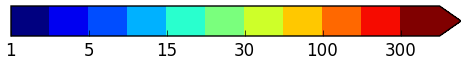
 Wind Speed (km/h)
 Rainfall (mm)
Latest Weather and Haze Situation
Scattered showers were observed over most parts of the ASEAN region today except for drier conditions observed over the central parts of Sumatra as well as over parts of Java, the Lesser Sunda Islands and the southern parts of Kalimantan. A few hotspots were detected in eastern parts of the Mekong sub-region, the eastern parts of Sumatra and in parts of Kalimantan. Slight and localised smoke plumes were observed in the eastern parts of Java and the central parts of Viet Nam.
Weather and Haze Outlook
In the coming days, showers are forecast to continue over the ASEAN region except for the central parts of the Mekong sub-region as well as over parts of Java and the Lesser Sunda Islands where drier conditions are forecast. Isolated hotspots and localised smoke plumes can occur in these are facing drier conditions. The prevailing winds over the Mekong sub-region, the northern parts of Sumatra and parts of Peninsular Malaysia and Borneo are forecast to blow from the southwest. The prevailing winds over the rest of the ASEAN region are forecast to blow from the southeast or south.
- All maps are to be used solely for displaying meteorological/geophysical information, and not for any other purpose. All maps are not to scale and for illustrative purpose only.
- The hotspots depicted on the map are derived from the NOAA satellite and they represent locations with possible fires. Hotspots may go undetected due to cloudy conditions or incomplete satellite pass.
- At Alert Level 0 and Alert Level 1, the regional haze situation is updated once a day at 0900 UTC. The regional haze situation is updated more frequently at 0300 UTC and 0900 UTC upon activation of Alert Level 2 or Alert Level 3. Updates at 0300 UTC display hotspot information from night-time passes of the NOAA-20 satellite. Fewer hotspots were typically detected at night as fire activities usually peak during the day.
- Reprocessed satellite data will be availed at a later timing. The hotspot information derived from satellite data reprocessed may differ slightly from that received near real-time but reprocessing is necessary for better quality data.
- The 2500 ft winds (depicted by arrows) are model analysis winds.