Review of Regional Haze Situation for August 2024
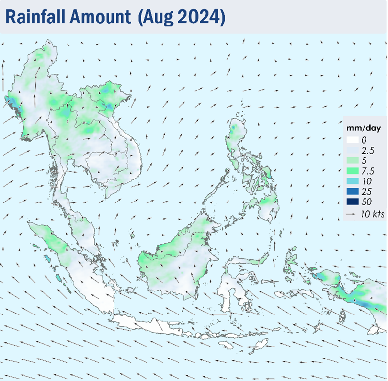
1.1 1.1 Southwest Monsoon conditions prevailed over the ASEAN region in August 2024. The prevailing winds over regions south of the Equator blew mainly from the southeast while the prevailing winds over areas north of the equator blew mainly from southwest to west, with winds turning southerly near the Equator (Figure 1). With the occurrence of Tropical Storms and Typhoons mainly over the northwestern Pacific Ocean, winds over the northern parts of the Philippines would occasionally blow from the east.
1.2 It was a generally wet August with rainfall observed over most areas of the ASEAN region, with higher rainfall over the northern parts of the Mekong sub-region, Sumatra and Borneo and parts of the Philippines and Papua. Flooding and landslides were reported in multiple areas of Thailand during the month (Figure 1). In contrast, drier conditions were observed over Java, the Lesser Sunda Islands, Sulawesi as well as the southern parts of Sumatra (Figure 1).
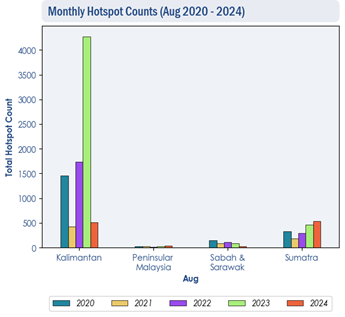
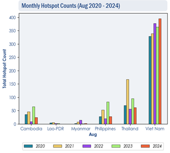
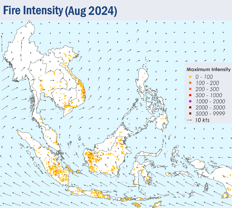
1.3 During August 2024, the hotspot count in the ASEAN region was comparable to that of previous years (Figure 2 and 3), except for Viet Nam where the hotspot count in August 2024 is the highest compared to the same month of previous years (Figure 2).
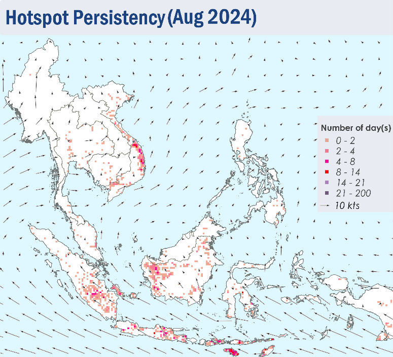
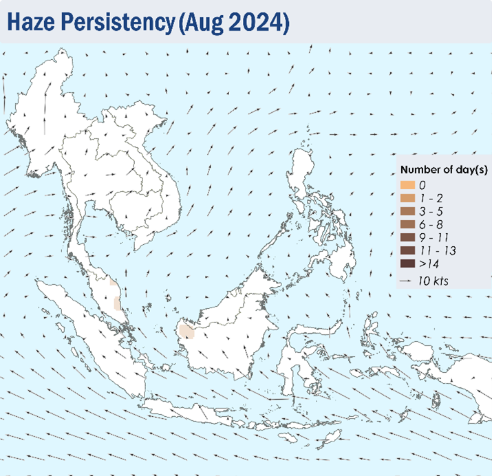
1.4 In August 2024, isolated to scattered hotspots were mainly detected in parts of the southern ASEAN region, particularly in Java, the Lesser Sunda Islands, the southern parts of Sumatra and the western parts of Kalimantan where hotspot persistency and fire intensity were more pronounced (Figure 4 and 5). Slight to moderate smoke haze was observed over the western parts of Kalimantan, while smoke plumes were observed over the southern parts of Sumatra (Figure 6). While the hotspot activity in the Mekong sub-region was suppressed, isolated hotspots with high persistency and intensity were detected mostly in the central parts of Viet Nam (Figure 4 and 5).


