Review of Regional Haze Situation for February 2025
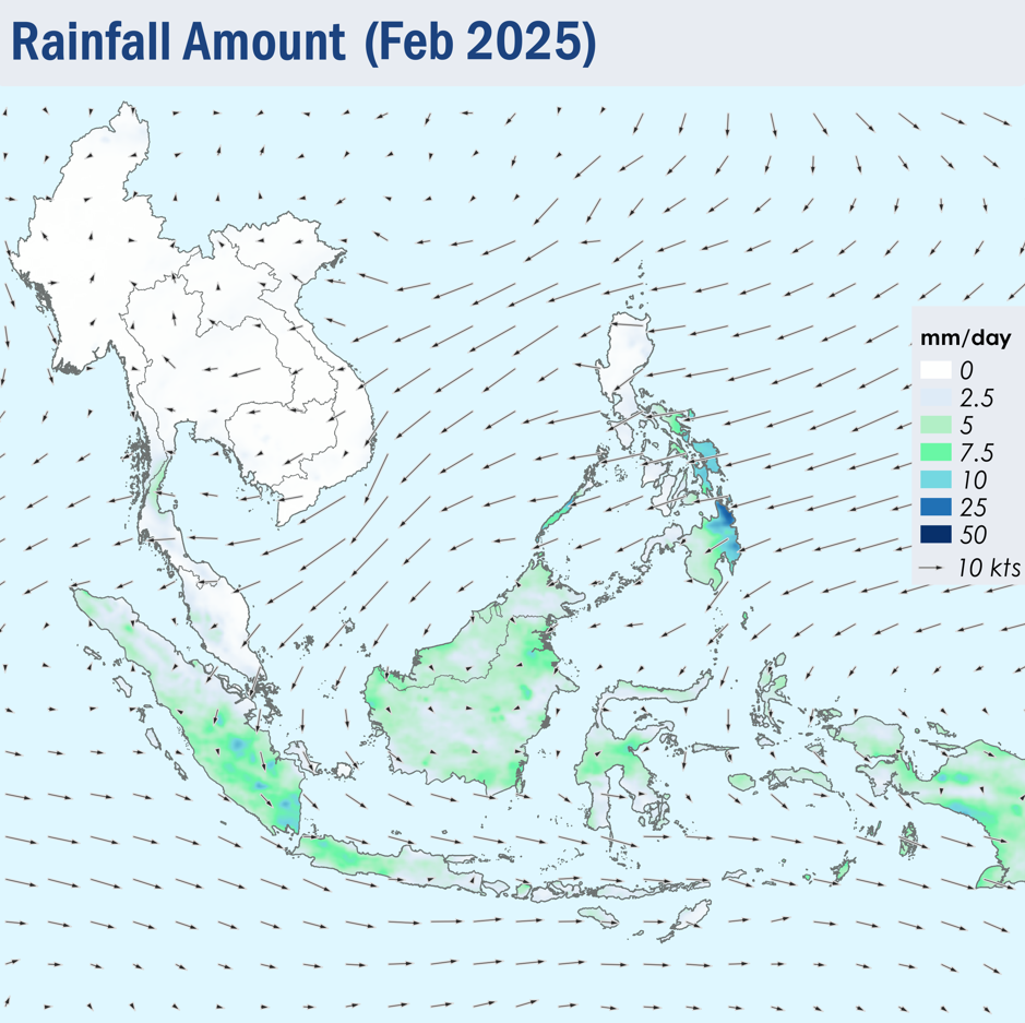
1.1 Northeast monsoon conditions prevailed throughout February 2025. The prevailing low-level winds generally blew from the northeast or east over areas north of the Equator, except over the Mekong sub-region where the prevailing winds were light and variable in direction (Figure 1). Over areas south of the Equator, the prevailing low-level winds blew from the west or northwest which gradually weakened to become light and variable in direction towards the end of the month.
1.2 Dry conditions continued over most areas of the Mekong sub-region and the northern parts of the Philippines. Relatively drier conditions were also observed over some parts of Peninsular Malaysia under the influence of the dry phase of the Northeast Monsoon. Higher rainfall was recorded over the rest of the ASEAN region, particularly over the southern parts of the Philippines and Sumatra where rainfall was more intense (Figure 1). Flooding and landslides were reported over parts of Indonesia and the Philippines, causing infrastructural damage and displacing people from homes.
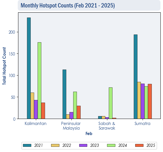
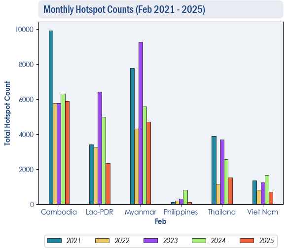
1.3 The overall hotspot counts for the ASEAN region in February 2025 were lower than or comparable to those in the same period in previous years (Figures 2 & 3).
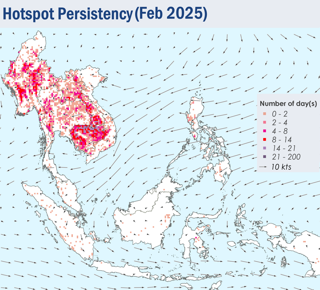
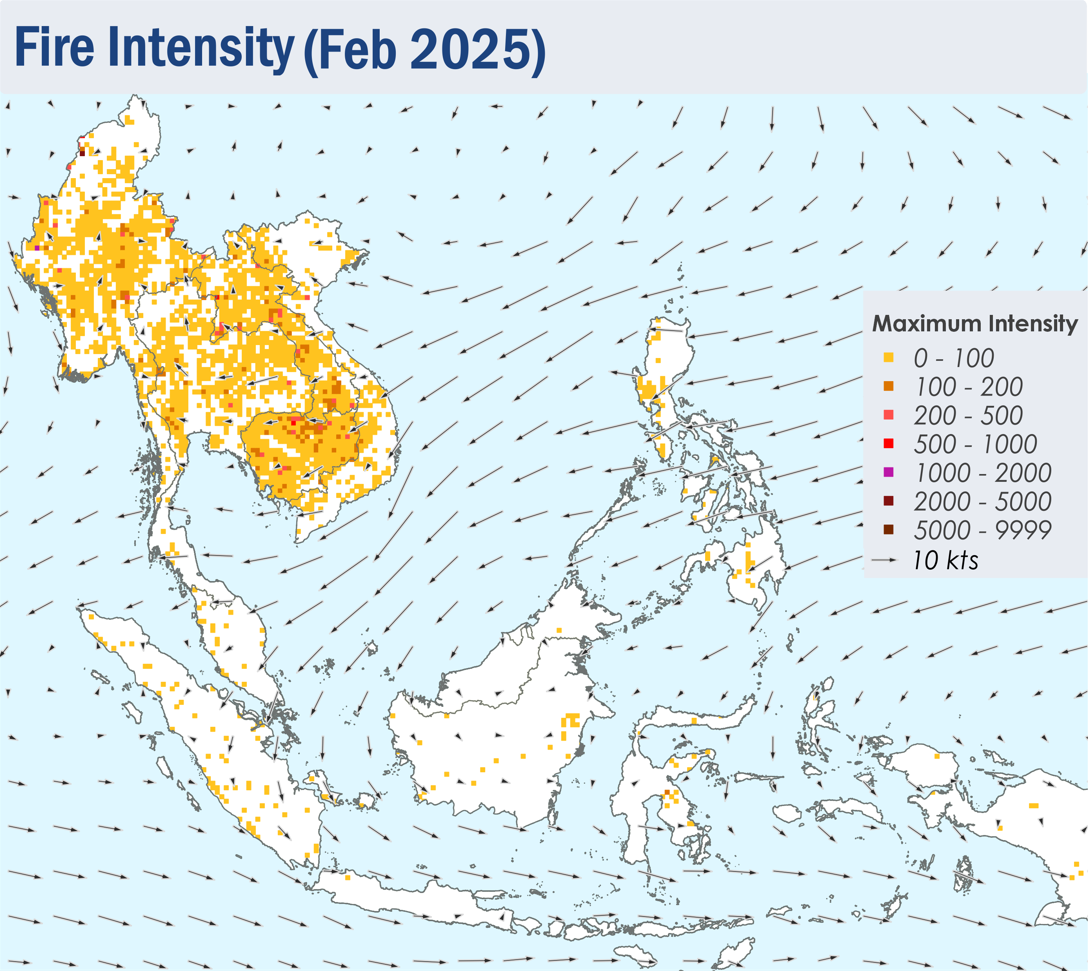
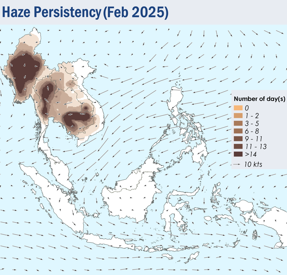
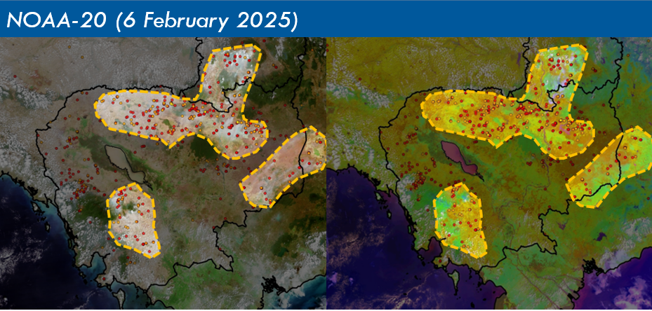
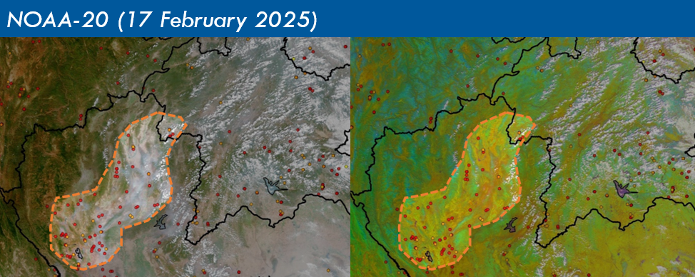
1.4 Scattered to widespread hotspots were detected in the northern and central parts of Myanmar, the central parts of Thailand, the southern parts of Lao PDR, and many parts of Cambodia. Isolated to scattered hotspots were detected elsewhere in the northern ASEAN region (Figure 4). Many hotspots detected in the Mekong sub-region were persistent and intense (Figures 4 & 5). This led to the development of moderate to dense smoke haze over the sub-region, particularly over the southern parts of Lao PDR, the northern and central parts of Thailand as well as most parts of Cambodia and Myanmar where the smoke haze was persistent (Figure 6 & 7). Some of this smoke haze became transboundary due to the prevailing wind conditions (Figure 7). Flight disruptions at airports due to smoke haze were reported in Thailand.
1.5 In the southern ASEAN region, the hotspot and smoke haze situation was generally subdued, with a few hotspots detected in parts of Sumatra, Peninsular Malaysia, Kalimantan and Sulawesi on a few days. Occasional slight localised smoke plumes were observed from hotspots detected in Sumatra.