Review of Regional Haze Situation for February 2026
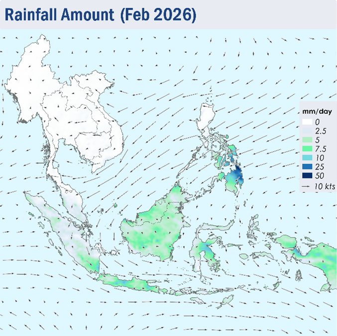
1.1 During February 2026, Northeast monsoon conditions were predominantly observed over the ASEAN region. While the prevailing winds blew mostly from the northeast or northwest over the region, the Mekong sub-region occasionally experienced days with prevailing light and variable winds. (Figure 1)
1.2 Extensive dry conditions were generally observed over the Mekong sub-region as well as the northern parts of the Philippines during the month of February 2026, though there were some showers observed over the southeastern and central parts of the Mekong sub-region on a few days during the last week of February. Parts of Peninsular Malaysia and Sumatra also experienced days with relatively lower rainfall during the month (Figure 1). Heavier showers were observed over the Philippines, which can be attributed to Tropical Storm Penha. To reflect the ongoing and expected dry weather conditions over the Mekong sub-region, ASMC issued Alert Level 2 for the Mekong sub-region on 2 February 2026.
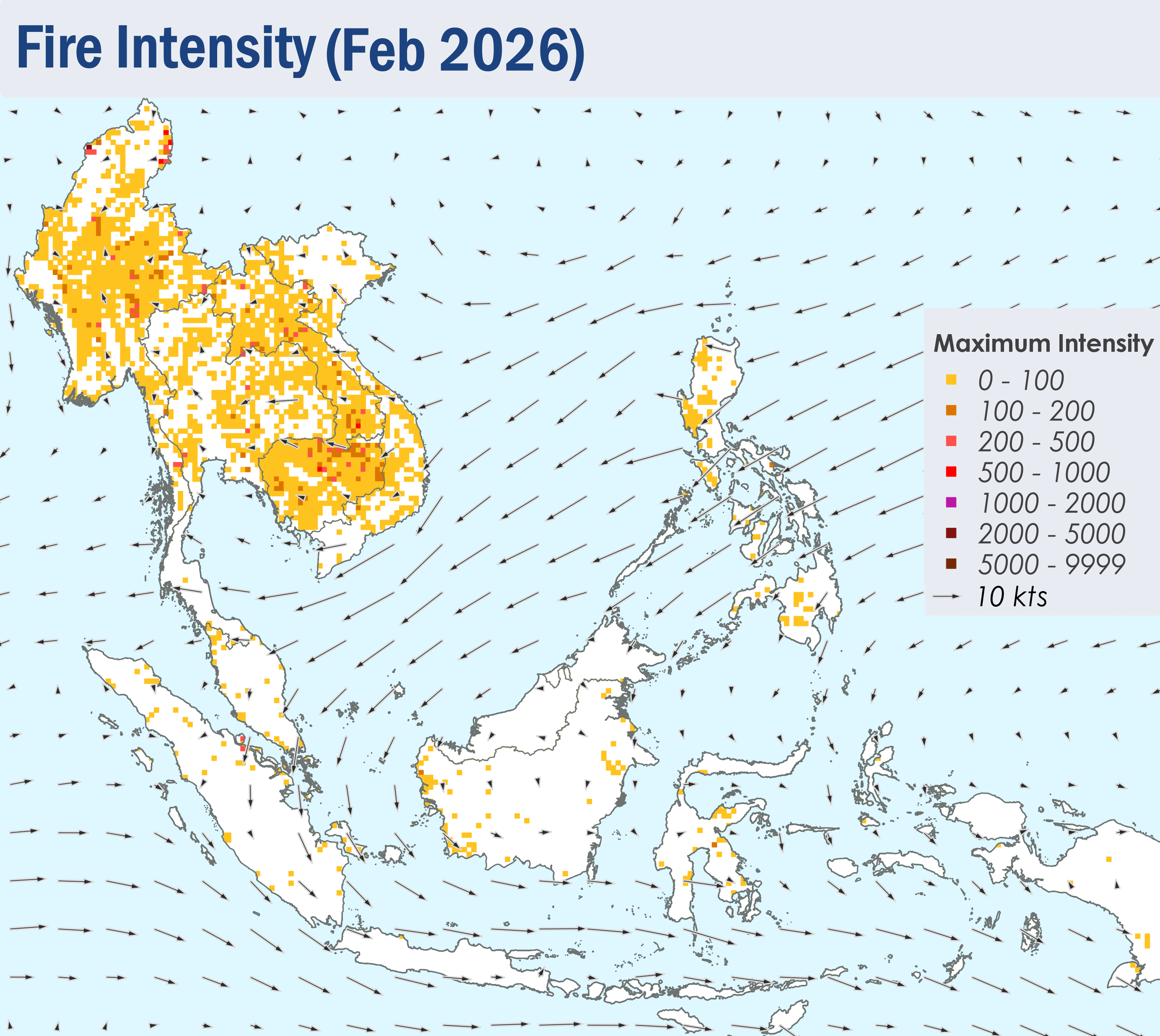
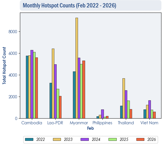
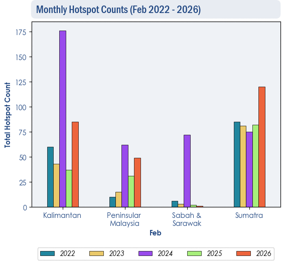
1.3 Despite the drier conditions, hotspot counts over the ASEAN region for February 2026 were observed to be much lower or comparable compared to the hotspot counts from the preceding years (2022-2025), except for Sumatra where hotspot counts were higher.
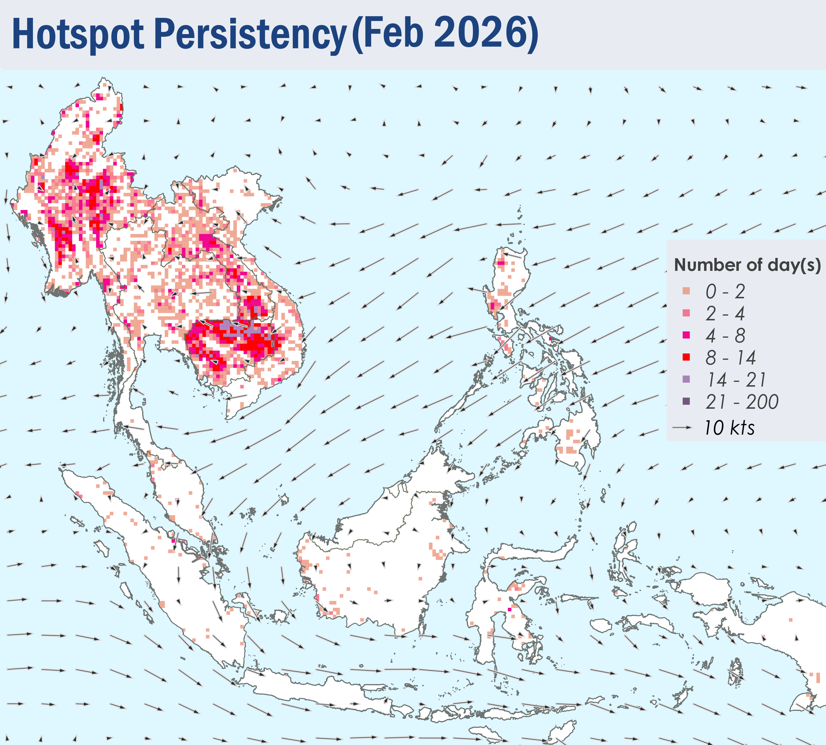
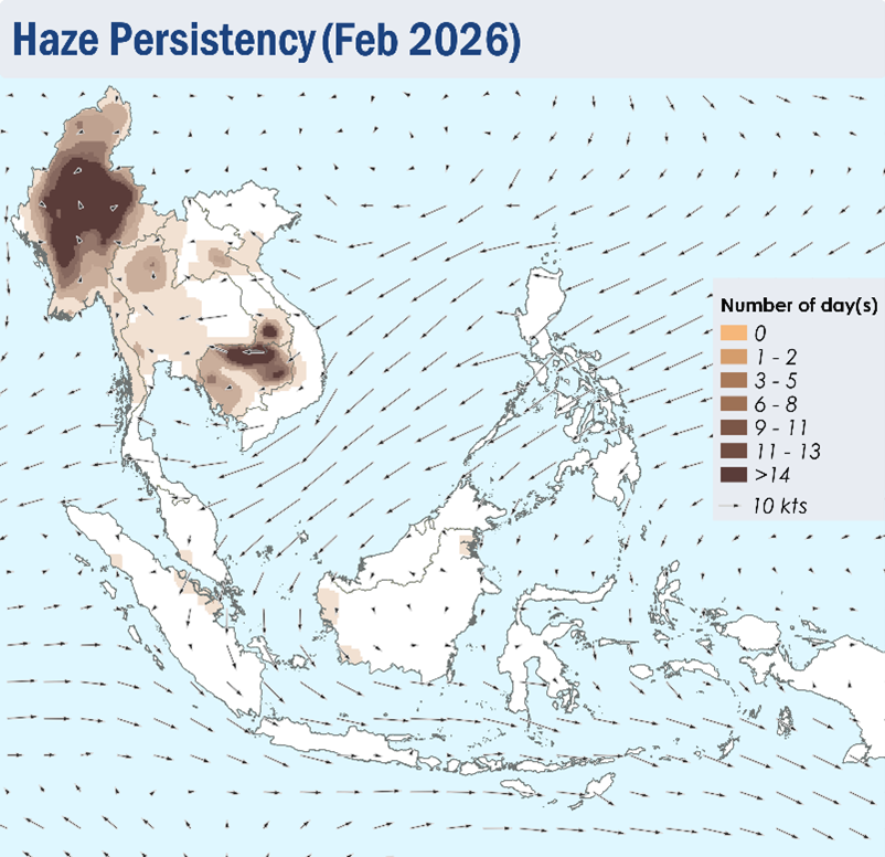
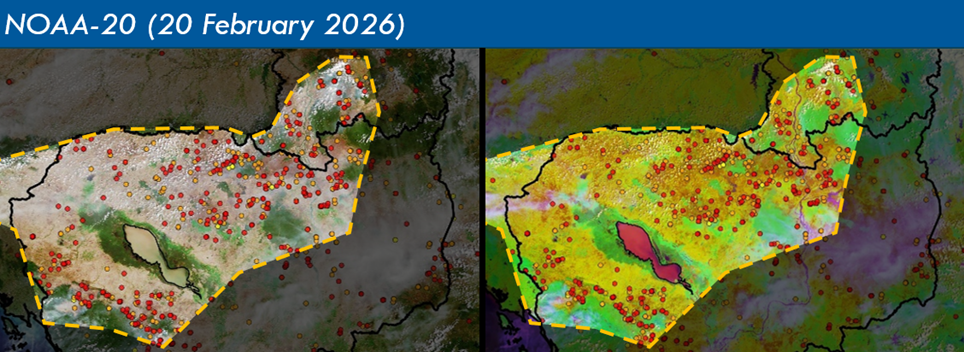
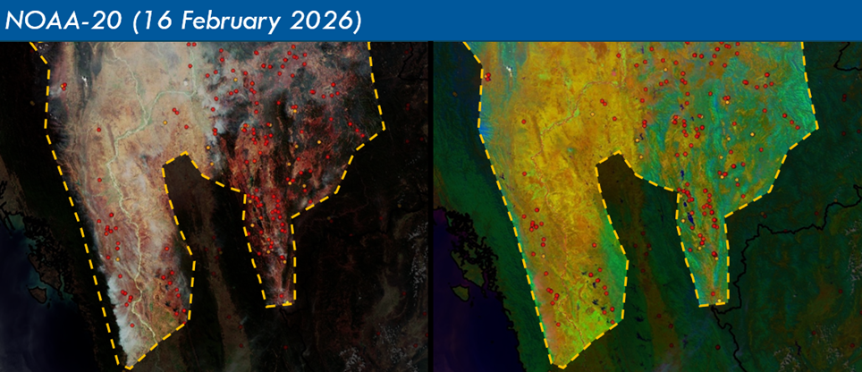
1.4 Scattered to widespread hotspots were often observed over the northern and western parts of Cambodia as well as the southern parts of Lao PDR (Figure 4), leading to moderate to dense smoke plumes observed over these areas for many days during February 2026 (Figure 6). Transboundary smoke haze would occasionally occur from the southern parts of Lao PDR to the northern parts of Cambodia, as well as from the western parts of Cambodia to the central parts of Thailand (Figure 8 & 9) . Moderate to dense smoke haze was observed to persist over the central and northern parts of Myanmar under the prevailing light winds situation (Figure 6 and 9 ). In the southern ASEAN region, Smoke plumes were also observed in the southern parts of Peninsular Malaysia, the central parts of Sumatra and in West Kalimantan for a few days in the month. (Figure 6 and 7 )