Review of Regional Haze Situation for January 2026
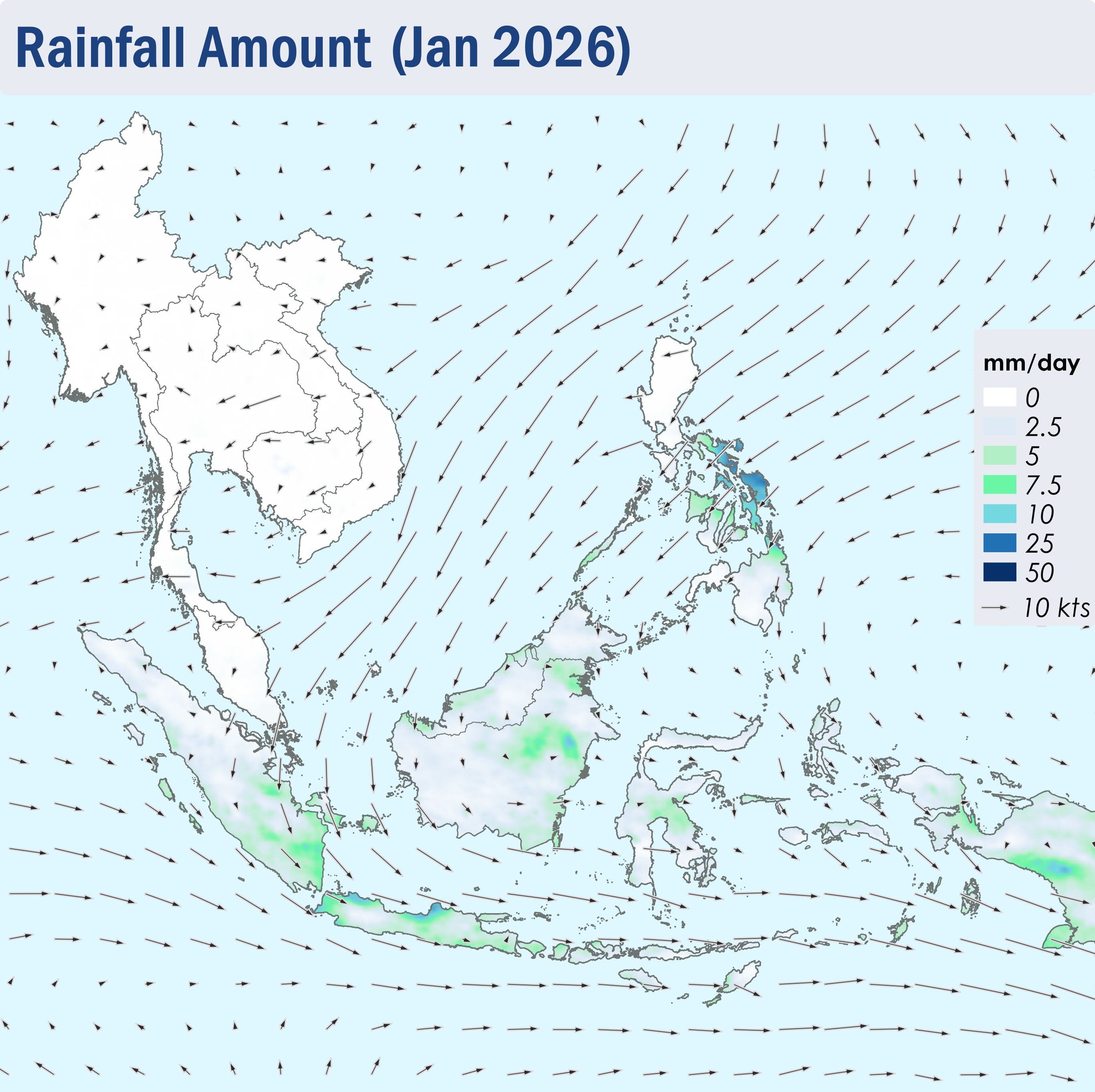
1.1 The Northeast Monsoon continued over the ASEAN region throughout January 2026. The prevailing low-level winds over regions north of the Equator blew mainly from the northeast to east, except over the northern parts of the Mekong sub-region where the winds were light and variable in direction (Figure 1). Over regions south of the Equator, the prevailing low-level winds blew mainly from the west to north (Figure 1).
1.2 Dry weather persisted over the Mekong sub-region, Peninsular Malaysia and the northern parts of the Philippines in January 2026. Showers were observed elsewhere in the ASEAN region (Figure 1), with the areas south of the Equator, the eastern parts of Borneo and the central parts of the Philippines experiencing higher rainfall. The latter was due to the influence of Tropical Storm NOKAEN.
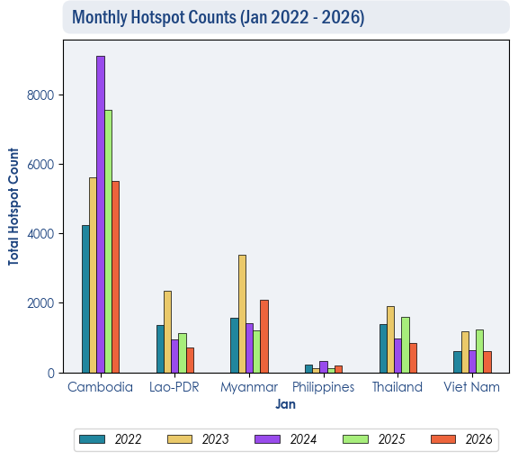
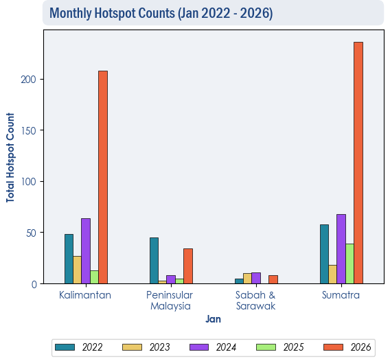
1.3 The hotspot counts over the northern ASEAN region were generally lower than or comparable to those recorded in the same month during previous years (Figure 2). Over the southern ASEAN region, the hotspot counts were mostly higher compared to previous years, especially over Kalimantan and Sumatra, where there was a significant increase in hotspot activity, with the highest count recorded in five years (Figure 3).
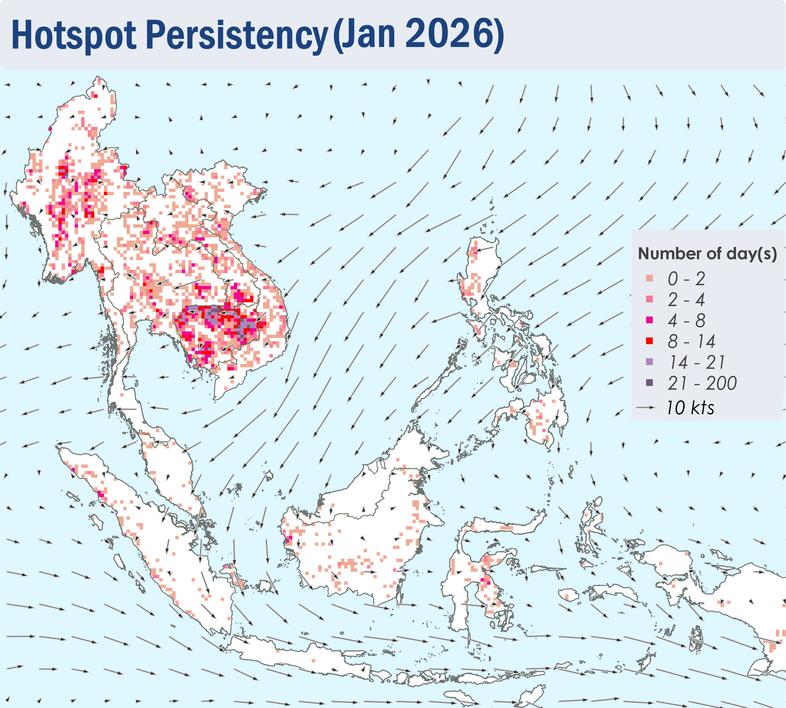
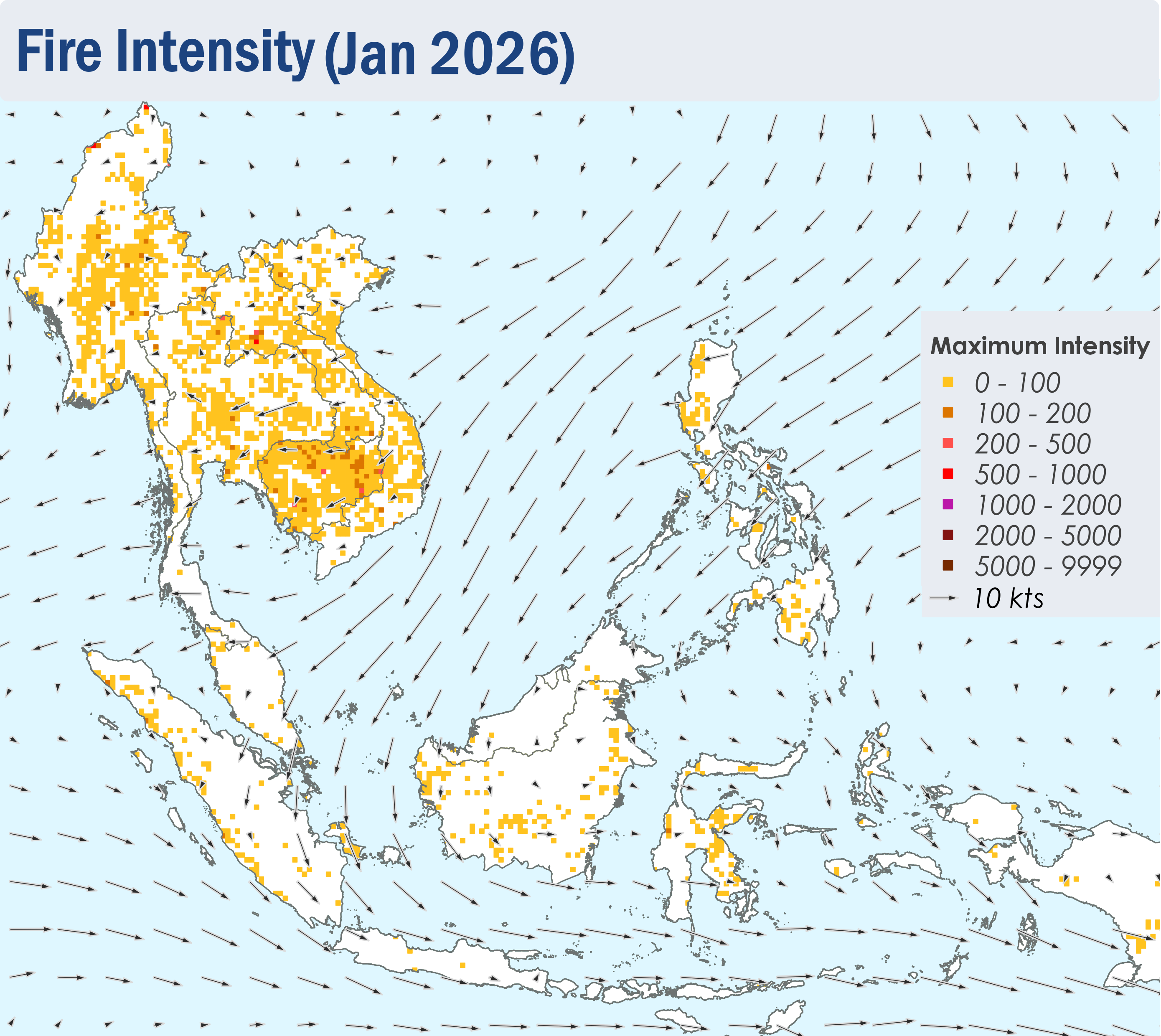
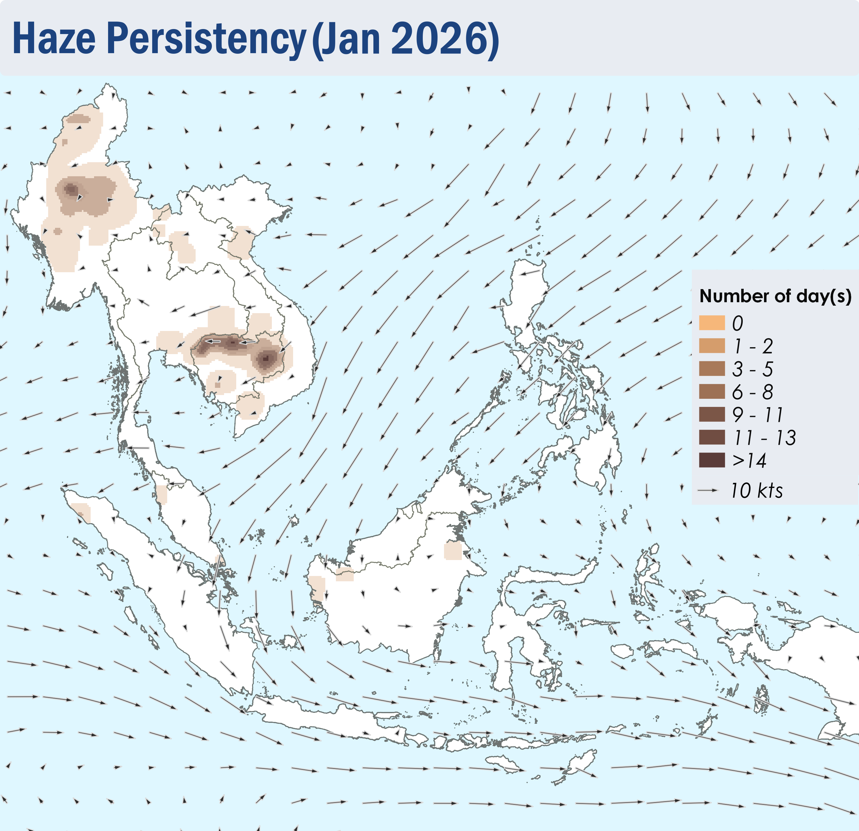
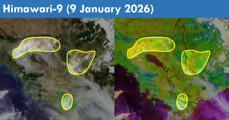
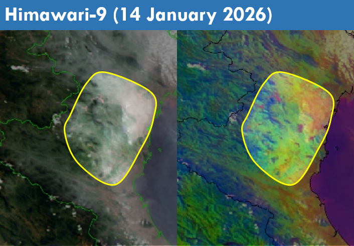
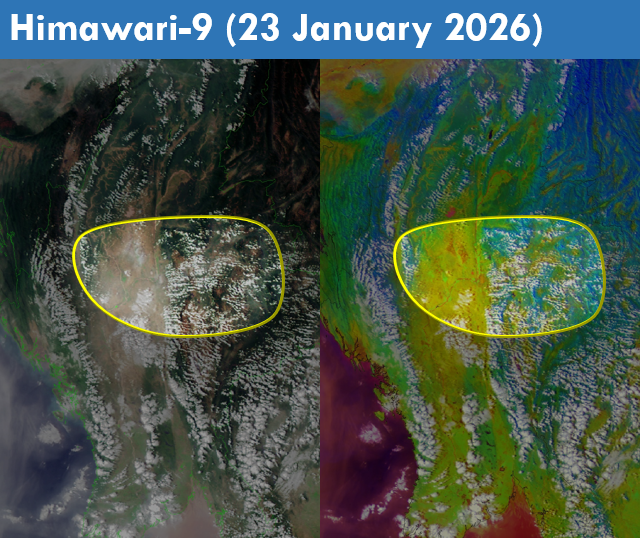
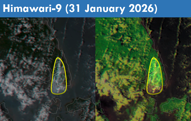
1.4 Persistent and intense hotspots were detected mostly in Cambodia, Myanmar and the southern parts of Lao PDR (Figures 4 and 5). During prolonged periods of dry weather, moderate and persistent smoke plumes were observed mainly over the central parts of Myanmar and the northern parts of Cambodia. Smoke plumes were also observed over the other parts of the Mekong sub-region, Sumatra, Peninsular Malaysia and Kalimantan (Figures 6 to 10).