Review of Regional Haze Situation for June 2025
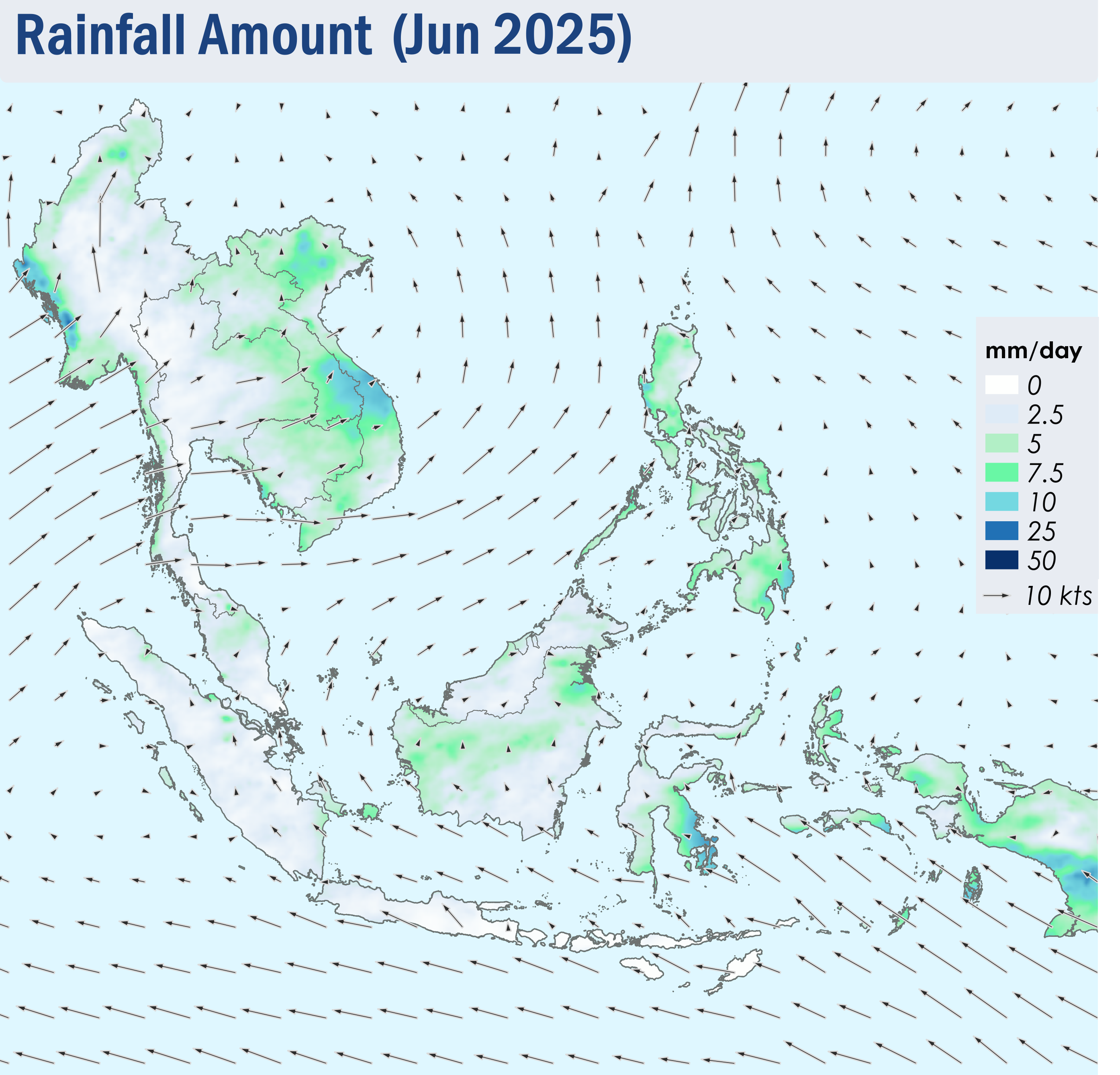
1.1 Southwest Monsoon conditions became fully established over the ASEAN region in June 2025. Over much of the southern ASEAN region, the prevailing winds blew mainly from the southeast. The prevailing winds over the Mekong sub-region were mostly southwesterly or westerly while the regions close to the Equator and the Philippines experienced winds that were mostly light and variable in direction (Figure 1).
1.2 Rainy weather prevailed over most parts of the ASEAN region during the review period. In particular, moderate to heavy showers fell on several days over the central parts of Viet Nam under the influence of Typhoon WUTIP. The resulting flooding and landslides were reported across multiple areas in the central parts of Viet Nam . In contrast, drier conditions were observed over Sumatra, Java and the Lesser Sunda Islands (Figure 1). In view of the expected continuation of the dry weather, Alert Level 1 for the southern ASEAN region was activated on 12 June 2025.
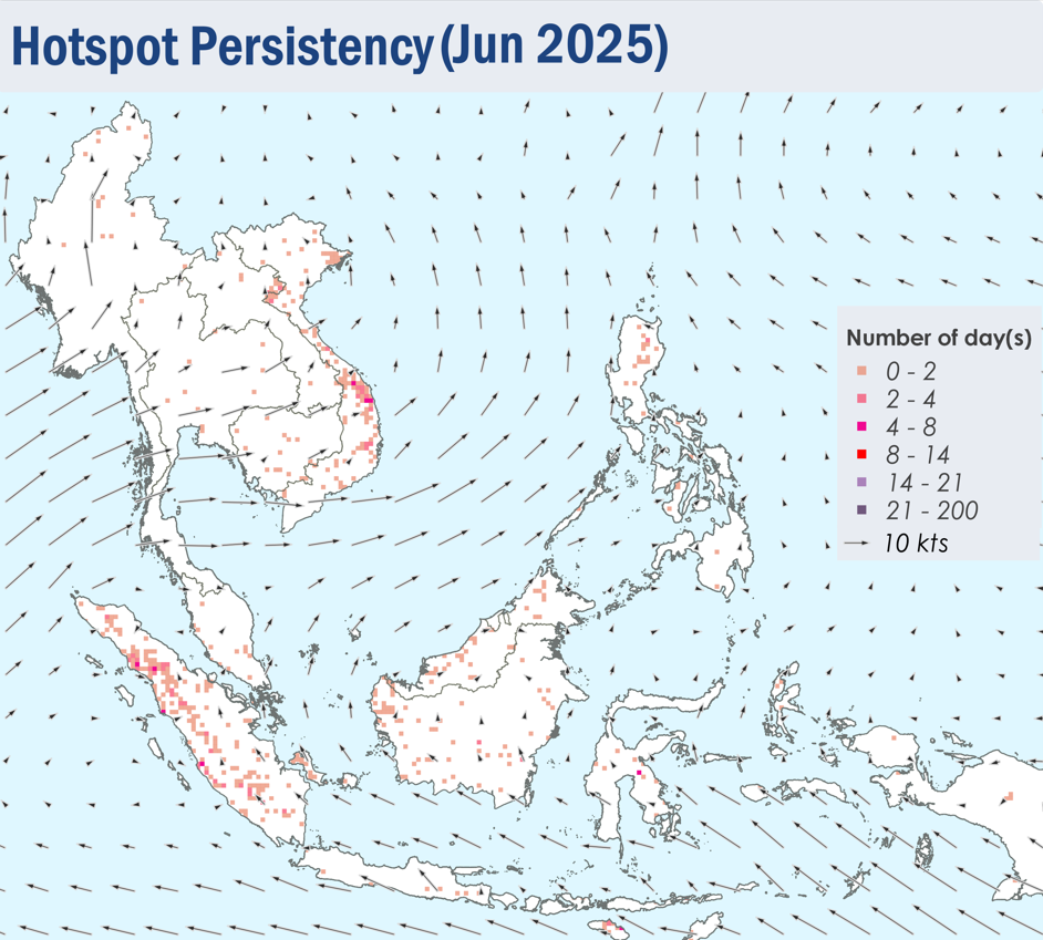
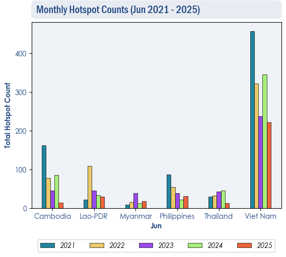
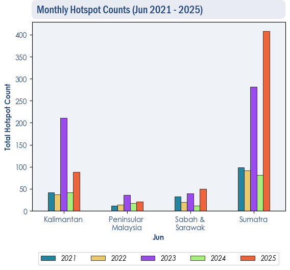
1.3 Hotspot activity in the northern ASEAN region was mostly subdued in June 2025 due to the prevailing wet weather conditions. The total number of hotspots were lower or comparable to the same period of previous years (Figure 2). Meanwhile, hotspot counts in the southern ASEAN region were generally comparable to previous years except for Sumatra which recorded the highest number of hotspots in five years (Figure 3).
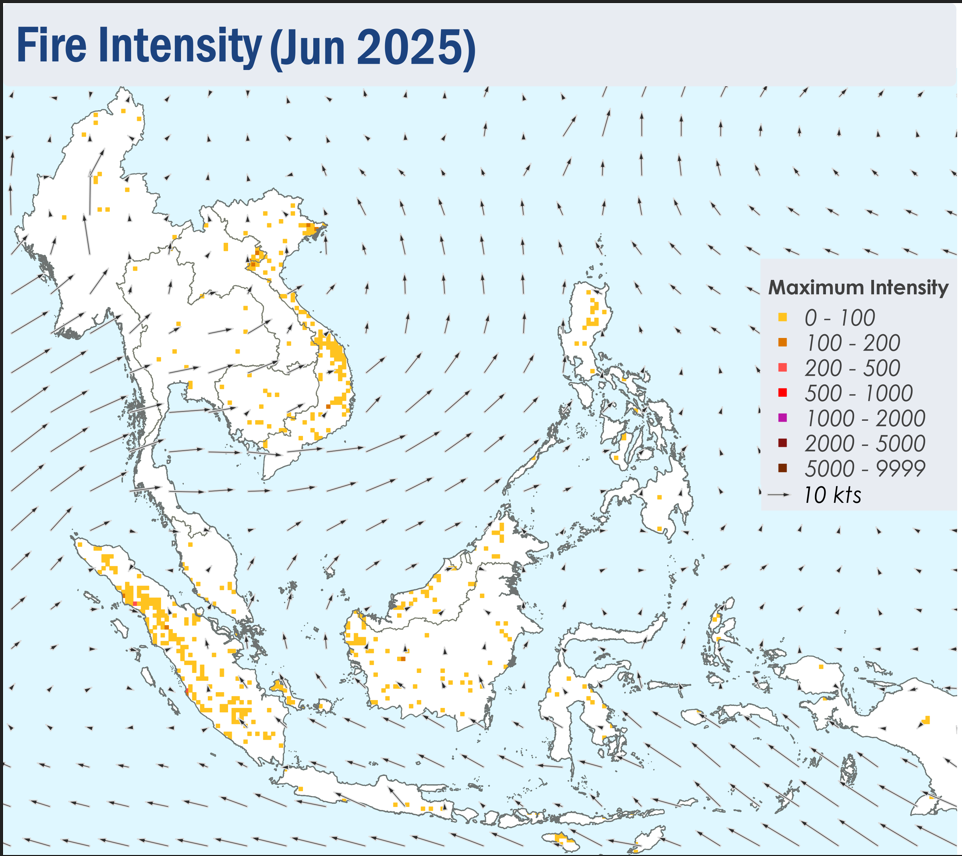
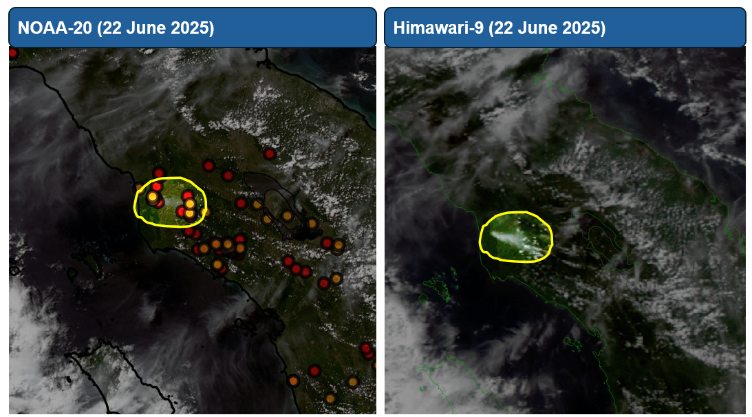
1.4 In June 2025, a few to isolated hotspots were detected in the ASEAN region, particularly in the northern and central parts of Sumatra, as well as parts of Viet Nam where the fires were more persistent and intense. Slight localised smoke plumes were observed emanating from hotspots in West Kalimantan, Sarawak and the northern and central parts of Sumatra on some days (Figure 4, 5 and Figure 6).