Review of Regional Haze Situation for October 2024
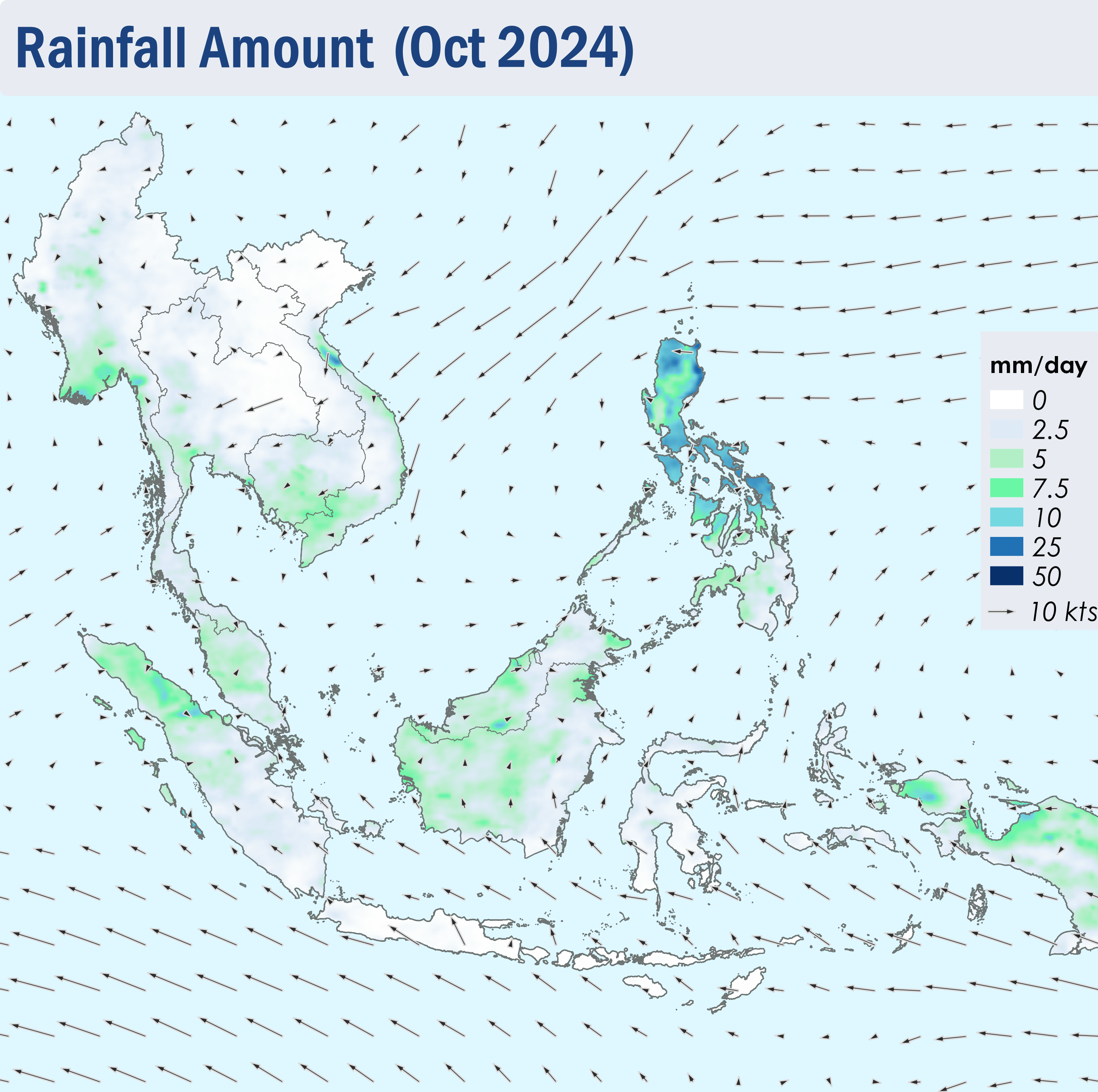
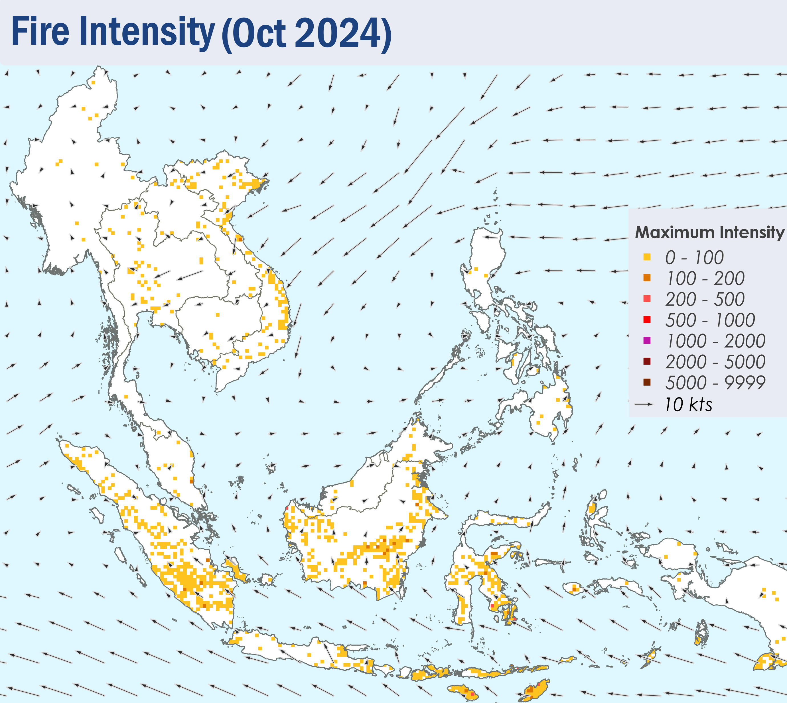
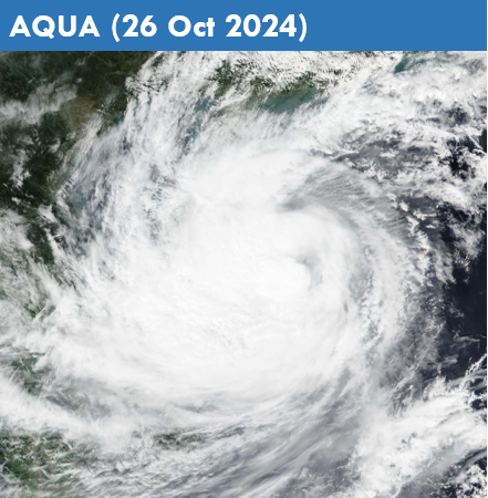
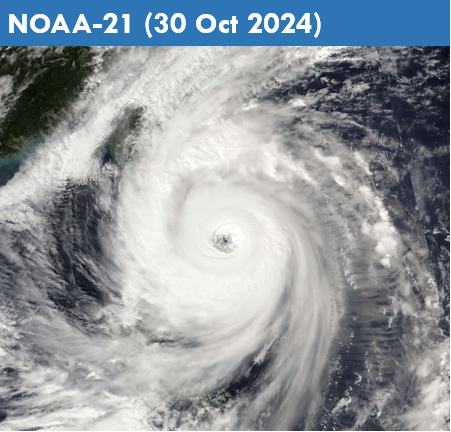
1.1 In October 2024, the Southeast Monsoon transitioned to the inter-monsoon conditions. As the monsoon rainband shifted towards the Equator, the winds over the equatorial regions became light and variable in direction (Figure 1). However, strong winds affected the northern parts of the Philippines at times, driven by Tropical Storm Trami and Super Typhoon Kong-Rey (Figures 8 and 9).
1.2 Showers prevailed over most of the ASEAN region in October 2024, apart from Java, the Lesser Sunda Islands and the northern and central parts of the Mekong sub-region where conditions were relatively drier (Figure 1). On 14 October 2024, ASMC downgraded the Alert Level for the southern ASEAN region from Level 1 to Level 0, following increased shower activity, marking the end of the dry season of the region. Towards the end of the month, heavy rainfall affected the northern and central parts of the Philippines, influenced by Tropical Storm Trami and Typhoon Kong-Rey, which were located over the northern South China Sea and the northwestern Pacific Ocean, respectively (Figures 8 and 9).
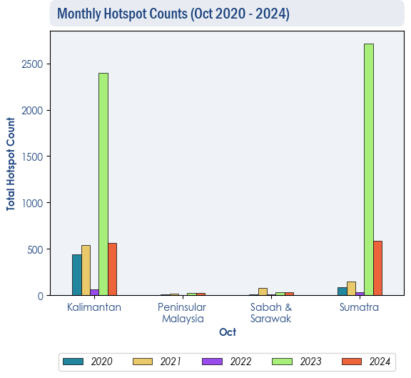
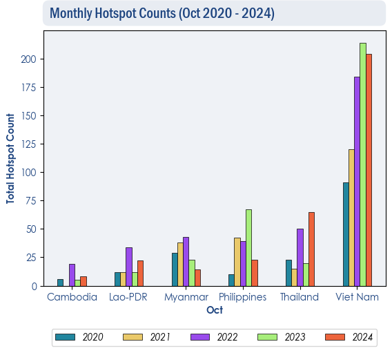
1.3 Over the ASEAN region, hotspot counts in October 2024 were generally comparable or lower than the same month of previous years (Figure 2 and 3) except in Thailand where the highest hotspot counts over the past five years was recorded. Despite this, the overall hotspot activity in the northern ASEAN region remained relatively low compared to previous years.
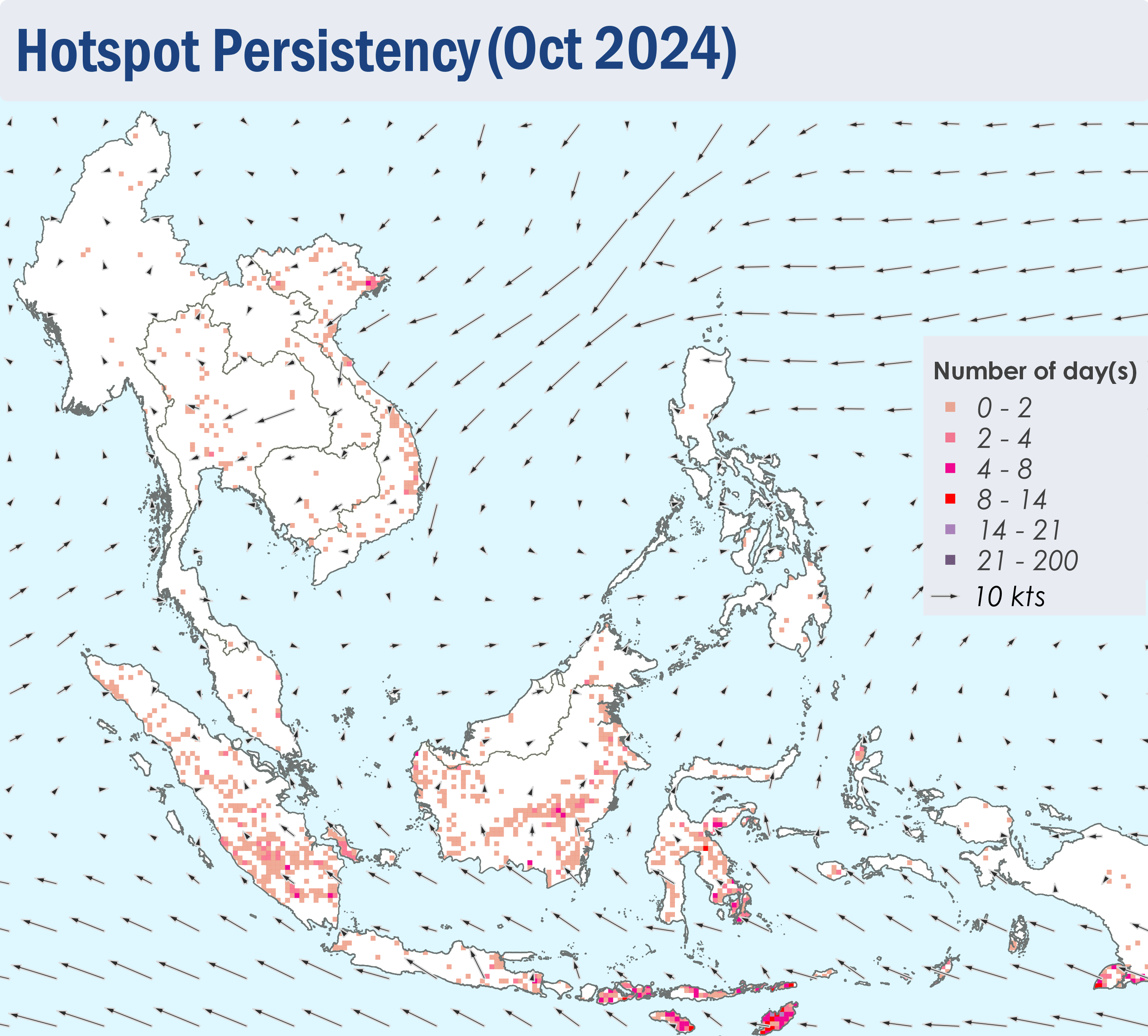
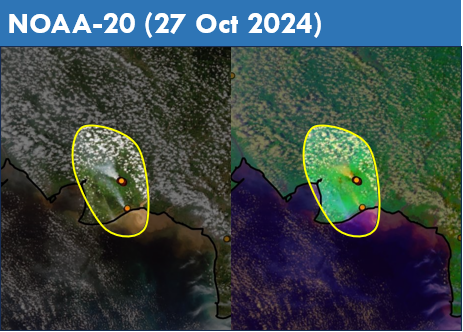
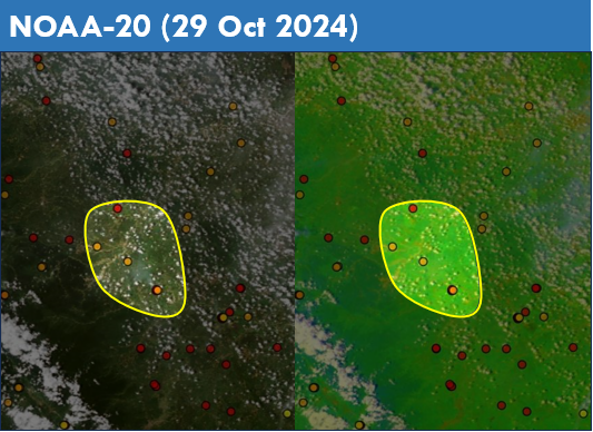
1.4 During the second half of October 2024, persistent and intense hotspots were detected mostly in the central and southern parts of Sumatra, the central and southeastern parts of Kalimantan and parts of Sulawesi and the Lesser Sunda Islands (Figure 4 and 5). Slight localised smoke plumes were observed to emanate from hotspots detected in the southeastern parts of Kalimantan and the southern parts of Sumatra (Figure 6 and 7).


