Review of Regional Haze Situation for September 2024
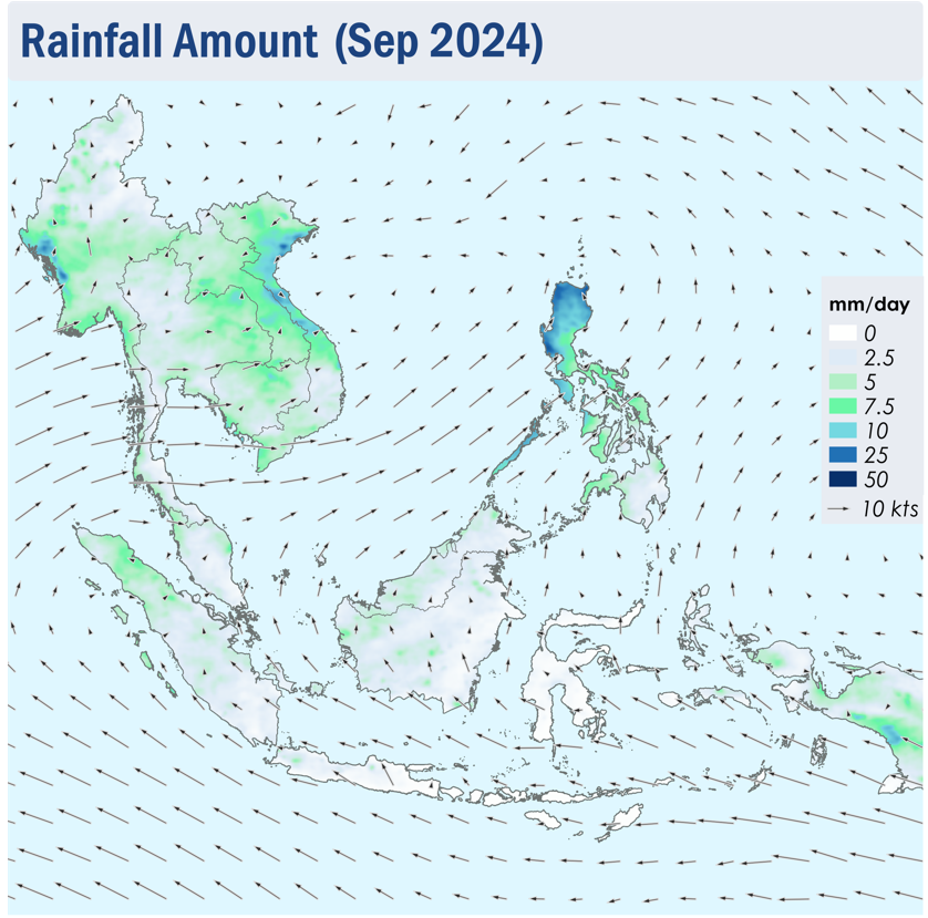
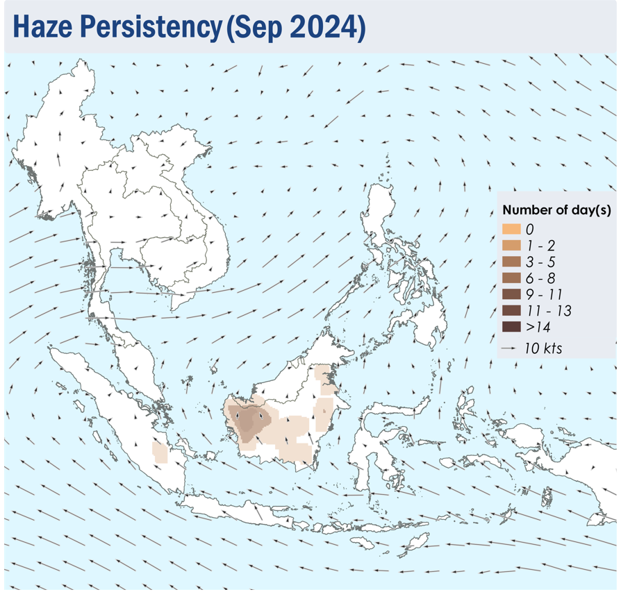
1.1 Southwest Monsoon conditions persisted in September 2024 as the prevailing winds blew mainly from the southeast over areas south of the Equator and turned to blow from the southwest or west over areas north of the Equator (Figure 1).
1.2 Rainy conditions prevailed over most parts of the ASEAN region in September 2024, except for parts of Kalimantan, Sumatra, Java and the Lesser Sunda Islands which saw occasional dry weather . The month was marked by the occurrences of multiple tropical cyclones/typhoon, with Typhoon Yagi being the most notable one, which formed during the first week of the review period, and later Tropical Storm Soulik , which formed during the middle of the month. Heavy rain and strong winds brought by the storms affected large parts of northern Philippines and the northern parts of Viet Nam as they made landfall over both countries, resulting in significant damage to infrastructures and loss of life (Figure 1).
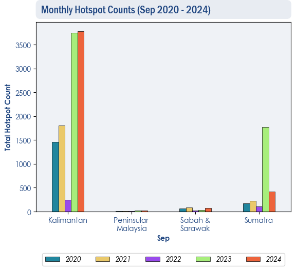
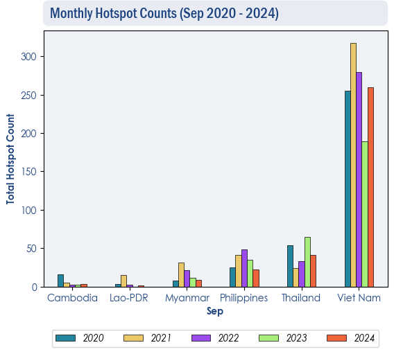
1.3 In September 2024, overall hotspot activity in the southern ASEAN region were generally comparable to previous years. Over Kalimantan, the hotspot counts in 2024 were as high as in 2023 (Figure 2) . For the northern ASEAN region, hotspot counts were lower or comparable to the same period in previous years (Figure 3).
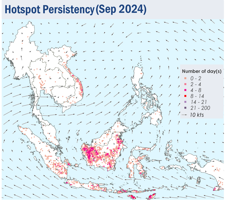
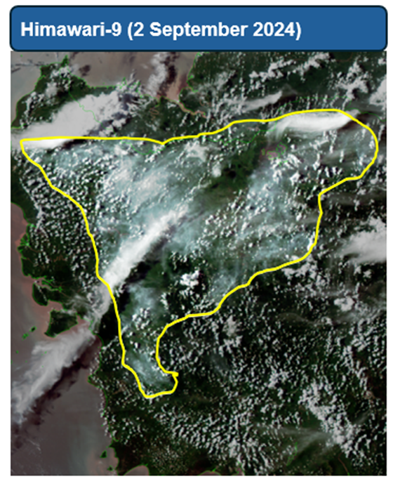
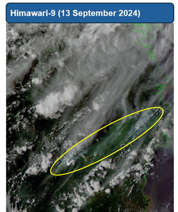
1.4 Isolated to scattered hotspots were detected in Sumatra, Kalimantan, Java and the Lesser Sunda Islands on multiple days during the review period, with more intense and persistent hotspots located mostly in Kalimantan (Figure 4 and 5). Slight to moderate smoke haze was observed over parts of West Kalimantan, while localised smoke plumes were seen emanating from hotspots in other parts of Kalimantan, as well as from hotspots in the central and southern parts of Sumatra (Figure 6, 7 and 8). Smoke haze from West Kalimantan was also observed to drift into western Sarawak on some days during the review period. While the hotspot activity in the Mekong sub-region was suppressed, isolated hotspots were detected mostly in the central parts of Viet Nam (Figure 4 and 5).


