Review of Regional Weather for December 2025
1. Overview
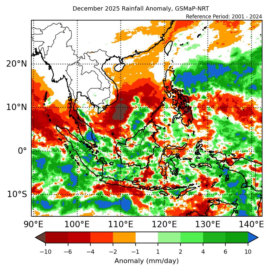
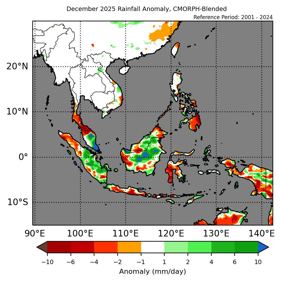
1.1 During December 2025, a mix of below- to above-average rainfall was recorded over the Maritime Continent with near-average rainfall over Mainland Southeast Asia (Figure 1). For the Maritime Continent, most of the equatorial region recorded above-average (wetter) anomalies with the surrounding region recording predominately below-average (drier) anomalies in both datasets (GSMaP-NRT and CMORPH-Blended). There were no notable anomalies over Mainland Southeast Asia, in line with the current dry season. The largest positive (wetter) anomalies were recorded over parts of Peninsular Malaysia and Borneo, with the largest negative (drier) anomalies over the northern Malay Peninsula and the southern Philippines.
1.2 The observed rainfall anomaly pattern of below-average rainfall over parts of the Maritime Continent outside of the equatorial region is consistent with the predictions from the subseasonal weather outlooks for December 2025 (24 November – 7 December 2025, 8 – 21 December 2025, and 22 December – 4 January 2026) although the above-average anomalies for most of the equatorial region were not predicted. The observations differ from the most likely tercile from the seasonal outlook for December 2025, which predicted an increase in chance of above-normal rainfall over parts of the northeastern and southern Maritime Continent.
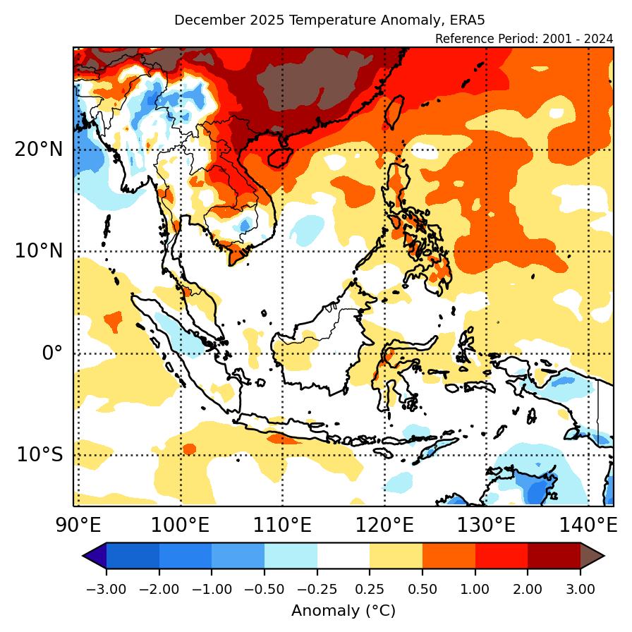
1.3 Above-average temperature was recorded over northeastern Mainland Southeast Asia and the northeastern Maritime Continent, with near-average temperature for much of the rest of Southeast Asia (Figure 2). The warmest anomalies (1°C – 3°C above average) were recorded over northern and central Viet Nam, while the coolest anomalies (0.5°C – 1°C below average) were recorded over northern Myanmar.
2. Climate Drivers
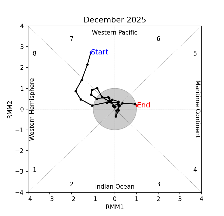
2.1 At the start of December, the Madden-Julian Oscillation (MJO) was present over the Western Pacific (Phase 7) based on the RMM diagram (Figure 3). The signal propagated eastwards, weakening over Western Hemisphere (Phase 8) and entering the unit circle by Week 2. For the rest of December there was no sustained MJO signal based on the RMM index. At this time of the year, Phases 1 and 2 tend to bring drier conditions to the eastern Maritime Continent, while Phases 4 and 5 tend to bring wetter conditions to much of the Maritime Continent. However, these patterns are not clear in Figure 1, indicating other drivers and weather systems likely had a stronger influence on the region’s rainfall.
2.2 La Niña conditions persisted in December 2025. La Niña events tend to bring wetter-than-average conditions to much of the Maritime Continent during this time of the year. The Indian Ocean Dipole (IOD) returned to neutral in December 2025.


