
Review of Regional Haze Situation for August 2026
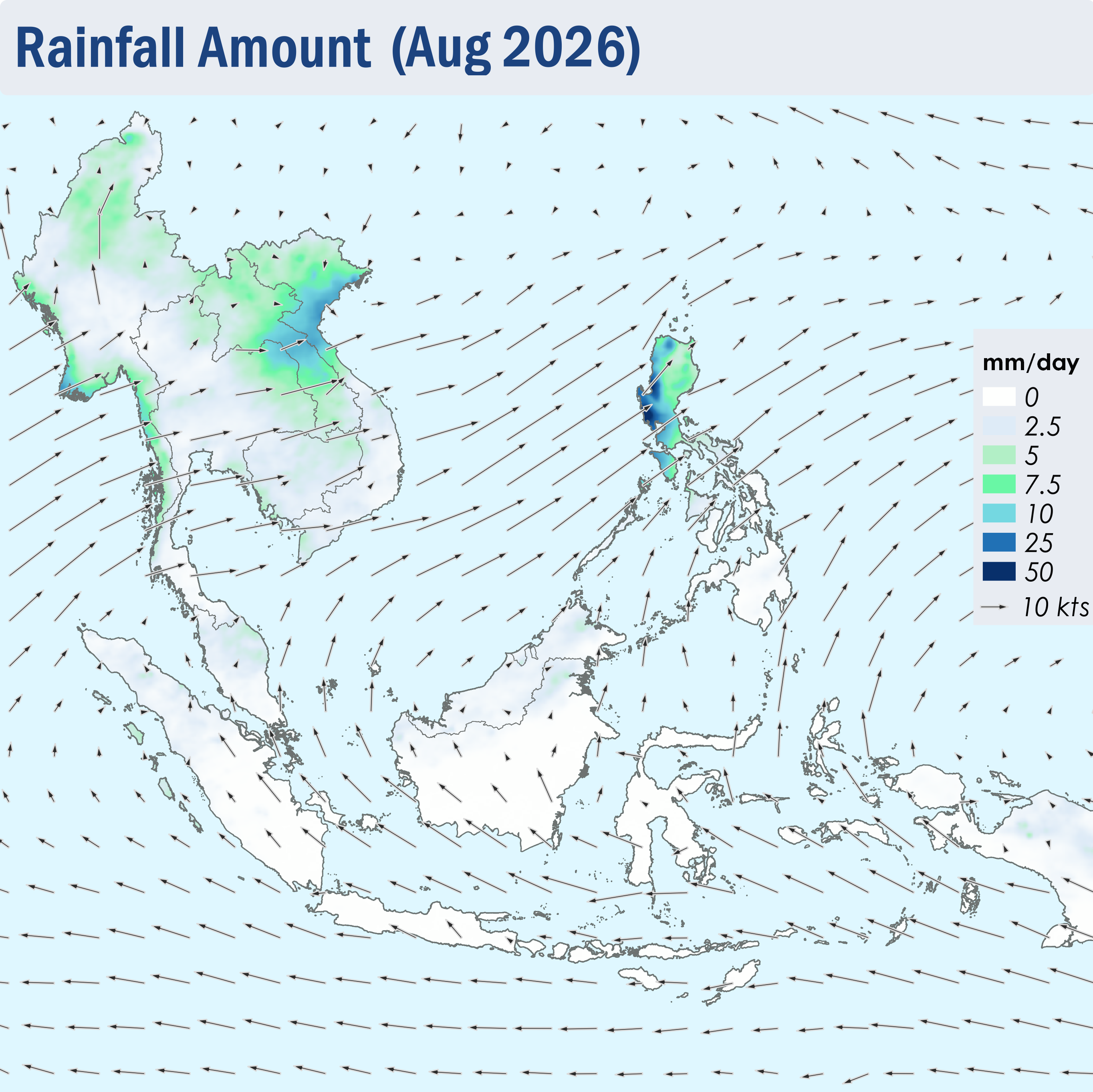
1.1 During August 2026, the ASEAN region continued to experience the Southwest Monsoon conditions. The prevailing winds over the southern ASEAN region blew from the southeast or south, while the prevailing winds over the northern ASEAN region blew from the southwest to west (Figure 1).
1.2 Dry weather was observed over most of the southern ASEAN region during the review period, except for some showers over the northern parts of Peninsular Malaysia and Sumatra, and the northeastern parts of Borneo (Figure 1). Alert Levels 2 and 3 for the southern ASEAN region were raised on 3 August 2026 and 26 August 2026 respectively, in view of an increased risk of transboundary haze occurrence, amid persistent dry weather and an escalating hotspot and smoke haze situation. On the other hand, showers prevailed over the northern ASEAN region (Figure 1).
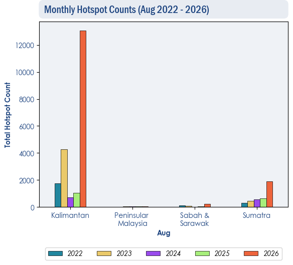
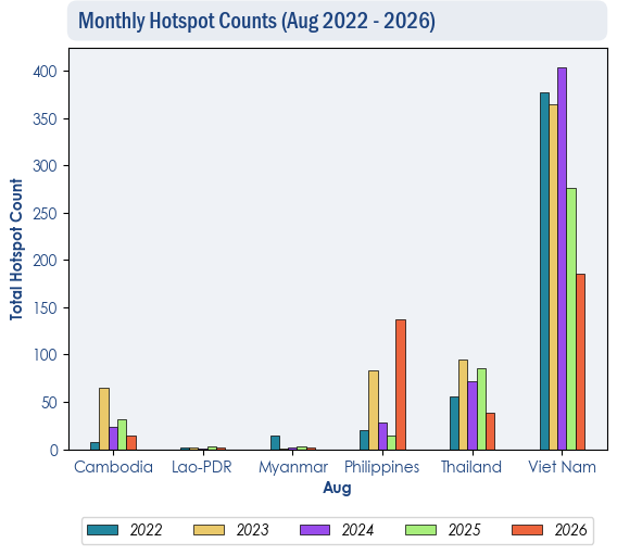
1.3 Over the southern ASEAN region, hotspot counts were mostly higher in August 2026 compared to previous years, with Kalimantan, Sumatra, Sabah and Sarawak having the highest counts recorded in five years (Figure 2). Over the northern ASEAN region, the hotspot counts for August 2026 were generally lower or comparable to previous years, except over the Philippines where the hotspot count was the highest recorded in five years (Figure 3).
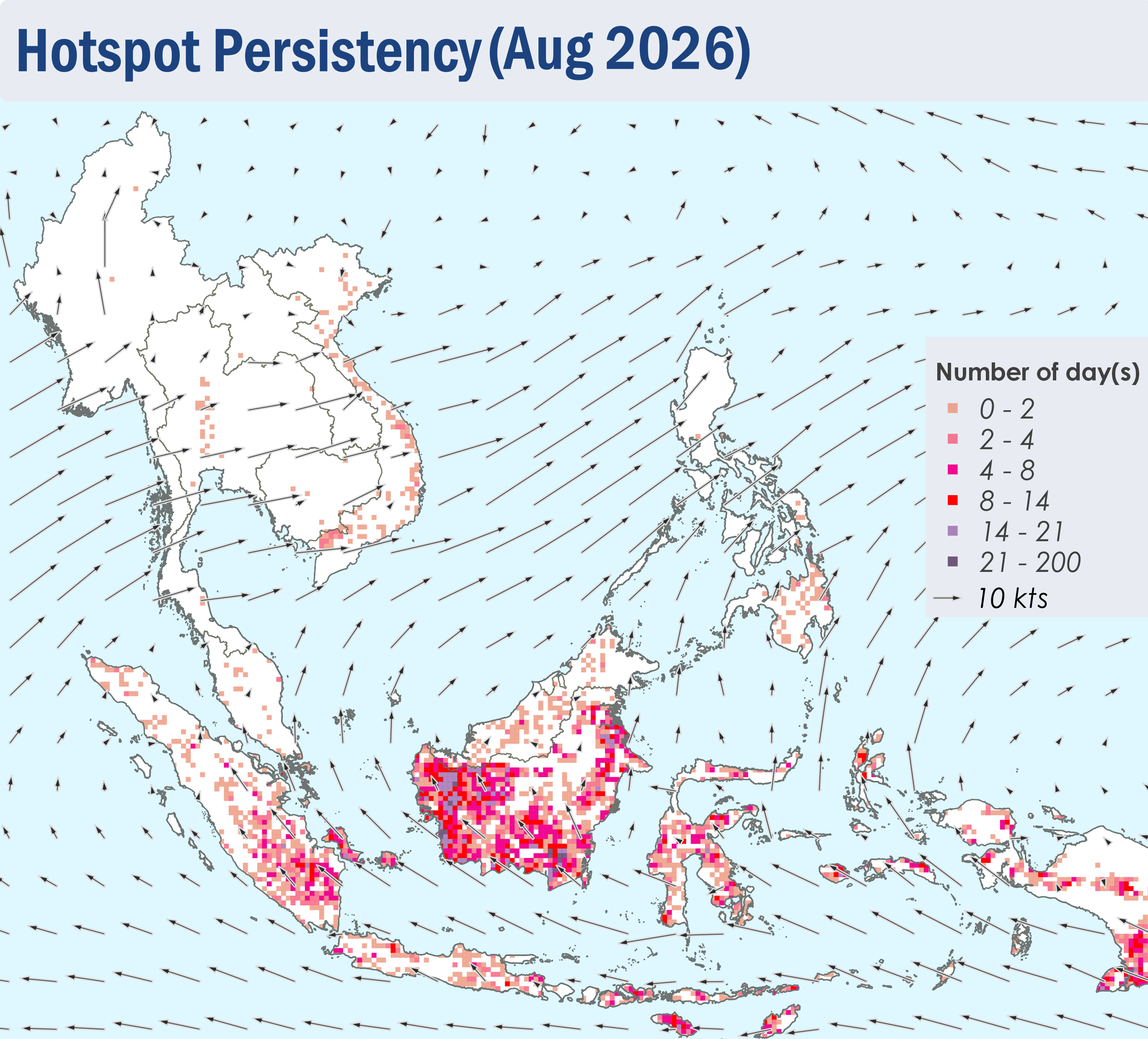
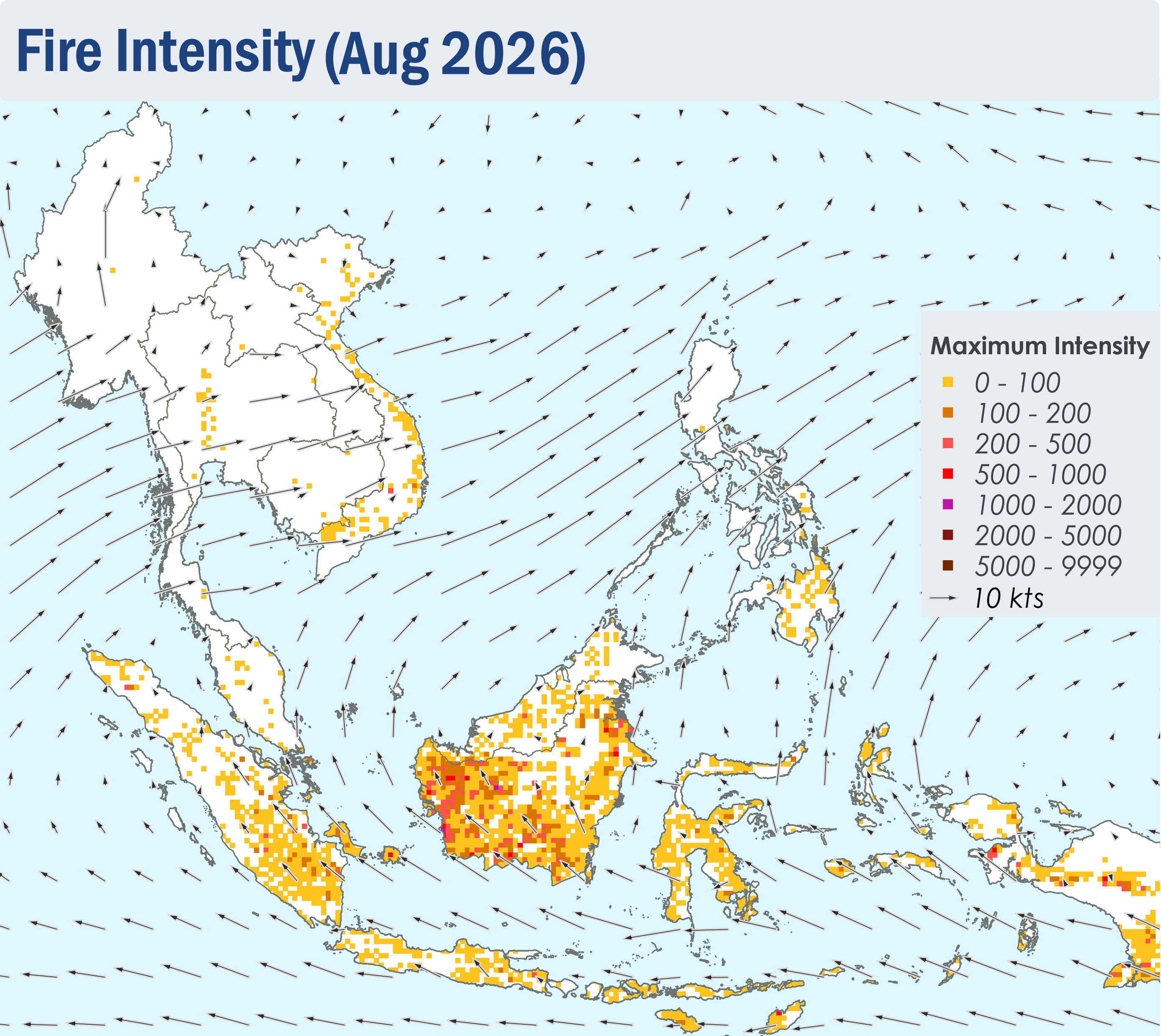
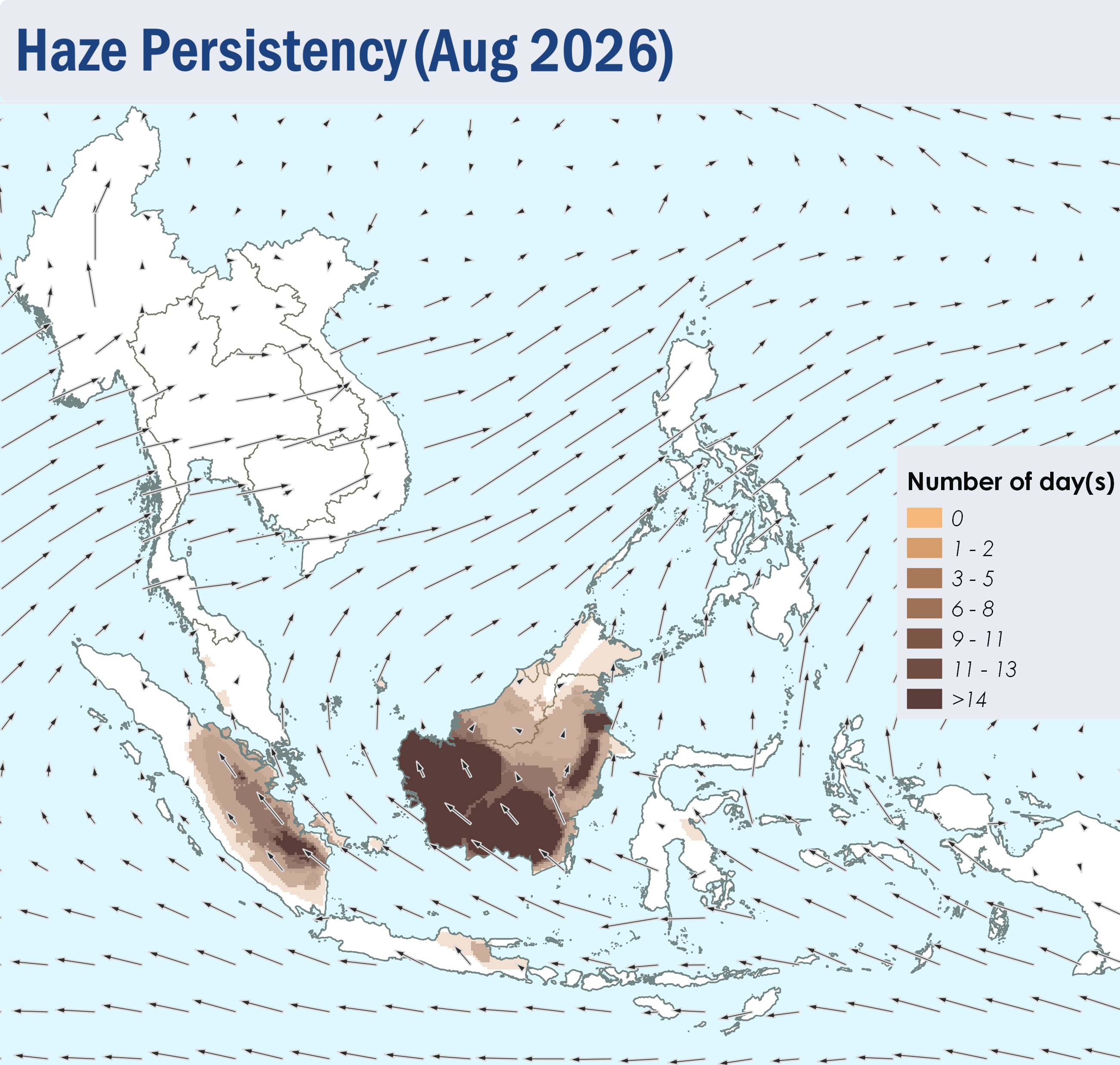
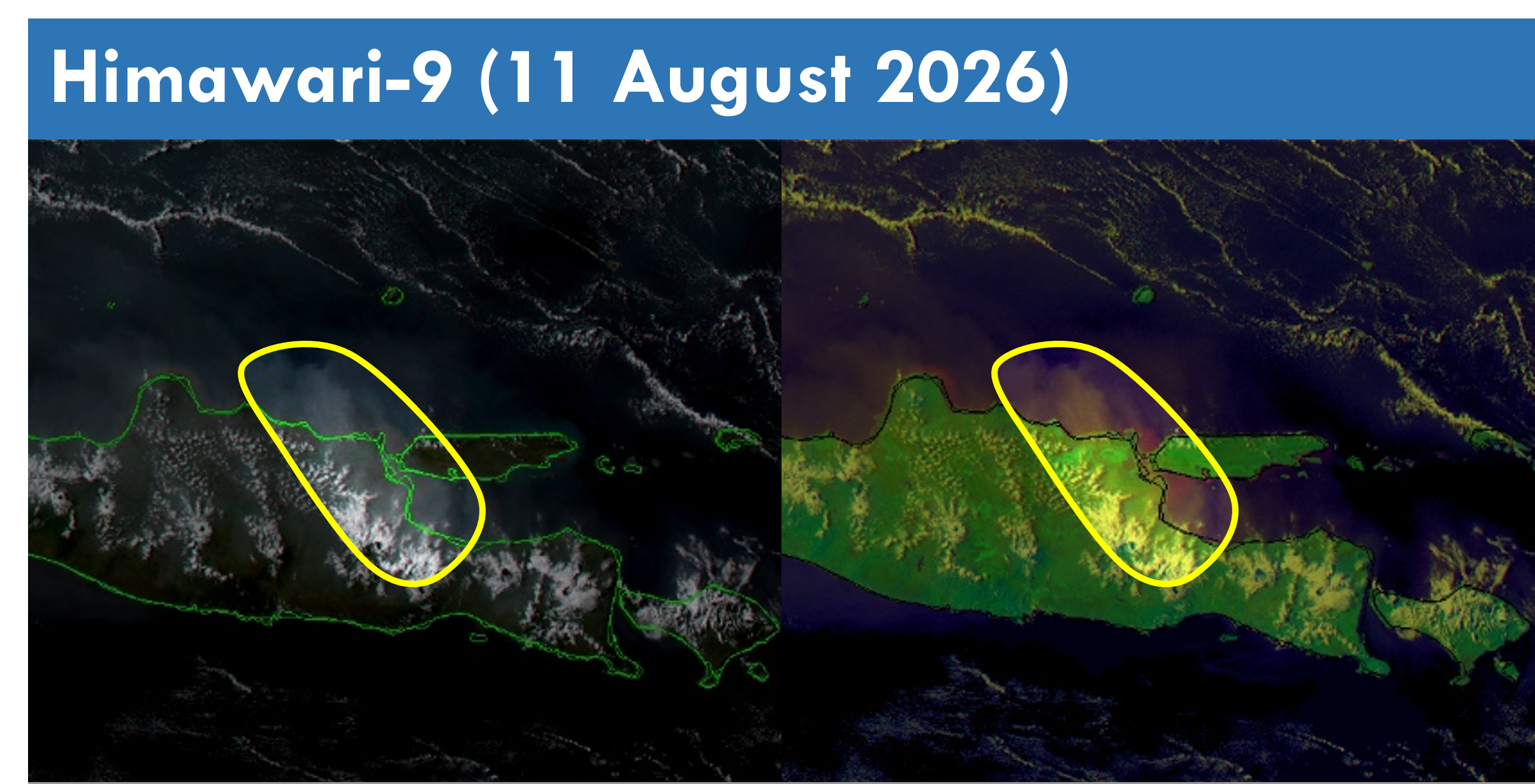
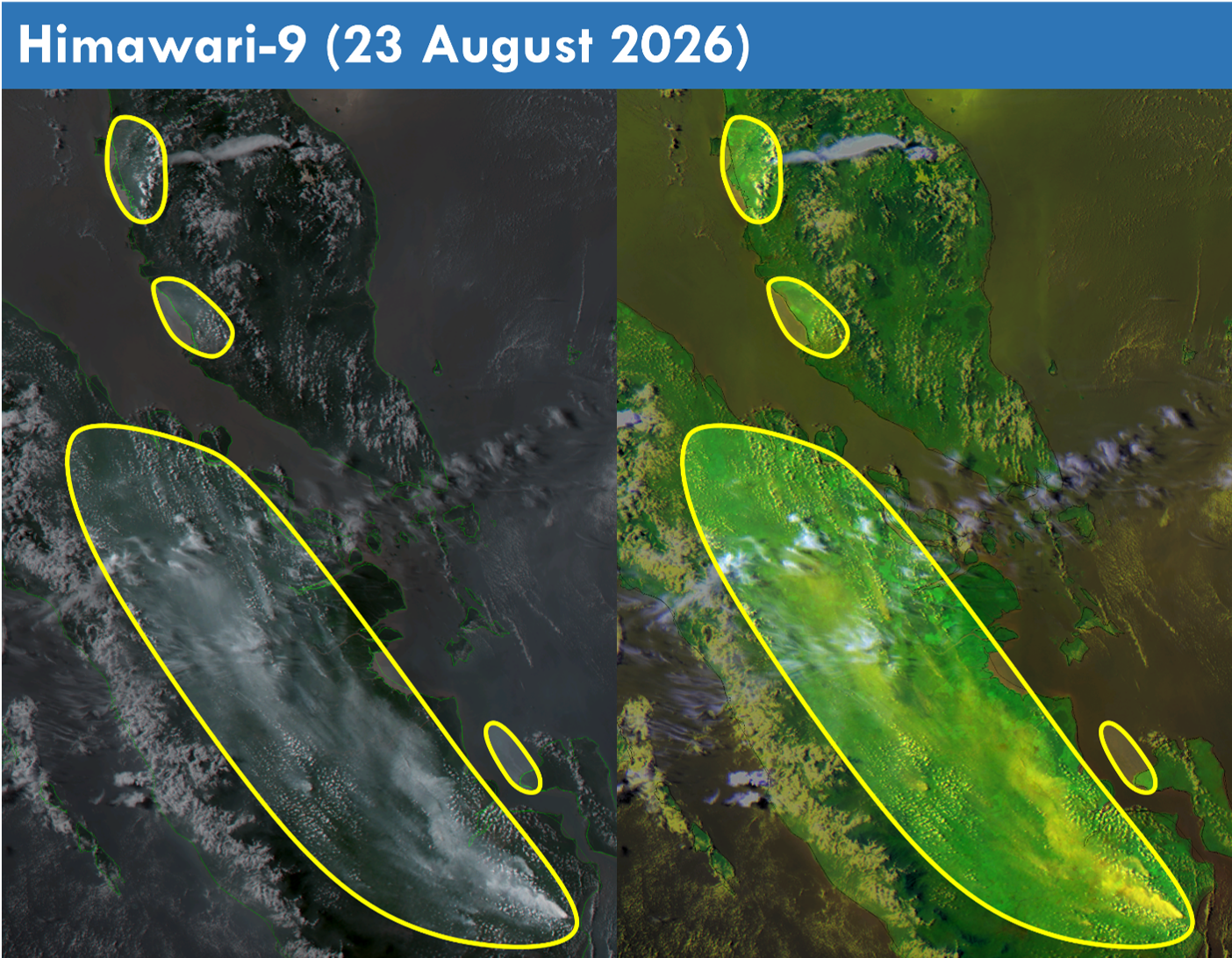
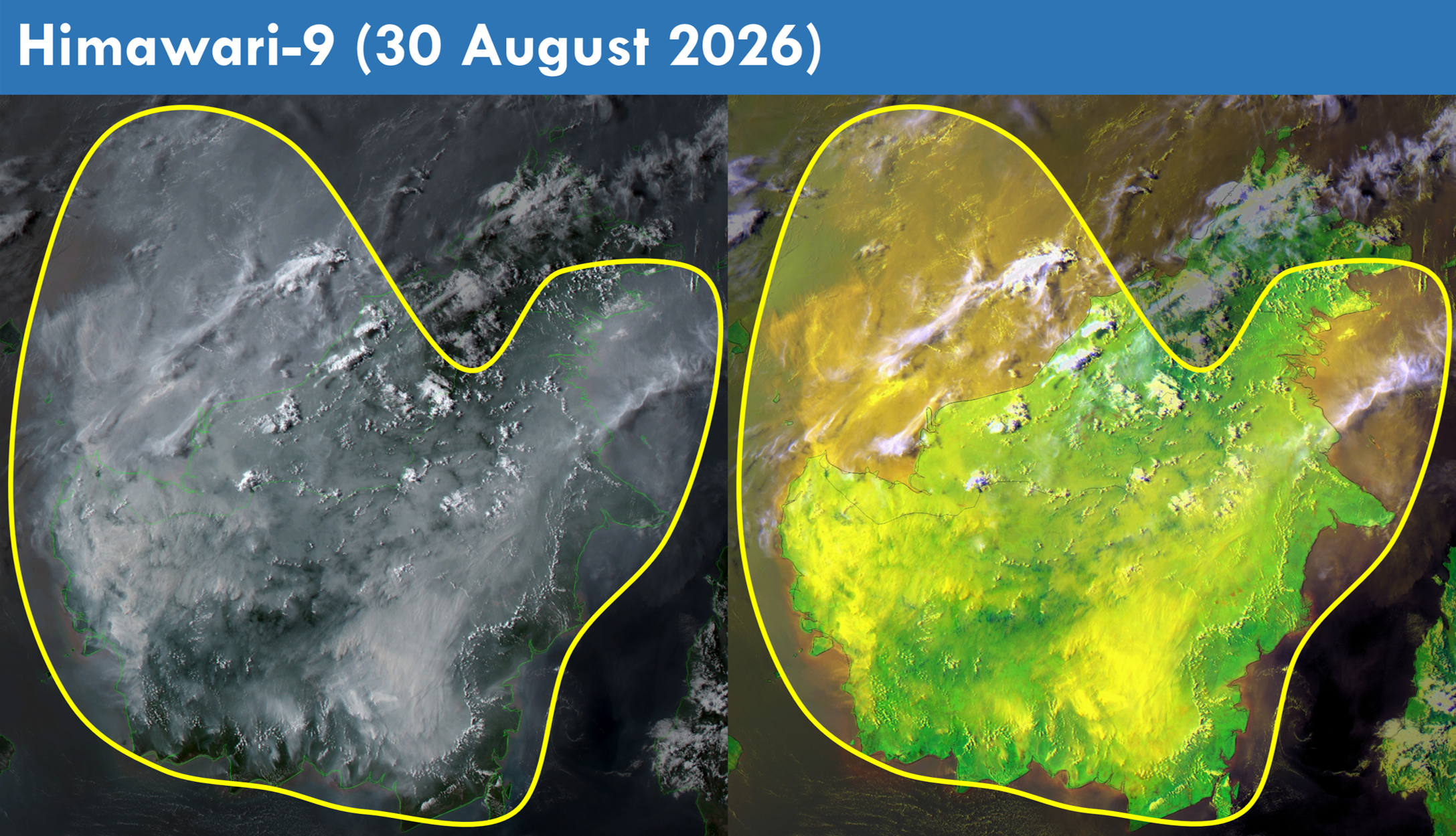
1.4 Scattered to widespread persistent and intense hotspots were detected in parts of Kalimantan and the southern parts of Sumatra (Figures 4 and 5). Towards the end of the review period, moderate to dense transboundary smoke plumes were observed to cover North, West and Central Kalimantan, Brunei, the western and central parts of Sarawak and the southern parts of Sabah (Figure 6 and 9). Moderate to dense smoke plumes were also observed to emanate from hotspots detected in other parts of Kalimantan, the central and southern parts of Sumatra, the western parts of Peninsular Malaysia and the eastern parts of Java (Figures 6, 7, 8 and 9).
1.5 Over the northern ASEAN region, the overall hotspot and smoke haze situation remained subdued (Figures 4 and 5).