
Review of Regional Haze Situation for July 2026
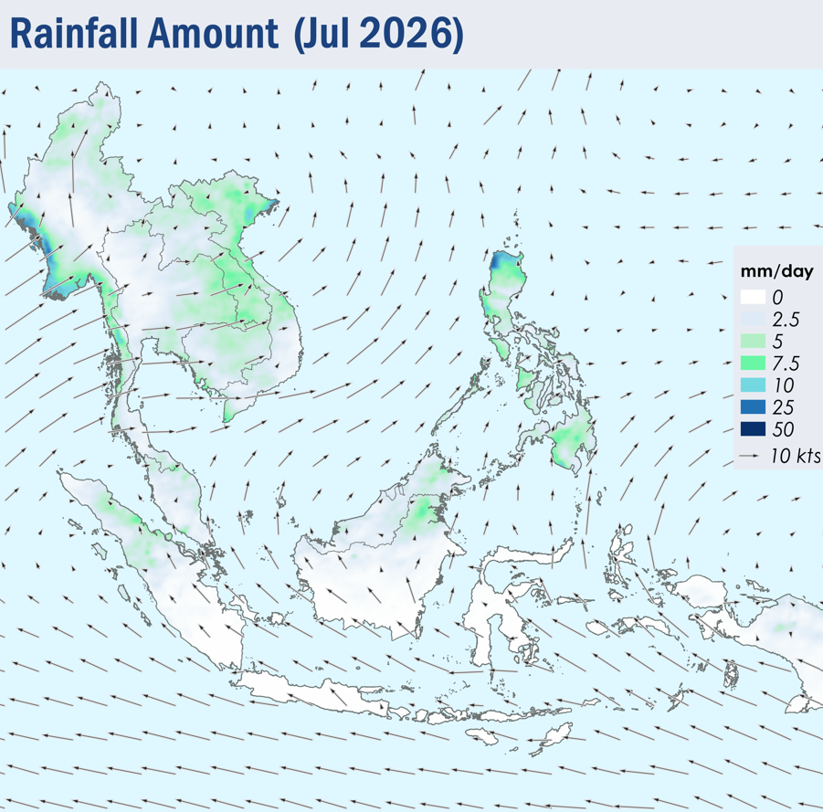
1.1 Southwest Monsoon conditions continued over the ASEAN region throughout July 2026. The prevailing winds across the southern ASEAN region blew mainly from the southeast to south, while winds over the northern ASEAN region blew mostly from the southwest to west (Figure 1).
1.2 Showers were observed over many parts of the ASEAN region during the review period, except over Java and the Lesser Sunda Islands, where persistent dry conditions were observed (Figure 1). The southern parts of Sumatra, and the southern and central parts of Borneo also experienced periods of dry weather. On 10 July 2026, the Alert Level 1 for the southern ASEAN region was activated, signalling the start of the dry season. Over the northern ASEAN region, relatively higher rainfall was recorded over the northern parts of Viet Nam and the Philippines due to Typhoon Maysak, Bavi and Noul.
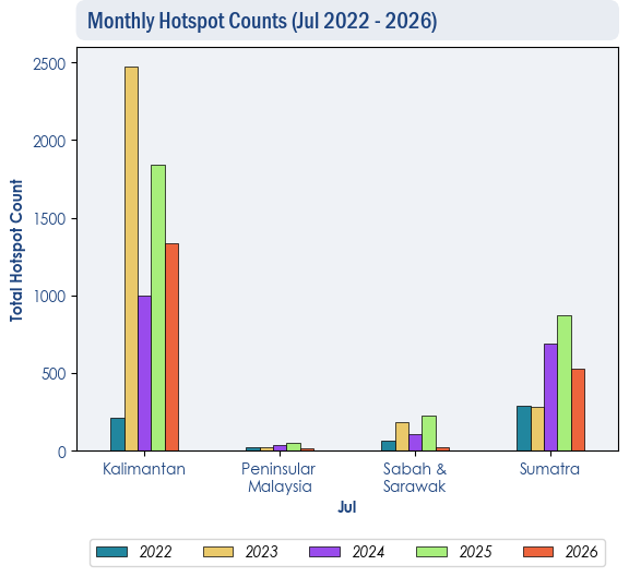
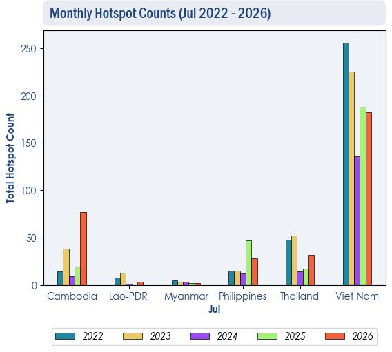
1.3 The hotspot counts for July 2026 over the ASEAN region were generally comparable to previous years (Figure 2 and 3), except in Cambodia, where hotspot counts were slightly higher relative to the past four years (Figure 3).
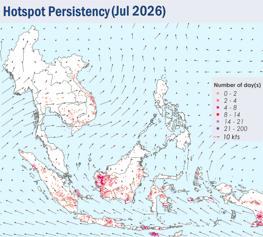
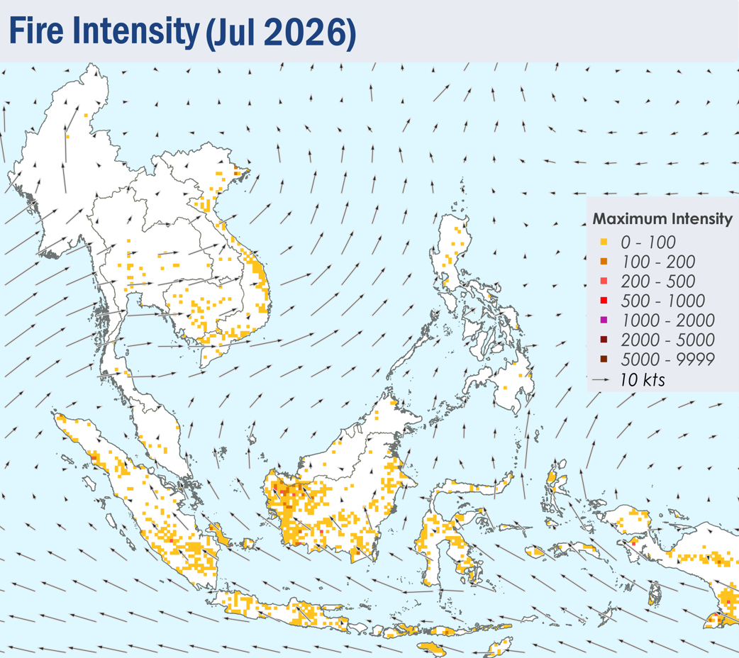
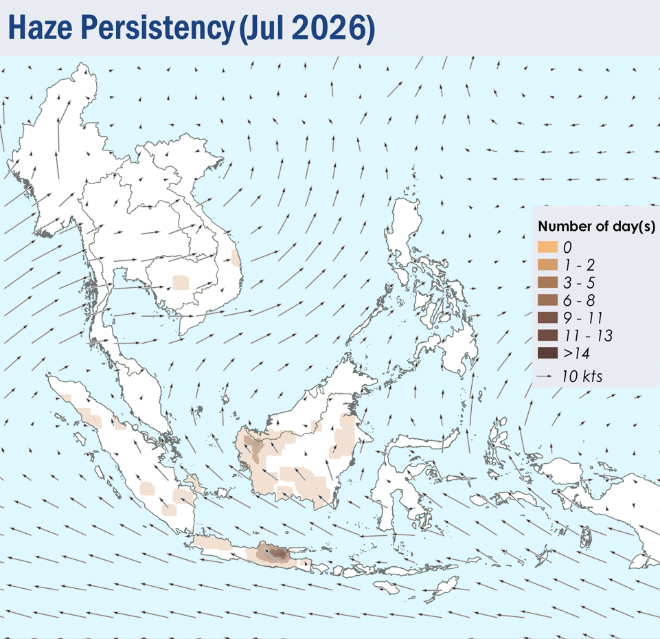
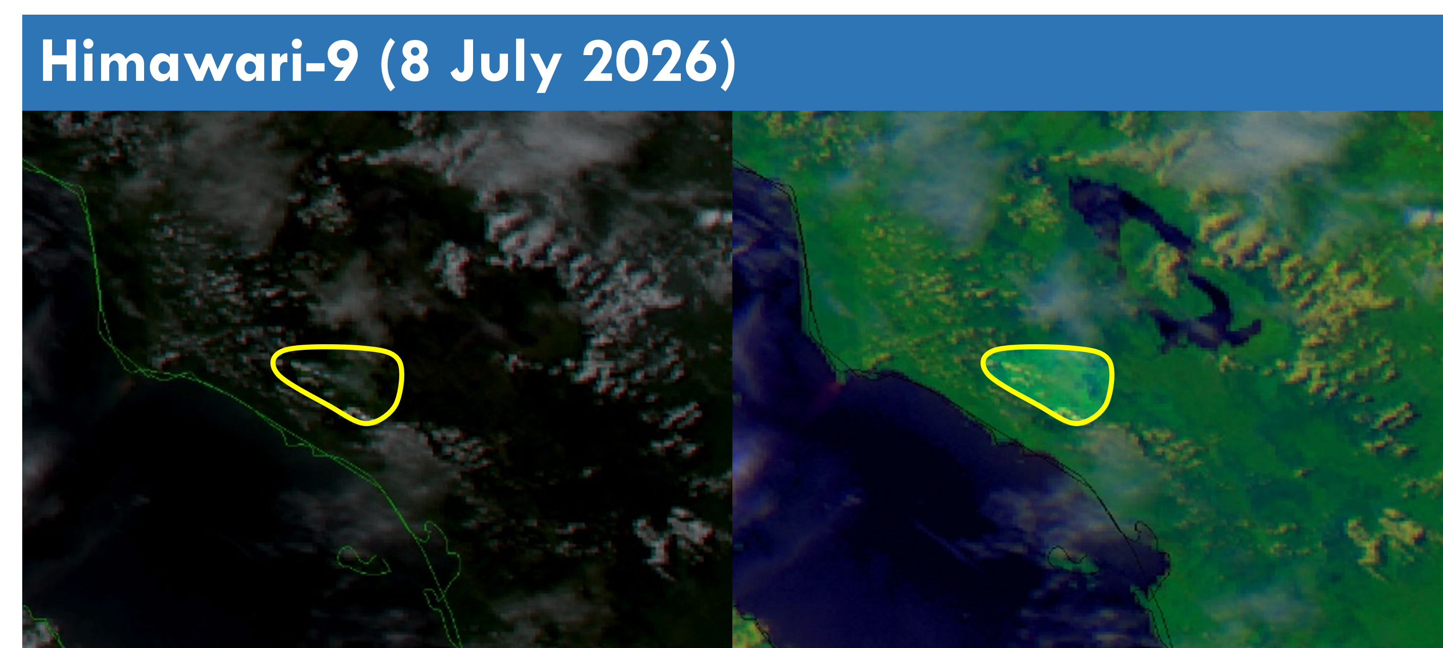
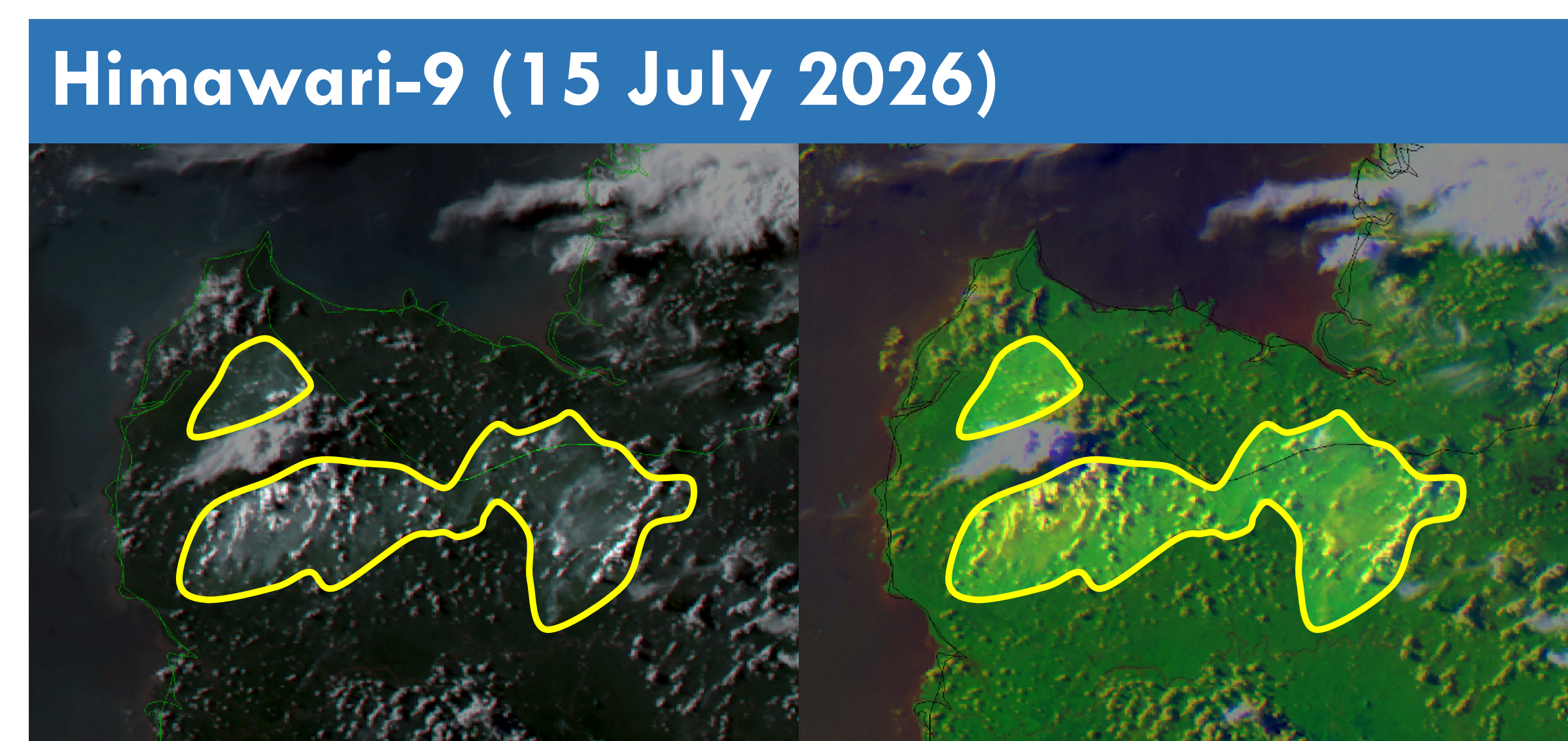
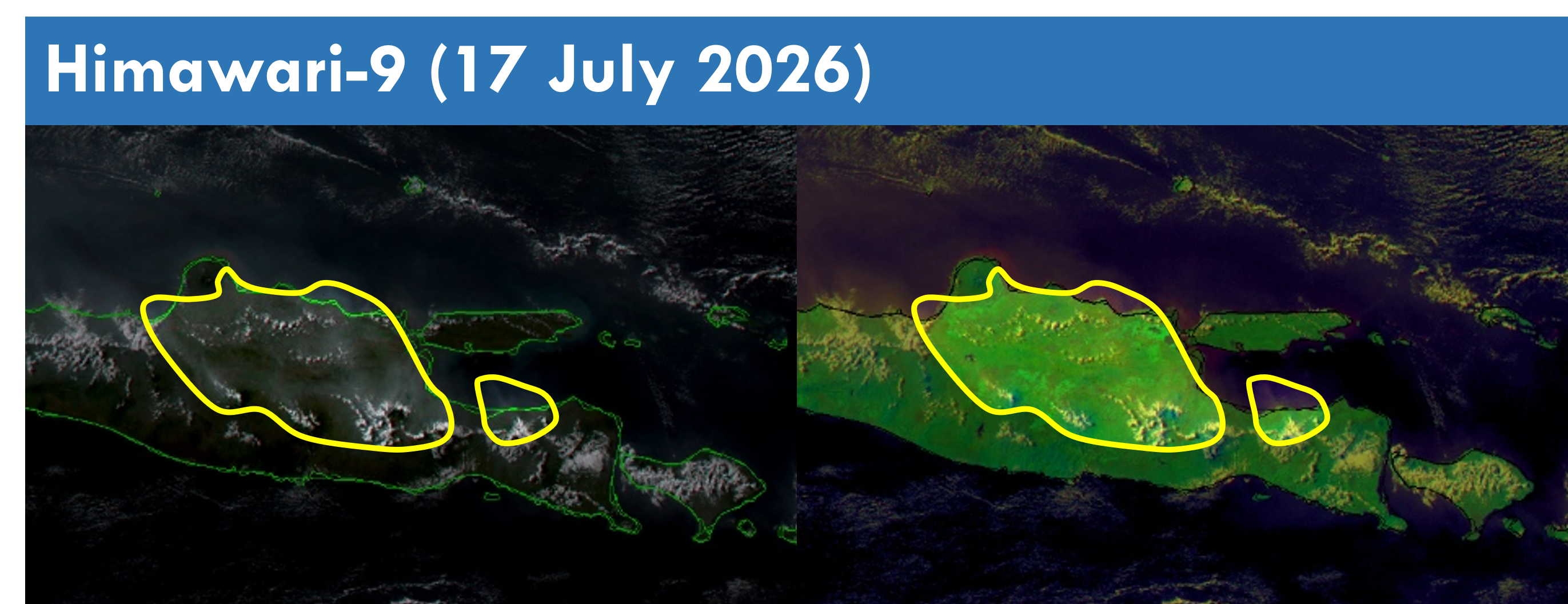
1.4 Hotspot activities were more persistent in West Kalimantan and parts of the Lesser Sunda Islands towards the latter half of the review period (Figure 4), with more intense fires detected in West Kalimantan as well (Figure 5). Slight to moderate smoke plumes were observed mainly over Java, parts of Borneo, and the northern and southern parts of Sumatra, with transboundary smoke haze observed to drift from West Kalimantan into the western parts of Sarawak on a few days (Figures 6 – 10). Slight to moderate smoke plumes were also observed over the central parts of Cambodia and Viet Nam on a few days.