Monthly Archives: February 2019

February 28, 2019

Outlook for Land Fires and Smoke Haze Situation (1 – 15 Mar 2019)

Outlook for Land Fires and Smoke Haze Situation (1 – 15 Mar 2019)

Issued 28 February 2019

With warm and dry weather prevailing over many parts of the Mekong sub-region, current hotspot activities and smoke haze situation are expected to persist. In the southern ASEAN region, hotspot activities are likely to remain subdued except for some isolated hotspots with localised smoke plumes that may emerge during brief periods of dry weather.

Subseasonal Weather Outlook (1 Mar – 15 Mar 2019)

Subseasonal Weather Outlook (1 Mar – 15 Mar 2019)

Issued 28 Feb 2019
valid for weeks 1 and 2: 1 Mar – 15 Mar

figure1

Figure 1: Rainfall Outlook
figure2

Figure 2: Temperature Outlook

In the coming fortnight, the Philippines, Malaysia, southern Viet Nam, southern Thailand and northern Sumatra are expected to receive below average rainfall. Wetter-than-usual conditions are forecast over the southwestern parts of the southern ASEAN region (marked in green in Figure 1) in the first week of March, and may extend eastward in the second week. The higher-than-average rainfall can be attributed to the passage of the Madden-Julian Oscillation (MJO) during this period.

Warmer-than-usual conditions are expected to persist over Cambodia, Lao PDR, southern Thailand, Viet Nam, Peninsular Malaysia and northern Sumatra in the first fortnight of March.

The outlook is assessed for the region in general. For specific updates on the national scale, the relevant ASEAN National Meteorological and Hydrological Services should be consulted.

February 23, 2019

Review of Land Fires and Smoke Haze Situation for First Fortnight of February 2019

Review of Land Fires and Smoke Haze Situation for First Fortnight of February 2019

1.1 In the Mekong sub-region, the hotspot and smoke haze activities remained elevated under the prevailing prolonged dry conditions. The smoke haze observed from hotspot clusters in Cambodia in January 2019 continued to persist into the first fortnight of February. In addition, moderate to dense smoke haze was observed over most parts of Thailand, and isolated hotspots with smoke plumes were observed in other parts of the Mekong sub-region. In the southern ASEAN region, shower fell over most parts of the region. However, isolated hotspots with localized smoke plumes were detected in parts of Sumatra during brief periods of dry conditions.

1.2 Figures 1 and 2 show satellite images over the ASEAN region in the first fortnight of February 2019.

Figure 1: Himawari-8 satellite image on 7 February 2019 shows moderate to dense smoke haze observed in Cambodia, Thailand, and parts of southern Lao PDR. Localised smoke plumes were observed in Myanmar.

Figure 2: AQUA satellite image on 13 February 2019 shows smoke plumes observed in parts of Sumatra.

Review of Regional Weather Conditions for First Fortnight of February 2019

Review of Regional Weather Conditions for First Fortnight of February 2019

Print Version

1. Review of Regional Weather Conditions for First Fortnight of February 2019

1.1 Northeast Monsoon conditions prevailed over the ASEAN region during the first fortnight of February 2019.

1.2 The Mekong sub-region continued to experience dry conditions, which is typical over the region during this period. The dry conditions were exacerbated by the influence of an extensive dry air mass over the northern ASEAN region. Pockets of drier than usual conditions were observed mainly over parts of Viet Nam, and the eastern and southern parts of Thailand. The Philippines also observed below-average rainfall due to the influence of the dry air mass.

1.3 In the southern ASEAN region, scattered showers fell over most parts of the region. However, well below-average rainfall was recorded around the equatorial region over northern Sumatra, East Kalimantan, Singapore and most parts of Malaysia. This drier than normal conditions were partly due to the southward extension of the dry air mass from the northern ASEAN region. Elsewhere in the southern ASEAN region, above-average rainfall was observed.

1.4 The rainfall distribution and the percent of average rainfall for the first fortnight of February 2019 are shown in Figure 1 and 2.

figure1_febfn1

Figure 1: Daily average rainfall for the ASEAN region in the first fortnight of February 2019. (Source: JAXA Global Satellite Mapping of Precipitation)

Figure 2: Percent of average rainfall for 1 – 15 February 2019. The rainfall data may be less representative for areas with a less dense rainfall network. Hatched areas indicate climatology dry mask (average daily rainfall below 1 mm). (Source: IRI NOAA/NCEP CPC Unified Precipitation Analyses)

1.5 During the fortnight, prevailing winds in the northern ASEAN region were generally blowing from the northeast or east, except for Myanmar where the winds were from the southwest or west. In the southern ASEAN region, westerly or northwesterly winds prevailed, except for the region west of southern Sumatra where southeasterly anomalies were observed.

figure3a_febfn1

figure3b_febfn1

Figure 3: 5000 ft average winds (left) and anomalies (right) for 1 – 15 February 2019. (Source: JMA)

1.6 The El Niño Southern Oscillation (ENSO) continued to remain neutral (neither El Niño nor La Niña). However, the sea surface temperatures (SSTs) over the tropical Pacific Ocean was observed to have warmed slightly during the fortnight, aided by the westerly wind anomalies in the presence of the MJO. Consequently, trade winds in the western Pacific Ocean were also observed to have weaken.

1.7 During the fortnight, the MJO propagated through Phase 7 – 8. The MJO in Phases 7 and 8 usually brings drier conditions over most parts of the southern ASEAN region and equatorial South China Sea. During this period, the MJO might have contributed to the drier conditions over the equatorial region.

Figure 4: The MJO phase diagram for Feb 2019 (blue). The diagram illustrates the movement of the MJO through different phases, which correspond to different locations along the equator. The distance of the index from the centre of the diagram is correlated with the strength of MJO. When the index falls within the circle, the MJO is considered weak or indiscernible. (Source: Bureau of Meteorology)

February 16, 2019

Outlook for Land Fires and Smoke Haze Situation (16 – 28 Feb 2019)

Outlook for Land Fires and Smoke Haze Situation (16 – 28 Feb 2019)

Issued 16 February 2019

With the prolonged dry weather expected to persist, hotspot activities in the Mekong sub-region are likely to remain elevated, and could lead to a further deterioration of the haze situation there. Hotspot activities in the southern ASEAN region are expected to remain generally subdued.

Subseasonal Weather Outlook (16 Feb – 28 Feb 2019)

Subseasonal Weather Outlook (16 Feb – 28 Feb 2019)

Issued 16 Feb 2019
valid for weeks 3 and 4: 16 Feb – 28 Feb

figure1

Figure 1: Rainfall Outlook
figure2

Figure 2: Temperature Outlook

Under the prevailing Northeast Monsoon conditions, dry weather is expected to persist over the northern ASEAN region. While scattered showers are forecast over the southern ASEAN, there could still be occasional brief periods of dry weather over parts of the equatorial region.

The drier-than-average conditions over the Philippines, Malaysia and parts of Kalimantan in the past two weeks are expected to persist into the second fortnight of the month. Drier-than-usual conditions are also expected to develop in most parts of the Indonesian archipelago.

The Madden-Julian Oscillation (MJO) is forecast to propagate through Phase 8 – 1 during this period, and may contribute to drier conditions over the Southeast Asia region.

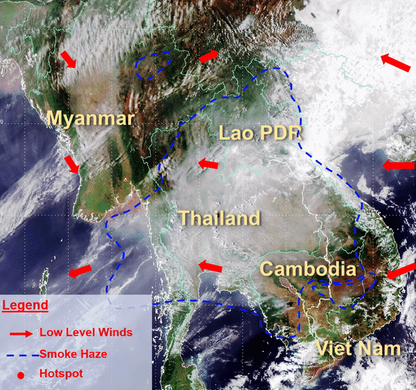
Warm conditions are forecast over Cambodia, Viet Nam, parts of Thailand and Lao PDR, as well as over Peninsular Malaysia.

The outlook is assessed for the region in general. For specific updates on the national scale, the relevant ASEAN National Meteorological and Hydrological Services should be consulted.

February 12, 2019

Situation Update (11 Feb 2019 1050 UTC) – Widespread haze affecting many parts of the Mekong sub-region
Dry weather prevailed over the Mekong Sub-region, with the exception of isolated showers ver parts of Thailand. Based on the latest Himawari-8 satellite images between 0710 and 0820UTC on 11 February 2019, widespread smoke haze from persistent hotspots continued to affect many parts of the Mekong sub-region, including Cambodia, Lao PDR, southern Myanmar, Thailand and central Viet Nam. In particular, dense smoke haze was observed in southwest Cambodia, and northern and northeastern Thailand. In addition, isolated hotspots with localised smoke plumes were also detected in northern Myanmar and southern Viet Nam. The hazy conditions are expected to persist over the Mekong sub-region under the prevailing dry weather. A gradual strengthening of northeasterly and easterly winds in the next few days is expected to blow the smoke haze westward.

February 8, 2019

Alert20190208 – Activation of Alert Level 3 for the Mekong sub-region

Activation of Alert Level 3 for the Mekong sub-region

In recent days, there has been a deterioration in the hotspot and haze situation in the Mekong Sub-region. Moderate to dense smoke from persistent hotspots was observed in Cambodia and Thailand, and the smoke haze was being blown by the prevailing winds to neighbouring areas in Lao PDR and Viet Nam. Hotspot activities with smoke plumes have also been observed in Lao PDR, Myanmar, and Viet Nam. Based on the NOAA-19 satellite, a total of 272 and 108 hotspots were detected in the Mekong Sub-region on 6 and 7 Feb 2019 respectively.

With the prevailing dry weather over the Mekong Sub-region forecast to persist, a further deterioration of the hotspot and haze situation in the Mekong Sub-region can be expected.