Monthly Archives: April 2020

April 29, 2020

Subseasonal Weather Outlook (1 – 15 May 2020)

Subseasonal Weather Outlook (1 – 15 May 2020)

Issued 29 April 2020
Valid for weeks 1 and 2: 1 – 15 May 2020

figure1

Figure 1: Rainfall Outlook

figure2

Figure 2: Temperature Outlook

 
For the first fortnight of May 2020, drier conditions are expected to persist over most of northern Southeast Asia. However, for Myanmar, drier conditions are expected only in Week 2.

There is an increased chance of wetter conditions over the western Maritime Continent and southern parts of the eastern Maritime Continent associated with the Madden-Julian Oscillation (MJO) activity. The wetter conditions in the western Maritime Continent are expected to ease by Week 2.

For most of Southeast Asia, warmer conditions are expected throughout the first two weeks of May, with the warmest anomalies over parts of Cambodia, Laos and Viet Nam. Colder conditions are likely over northern and western Myanmar in Week 1.

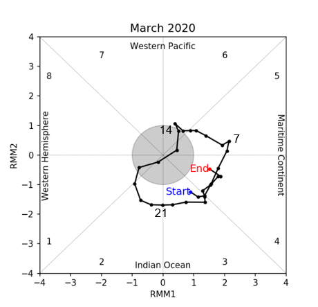
An MJO is currently present over the eastern Indian Ocean. Some models predict the MJO to decay in Week 1 as it enters the Maritime Continent, while other models indicate the MJO may continue propagating through the region. If the MJO continues to propagate, this would increase the probability of wetter conditions in the eastern Maritime Continent.
 
The outlook is assessed for the region in general, where conditions are relative to the average conditions for the corresponding time of year. For specific updates on the national scale, the relevant ASEAN National Meteorological and Hydrological Services should be consulted.

April 28, 2020

Alert20200428 – Downgrading of Alert Level 2 to Alert Level 1 for the Mekong sub-region

Downgrading of Alert Level 2 to Alert Level 1 for the Mekong sub-region

In the past week, increased shower activities over many areas of the Mekong sub-region have contributed to a significant improvement in the hotspot and haze situation there. The air quality in many parts of the sub-region have been in the good to moderate range.

Based on surveillance by the NOAA-20 satellite, the number of hotspots detected has been decreasing over the past week. 160 and 60 hotspots were detected in the Mekong sub-region on 26 and 27 Apr respectively, a significant reduction from a high of over 700 hotspots a week earlier.

Rainy weather is forecast to persist in the Mekong sub-region over the next few weeks. This is expected to bring a further improvement in the hotspot and haze situation in the Mekong sub-region. However, isolated hotspot activities with localised smoke plumes could still develop during brief periods of dry weather.

April 15, 2020

Review of Regional Weather for March 2020

Review of Regional Weather for March 2020

Print Version

1. Overview

1.1 Much of the region south of the equator experienced above-normal rainfall during March 2020 (Figure 1). In particular, parts of southern Sumatra, West Papua, and central Sulawesi experienced more intense wetter conditions based on both satellite-derived rainfall estimates datasets (GSMaP-NRT and CMORPH-Blended). For north of the equator, below-average rainfall is experienced in most places (between 0°-15°N) over the sea, over the eastern coasts of land masses (Peninsular Malaysia, Borneo, and the Philippines) and southern Thailand. The observed large-scale rainfall anomaly patterns over the Southeast Asia region during March (i.e. wetter to the south, and drier to the north of the equator) are broadly aligned with the model predictions depicted in the subseasonal weather outlooks for the first and second fortnights of March 2020.

era5_rainfall_anomalies
cmorph_bld_rainfall_anomalies
Figure 1: Rainfall anomalies for the month of March 2020 based on GSMaP-NRT data (left) and CMORPH-Blended data (right). The climatological reference period is 2001-2019. Green colour denotes above-average rainfall (wetter), while orange denotes below-average rainfall (drier).


1.2 Most parts of Southeast Asia experienced above-average temperature during March 2020 (Figure 2). The largest warm anomalies occurred over parts of northern and central Viet Nam. Apart from the far eastern, southern, and northern corners, the rest of Myanmar experienced near-normal to below-normal temperature conditions during March 2020.

era5_temperature_anomalies

Figure 2: Temperature anomalies for the month of March 2020 based on ERA-5 reanalysis. The climatological reference period is 2001-2019. Red colour denotes above-average temperature (warmer), while blue denotes below-average temperature (colder).


2. Climate Drivers

2.1 The Madden-Julian Oscillation (MJO) was active for much of March 2020. The MJO signal propagated eastwards from Phase 3 (Indian Ocean) to Phase 5 (Maritime Continent) during the first two weeks of March. The MJO then re-emerged in the third week in Phase 2 (Indian Ocean) and continued propagating until the end of March in Phase 4 (Maritime Continent). Generally, the phases the MJO went through (Phases 2-5) in March typically bring wetter conditions to many parts of the Maritime Continent, especially the south.

mjo_phase_diagram

Figure 3: The MJO phase diagram. The diagram illustrates the movement of the MJO through different phases, which correspond to different locations along the equator (denoted in the text with the first day of the month in blue and the last day of the month in red). The distance of the index from the centre of the diagram is related to the strength of the MJO. Values within the grey circle are considered weak or indiscernible (data from the Bureau of Meteorology, Australia).

April 14, 2020

Subseasonal Weather Outlook (16 – 30 April 2020)

Subseasonal Weather Outlook (16 – 30 April 2020)

Issued 14 April 2020
Valid for weeks 3 and 4: 16 – 30 April 2020

figure1

Figure 1: Rainfall Outlook

figure2

Figure 2: Temperature Outlook


For the second fortnight of April 2020, drier conditions are expected to persist over Thailand, Cambodia, southern parts of Laos, southern parts of Viet Nam, southern parts of Myanmar, and most parts of the Philippines. Drier conditions are also forecasted to persist over northern Borneo, although these conditions may ease in Week 4 tied to the Madden-Julian Oscillation (MJO) activity.

There is an increased chance of wetter conditions over western parts of the Maritime Continent in Week 4 (northern Sumatra, Peninsular Malaysia, and eastern Borneo), associated with the same MJO signal.

For temperature in Week 3, warmer conditions are expected over most of Southeast Asia, apart from northern Myanmar and northern Viet Nam. These warmer conditions are expected to persist in Week 4, although the warmer conditions may ease in the equatorial part of the region.

An MJO is currently present over Africa and is expected to propagate eastward through the Indian Ocean during Week 3 and Week 4. However, a few models forecast the signal to weaken towards the end of April.

The outlook is assessed for the region in general. For specific updates on the national scale, the relevant ASEAN National Meteorological and Hydrological Services should be consulted.

April 13, 2020

Alert20200413 – Downgrading of Alert Level 3 to Alert Level 2 for the Mekong sub-region

Downgrading of Alert Level 3 to Alert Level 2 for the Mekong sub-region

In recent days, an increase in shower activities has brought an improvement to the haze situation in the Mekong sub-region. Based on surveillance by the NOAA-20 satellite, the number of hotspots detected has been decreasing over the past week. A total of 888 and 603 hotspots were detected in the Mekong sub-region on 11 and 12 April respectively, a reduction from over 3000 hotspots detected in early April. Smoke haze has been confined in eastern Myanmar, the northern parts of Thailand and Lao PDR, and central Thailand.

In the coming days, showers are forecast over parts of the Mekong sub-region, and this is expected to bring a further improvement to the haze situation. Periods of dry weather can be expected, and hotspot activities and hazy conditions may still persist in some areas.

April 8, 2020

Review of Regional Haze Situation for March 2020

Review of Regional Haze Situation for March 2020


1.1
While Northeast Monsoon conditions continued to prevail over the ASEAN region in March 2020, the prevailing winds over the Mekong sub-region during the month were mostly blowing from southeast or southwest. Despite an increase in isolated showers over the eastern parts of the Mekong sub-region, the weather over the sub-region remained largely dry during this period. In contrast, scattered showers fell over the southern ASEAN region, particularly over areas south of the equator.

Figure 1: Average Daily Rainfall for Mar 2020. (Source: JAXA GsMaP)


1.2
Scattered hotspots were detected in the Mekong sub-region, while hotspot activities remained subdued in the southern ASEAN region. In terms of the hotspot count, Lao PDR recorded one of the highest number of hotspots in March 2020 in comparison with previous years. Elsewhere in the region, there was no significant trend observed during the review period.

Figure 2: Hotspot count for the northern ASEAN region for Mar 2013 – 2020. [Note: Hotspot count from year 2019 onward is based on the NOAA-20 satellite, and for the period from year 2013-2018 is based on the Suomi-NPP satellite.]

Figure 3: Hotspot count for the southern ASEAN region for Mar 2013 – 2020. [Note: Hotspot count from year 2019 onward is based on the NOAA-20 satellite, and for the period from year 2013-2018 is based on the Suomi-NPP satellite.]


1.3
In March 2020, persistent hotspots were detected in many parts of the Mekong sub-region, particularly in Myanmar, northern and southern Lao PDR, parts of northern and central Thailand, northern Cambodia, as well as a few areas in southern Viet Nam. In the southern ASEAN region, hotspots were detected on occasions and these were mostly short-lived.

Figure 4: Distribution of hotspots detected based on NOAA-20 satellite surveillance for Mar 2020.


1.4
Over the aforementioned areas in the Mekong sub-region with persistent hotspots, the intensity of fires was also high relative to the other parts of the ASEAN region.

Figure 5: Maximum fire intensity based on NOAA-20 satellite surveillance in Mar 2020.


1.5
March 2020 saw a further deterioration in the haze situation over the Mekong sub-region, where many areas were enveloped in widespread smoke haze. In particular, dense haze was observed over eastern Myanmar, parts of northern and central Thailand, as well as the northern parts of Lao PDR and Viet Nam, where there were occurrences of transboundary smoke haze. On some days, transboundary smoke haze also affected southern Lao PDR, southern Viet Nam and northern Cambodia. The air quality levels in northern Thailand remained in the Unhealthy to Very Unhealthy range on most days in March 2020. Smoke haze in the Mekong sub-region also contributed to reduced visibility readings across several parts of the sub-region. In the southern ASEAN region, no significant smoke haze was observed except for localized smoke plumes from the short-lived hotspots in central Sumatra.

Figure 6: Number of days with moderate to dense smoke haze observed over an area based on satellite imageries, ground observations and air quality reports in Mar 2020.