ASMC Bulletin (Issue #8, Sep 2021)
September 21, 2021
September 17, 2021
Issued 17 September 2021
First forecast week: 20 September – 26 September
Second forecast week: 27 September – 3 October
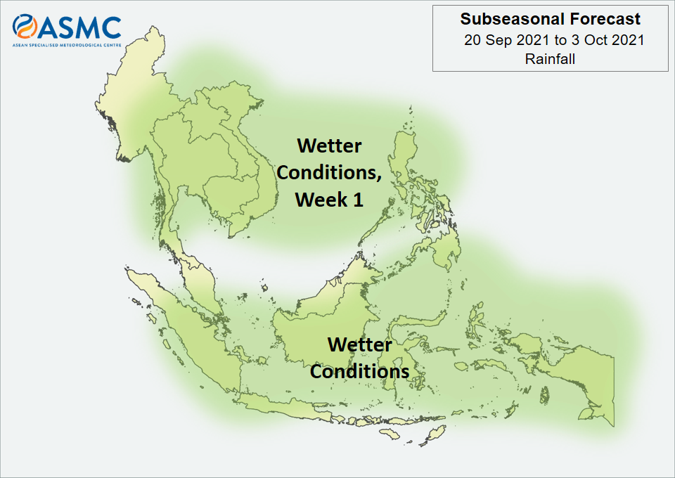
Wetter conditions are expected to continue over much of the Maritime Continent in the next fortnight (20 September – 3 October), with the highest probability for wetter conditions over parts of the southeastern Maritime Continent.
Wetter conditions are also expected in Week 1 (20 – 26 September) over most parts of Mainland Southeast Asia as well as the northern half of the Philippines. The wetter conditions over northern Philippines and northern Viet Nam are highly dependent on tropical cyclone development.
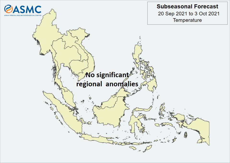
No significant regional temperature anomalies are expected in the next fortnight (20 September – 3 October).
A Madden-Julian Oscillation (MJO) signal was present over the Indian Ocean (Phase 3) in the middle of September based on the RMM Index. Most models predict this signal to weaken and become indiscernible around the start of the forecast period.
The outlook is assessed for the region in general, where conditions are relative to the average conditions for the corresponding time of year. For specific updates on the national scale, the relevant ASEAN National Meteorological and Hydrological Services should be consulted.
September 14, 2021
1.1 With the low-level winds blowing from the southeast or southwest on most days, Southwest Monsoon conditions continued to prevail over the ASEAN region in August 2021 (Figure 1). The first week of August was relatively dry for most parts of the southern ASEAN region, with the monsoon rain band located north of the Equator. In subsequent weeks, the movement of the monsoon rain band closer to the Equator brought wet weather to much of the ASEAN region except its southernmost regions (Java, the Lesser Sunda Islands and southern Sumatra).

1.2 For the August 2021 review period, the hotspot counts over the southern ASEAN region were much lower than those detected in previous years (Figure 2). The hotspot counts over the northern ASEAN region were similar to those detected in previous years, with the exception of Thailand and Viet Nam which recorded higher hotspot counts (Figure 3).


1.3 Isolated to scattered hotspots continued to be detected in most parts of the southern ASEAN region in August 2021 (Figures 4 and 5). There was increased hotspot activity in areas where drier conditions were experienced, such as over the southern ASEAN region in the first week of August, and throughout the month in Java and the Lesser Sunda Islands. At times this month, localised smoke plumes were observed emanating from clusters of hotspots in Sumatra and Kalimantan. This was particularly so for West Kalimantan, where a persistent cluster of hotspots was observed on most days this month (Figure 5).
1.4 Isolated hotspots were detected mainly in the southeastern parts of the northern ASEAN region in August 2021. Towards the middle of the month, localised smoke plumes were observed in parts of central Viet Nam; no smoke plumes were observed elsewhere in the northern ASEAN region (Figures 4 and 5).


1.1 During August 2021, there was above-average rainfall recorded over much of the ASEAN region, while below-average rainfall was recorded over the northeastern ASEAN region (Figure 1). The largest positive anomalies (wetter conditions) were found across the equatorial region for both satellite-derived rainfall estimates datasets (GSMaP-NRT and CMORPH-Blended). The two datasets were also in agreement that the largest negative anomalies over land (drier conditions) were observed over parts of northern Viet Nam. However, there were some discrepancies over the southern Myanmar, where CMORPH-Blended recorded wetter conditions while GSMaP-NRT recorded drier conditions.
1.2 The observed rainfall anomaly pattern of above-average rainfall for much of the ASEAN region is broadly consistent with the predictions from the subseasonal weather outlooks for August 2021 (26 July – 8 August, 9 – 22 August and 23 August – 5 September).


1.3 Most of the northern ASEAN region and southern Maritime Continent experienced above-average temperatures during August 2021 (Figure 2). The warmest anomalies (above-average temperature) were recorded over northern Viet Nam, where the drier conditions were observed. For the equatorial region and central and northern Myanmar, near- to below-average temperature was recorded.

2.1 At the start of August 2021, a Madden-Julian Oscillation (MJO) signal was present in the Western Hemisphere (Phase 8, Figure 3), which weakened by the middle of the first week based on the RMM plot. The signal emerged over the Indian Ocean (Phase 2) in the second week of August, with a rapid strengthening of the signal in the RMM plot and slow eastward propagation. This MJO signal weakened in the second half of August while it was still over the Indian Ocean. The mix of below- to above-average rainfall for the ASEAN region is indicative of the MJO signal: Phase 2 tends to bring drier conditions over the northeastern ASEAN region and wetter conditions for the western Maritime Continent at this time of the year.

2.2 The equatorial Pacific Ocean was in the ‘ENSO-neutral’ state while a negative Indian Ocean Dipole (IOD) was present in August. At the seasonal timescale, negative IOD events tend to bring wetter conditions to the southern Maritime Continent.
September 13, 2021
15 – 18 March 2021, Centre for Climate Research Singapore
The Third Workshop on ASEAN Regional Climate Data, Analysis and Projections (ARCDAP-3) was conducted from 15 – 18 March 2021 on the Zoom platform. This workshop was conducted as part of the ASMC 5-year capability building programme and coordinated by the Centre for Climate Research Singapore (CCRS), part of the Meteorological Service Singapore. The workshop was led by CCRS scientists and attended by representatives from 10 ASEAN National Meteorological and Hydrological Centres (NMHSs) and relevant agencies, representatives from both WMO’s headquarters and its Regional Office for Asia and the South-West Pacific (RAP), and experts from regional and international institutes.

The overall objectives of ARCDAP-3 were to assess the region’s understanding of the Coupled Model Intercomparison Project’s (CMIP) latest phases (in particular CMIP6, which builds on CMIP5 most notably through the incorporation of socioecnomic pathways (SSPs) to represent future scenarios, in addition to representative concentration pathways (RCPs)); obtain a shared understanding of CMIP’s current status and latest developments of CMIP6; introduce participants to certain resources for CMIP model evaluation; work towards developing a common framework for studying key regional climate processes; develop a common understanding of suitable global climate models (GCMs) that can be relied upon for the ASEAN region; develop a regional consensus on most relevant emission scenarios to use for regional climate change projections; and link the developed understanding about CMIP databases with existing and on-going projects that generate downscaled climate projections across the ASEAN region.
Participants were first introduced to the World Climate Research Programme (WCRP) and CMIP, followed by a sharing on the technological advancements (e.g. streamlined data tools such as Synda and Pangeo) and notable scientific observations from CMIP6 so far, e.g. higher equilibrium climate sensitivities (ECS) observed by a number of CMIP6 GCMs. The value of CMIP6 data was then demonstrated through seminars led by academic experts on several applications of CMIP6 for the study of important regional climate processes, as well as case studies of how CMIP data has been used to produce national climate change projections by the Australian Bureau of Meteorology (BOM) and Commonwealth Scientific and Industrial Research Organisation (CSIRO), the Vietnam Institute of Meteorology, Hydrology and Climate Change (IMHEN), and CCRS. A session was also dedicated towards to the sharing and discussion of regional downscaling results from the Coordinated Regional Downscaling Experiment Southeast Asia’s (CORDEX-SEA) first phase along with Singapore’s ongoing Third National Climate Change Study (V3) underway at CCRS.

The workshop ended on an optimistic note, with all ASEAN representatives eager to incorporate CMIP6 in their future work. While participants understood the decision to not conduct an extensive hands-on session due to the limitations in a virtual setting, many looked forward to having one involving CMIP6 data in the follow up workshop which will hopefully take place physically, an opinion shared by the organising team as well. Further recommended topics included bias correction, application of extreme indices for impacts assessment and regional model data analysis.
September 3, 2021
Issued 3 September 2021
First forecast week: 6 September – 12 September
Second forecast week: 13 September – 19 September
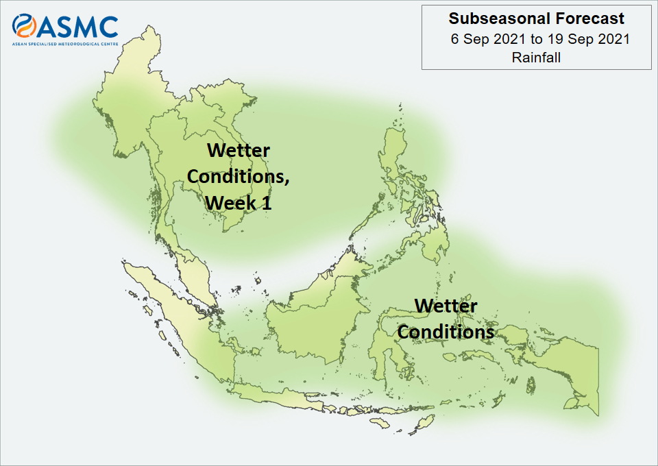
Wetter conditions are expected in the next fortnight (6 – 19 September) over much of the central and eastern Maritime Continent. Wetter conditions are also expected in Week 1 (6 – 12 September) over most parts of Mainland Southeast Asia as well as northern parts of the Philippines. These wetter conditions are generally expected to ease by Week 2 (13 – 19 September), apart from a small increase in probability that the wetter conditions continue for some coastal regions of Myanmar.
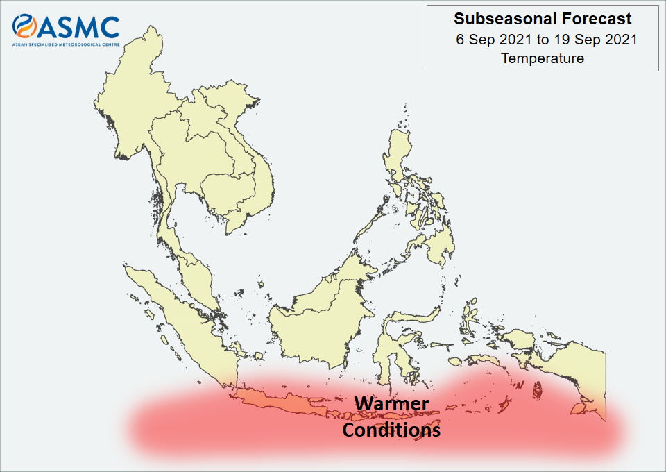
Warmer temperatures are expected over the southern Maritime Continent in the next fortnight (6 – 19 September).
No coherent MJO signal was present at the start of September. Some models predict an MJO to develop over the Indian Ocean (Phases 2 and 3) in Week 1 and then propagate eastwards over the Maritime Continent (Phases 4 and 5). There is a large uncertainty in the strength of this MJO signal.
The outlook is assessed for the region in general, where conditions are relative to the average conditions for the corresponding time of year. For specific updates on the national scale, the relevant ASEAN National Meteorological and Hydrological Services should be consulted.