Review of Regional Haze Situation for July 2024
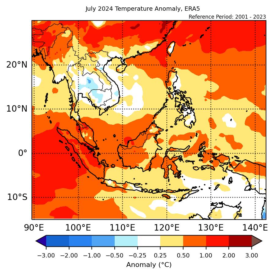
1.1 In July 2024, the Southwest Monsoon conditions continued over the ASEAN region. Over the northern ASEAN region, the prevailing winds blew mostly from the southwest to west. In the southern ASEAN region, the prevailing winds over areas near the Equatorial region were observed to be generally weak and variable in direction while southeasterly winds were observed over the rest of the region (Figure 1).
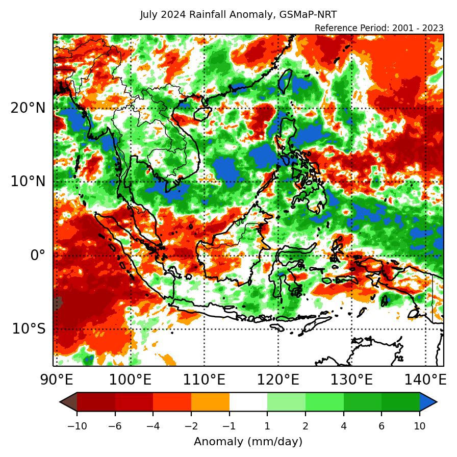
1.2 Showers were observed over most of the ASEAN region during the review period, apart from Java and the Lesser Sunda Islands where dry conditions were observed (Figure 1). Parts of Peninsular Malaysia, Sumatra, and Kalimantan also experienced drier conditions during the latter half of the review period. On 17 July 2024, the Alert Level 1 for the southern ASEAN region was activated, signalling the start of the traditional dry season for the region. Over the northern ASEAN region, heavy rainfall was recorded over the northern parts of the Philippines due to the influence of Tropical Storm Prapiroon and Typhoon Gaemi situated over the northern parts of the South China Sea and the northwest Pacific Ocean respectively during the latter half of July (Figure 9 and 10). Rainfall was also observed to be high over the western coastal areas of Myanmar (Figure 1).
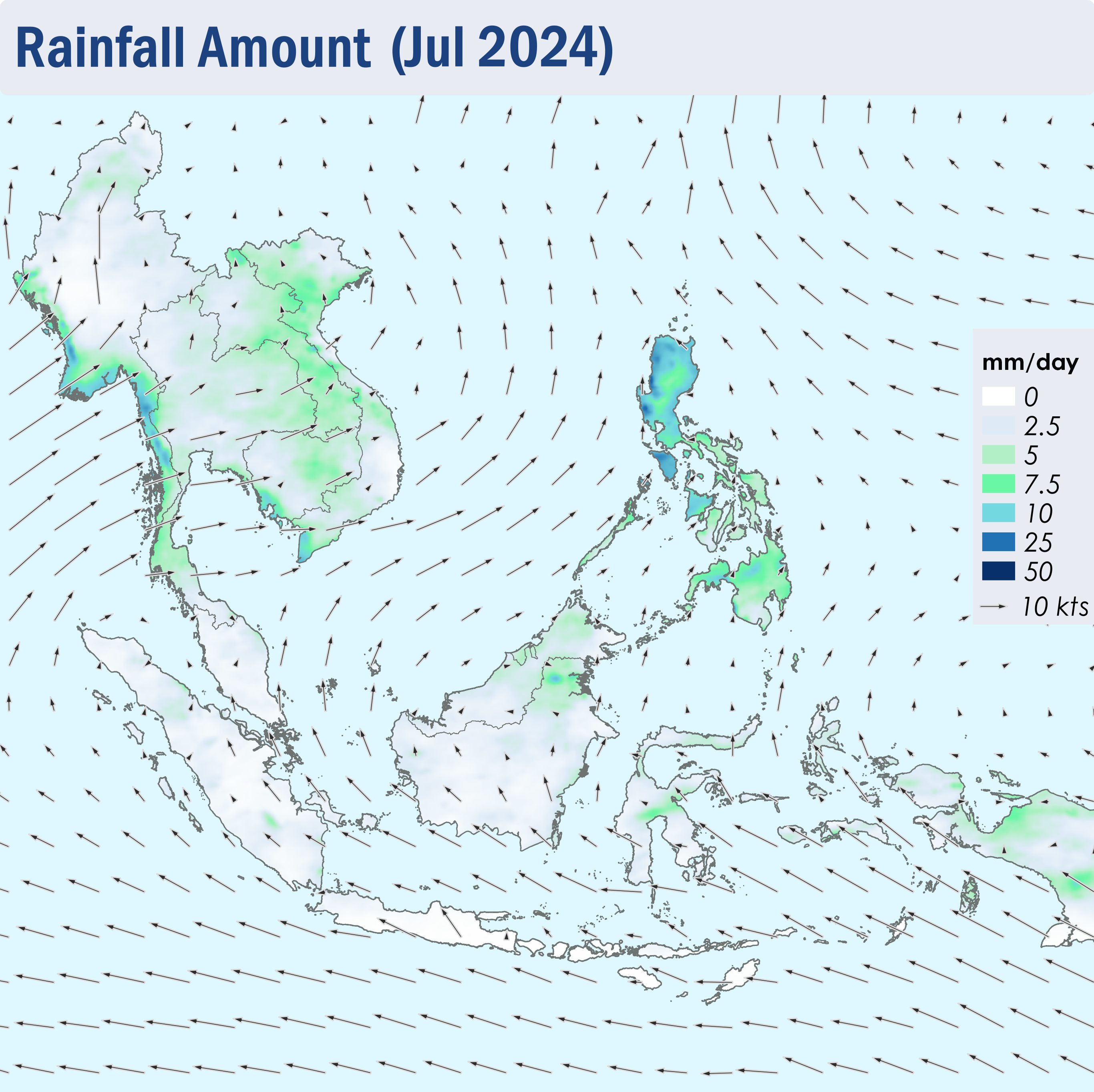
Figure 1: Average Daily Rainfall and Mean Winds for July 2024. (Source: JAXA GsMaP and GFS, respectively)
1.3 Over the southern ASEAN region, the hotspot counts were generally lower or comparable to previous years, except for the hotspot counts in Sumatra which was the highest compared to the past 5 years (Figure 2). Nonetheless, the hotspot activity for the southern ASEAN region remained relatively low compared to other parts of the year. Over the northern ASEAN region, the hotspot counts were lower or comparable to the past few years (Figure 3).
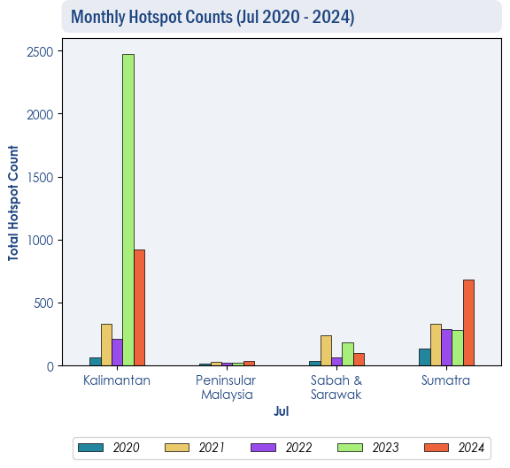
Figure 2: Hotspot counts for the southern ASEAN region for July (2020-2024) based on NOAA-20 satellite surveillance.

Figure 3: Hotspot counts for the northern ASEAN region for July (2020-2024) based on NOAA-20 satellite surveillance.
1.4 Hotspot activities were intense and persistent especially in the western parts of Kalimantan and parts of Sumatra towards the end of July 2024 (Figure 4). Slight to moderate localised smoke plumes were observed to emanate from hotspots detected in the western and central parts of Kalimantan and parts of Sumatra (Figure 5, 6, 7 and 8).
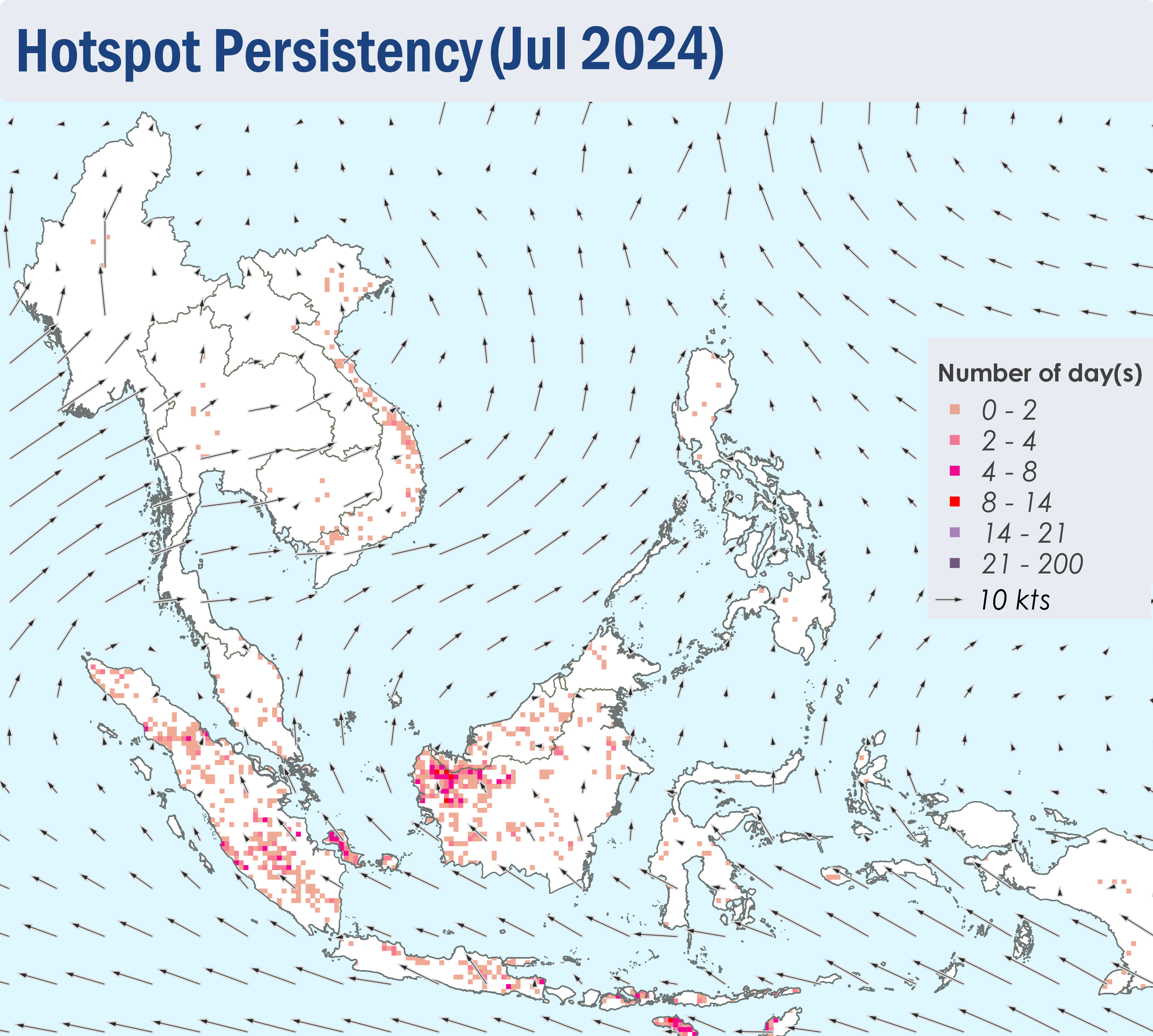
Figure 4: Distribution of hotspots detected in July 2024 based on NOAA-20 satellite surveillance.
Figure 5: Maximum fire intensity in July 2024 based on NOAA-20 satellite surveillance.
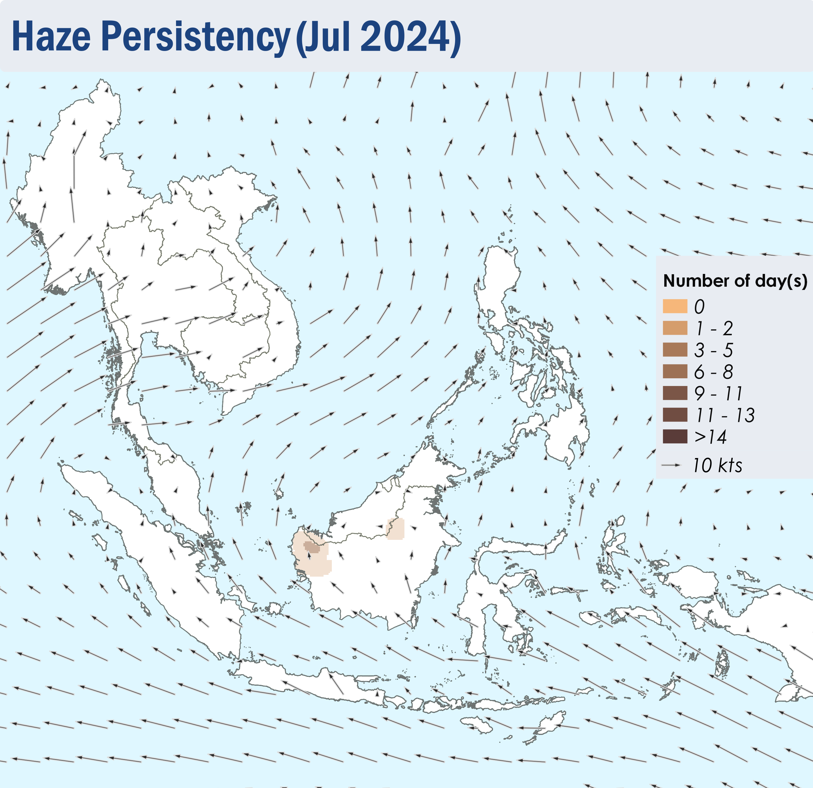
Figure 6: Number of days with moderate to dense smoke haze observed in July 2024 based on satellite imagery, ground observations, and air quality reports.
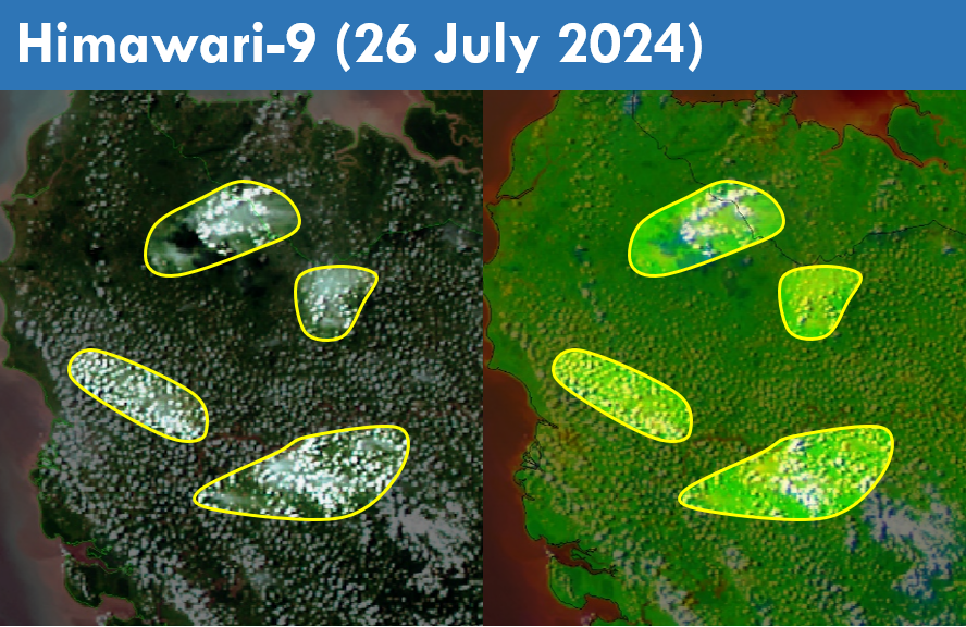
Figure 7: Slight localised smoke plumes were observed to emanate from a few hotspots in the western parts of Kalimantan on 26 July 2024. (Source: Himawari-9 satellite surveillance)
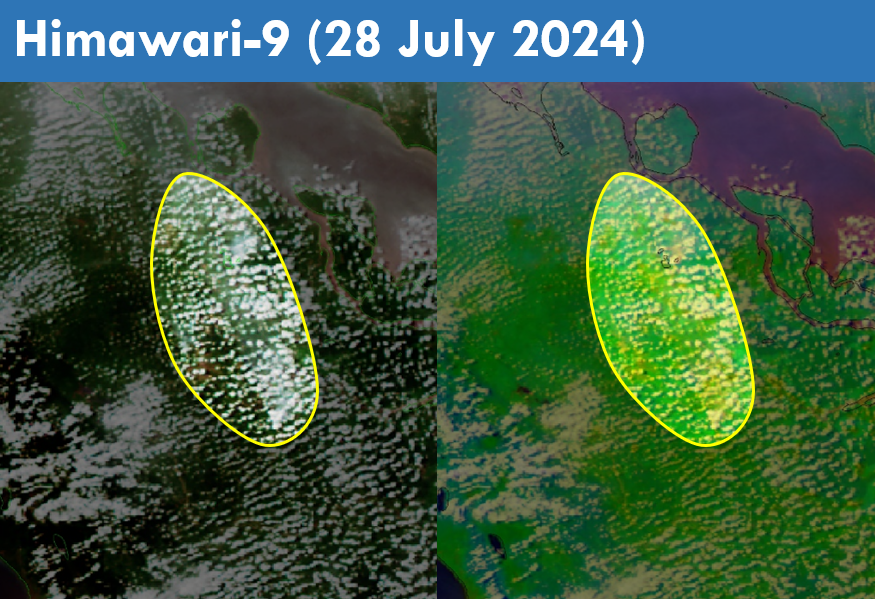
Figure 8: Slight localised smoke plumes were observed to emanate from a few hotspots over the central parts of Sumatra on 28 July 2024. (Source: Himawari-9 satellite surveillance)
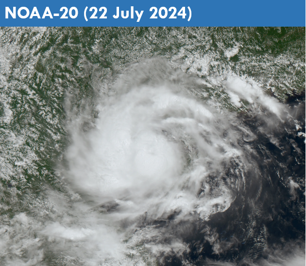
Figure 9: Tropical Storm Prapiroon over the northern parts of the South China Sea (Source: NOAA-20 satellite surveillance)
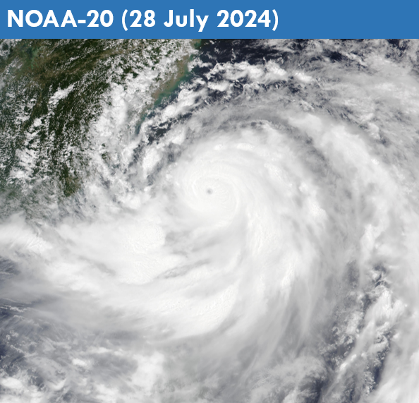
Figure 10: Typhoon Gaemi over the western Pacific Ocean (Source: NOAA-20 satellite surveillance)
Subseasonal Weather Outlook (5 – 18 August 2024)
Issued: 31 July 2024
First forecast week: 5 – 11 August 2024
Second forecast week: 12 – 18 August 2024
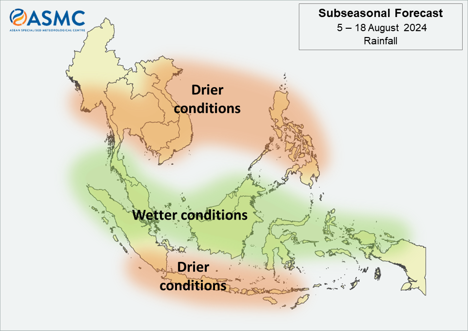
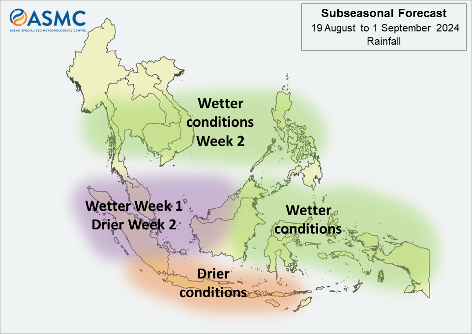
Figure 1: Rainfall Outlook
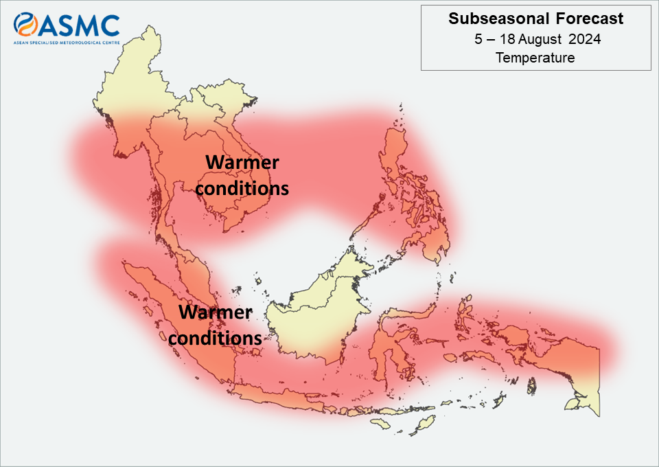
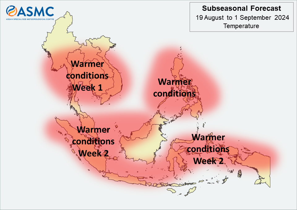
Figure 2: Temperature Outlook
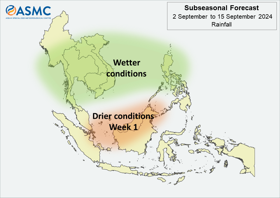
Drier conditions are predicted over southern and eastern Mainland Southeast Asia and the Philippines in the next fortnight (5 – 18 August). Drier conditions are also predicted over the southern Maritime Continent in the next fortnight.
Wetter conditions are predicted over much of the equatorial region in the next fortnight (5 – 18 August).
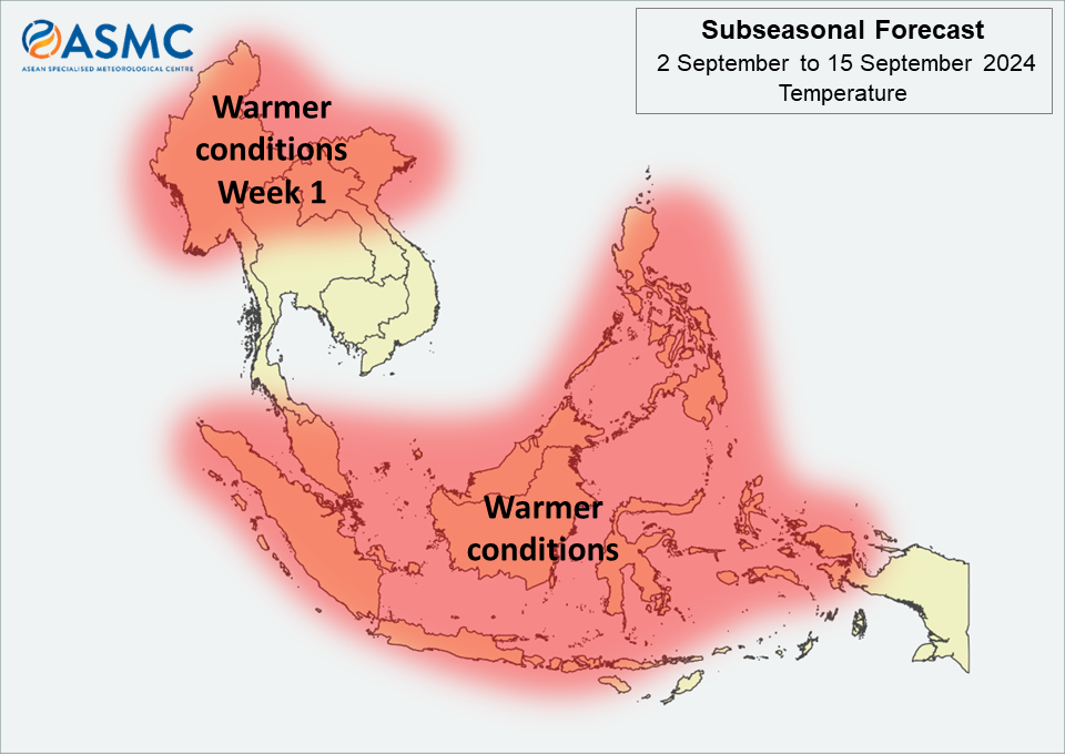
Warmer than usual temperature is predicted over much of southern and eastern Mainland Southeast Asia, and the Philippines in the next fortnight (5 – 18 August). Warmer than usual temperature is also predicted over parts of the western and southern Maritime Continent in the next fortnight.
No Madden-Julian Oscillation (MJO) signal was present during end of July based on the RMM index. Most models predict no significant MJO activity during the forecast period.
The outlook is assessed for the region in general, where conditions are relative to the average conditions for the corresponding time of year. For specific updates on the national scale, the relevant ASEAN National Meteorological and Hydrological Services should be consulted.