Category Archives: Regional Weather Review for Year 2016

January 12, 2017

Review of Regional Weather and Smoke Haze for Dec 2016

Review of Regional Weather and Smoke Haze for Dec 2016

Print Version

1.   Review of Regional Weather Conditions in December 2016

1.1    Northeast Monsoon conditions prevailed in December 2016. These conditions brought dry weather conditions interspersed with brief periods of showers to most parts of the northern ASEAN region. On the other hand, with the gradual southward migration of the monsoon rain band, the Northeast Monsoon brought wet weather conditions to the southern ASEAN region. The rainfall distribution for December 2016 is shown in Figure 1.

figure1

Figure 1: Daily average rainfall for the ASEAN region in December 2016. (Source: JAXA Global Satellite Mapping of Precipitation).

figure2

Figure 2: Percentage of Normal Rainfall for December 2016. The rainfall data may be less representative for areas with low density of rainfall network.

1.2    For December 2016, above-normal rainfall was recorded in southern Thailand, Vietnam and the Philippines while rainfall was below-normal in Myanmar, central Thailand, parts of Lao PDR and northern Vietnam. In the southern ASEAN region, rainfall was near-normal in most regions except in central Sumatra and western Java, where below-normal rainfall was recorded. The percentage normal of rainfall for December 2016 is shown in Figure 2.

1.3    The rainfall in December 2016 was distributed mainly in the equatorial region between 10N and 15S with several areas affected by heavy rainfall. A few northeast monsoon surges in December 2016 brought heavy rains to southern Thailand, central and southern parts of Vietnam and the east coast of Peninsular Malaysia. In addition, the presence of a low pressure system over the South China Sea in mid-December 2016 brought well above normal rainfall to the central and southern parts of Vietnam.

1.4    Over the Western Pacific Ocean, Typhoon Nock-Ten was first categorised as a tropical storm on 22 December 2016. It intensified further and tracked west-north-westward toward central Philippines before it made landfall on the eastern coast near Catanduanes Island on 25 December 2016. The typhoon then tracked westward and brought heavy rains and strong winds to the regions of Bikon and Calabarzon in central Philippines. ”Nock-Ten” moved over the South China Sea on 26 December and rapidly weakened into a tropical depression the next day.

1.5    In December 2016, the average and anomalous winds at 5000 feet (as in Figure 3), showed that north-easterly winds prevailing in the northern ASEAN region while westerlies prevailed in the southern ASEAN region. In the equatorial region of South China Sea, a cyclonic circulation was observed off the west coast of Sarawak and Sabah. This was due to the formation of Borneo vortices on some days in December, a feature which is typical during the Northeast Monsoon. The anomaly wind chart suggests that the anomalous circulation off the coast of southern Thailand is likely to be the primary cause of the well-above normal rainfall received in that region. The easterly anomaly brought below normal rainfall to most parts of the northern ASEAN region. Large-scale and persistent westerly anomaly winds observed across the equatorial region between 5 N and 10 S inhibited the incursion of the prevailing north-easterly flow across the equatorial region, contributing to the reduction of shower activities over Sumatra and parts of Java.

figure3a

figure3b

Figure 3: 5000 ft average winds streamlines (left) and anomaly (right) for December 2016.

1.6    In December 2016, the equatorial Pacific Ocean’s sea surface temperature (SST) over the Nino 3.4 region was near weak La Niña threshold values. However, the atmospheric variables, such as trade winds and cloudiness over the equatorial Pacific, showed conditions that were more consistent with neutral ENSO conditions.

figure4

Figure 4: The MJO phase diagram for December 2016. The MJO phase diagram illustrates the movement of the MJO through different phases, which correspond to different locations along the equator. The distance of the index from the centre of the diagram is correlated with the strength of MJO. When the index falls within the circle, the MJO is considered weak or no signal exhibited. (Source: Bureau of Meteorology)

1.7    In December 2016, the Madden Julian Oscillation (MJO) was weak or indiscernible and is unlikely to have significantly influenced the weather over the region.

2.   Review of Land/Forest Fires and Smoke Haze Situation

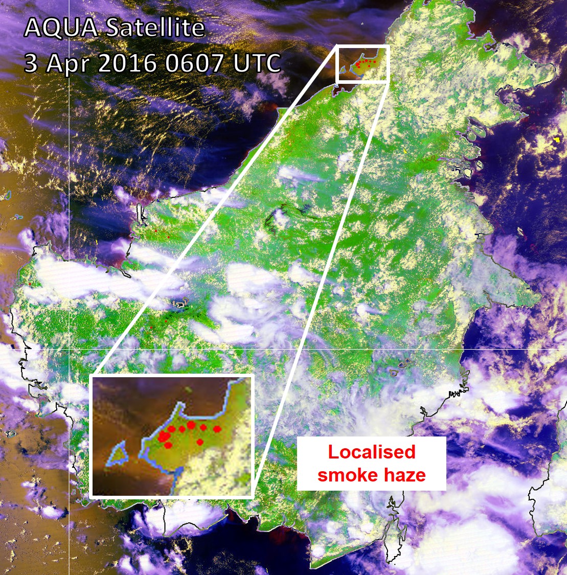
2.1    In December 2016, dry weather conditions interspersed with brief periods of showers prevailed in the Mekong sub-region. This led to a gradual increase of hotspots detected in most parts of the northern ASEAN region. However, the hotspots were mostly short-lived and the smoke haze observed was localised.

2.2    In the southern ASEAN region, hotspot activities were subdued by shower activities, except in central Sumatra where drier than usual weather conditions emerged. Nonetheless, the hotspots did not persist or give rise to the emission of significant smoke haze.2.3    Satellite images depicting some of the hotspot activities over parts of the ASEAN region during December 2016 are shown in Figure 5 – Figure 9.

figure5

Fig. 5: NOAA-19 satellite image on 1 December 2016 shows hotspots subdued as wet weather conditions prevailed over Kalimantan.

figure6

Fig. 6: NOAA-19 satellite image on 9 December 2016 shows isolated hotspots began to emerge in the northern ASEAN region, particularly over eastern Thailand and northern Vietnam.


figure7

Figure 7: NOAA-19 satellite image on 14 December 2016 shows isolated hotspots detected in central Sumatra.

figure8

Figure 8: NOAA-19 satellite image on 18 December 2016 shows isolated hotspots detected in eastern Thailand.

figure9

Figure 9: NOAA-19 satellite image on 23 December 2016 shows isolated hotspots detected in the surrounding region of Yangon, Myanmar.


2.4    The hotspot distribution charts and daily hotspot charts for December 2016 are shown in Figure 10, Figure 11 and Figure 12 respectively.

2.5    Most of the hotspots detected in December 2016 were mainly in the northern ASEAN region, with several clusters found in the coastal region of Myanmar, central Thailand and northern Vietnam (as shown in Figure 10). In the southern ASEAN region, the number of hotspots detected remained low except in central Sumatra where few clusters of hotspots were detected.

figure10

Figure 10: Figure 10: NOAA-19 hotspots distribution in December 2016.

figure11

Figure 11: Hotspot Counts in Cambodia, Lao PDR, Thailand, Vietnam and Myanmar in December 2016.


figure12

Figure 12: Hotspot Counts in Sumatra, Borneo and Peninsular Malaysia in December 2016.


3.   Status of El Niño/La Niña and Indian Ocean Dipole

3.1    Climate models from major climate centres are expecting the borderline La Niña conditions to weaken to neutral conditions in the upcoming season. The neutral conditions are forecast to then persist till mid-2017.

3.2    The region is currently experiencing Northeast Monsoon conditions. The impact of La Niña on the weather over the near-equatorial region is usually less pronounced during the Northeast Monsoon as compared to the Southwest Monsoon (Jun – Sep).

3.3    The Indian Ocean Dipole (IOD) continued to remain at neutral levels, as shown in Figure 13. International climate models indicate that the IOD is expected to remain in neutral condition and is unlikely to have a significant influence on the weather over the region for the next few months. The formation of IOD typically starts around May or June, and peaks between August and October before decaying rapidly between December and April.

figure13

Figure 13: Indian Ocean Dipole (IOD) index time series. The IOD index is at the neutral level for December 2016. (Source: Bureau of Meteorology).

December 9, 2016

Review of Regional Weather and Smoke Haze for Nov 2016

Review of Regional Weather and Smoke Haze for Nov 2016

Print Version

1.   Review of Regional Weather Conditions in November 2016

1.1    Inter monsoon conditions prevailed in the first half of November 2016. During this period, there was a gradual migration of the monsoon rain band from the northern ASEAN region to the near-equatorial region. In the Mekong sub-region, rainfall decreased gradually as the month progressed, and in the second half of the month, dry weather conditions were observed to have set in over the region. In contrast, wet weather conditions prevailed in the southern ASEAN region, particularly over Indonesia.

1.2    Over the Western Pacific Ocean, a tropical depression that developed to the southeast of central Philippines on 23 November 2016 intensified into Tropical Storm Tokage and made landfall over central Philippines on 25 November 2016. “Tokage’s” passage through the Philippines was brief as it northeast and moved over the South China Sea before dissipating over water on 27 November 2016. “Tokage” brought heavy rainfall and strong winds of up to 102km/h to areas along its path.

1.3    The Northeast Monsoon season onset in the ASEAN region in late November 2016. Between 28 and 30 November, the region experienced a monsoon surge episode where cold and strong northeasterly winds from a high pressure system over northern China surged into the South China Sea bringing widespread showers to the surrounding region, including Sarawak and the eastern coastal areas of Peninsular Malaysia.

1.4    For November 2016, above-normal rainfall was received in parts of the Mekong sub-region including Myanmar, north-eastern Thailand, Lao PDR and Vietnam. For the Philippines, near-normal to above-normal rainfall prevailed. Below-normal to near-normal rainfall prevailed over most parts of the southern ASEAN region including southern Thailand, Malaysia, Singapore, Brunei and Indonesia The regional rainfall distribution for November 2016 is shown in Fig. 1A.


Fig. 1A: Percentage of Normal Rainfall for November 2016. The rainfall data may be less representative for areas with low density of rainfall network.


2.   Review of Land/Forest Fires and Smoke Haze Situation

2.1    In November 2016, hotspot activities in both the northern and southern ASEAN region remained largely subdued.

2.2    The Inter monsoon conditions in November 2016 brought an increase of rainfall over the southern ASEAN region, and the showers contributed to keep the hotspot activities over Sumatra and Kalimantan low. In the northern ASEAN region, hotspot activities were generally subdued on most days of the month and as the weather started to become drier, increase in hotspot activities were observed over parts of the Mekong sub-region towards the end of November 2016 with the onset of the Northeast Monsoon. Satellite images depicting some of the hotspot activities over parts of the ASEAN region during November 2016 are shown in Fig. 2AFig. 2E

Fig. 2A: NOAA-19 satellite image on 20 November 2016 shows isolated hotspot activities in the eastern part of Myanmar.

Fig. 2B: NOAA-19 satellite image on 21 November 2016 shows isolated hotspots over northern Vietnam.


Figure 2C: NOAA-19 satellite image on 24 November 2016 shows wet conditions over Kalimantan.

Fig. 2D: NOAA-19 satellite image on 29 November 2016 shows cloudy conditions over Sumatra and widespread showers over northern Peninsular Malaysia due to the presence of a northeast monsoon surge.

Fig. 2E: NOAA-19 satellite image on 29 November 2016 shows isolated hotspots detected over central Thailand and showers over southern part of Thailand due to a northeast monsoon surge.


2.3    The hotspot charts for November 2016 for

  1. Cambodia, Myanmar, Thailand, Lao PDR and Vietnam;
  2. Sumatra, Borneo and Peninsular Malaysia;

are shown in Figs. 2F to 2G respectively


Fig. 2F: Hotspot Counts in Cambodia, Lao PDR, Thailand, Vietnam, Myanmar for November 2016.


Fig 2G: Hotspot Counts in Sumatra, Borneo and Peninsular Malaysia for November 2016.


3.   Status of El Niño/La Niña

3.1    In November 2016, the equatorial Pacific Ocean’s sea-surface temperature (SST) continued to gradually cool over the Niño3.4 region and was at borderline La Niña threshold values. Atmospheric variables, such as trade winds and cloudiness, over the equatorial Pacific have been consistent with borderline La Niña conditions.3.2    Expert assessments of international climate models do not favour La Niña conditions significantly over neutral conditions in the coming December-January-February season.

3.3    The region is currently experiencing Northeast Monsoon conditions. The impact of La Niña on the weather over the near-equatorial region is usually less pronounced during the Northeast Monsoon as compared to the Southwest Monsoon (Jun – Sep).

November 11, 2016

Review of Regional Weather and Smoke Haze for Oct 2016

Review of Regional Weather and Smoke Haze for Oct 2016

Print Version

1.   Review of Regional Weather Conditions in October 2016

1.1    Southwest Monsoon conditions prevailed on most days in October 2016 and the winds were blowing mostly from the west over most of the ASEAN region. In October 2016, there was a gradual increase of shower activities over the southern ASEAN region, and wetter than usual weather conditions were experienced in Java due to the warmer than usual sea surface temperatures over the eastern Indian Ocean. In contrast, the northern ASEAN region experienced less rainfall with dry weather conditions beginning to set in over parts of the region.

1.2    On 16 October, Typhoon Sarika made landfall and brought strong winds and heavy rains over central Luzon, the Philippines before tracking west-northwestward toward Hainan Island. This was followed by the passage of Super Typhoon Haima, which struck the northern tip of Luzon, the Philippines on 19 October 2016. Super Typhoon Haima moved to the northwest over the South China Sea and continued to steer toward southern China. The influence of both typhoons brought moderate to heavy rainfall parts of Indonesia, Peninsular Malaysia, Singapore, and Borneo Island as well.

1.3    Towards the end of October 2016, the region gradually transitioned from Southwest Monsoon conditions to Inter-Monsoon conditions. For October 2016, the Philippines and most parts of the Mekong sub-region received near-normal to above-normal rainfall. In the southern ASEAN region, near-normal rainfall prevailed over most parts of the near-equatorial region. Above-normal rainfall continued to prevail over Kalimantan, Java and the eastern parts of Indonesia Archipelago. The regional rainfall distribution for October 2016 is shown in Fig. 1A.


Fig. 1A: Percentage of Normal Rainfall for October 2016. The rainfall data may be less representative for areas with low density of rainfall network.


2.   Review of Land/Forest Fires and Smoke Haze Situation

2.1    In October 2016, hotspot activities in both the northern and southern ASEAN region were largely subdued due to the prevailing wet weather conditions.

2.2    In early and mid-October 2016, there were brief periods of dry weather conditions over Sumatra and Kalimantan respectively. There was an increase in the number of hotspots, particularly in the western parts of central Sumatra and central Kalimantan. While smoke plumes were observed to emanate from some of the hotspots, the hotspot activities were localised and short-lived. The return of shower activities at the end of the brief dry periods helped to suppress the hotspot activities in Sumatra and Kalimantan. Satellite images depicting some of the hotspot activities over parts of the ASEAN region during October 2016 are shown in Fig. 2AFig. 2E

Fig. 2A: NOAA-19 satellite image on 4 October shows isolated hotspot activities in western parts of central Sumatra.

Fig. 2B: NOAA-19 satellite image on 19 October 2016 shows an increase of hotspot activities in central Kalimantan following a brief period of dry weather conditions.


Figure 2C: NOAA-19 satellite image on 20 October 2016 shows returning shower activities over Kalimantan after a brief period of dry weather conditions.

Fig. 2D: NOAA-19 satellite image on 26 October 2016 shows isolated shower activities in parts of the Mekong sub-region.

Fig. 2E: NOAA-19 satellite image on 29 October 2016 shows widespread shower activities over Peninsular Malaysia and Sumatra.


2.3    The hotspot charts for October 2016 for

  1. Cambodia, Myanmar, Thailand, Lao PDR and Vietnam;
  2. Sumatra, Borneo and Peninsular Malaysia;

are shown in Figs. 2F to 2G respectively


Fig. 2F: Hotspot Counts in Cambodia, Lao PDR, Thailand, Vietnam, Myanmar for October 2016.


Fig 2G: Hotspot Counts in Sumatra, Borneo and Peninsular Malaysia for October 2016.


3.   Status of El Niño/La Niña

3.1    In October 2016, the equatorial Pacific Ocean’s sea-surface temperature (SST) anomaly over the Nino3.4 region was cooler than average, at borderline La Niña threshold values. Atmospheric variables, such as trade winds and cloudiness, over the equatorial Pacific were mostly at levels indicative of weak La Niña conditions.3.2    Expert assessments of international climate models have maintained a 60% chance of weak or borderline La Niña developing in the November – January season.

3.3    The region is currently experiencing Inter-Monsoon conditions (Oct – Nov), and a transition into the Northeast Monsoon conditions (Dec – Mar) is expected in the latter part of November 2016. The impact of La Niña on the weather over the near-equatorial region is usually less pronounced during the Northeast Monsoon as compared to the Southwest Monsoon (Jun – Sep).

October 12, 2016

Review of Regional Weather and Smoke Haze for Sep 2016

Review of Regional Weather and Smoke Haze for Sep 2016

Print Version

1.   Review of Regional Weather Conditions in September 2016

1.1    Southwest Monsoon conditions continued to prevail in September 2016, and the prevailing winds in the region blew mainly from the southwest or west. The monsoon rain belt was north of the Equator between latitudes 5 N and 15 N on most days in September 2016.

1.2    During the review period, showers affected most parts of the northern ASEAN region. On 12 September 2016, Tropical Depression “Rai”, which developed over the South China Sea, east-northeast of Ho Chi Minh City, made landfall in central Vietnam. “Rai” brought heavy rainfall to the Mekong sub-region, in particular over Vietnam and northern Thailand, causing the rivers to break its banks which led to severe flooding and loss of 12 lives. Over the southern ASEAN region, it was generally wet with occasional brief periods of dry weather conditions. This wetter than normal conditions is atypical of the traditional dry season of the southern ASEAN region in September 2016.

1.3    For September 2016, most parts of the northern ASEAN region except Cambodia and southern Vietnam recorded near-normal to above-normal rainfall. In the southern ASEAN region, near-normal rainfall was recorded in Malaysia, Brunei Darussalam and most parts of Sumatra. Above-normal rainfall prevailed over large areas of the Indonesian Archipelago, including southern Sumatra, Kalimantan and Java. The regional rainfall distribution for September 2016 is shown in Fig. 1A.


Fig. 1A: Percentage of Normal Rainfall for September 2016. The rainfall data may be less representative for areas with low density of rainfall network.


2.   Review of Land/Forest Fires and Smoke Haze Situation

2.1    In September 2016, shower activities in the northern ASEAN region continued to subdue the hotspot activities there. For the southern ASEAN region, hotspot activities in the near-equatorial region were mostly subdued due to the higher than usual shower activities in the region.

2.2    In mid-September 2016, the influence of Super Typhoon Meranti over the western Pacific Ocean brought drier weather conditions over parts of Kalimantan. This led to an escalation of hotspot activities in West Kalimantan where more than 100 hotspots were detected between 12 and 14 September 2016. Visible smoke plumes and haze were observed mainly in West Kalimantan over the two days. The dry weather conditions were short-lived and an improvement in the hotspot and haze situation was experienced in the subsequent days as shower activities returned to Kalimantan.

2.3    In the last week of September 2016, the brief periods of dry weather conditions in parts of Sumatra brought an increase in hotspot activities but there were no significant smoke plumes or haze observed in the vicinity of the hotspots. Hotspot activities over parts of the ASEAN region during September 2016 are shown in Fig. 2AFig. 2E

Fig. 2A: NOAA-19 satellite image on 9 September 2016 shows hotspot activities in central Sumatra subdued by occurrence of shower. Isolated hotspots were detected in South Sumatra.

Fig. 2B: NOAA-19 satellite image on 13 September 2016 shows the presence of Tropical Depression Rai over northern Vietnam and the eastern part of Thailand and Lao PDR. Widespread showers affected most parts of the Mekong sub-region.


Figure 2C: NOAA-19 satellite image on 14 September 2016 shows widespread hotspot activities in West Kalimantan. Few clusters of hotspots with localised smoke plumes and haze were observed.

Fig. 2D: NOAA-19 satellite image on 15 September 2016 shows an increase in shower activities over Kalimantan which helped to subdue hotspot activities that had been persisting for the past few days.

Fig. 2E: NOAA-19 satellite image on 26 September 2016 shows hotspots in Sumatra, mostly in North Sumatra.


2.3    The hotspot charts for September 2016 for

  1. Cambodia, Myanmar, Thailand, Lao PDR and Vietnam;
  2. Sumatra, Borneo and Peninsular Malaysia;

are shown in Figs. 2F to 2G respectively


Fig. 2F: Hotspot Counts in Cambodia, Lao PDR, Thailand, Vietnam, Myanmar for September 2016.


Fig 2G: Hotspot Counts in Sumatra, Borneo and Peninsular Malaysia for September 2016.<


3.   Status of El Niño/La Niña

3.1    In September 2016, the equatorial Pacific Ocean sea surface temperature (SST) anomaly was near the La Niña threshold. However, the atmospheric variables (cloud and wind patterns) have yet to support weak La Niña conditions. There remains limited interaction between the atmospheric and oceanic conditions.

3.2    Experts’ assessment of international climate models suggests that there is about 60% chance of La Niña conditions developing in the October – December season and it is likely to be only weak or borderline.

3.3    The ASEAN region is currently in the Southwest Monsoon season (June-September/early October), where the La-Niña is known to have considerable impact (wetness) on the western part of the Maritime Continent.

September 14, 2016

Review of Regional Weather and Smoke Haze for Aug 2016

Review of Regional Weather and Smoke Haze for Aug 2016

Print Version

1.   Review of Regional Weather Conditions in August 2016

1.1    Southwest Monsoon conditions continued to prevail in August 2016, with prevailing winds in the region blowing from the southeast or southwest. In early-August, Tropical Storm Nida made landfall over parts of Cagayan province, Philippines bringing scattered showers there before steering westward toward Guangdong province, China.

1.2    During the first half of August 2016, the monsoon rain belt persisted in the northern ASEAN region and brought widespread showers particularly over coastal areas of Myanmar and north-western parts of Philippines. Drier weather conditions were experienced across most parts of the southern ASEAN region.

1.3    In the second half of August, with the southward migration of the monsoon rain belt towards the equatorial region, there was an increase in rainfall observed over most parts of the southern ASEAN region.

1.4    For August 2016, near-normal to above-normal rainfall was received in the Mekong sub-region. In the Philippines, near-normal to above-normal rainfall prevailed in the northern and southern parts, while the central parts received below-normal rainfall. In the southern ASEAN region, near-normal rainfall was received in most parts of the near-equatorial region, except in central Sumatra and West Kalimantan where below-normal rainfall prevailed. Southern Sumatra and Java received above-normal rainfall. The regional rainfall distribution for August 2016 is shown in Figure Fig. 1A.


Fig. 1A: Percentage of Normal Rainfall for August 2016. The rainfall data may be less representative for areas with low density of rainfall network.


2.   Review of Land/Forest Fires and Smoke Haze Situation

2.1    In August 2016, shower activities persisted on most days over the northern ASEAN region. This helped to subdue hotspot activities there.

2.2    Drier weather conditions in first half of August led to an escalation of hotspot activities over central Sumatra and West Kalimantan. Hotspots detected in central Sumatra were mostly localised, and slight hazy conditions were observed to have spread to the Strait of Malacca on a few days. In Kalimantan, widespread hotspot activities in excess of 100 hotspots with smoke haze were observed on a few days, particularly over West Kalimantan in mid-August 2016.

2.3    In the second half of August, an increase in shower activities over Kalimantan helped to ease the fire situation there. Showers fell over most parts of Sumatra, except in central Sumatra, where dry weather conditions with isolated hotspot activities were observed. The haze situation in Riau, central Sumatra deteriorated rapidly between 25 and 26 August 2016 and persisted until 29 August 2016 under dry weather and strong winds conditions. Moderate to dense smoke haze from the fires in Riau were blown by the southwesterly to westerly winds over the Strait of Malacca to central Peninsular Malaysia and Singapore, where the air quality deteriorated to Unhealthy levels.

2.4    The haze situation improved by 29 August 2016 with the return of shower activities over central Sumatra for the next few days. Hotspot activities over parts of the ASEAN region during August 2016 are shown in Figures 2A – 2E.

Fig. 2A: NOAA-19 satellite image on 1 July 2016 shows isolated hotspots detected in northern and central Sumatra.

Fig. 2B: NOAA-19 satellite image on 4 July 2016 shows showers over parts of the northern ASEAN region.


Figure 2C: NOAA-19 satellite image on 11 July 2016 shows few hotspots in central part of Peninsular Malaysia.

Fig. 2D: NOAA-19 satellite image on 14 July 2016 shows isolated hotspots detected in West Kalimantan during a brief period of dry weather conditions.

Fig. 2E: NOAA-19 satellite image on 20 July 2016 shows hotspot activities subdued as showers returned to the near-equatorial region in the second half of July 2016.


2.3The hotspot charts for August 2016 for

  1. Cambodia, Myanmar, Thailand, Lao PDR and Vietnam;
  2. Sumatra, Borneo and Peninsular Malaysia;

are shown in Figs. 2F to 2G respectively


Fig. 2F: Hotspot Counts in Cambodia, Lao PDR, Thailand, Vietnam, Myanmar for July 2016.


Fig 2G: Hotspot Counts in Sumatra, Borneo and Peninsular Malaysia for July 2016.


3.   Status of El Niño/La Niña

3.1    In August 2016, a weak cool sea surface temperature (SST) anomaly near La Niña thresholds was observed in the equatorial Pacific Ocean. However, key atmospheric variables (cloud and wind patterns) over the equatorial Pacific have yet to respond to the cooling of the SSTs.3.2    Neutral conditions are expected prevail in the equatorial Pacific in September 2016. Experts’ assessment of international climate models suggests that there is a 60% chance of weak La Niña conditions developing in the October – December season.

3.3    The ASEAN region is currently in the Southwest Monsoon season (June-September/early October), where the La-Niña is known to have considerable impact (wetness) on the western part of the Maritime Continent.

August 18, 2016

Review of Regional Weather and Smoke Haze for Jul 2016

Review of Regional Weather and Smoke Haze for Jul 2016

Print Version

1.   Review of Regional Weather Conditions in July 2016

1.1    Southwest Monsoon conditions prevailed in July 2016, and the low level winds in the region blew predominantly from the southeast or southwest. The monsoon rain belt was over the northern ASEAN region in particular in the first half of July 2016 which brought increased shower activities to the northern ASEAN region. In the southern ASEAN region during this period, dry weather conditions were experienced. In the second half of July 2016, with the southward migration of the monsoon rain belt to the near-equator region, several parts of the southern ASEAN region including Indonesia, Malaysia and Singapore experienced wet weather conditions.

1.2    Typhoon Nerpatak, the first typhoon in 2016 over the Western Pacific region, was categorised as a tropical depression on 2 July 2016, east of the Philippines. It intensified into a super typhoon on 6 July 2016 as it tracked north-west towards Taiwan. While Typhoon Nerpatak did not make landfall in the ASEAN region, its rainbands brought widespread showers and strong winds to the northern parts of ASEAN region.

1.3    For July 2016, near-normal to above-normal rainfall was received in most parts of the northern ASEAN region. For the southern ASEAN region, the southern and eastern parts of the Indonesia Archipelago received well above-normal rainfall while areas including Malaysia, Sumatra and Kalimantan received near-normal to above-normal rainfall. The regional rainfall distribution for July 2016 is shown in Figure Fig. 1A.


Fig. 1A: Percentage of Normal Rainfall for July 2016. The rainfall data may be less representative for areas with low density of rainfall network.


2.   Review of Land/Forest Fires and Smoke Haze Situation

2.1    In July 2016, it rained on most days for both the northern and southern ASEAN regions. In early July 2016, a brief period of dry weather conditions in parts of the southern ASEAN region led to an increase in hotspot activities over Sumatra. Smoke plumes were observed to emanate from some of the hotspots detected. Nonetheless, the hotspots were mostly short-lived and were mainly due to localised burning activities.

2.2    An increase in shower activities in the latter half of July 2016 brought a reduction to the number of hotspots detected over Sumatra and Kalimantan. There was no occurrence of transboundary smoke haze in July 2016. Some of the hotspot activities in the ASEAN region during July 2016 are shown in Figures 2A – 2E.

Fig. 2A: NOAA-19 satellite image on 1 July 2016 shows isolated hotspots detected in northern and central Sumatra.

Fig. 2B: NOAA-19 satellite image on 4 July 2016 shows showers over parts of the northern ASEAN region.


Figure 2C: NOAA-19 satellite image on 11 July 2016 shows few hotspots in central part of Peninsular Malaysia.

Fig. 2D: NOAA-19 satellite image on 14 July 2016 shows isolated hotspots detected in West Kalimantan during a brief period of dry weather conditions.

Fig. 2E: NOAA-19 satellite image on 20 July 2016 shows hotspot activities subdued as showers returned to the near-equatorial region in the second half of July 2016.


2.3    The hotspot charts for July 2016 for

  1. Cambodia, Myanmar, Thailand, Lao PDR and Vietnam;
  2. Sumatra, Borneo and Peninsular Malaysia;

are shown in Figs. 2F to 2G respectively


Fig. 2F: Hotspot Counts in Cambodia, Lao PDR, Thailand, Vietnam, Myanmar for July 2016.


Fig 2G: Hotspot Counts in Sumatra, Borneo and Peninsular Malaysia for July 2016.


3.   Status of El Niño/La Niña

3.1    In July 2016, the sea surface temperature (SST) anomaly in the equatorial Pacific Ocean was in Neutral conditions, i.e. neither El Niño nor La Niña. Key atmospheric variables (cloud and wind patterns) over the equatorial Pacific had also indicated Neutral conditions.3.2    While Neutral conditions currently prevail in the equatorial Pacific, latest assessment of international climate models from major climate centres suggest a moderate 60% chance of La Niña conditions developing during the October-December season.

3.3    The ASEAN region is currently in the Southwest Monsoon season (June-September/early October), where the La-Niña is known to have considerable impact (wetness) on the western part of the Maritime Continent.

July 14, 2016

Review of Regional Weather and Smoke Haze for Jun 2016

Review of Regional Weather and Smoke Haze for Jun 2016

Print Version

1.   Review of Regional Weather Conditions in June 2016

1.1    The Southwest Monsoon season onset in June 2016 with prevailing winds over the region blowing mostly from the southeast or southwest. Showers affected most parts of the southern ASEAN region, particularly over Java and its surrounding areas.

1.2    While shower activities affected many parts of the ASEAN region in the first three weeks of June 2016, dry weather conditions were experienced, in particular over the southern ASEAN region in the last week of June 2016.

1.3    For June 2016, most parts of the northern ASEAN region except Cambodia and Lao PDR received near-normal to above-normal rainfall. In the southern ASEAN region, above-normal rainfall was received over Peninsular Malaysia, Kalimantan and Java. The regional rainfall distribution for June 2016 is shown in Figure Fig. 1A.


Fig. 1A: Percentage of Normal Rainfall for June 2016


2.   Review of Land/Forest Fires and Smoke Haze Situation

2.1    In June 2016, hotspot activities remained largely subdued in both northern and southern ASEAN regions due to persistent wet weather conditions. In the last week of June 2016, the dry weather conditions experienced in the region contributed to a slight increase in hotspot activities in Sumatra. There was no occurrence of transboundary smoke haze in June 2016. Satellite images in Figure 2A – 2E show shower activities over various parts of the ASEAN region in June 2016.

Fig. 2A: NOAA-19 satellite image on 14 June 2016 shows shower activities over central and southern parts of Peninsular Malaysia.

Fig. 2B: NOAA-19 satellite image on 15 June 2016 shows shower activities over parts of the northern ASEAN region.


Figure 2C: NOAA-19 satellite image on 18 June 2016 shows shower activities over Sarawak and parts of Kalimantan.

Fig. 2D: NOAA-19 satellite image on 22 June 2016 shows shower activities over the southern parts of Sumatra.

Fig. 2E: NOAA-19 satellite image on 30 June 2016 shows isolated hotspots in central Sumatra.


2.3    The hotspot charts for June 2016 for

  1. Cambodia, Myanmar, Thailand, Lao PDR and Vietnam;
  2. Sumatra, Borneo and Peninsular Malaysia;

are shown in Figs. 2F to 2G respectively


Fig. 2F: Hotspot Counts in Cambodia, Lao PDR, Thailand, Vietnam, Myanmar for June 2016.


Fig 2G: Hotspot Counts in Sumatra, Borneo and Peninsular Malaysia for June 2016.


3.   Status of El Niño/La Niña

3.1    In June 2016, Niño3.4 sea-surface temperature (SST) readings were near zero, indicating Neutral (neither El Niño nor La Niña) conditions. Other atmospheric variables such as cloudiness and rainfall patterns in the central and eastern equatorial Pacific also indicate Neutral conditions.

3.2    Most international climate models and expert assessments project the Neutral condition to persist, with increasing possibility of La Niña conditions in the second-half of 2016. However, the possibility of Neutral conditions to persist for the rest of year 2016 cannot be ruled out.

3.3    The ASEAN region is currently in the Southwest Monsoon season (June-September/early October), where the La-Niña is known to have considerable impact (wetness) on the western part of the Maritime Continent.

June 8, 2016

Review of Regional Weather and Smoke Haze for May 2016

Review of Regional Weather and Smoke Haze for May 2016

Print Version

1.   Review of Regional Weather Conditions in May 2016

1.1    Inter Monsoon conditions prevailed in May 2016 and shower activities returned to most parts of the ASEAN region as El Niño conditions in the equatorial Pacific Ocean continued to further weaken in May 2016.

1.2    Diurnal shower activities and light wind conditions prevailed on most days in both the southern and northern ASEAN regions. Around the end of May 2016, the Inter Monsoon conditions gradually transitioned to the Southwest Monsoon conditions, and a strengthening of winds over the South China Sea was observed. Shower in the region were gradually becoming less active over the Java Sea as the monsoon rain belt migrated further north.

1.3    For May 2016, most parts of the southern ASEAN region received near-normal rainfall except in parts of Kalimantan and Java Island where above-normal rainfall was received. In the northern ASEAN region, less than 100% of the normal rainfall was received mainly in Thailand, Cambodia and Lao PDR. The regional rainfall distribution for May 2016 is shown in Figure Fig. 1A.


Fig. 1A: Percentage of Normal Rainfall for May 2016


2.   Review of Land/Forest Fires and Smoke Haze Situation

2.1    Isolated hotspot activities with localised smoke haze were observed in the northern parts of Mekong sub-region and in parts of Peninsular Malaysia, in particular in early-May. An increase in the occurrence of showers in the rest of May 2016 helped to subdue hotspot activities in the ASEAN region. There was no significant transboundary haze situation.

Fig. 2A: NOAA-19 satellite image on 1 May 2016 shows isolated hotspots with localised smoke haze in central Pahang, Malaysia.

Fig. 2B: NOAA-19 satellite image on 5 May 2016 shows localised hotspot activities in the northern parts of Mekong sub-region.


Figure 2C: NOAA-19 satellite image on 18 May 2016 shows widespread shower activities over the Strait of Malacca, the eastern coastal areas of central Sumatra and southern half of Peninsular Malaysia.

Fig. 2D: NOAA-19 satellite image on 21 May 2016 shows hotspot activities mostly subdued due to wet weather conditions.

Fig. 2E: NOAA-19 satellite image on 29 May 2016 shows shower activities in the northern ASEAN region.


2.3    The hotspot charts for May 2016 for

  1. Cambodia, Myanmar, Thailand, Lao PDR and Vietnam;
  2. Sumatra, Borneo and Peninsular Malaysia;

are shown in Figs. 2F to 2G respectively


Fig. 2F: Hotspot Counts in Cambodia, Lao PDR, Thailand, Vietnam, Myanmar for May 2016.


Fig 2G: Hotspot Counts in Sumatra, Borneo and Peninsular Malaysia for May 2016.


3.   Status of El Niño/La Niña

3.1    The prevailing El Niño weakened further in May 2016, approaching neutral levels based on Niño3.4 sea-surface temperature (SST) readings. The large-scale atmospheric patterns, such as the trade winds near the equatorial Pacific Ocean returning to near average conditions and the cloud patterns showing less of the typical El Niño characteristics, continue to respond to the weakening of the El Niño conditions.

3.2    International climate models and expert assessment predict the end of El Niño by mid-2016. While there has yet to be consensus among experts if La Niña or neutral conditions are to occur in the second half of 2016, model outlook increasingly suggest that La Niña conditions are favored more than neutral conditions, but the possibility of neutral conditions prevailing for the rest of the year cannot be ruled out.

3.3    The ASEAN region is currently in the Southwest Monsoon season (June-September/early October), where the La-Niña is known to have considerable impact (wetness) on the western part of the Maritime Continent.

May 16, 2016

Review of Regional Weather and Smoke Haze for Apr 2016

Review of Regional Weather and Smoke Haze for Apr 2016

Print Version

1.   Review of Regional Weather Conditions in April 2016

1.1    Inter Monsoon conditions characterised by light winds afternoon shower activities, particularly in the near-equatorial region prevailed in April 2016. In the northern ASEAN region, dry weather conditions persisted in the first half of April but there was a gradual increase of shower activities by late April 2016. Similar conditions were experienced in Peninsular Malaysia, Sabah and East Kalimantan. For parts of Sumatra and West Kalimantan, it was generally wet weather on most days of the month.

1.2    The drier and warmer than usual weather conditions which started since March 2016 continued in April 2016. Prolonged dry weather conditions affected many parts of the ASEAN region including Peninsular Malaysia, Philippines and countries in the Mekong Sub-region. High temperatures were also experienced in Thailand and Peninsular Malaysia where the maximum temperatures were reported to have exceeded 40 degrees Celsius in parts of Thailand. On 28 April 2016, the maximum temperature in Maehongsorn reached 44.3 degrees Celsius while in Peninsular Malaysia, maximum temperatures of between 35 to 39.2 degrees Celsius were reported in parts of the Malaysian States of Selangor, Perlis and Pahang.

1.3    1.3 For April 2016, most of the areas north of the equator including the northern ASEAN region, Peninsular Malaysia and Sabah received less than 100% of normal rainfall. Normal to above-normal rainfall were recorded in Sumatra, Kalimantan and the islands of Java. The regional rainfall distribution for April 2016 is shown in Figure Fig. 1A.


Fig. 1A: Percentage of Normal Rainfall for April 2016


2.   Review of Land/Forest Fires and Smoke Haze Situation

2.1    The fire-prone provinces of Sumatra and Kalimantan experienced wet weather conditions on most days in April 2016, and the showers helped to subdue the hotspot activities there. On the contrary, in parts of Peninsular Malaysia and Sabah, the drier than usual weather conditions contributed to the occurrence of localised hotspots and smoke haze on several days. In Beaufort, Sabah, for example, localized burning led to a deterioration of air quality where the Air Pollution Index (API) reached a high of 308 on 4 April 2016. On a few days around 22 April 2016, smoke haze from localized peat fires in Kuala Langat and Sepang in Selangor, Peninsular Malaysia affected the parts of Selangor including Shah Alam and Cheras where API readings were in the Unhealthy range for a few hours.

2.2    In the northern ASEAN region, with dry weather conditions persisting in the first half of April 2016, the hotspot activities continued to be high. Scattered hotspots and smoke haze were observed in the northern parts of Thailand, Lao PDR, as well as over the ranges west of Nakhon Sawan province and in parts of Cambodia. PM10 concentration levels in Chiang Mai, Chiangrai and Maehongsorn exceeded 120ug/m3 on several days in April 2016.

2.3    An increase in shower activities in the northern ASEAN region in the latter half of April 2016 helped to ease the haze situation in the Mekong Sub-region, which also brought a reduction to the number of hotspots detected.


Fig. 2A: AQUA satellite image on 3 April 2016 shows localised smoke plumes emanating from hotspots detected in Beaufort, Sabah.

Fig. 2B: AQUA satellite image on 5 April 2016 shows scattered hotspots and smoke haze in the northern parts of Mekong Sub-region.


Figure 2C: AQUA satellite image on 15 April 2016 shows scattered hotspots in the northern parts of Mekong Sub-region. Smoke haze was observed to spread over the northern border areas of Vietnam.

Fig. 2D: AQUA satellite image on 19 April 2016 shows localised smoke plumes emanating from isolated hotspots in central Pahang, Malaysia.

Fig. 2E: AQUA satellite image on 25 April 2016 shows shower activities over parts of Peninsular Malaysia and Sumatra.


2.3    The hotspot charts for April 2016 for

  1. Cambodia, Myanmar, Thailand, Lao PDR and Vietnam;
  2. Sumatra, Borneo and Peninsular Malaysia;

are shown in Figs. 2F to 2G respectively


Fig. 2F: Hotspot Counts in Cambodia, Lao PDR, Thailand, Vietnam, Myanmar for April 2016.


Fig 2G: Hotspot Counts in Sumatra, Borneo and Peninsular Malaysia for April 2016.


3.   Status of El Niño/La Niña

3.1    The El Niño has been gradually weakening over the past few months and based on the latest assessment, is at a moderate-to-weak level. The trade winds over the tropical Pacific Ocean are near normal, and cloudiness near the dateline is less typical of El Niño conditions.

3.2    Large-scale rainfall response to the El Niño in terms of widespread, drier-than-normal conditions was observed over many parts of the Southeast Asia region for April 2016. International climate models and expert assessment suggests that the current El Niño is likely to weaken by the mid-2016, and there is a chance of La Niña developing in the third quarter of 2016. However, there is still a possibility of Neutral conditions persisting for the second half of 2016.

3.3    The region is currently in the Inter-Monsoon period (Apr – May), and the impact of El Niño (La Niña) is usually less pronounced as compared to the Southwest Monsoon season (Jun – Sep). Typically, El Niño (La Niña) will bring drier (wetter) than average rainfall conditions over to the southern and eastern parts of the region but less significant impact to the northern and western parts of the region during this period. More locally-specific impact differs from place to place and for different seasons.

April 11, 2016

Review of Regional Weather and Smoke Haze for Mar 2016

Review of Regional Weather and Smoke Haze for Mar 2016

Print Version

1.   Review of Regional Weather Conditions in March 2016

1.1    Weak Northeast Monsoon conditions prevailed in March 2016 with winds that were light and from the northeaster on most days in March 2016. The monsoon rain belt continued to lie south of the equator. Most of the shower activities fell mostly over areas south of the equator while warm and dry weather conditions persisted over areas in the southern ASEAN region north of the equator, in particular over Peninsular Malaysia and Singapore.

1.2    Drought conditions affected several parts of the northern ASEAN region, and were particularly severe in northern Thailand, central and south Vietnam. Persistent warmer than usual temperatures were experienced in countries such as Thailand, Malaysia and Singapore. The northern states of Peninsular Malaysia, such as Chu Ping, Alor Star and Ipoh experienced very high temperatures on several consecutive days where the highest daily maximum temperatures ranged between 37 and 39 degrees Celsius.

1.3    Large scale drier than usual weather conditions were observed across many parts of ASEAN region in March 2016. In particular, significantly below-normal rainfall, i.e. less than 50% of normal rainfall, was received over areas north of the equator including northern ASEAN, Malaysia, Singapore, northern Sumatra and eastern Kalimantan. An exception was in the western coastal areas of Kalimantan where near-normal rainfall was received. The regional rainfall distribution for March 2016 is shown in Figure Fig. 1A.


Fig. 1A: Percentage of Normal Rainfall for March 2016


2.   Review of Land/Forest Fires and Smoke Haze Situation

2.1    Hotspot activities in Sumatra and Kalimantan were generally subdued by shower activities in March 2016. However, isolated hotspots with localised smoke plumes were detected in some parts of Peninsular Malaysia and Sabah such as central Pahang and Beaufort, Sabah due to drier than usual weather conditions there.

2.2    In the northern ASEAN region, hotspot activities remained elevated in March 2016 due to the prevailing dry weather conditions. The fires were particularly active along the borders between Myanmar and Thailand near Maehongsorn and Kanchanaburi provinces, as well as in northern Lao PDR and eastern Cambodia. Visible smoke plumes were seen emanating from these hotspot regions on a number of days. Hazy conditions and elevated PM10 readings exceeding 150ug/m3 were reported in Maehongsorn, Thailand.


Fig. 2A: AQUA satellite image on 4 March 2016 shows scattered hotspots detected in Thailand and Cambodia.

Fig. 2B: AQUA satellite image on 20 March 2016 shows widespread shower activities around Sumatra.


Figure 2C: AQUA satellite image on 22 March 2016 shows localised smoke plumes emanating from hotspots detected in Miri, Sarawak and Sabah.

Fig. 2D: AQUA satellite image on 23 March 2016 shows isolated hotspots detected in central Sumatra.

Fig. 2E: AQUA satellite picture on 27 March 2016 shows scattered hotspots mostly in Cambodia.


2.3    The hotspot charts for March 2016 for

  1. Cambodia, Myanmar, Thailand, Lao PDR and Vietnam;
  2. Sumatra, Borneo and Peninsular Malaysia;

are shown in Figs. 2F to 2G respectively


Fig. 2F: Hotspot Counts in Cambodia, Lao PDR, Thailand, Vietnam, Myanmar for February 2016.


Fig 2G: Hotspot Counts in Sumatra, Borneo and Peninsular Malaysia for March 2016.


3.   Status of El Niño/La Niña

3.1    The tropical Pacific Ocean continued to show declining but still strong El Niño conditions in March 2016. The El Niño has passed its peak strength, and will continue a slow and steady decline.

3.2    Large-scale rainfall response to the El Niño in terms of widespread drier-than-normal conditions was observed over mosst areas of the Southeast Asia region for March 2016. The consensus forecast based on assessments from international climate models and experts assessment project that the current El Niño conditions to continue through the first quarter of 2016 before transiting to Neutral (neither El Niño nor La Niña) by mid-2016 and persisting for a few months. There is a chance of La Niña development by the third quarter of 2016.

3.3    The region is transitioning from the Northeast Monsoon season (late Nov – Mar) to the Inter-Monsoon period (Apr – May), and the impact of El Niño is usually less pronounced as compared to the Southwest Monsoon season (Jun – Sep). Typically, El Niño will bring drier than average rainfall conditions over to the southern and eastern parts of the region but less significant impact to the northern and western parts of the region during this period. More locally-specific impact differs from place to place and for different seasons.