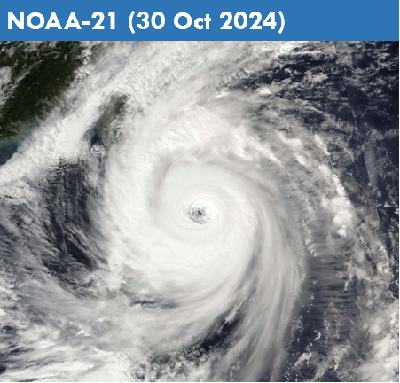
Review of Regional Haze Situation for April 2025
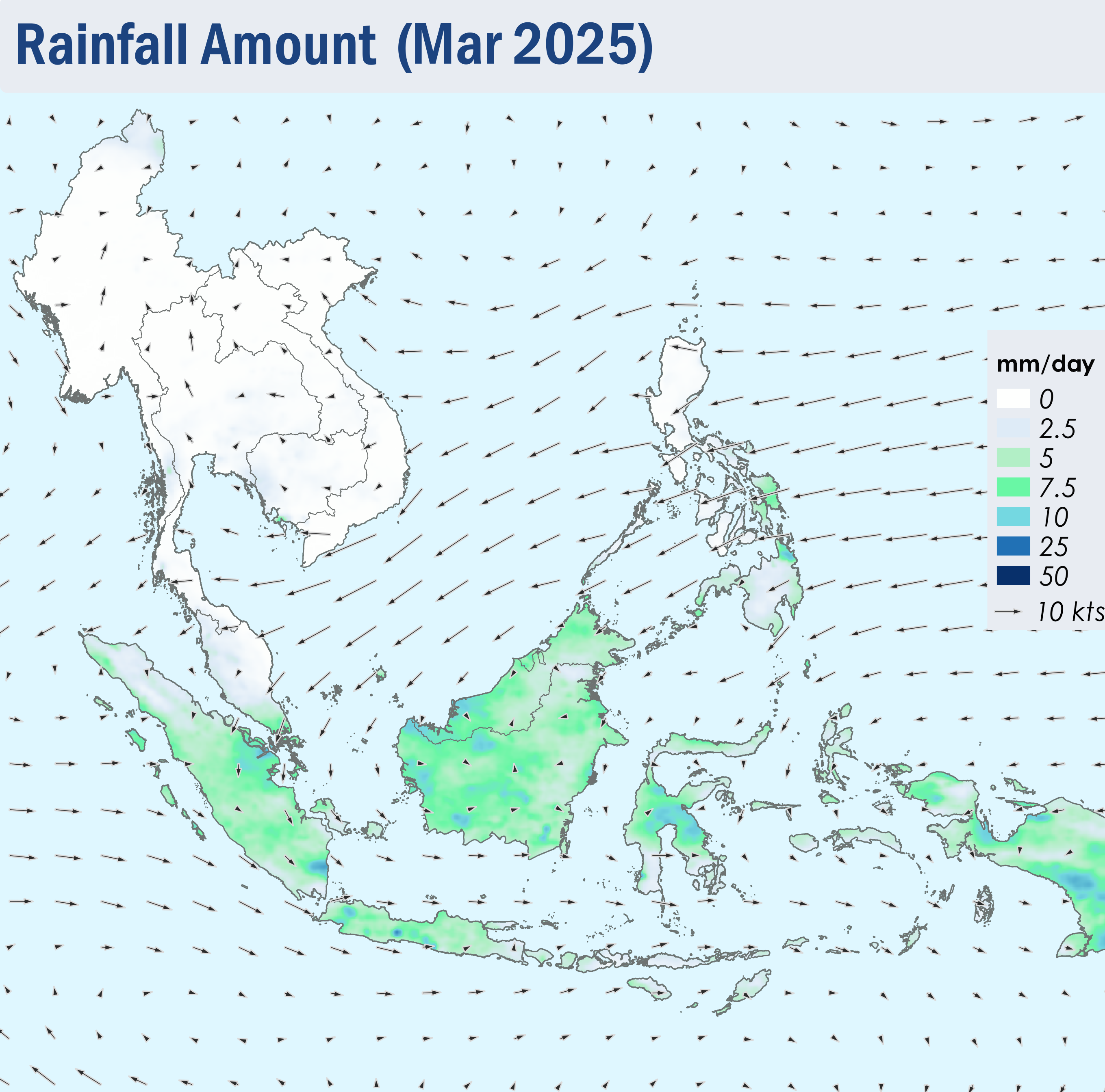
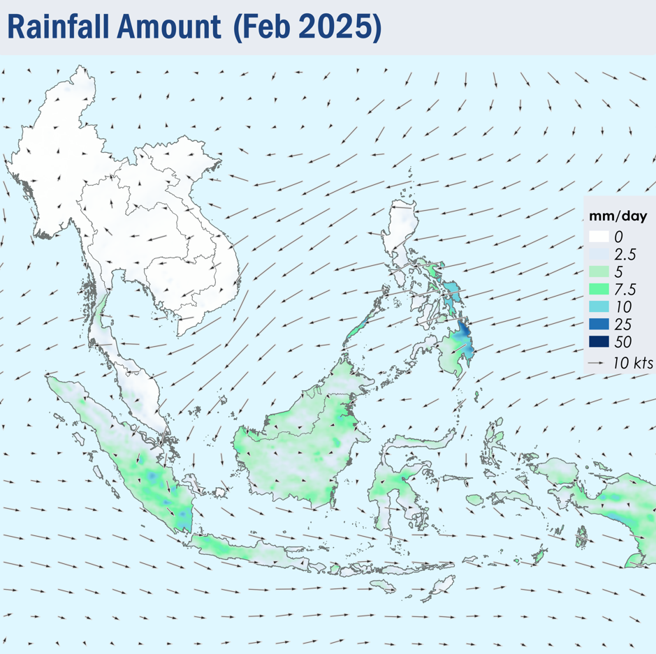
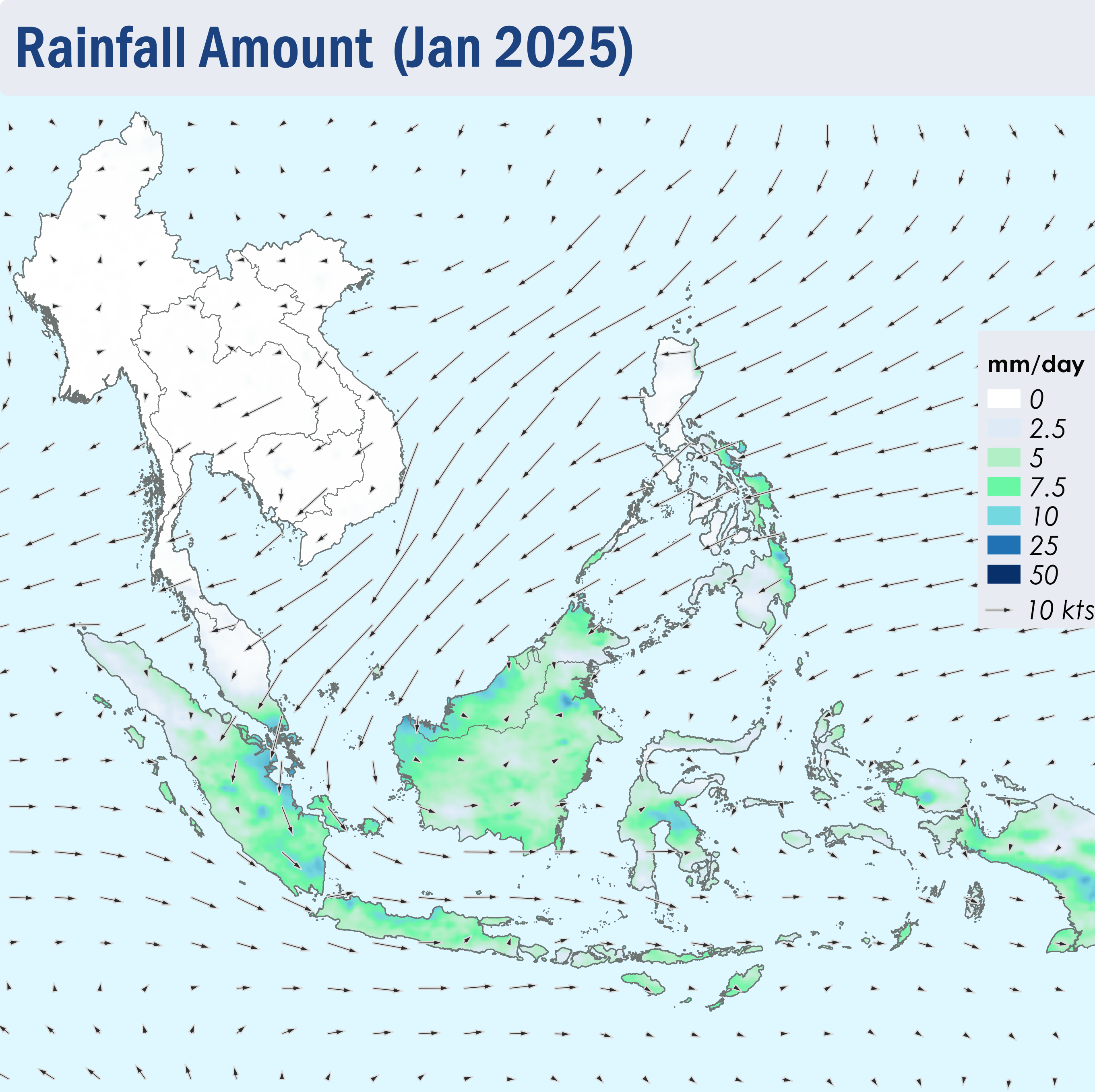
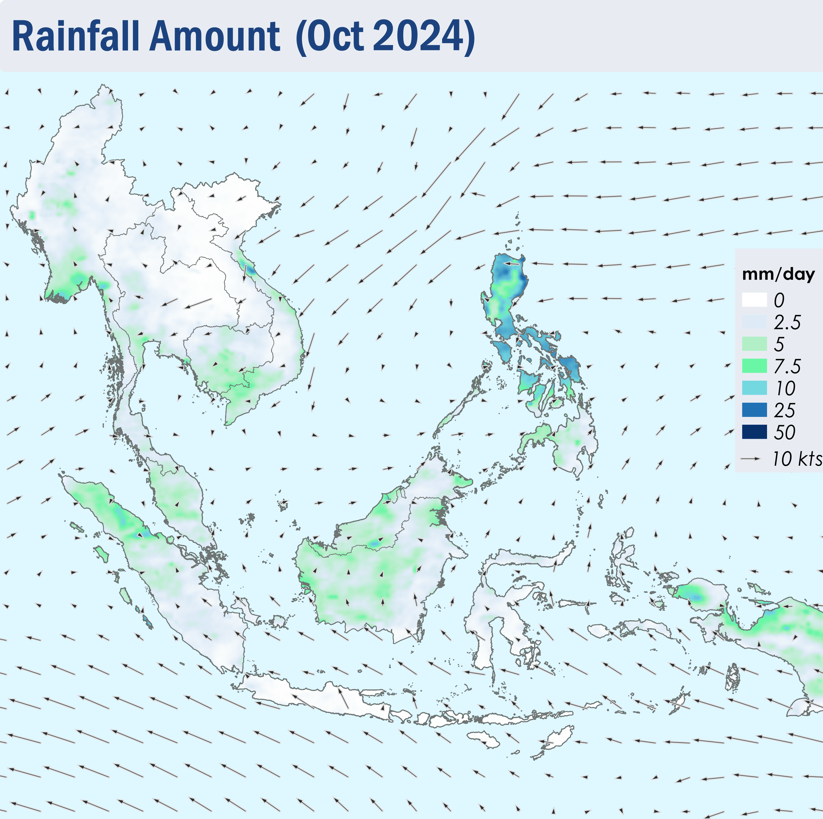
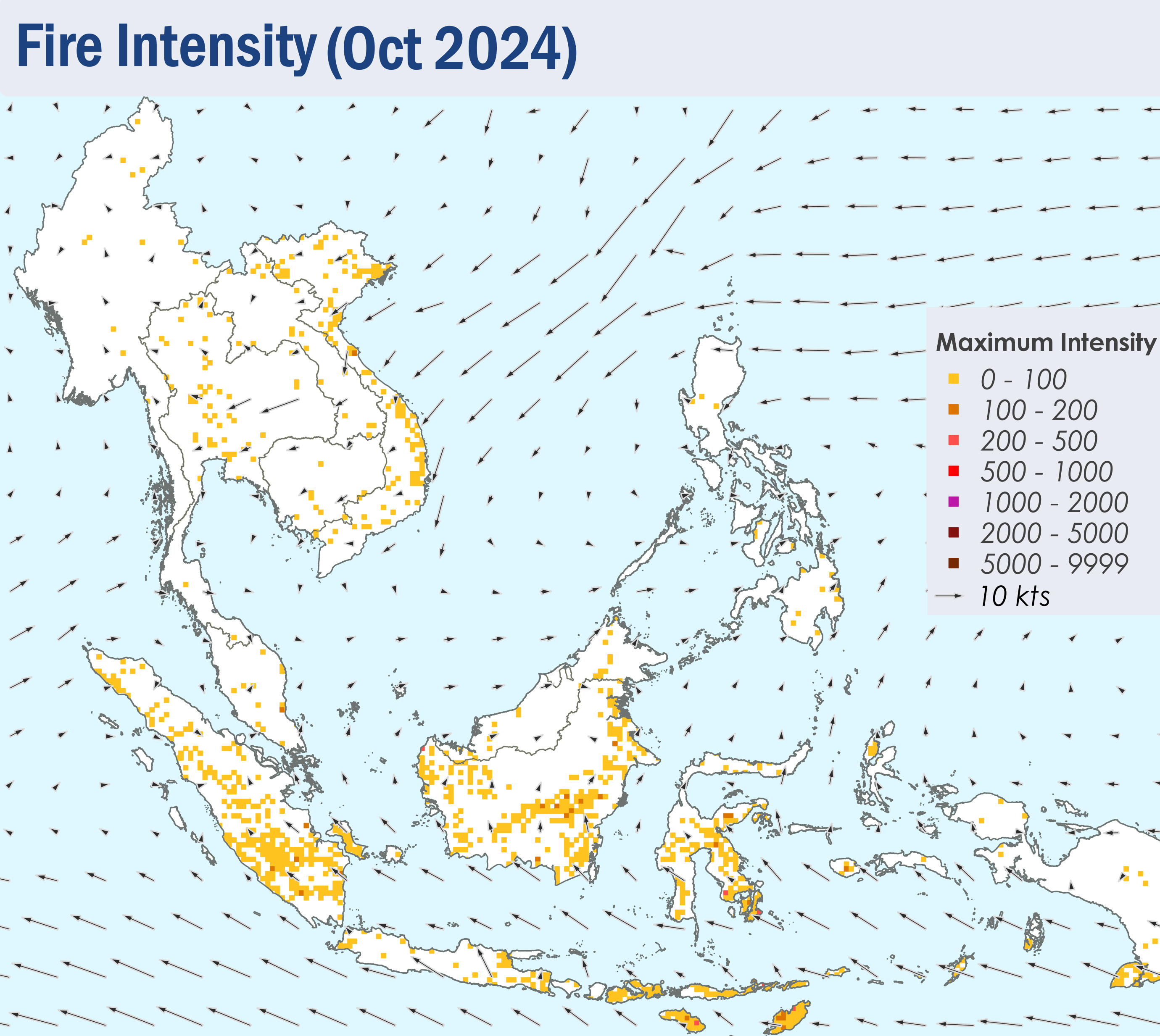
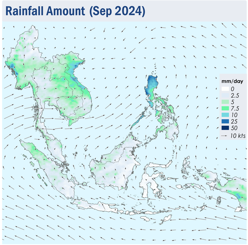
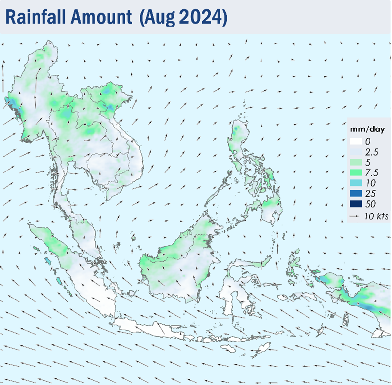
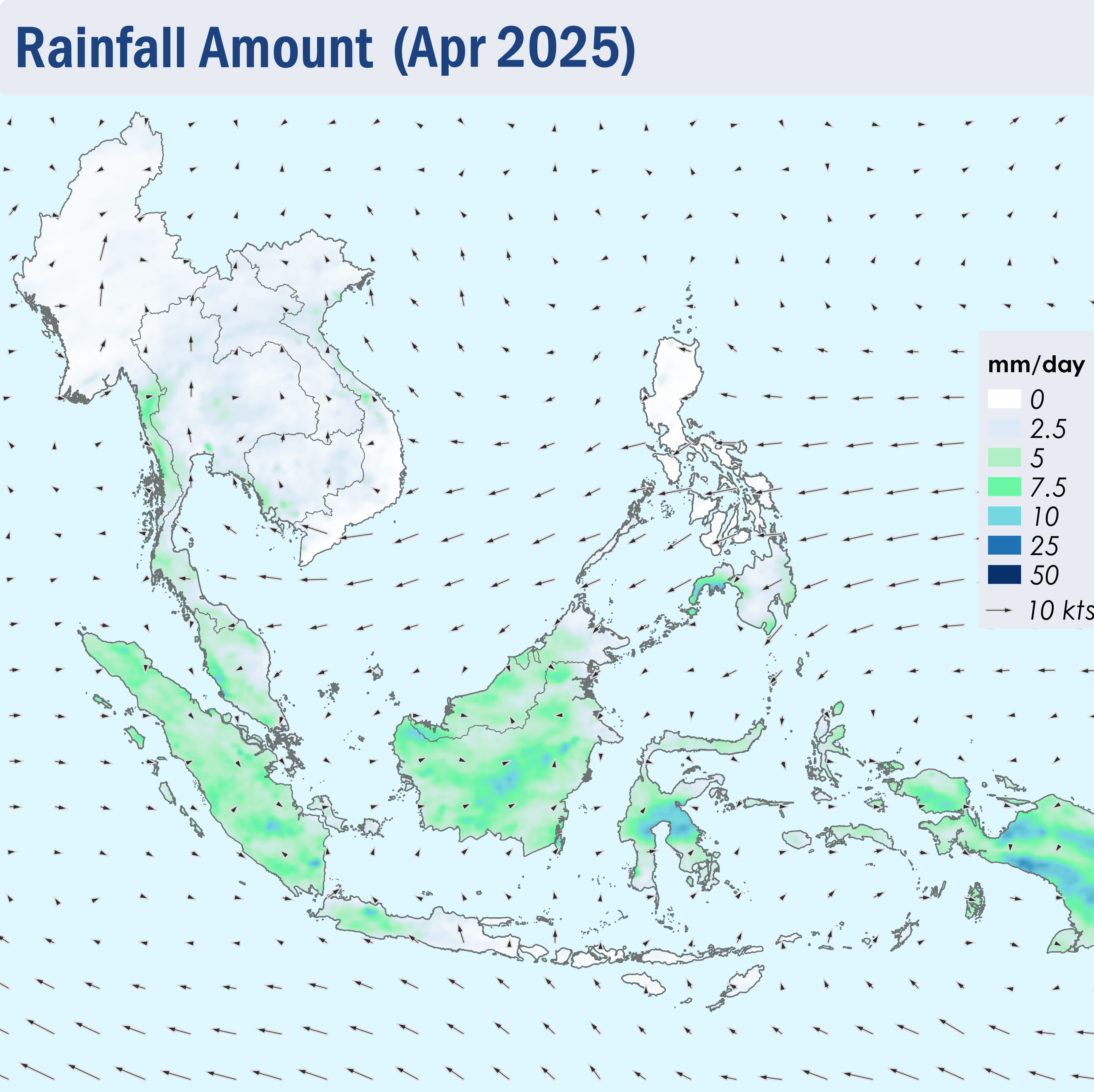
1.1 During April 2025, the Northeast Monsoon transitioned into the Inter-monsoon conditions as the monsoon band shifted northwards towards the Equator. The period was characterized by the light and variable winds across most of the ASEAN region, except over the Philippines where the prevailing winds blew mostly from the northeast or east (Figure 1).
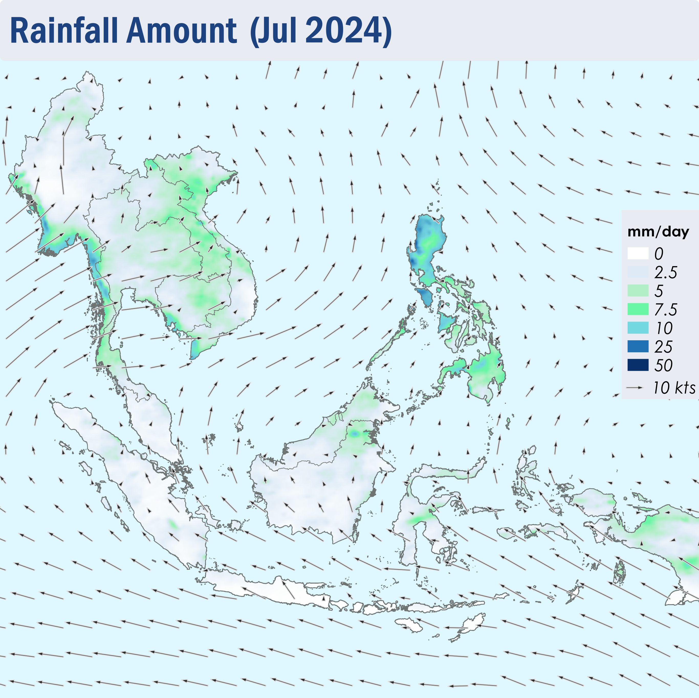
1.2 Despite increased rainfall over the Mekong sub-region compared to the previous month, drier weather persisted over much of the Mekong sub-region and the northern parts of the Philippines (Figure 1). Given the increased in showers which can improve the hotspot and smoke haze situation, the Alert level for the Mekong sub-region was downgraded to Alert level 2 on 15 April 2025. While showers continued to prevail over the southern ASEAN region, drier conditions were observed over parts of Java towards the end of April 2025 (Figure 1).
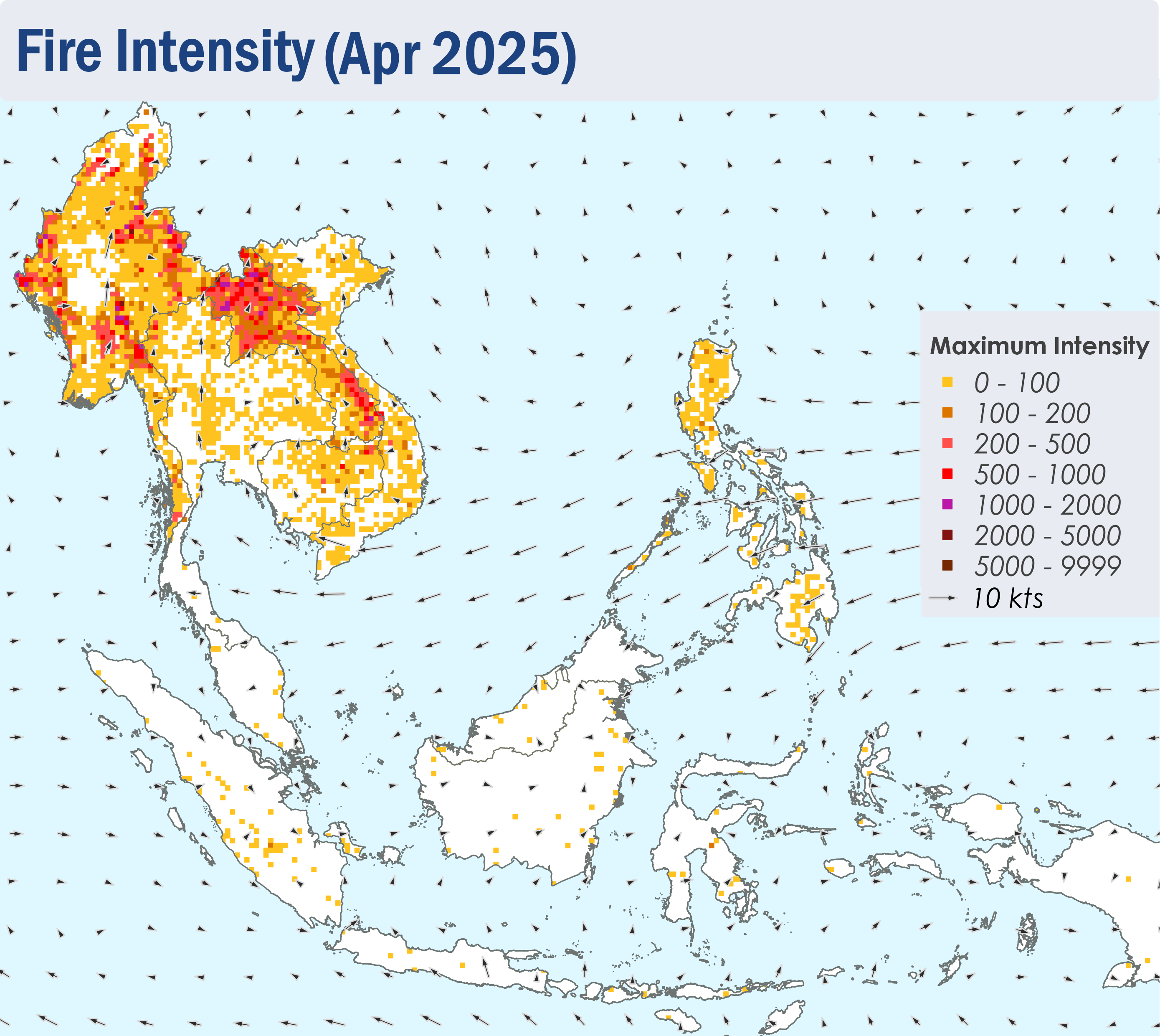
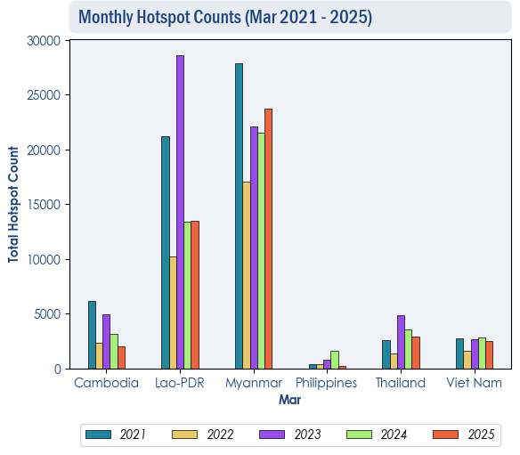
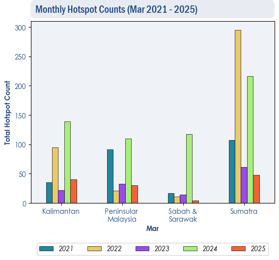
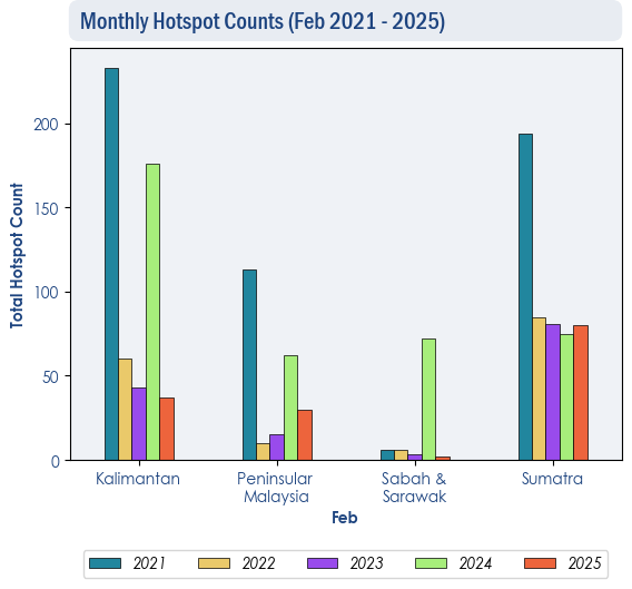
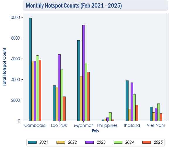
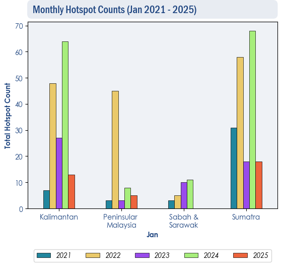
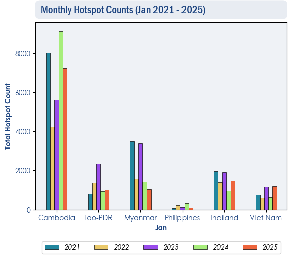
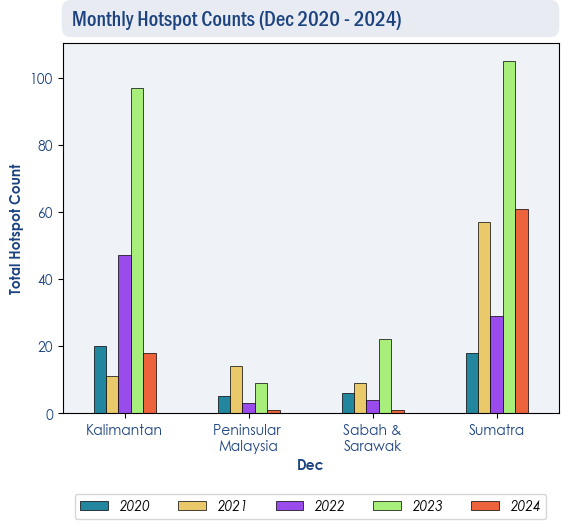
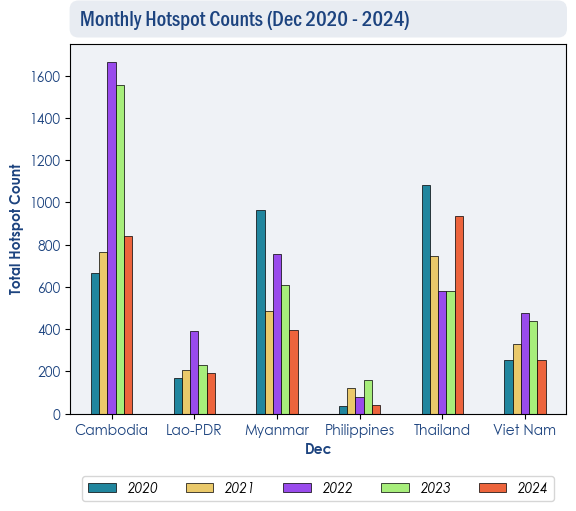
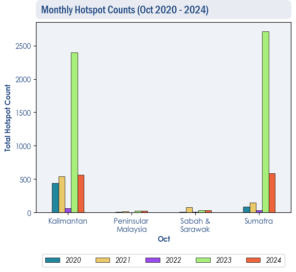
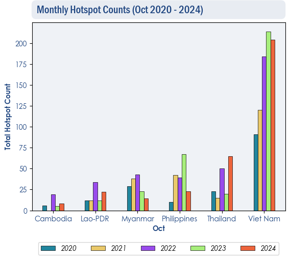
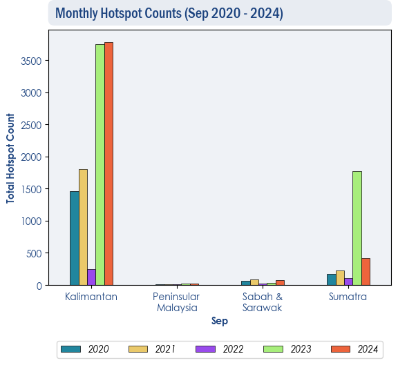
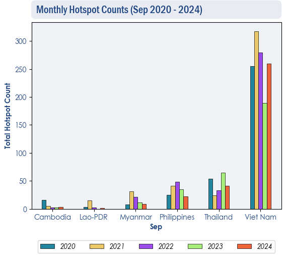
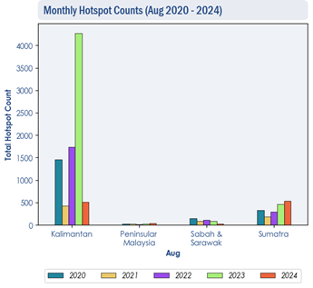
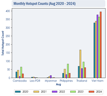
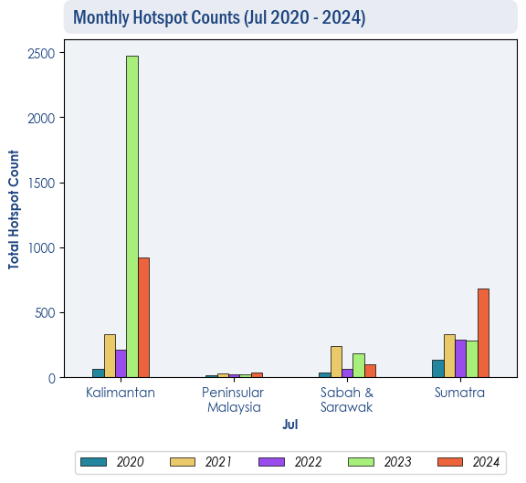
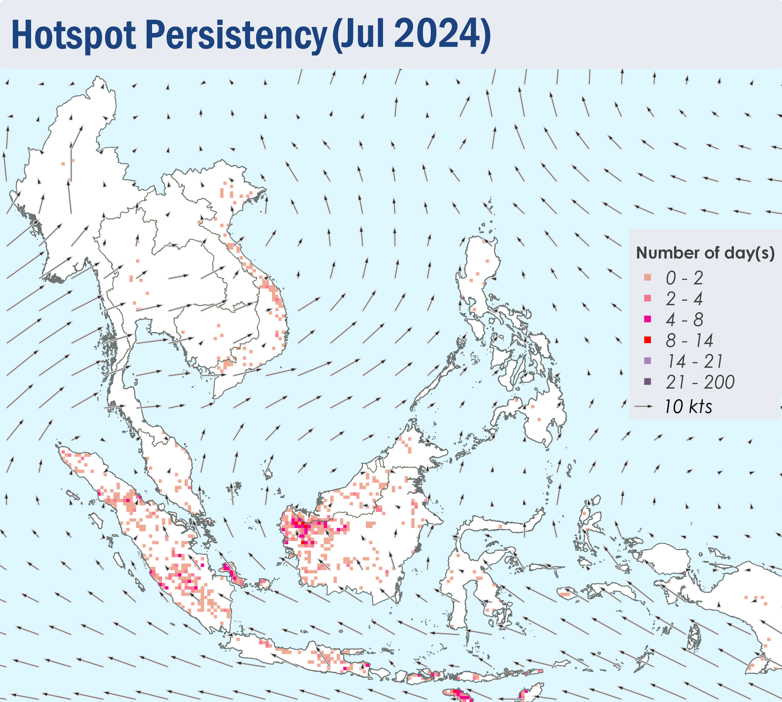
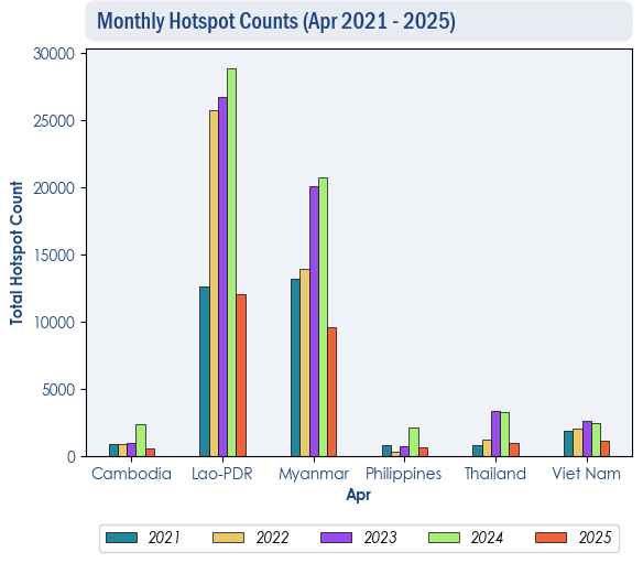
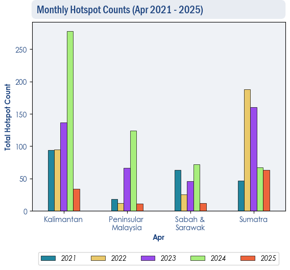
1.3 The hotspot counts for the ASEAN region in April 2025 were lower than or comparable to those of previous years (Figure 2, 3).
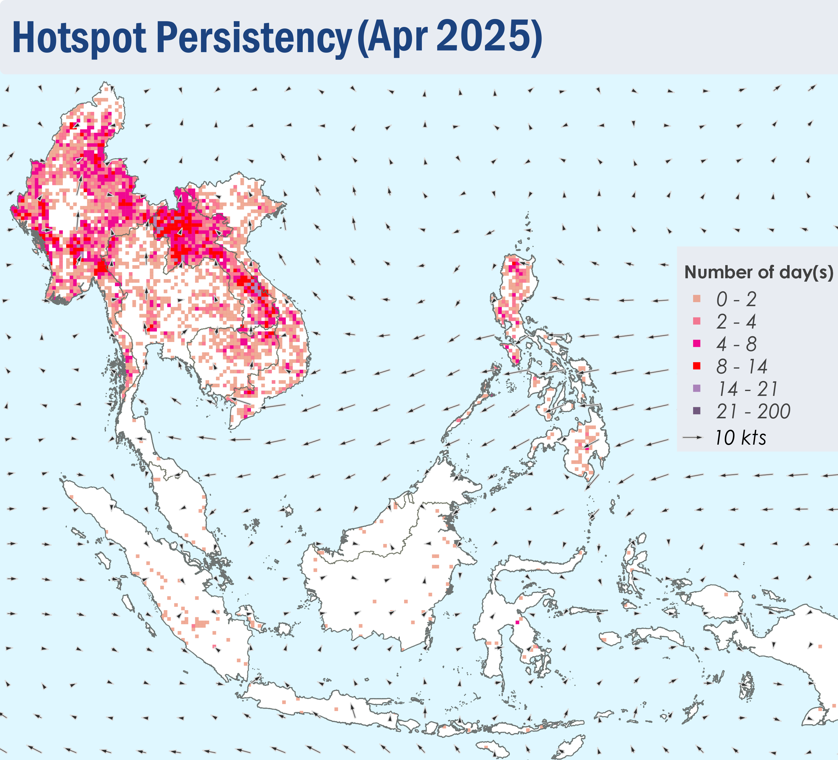
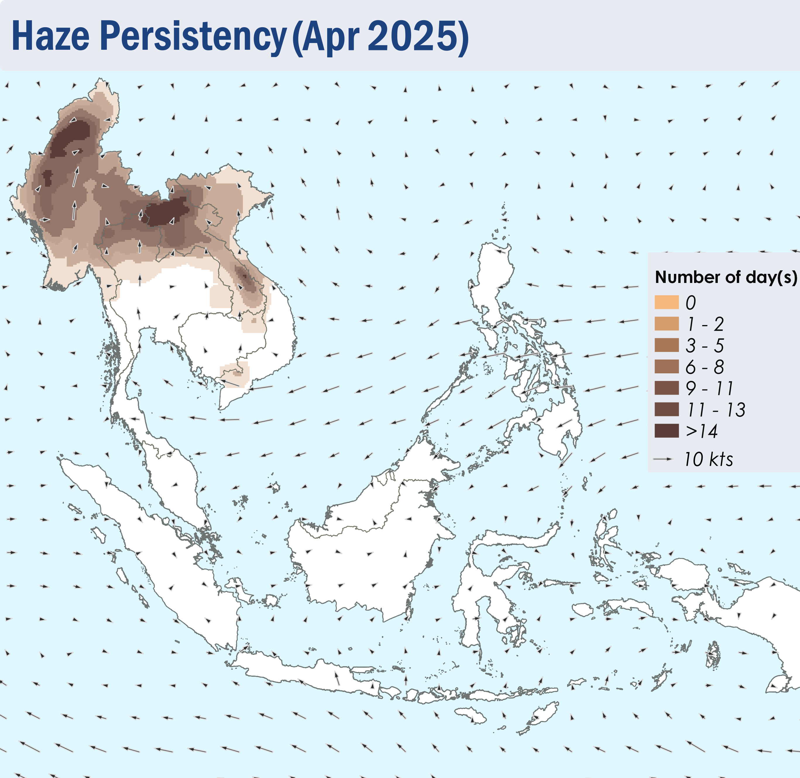
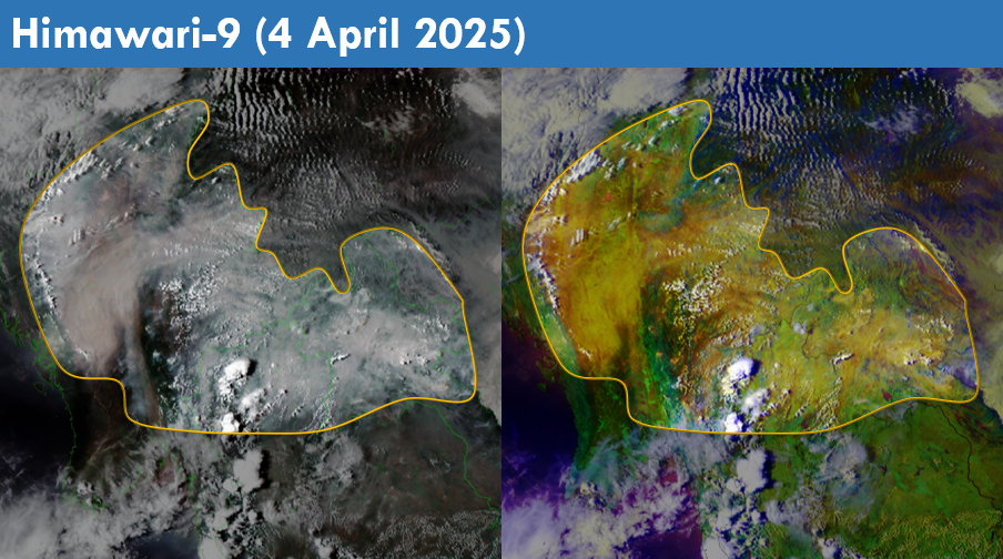
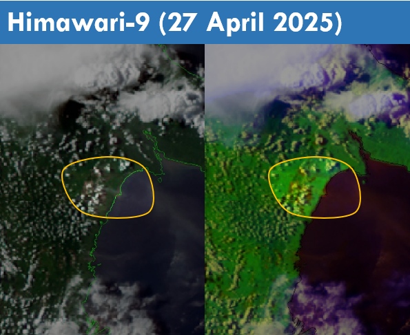
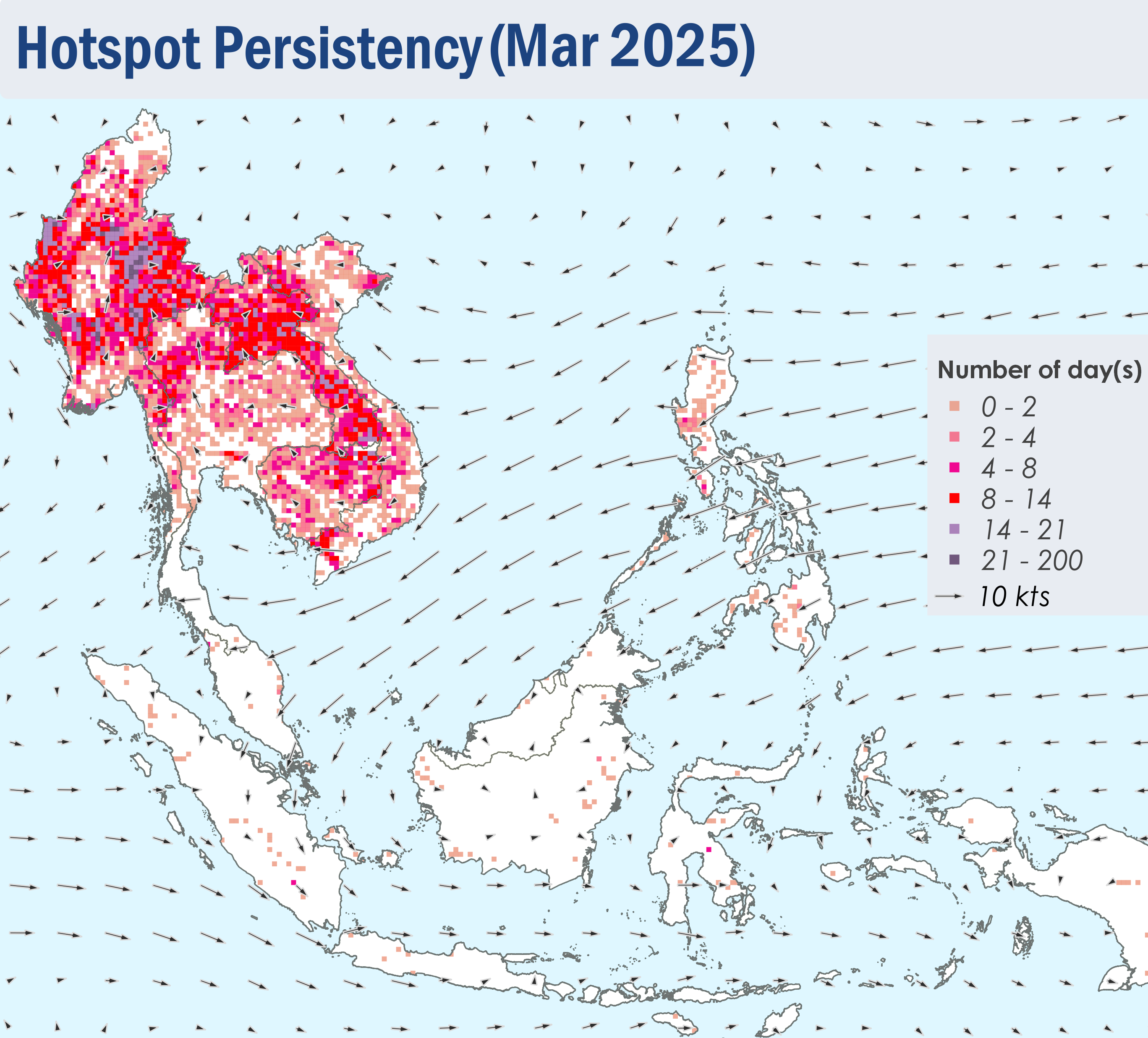
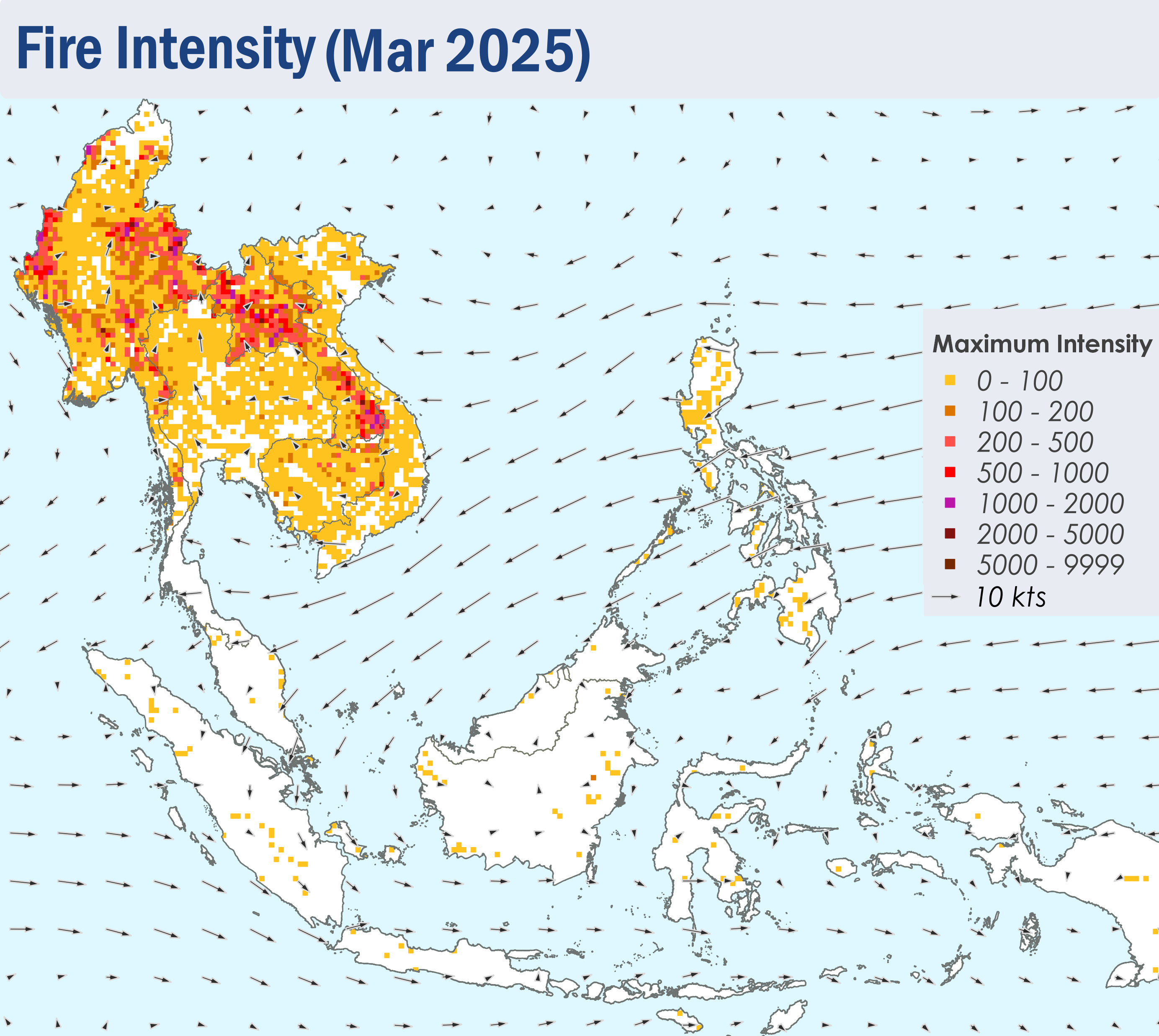
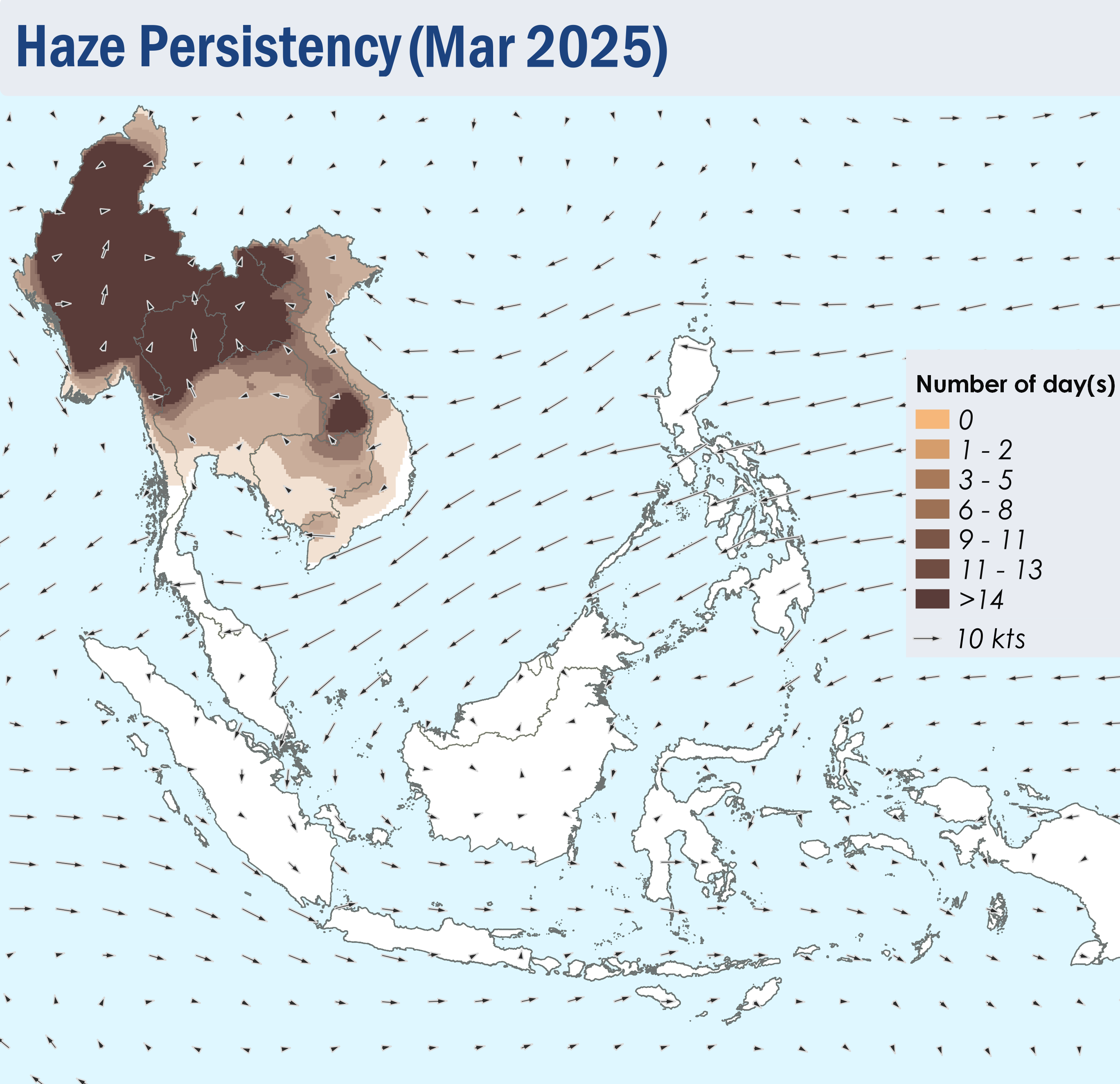
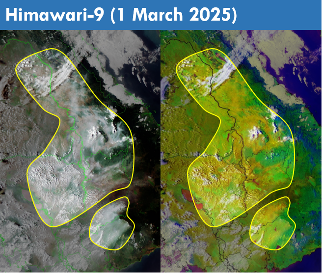
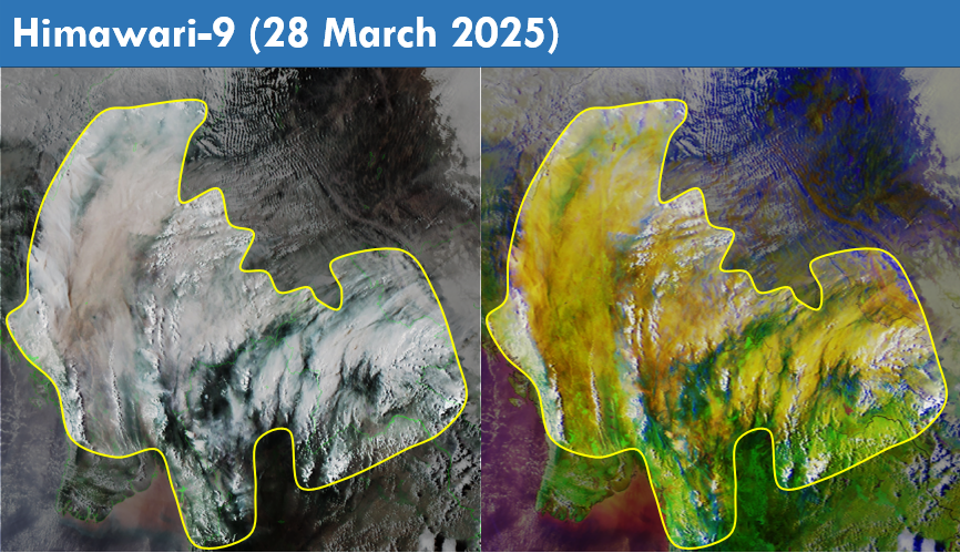
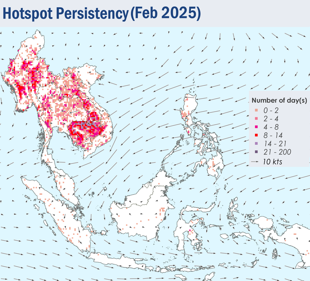
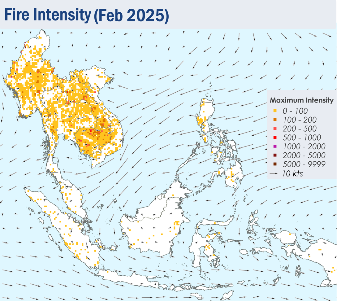
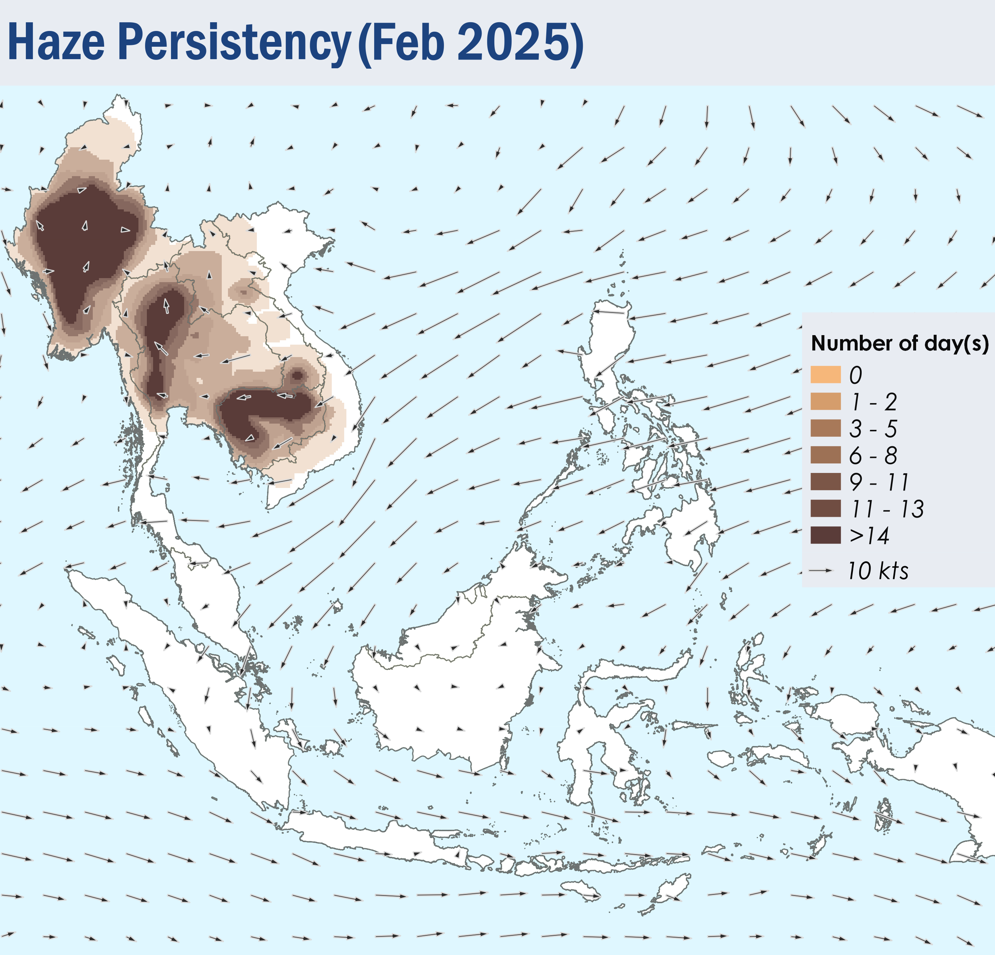
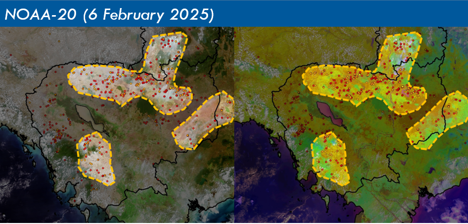
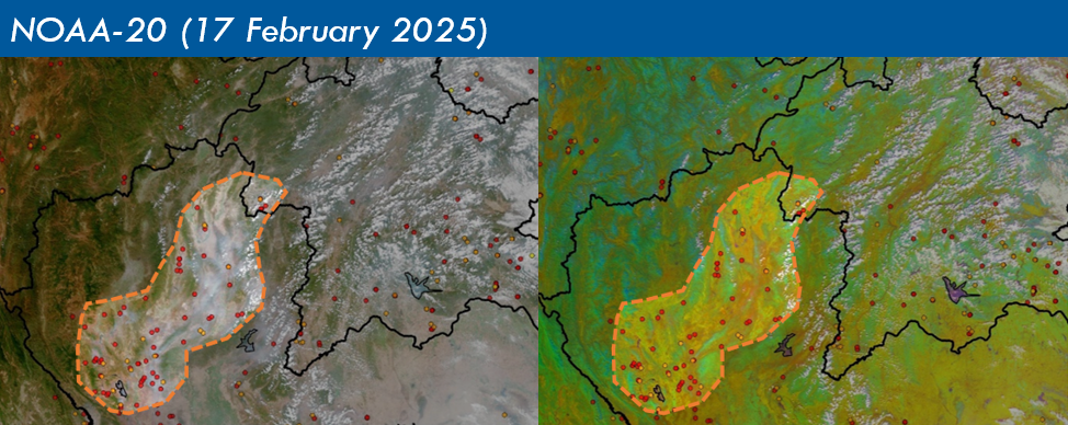
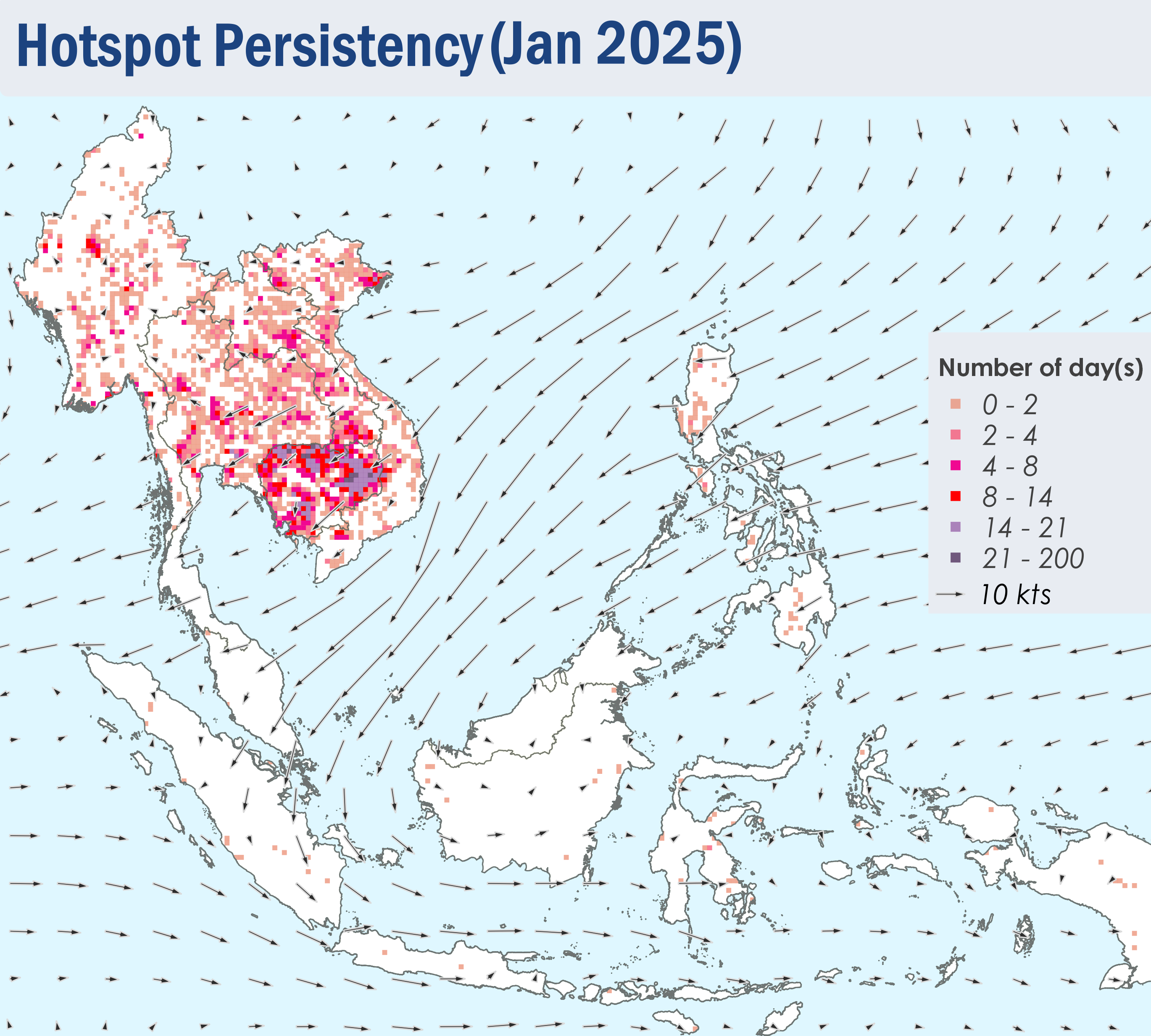
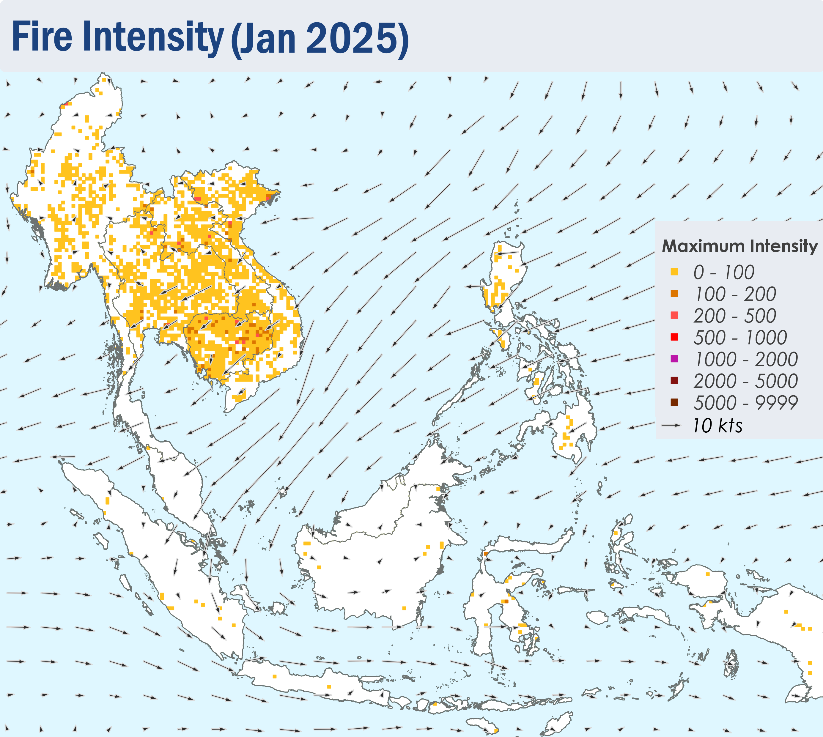
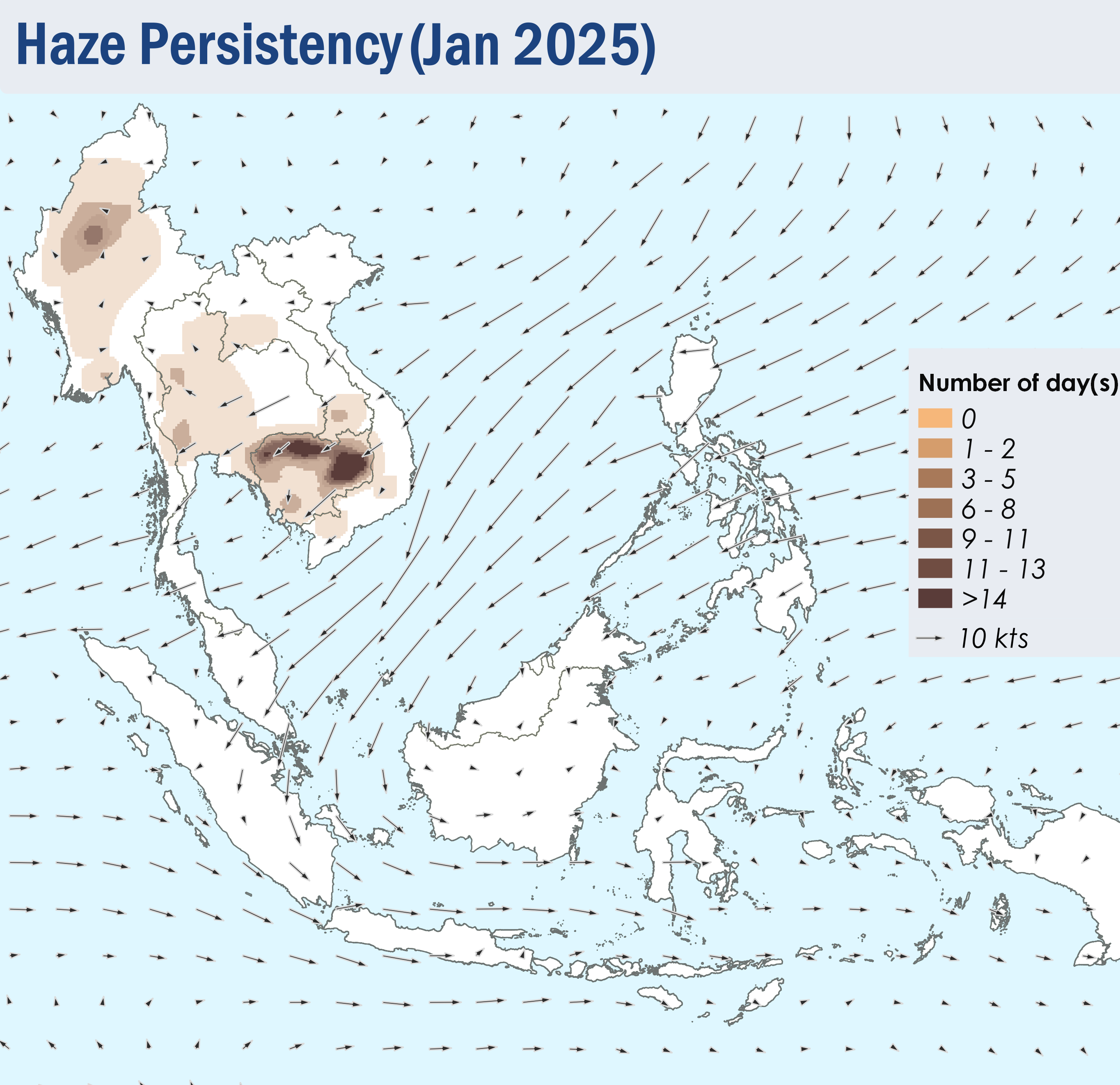
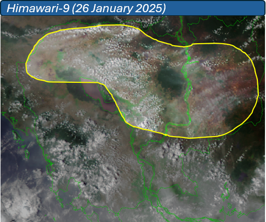
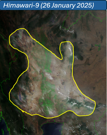
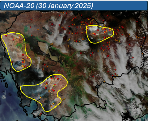
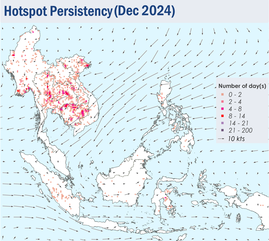
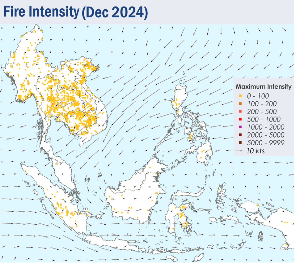
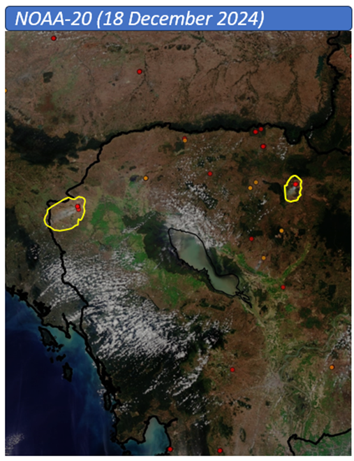
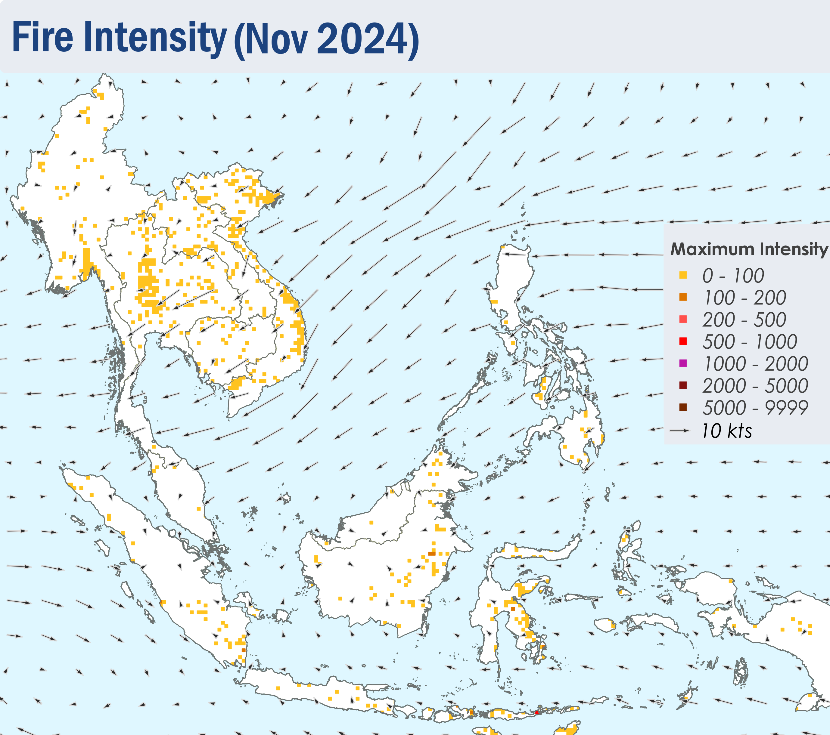
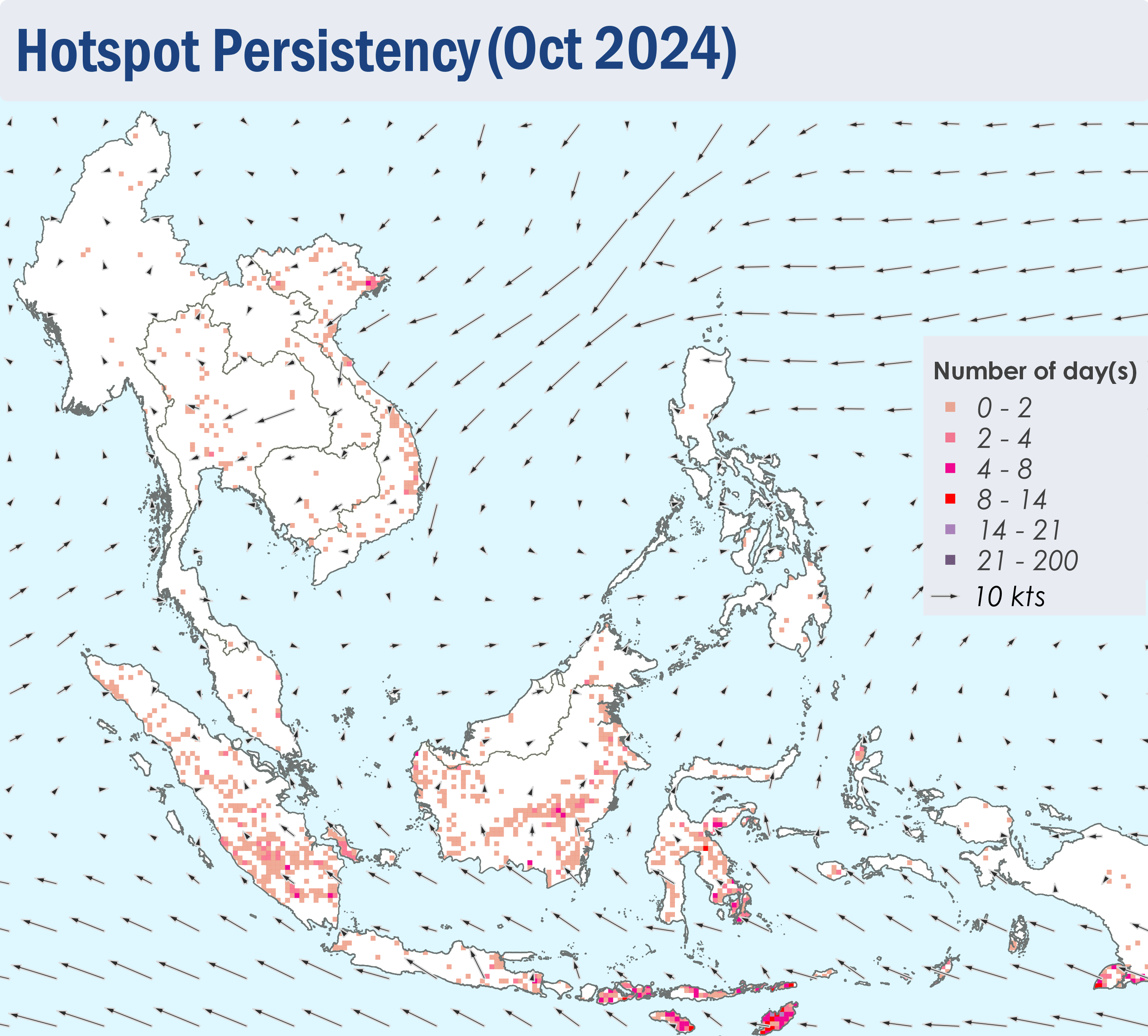
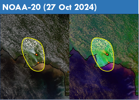
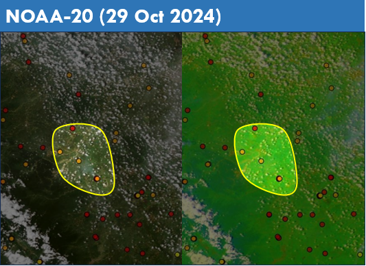
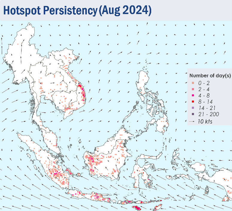
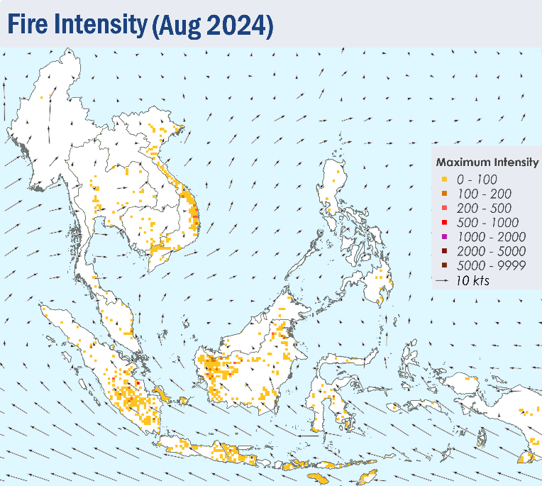
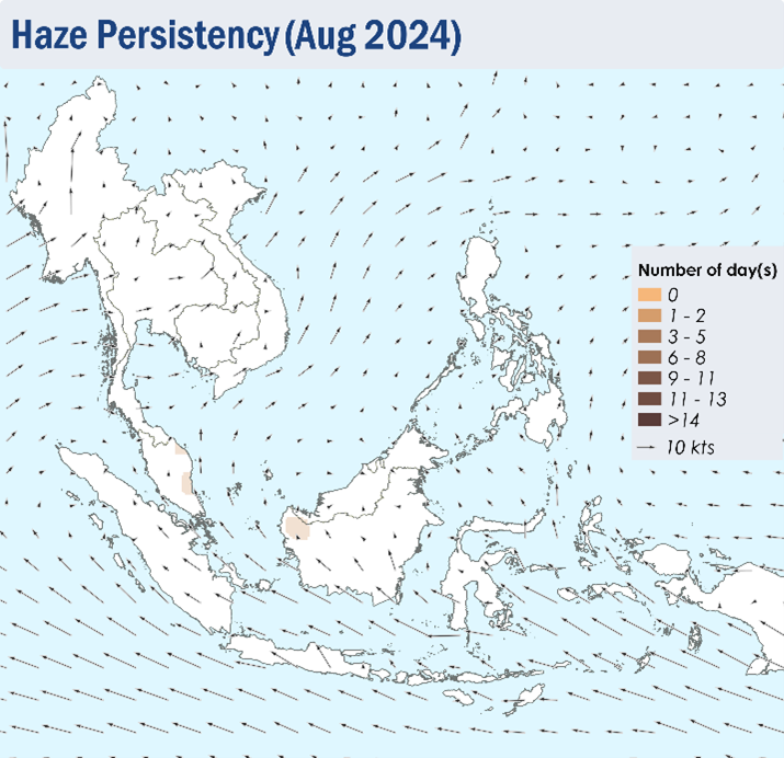
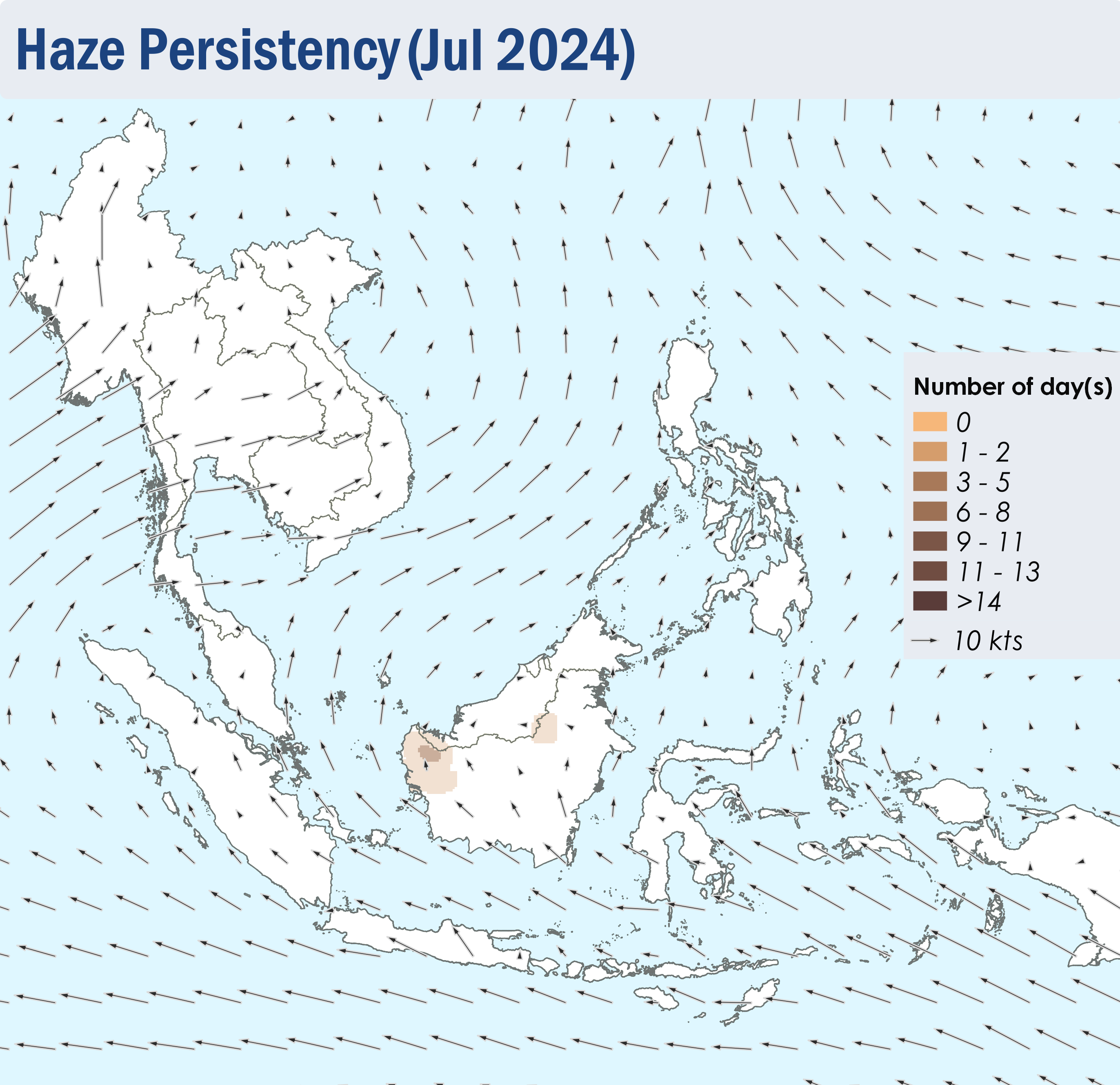
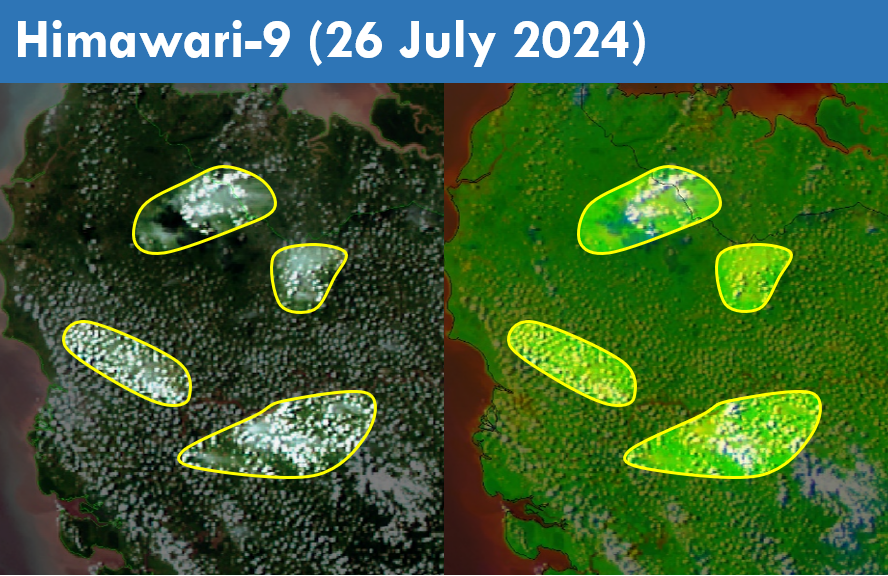
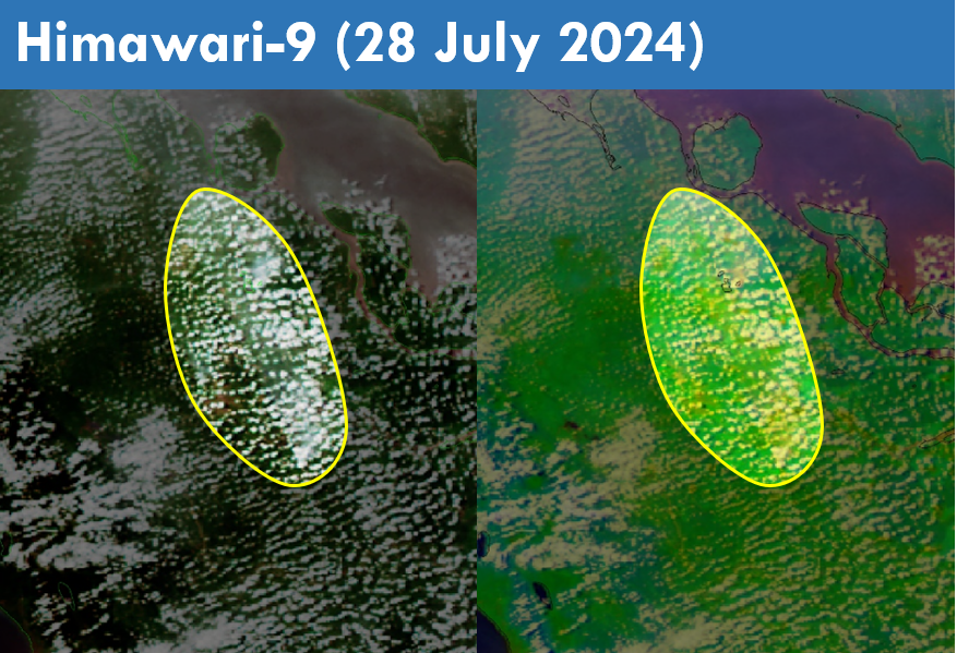
1.4 Over the Mekong sub-region, scattered to widespread hotspots were detected, especially over the northern parts of the sub-region and the other parts of Lao PDR, where the hotspot clusters were more persistent and intense (Figures 4, 5). Persistent moderate to dense transboundary smoke haze were observed over the northern parts of the Mekong sub-region, as well as the other parts of Lao PDR (Figure 6, 7). In contrast, the southern ASEAN region and the Philippines, experienced low hotspot activity (Figure 6), though slight localised smoke plumes were observed emanating from hotspots detected in the central parts of Sumatra and the eastern parts of Kalimantan (Figure 8).