Review of Regional Haze Situation for December 2021
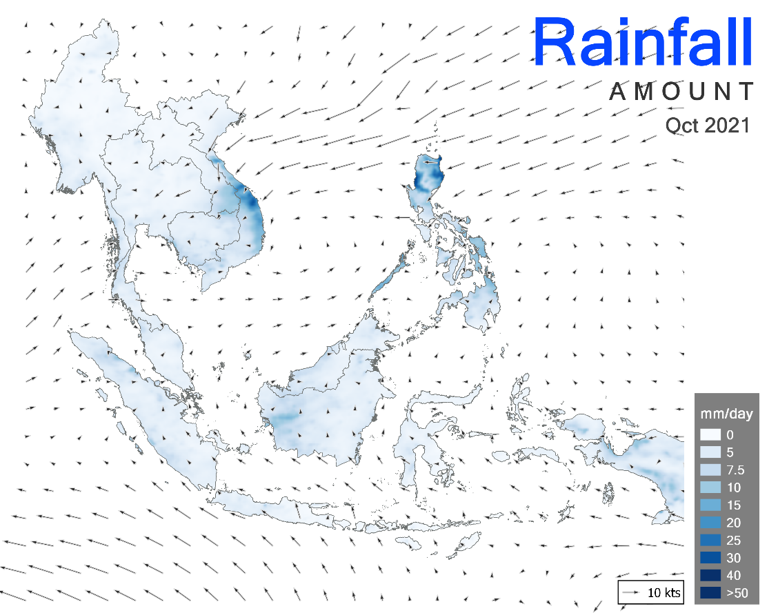
1.1 By December 2021, Northeast Monsoon conditions had become fully established over the ASEAN region. The prevailing low-level winds over regions north of the equator blew mostly from the north or northeast while the winds over regions south of the equator blew mainly from the west or northwest. Alert Level 1 for the Mekong sub-region was issued on 7 December 2021, indicating the start of the dry season. Persistent dry conditions were observed over the sub-region in December 2021. Higher rainfall was observed over the rest of the ASEAN region, particularly over Peninsular Malaysia and the southern Philippines, which were affected by heavy rainfall in December 2021 (Figure 1). In particular, Super Typhoon Rai made landfall over the southern Philippines on December 16, 2021 and caused severe damage, flooding and loss of lives. Floods also affected several Malaysian states including Pahang, Melaka, Negri Sembilan and Johor in the second half of December, resulting in significant damage and casualties.

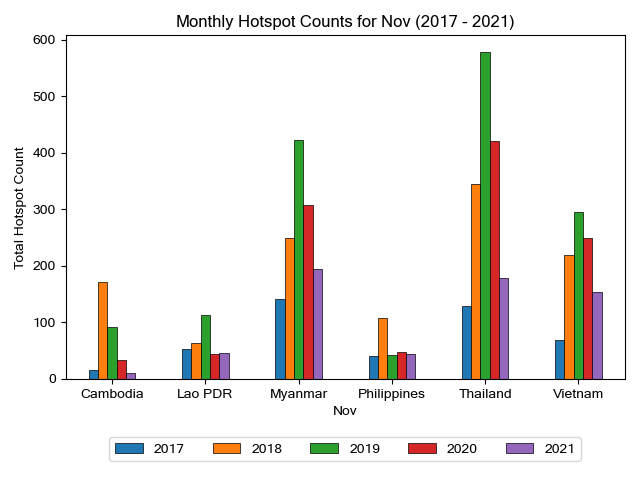
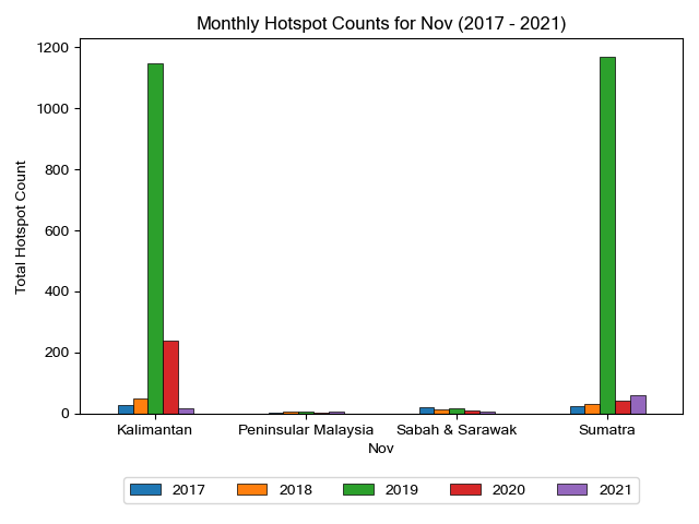
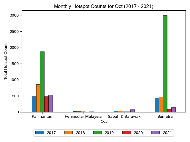
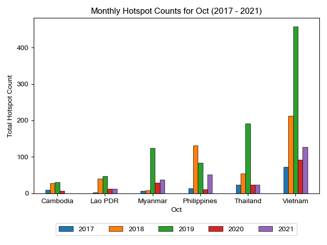
1.2 For the December 2021 review period, overall hotspot activities started to increase in the Mekong sub-region following the onset of dry conditions, while wet conditions continued to subdue hotspot activities in the southern ASEAN region. The hotspot counts for the Mekong sub-region in December 2021 were mostly lower compared to previous years, while the hotspot counts over the southern ASEAN region were generally comparable to those in previous years (Figures 2 and 3).


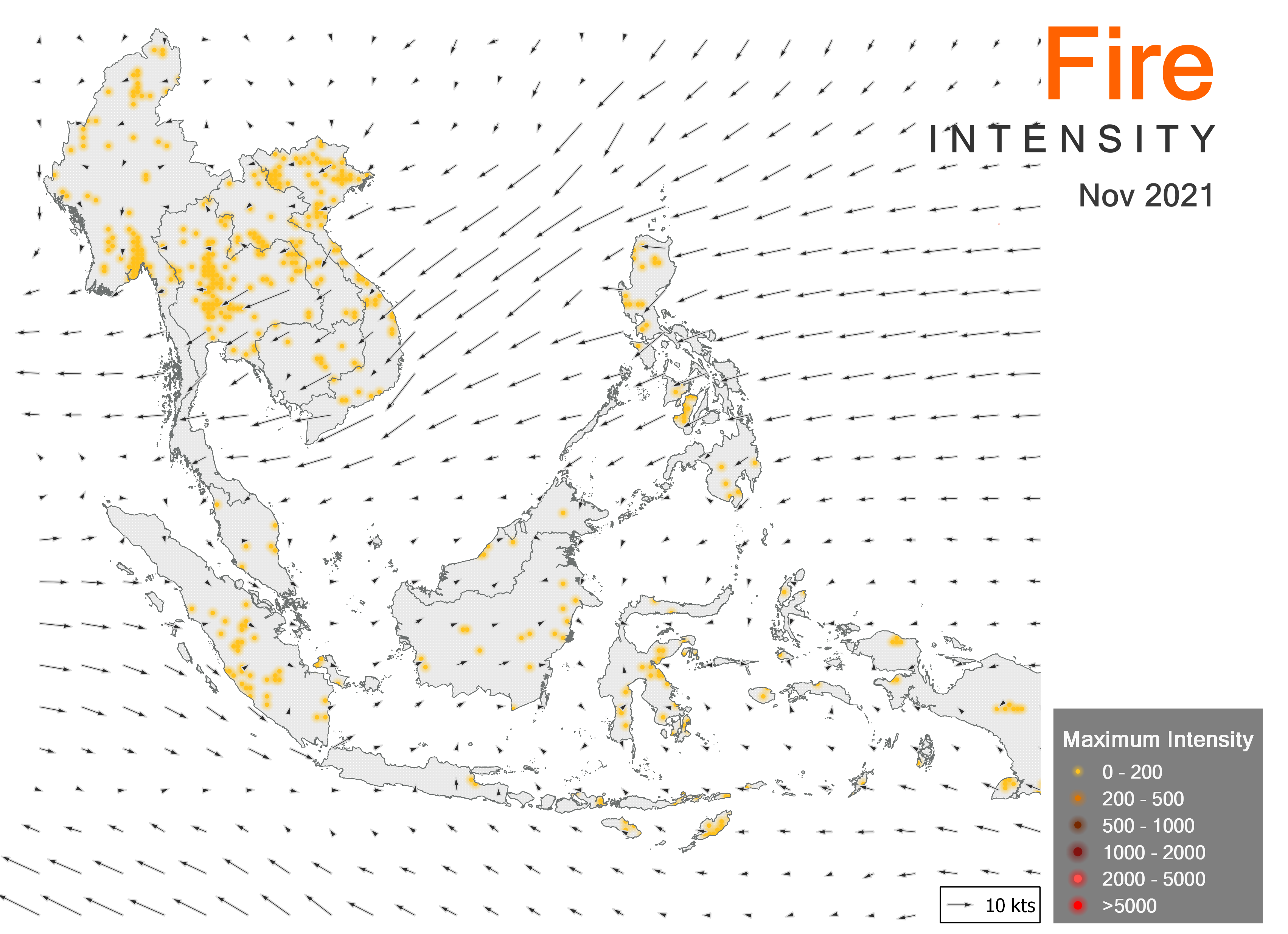
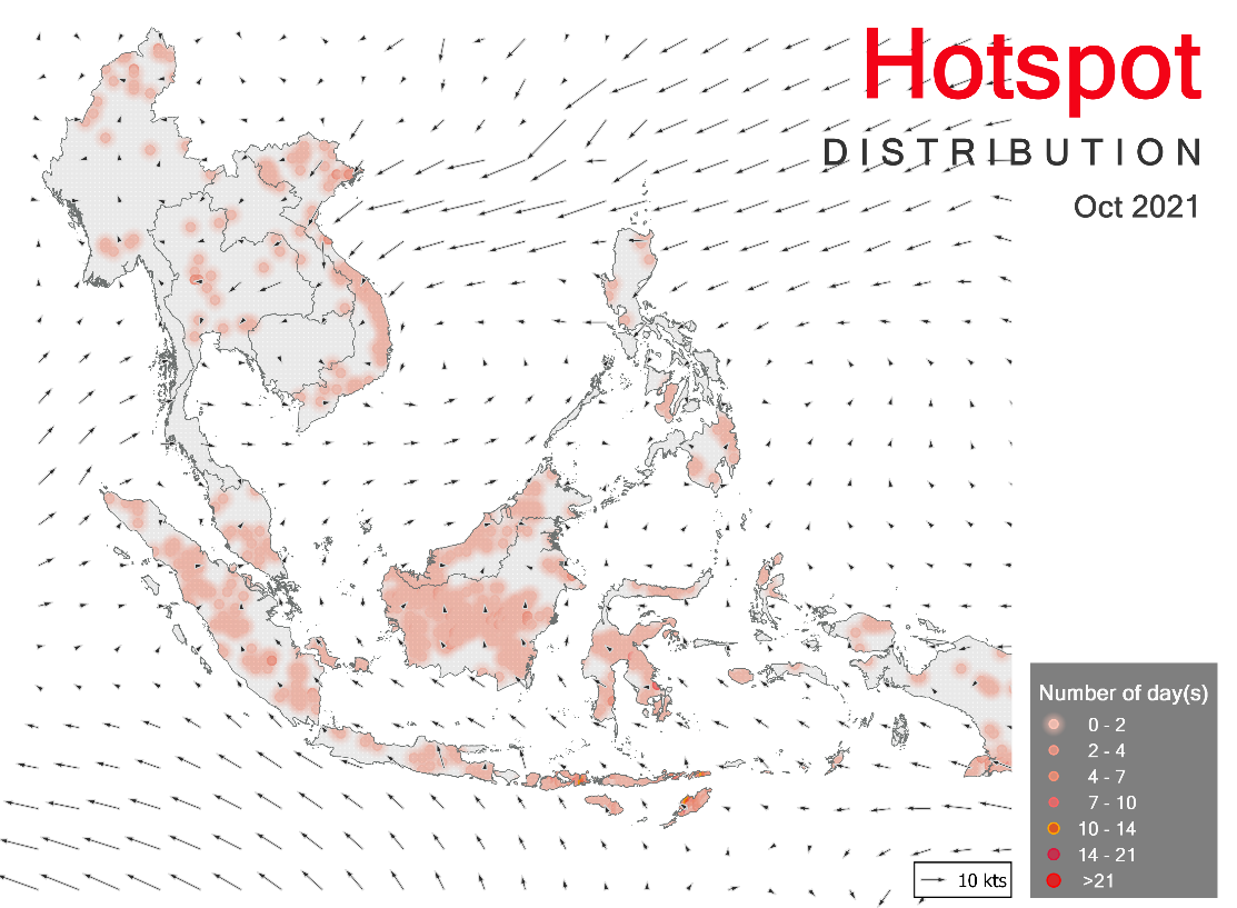
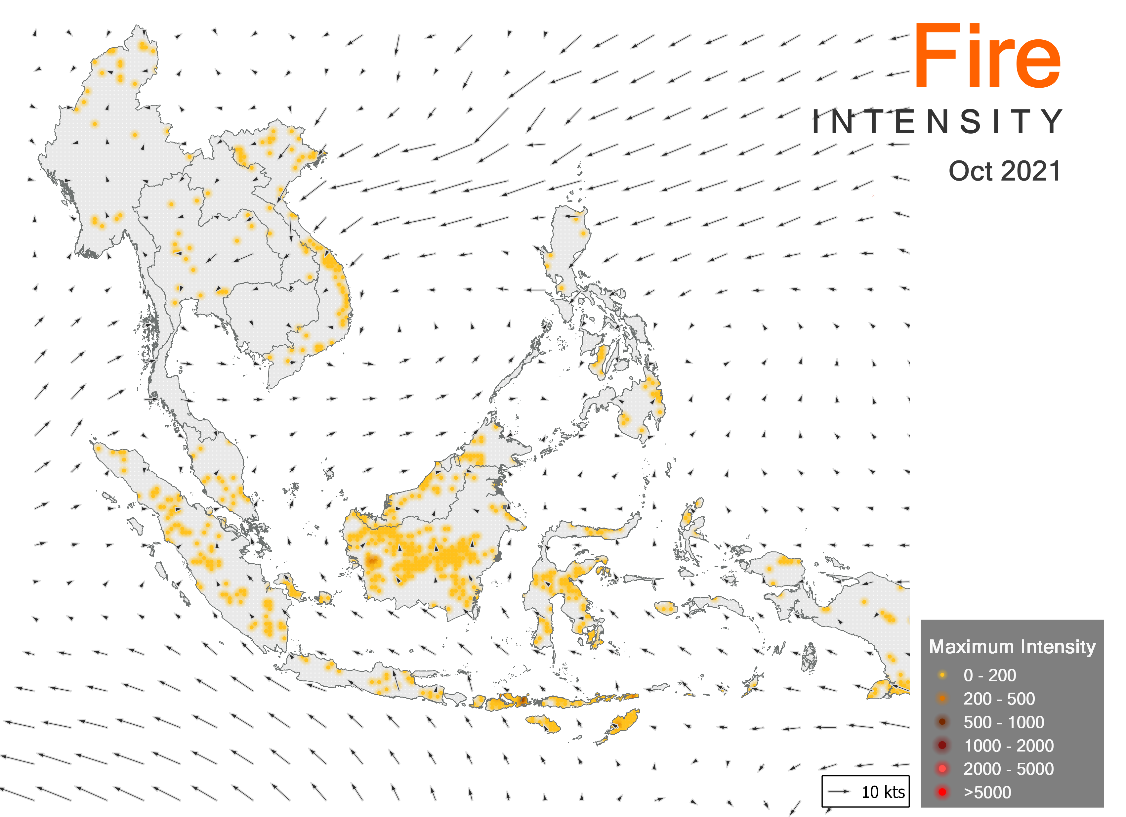
1.3 During the review period, isolated to scattered hotspots were detected throughout the Mekong sub-region and isolated smoke plumes were sometimes observed to emanate from the detected hotspots. Although isolated hotspots were detected in Sumatra, parts of Peninsular Malaysia and Kalimantan, the hotspot activities were generally subdued over the southern ASEAN region (Figures 4 and 5).