Subseasonal Weather Outlook (25 May – 7 June 2026)
Issued: 20 May 2026
First forecast week: 25 – 31 May 2026
Second forecast week: 1 – 7 June 2026
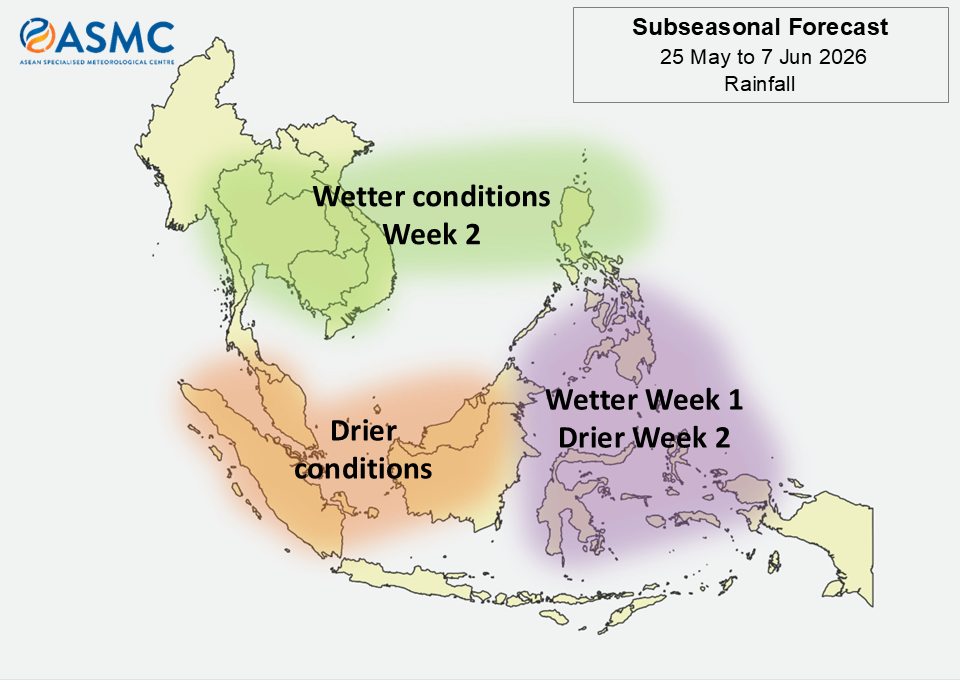
Over much of the eastern Maritime Continent, wetter conditions are predicted in Week 1 (25 – 31 May) and drier conditions in Week 2 (1 – 7 June).
Over the western half of the equatorial region, drier conditions are predicted over the next fortnight (25 May – 7 June).
Over parts of the northeastern Maritime Continent and much of Mainland Southeast Asia, wetter conditions are predicted in Week 2 (1 – 7 June).
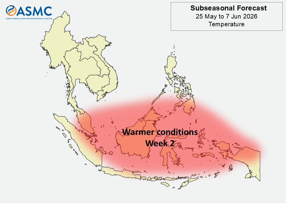
Warmer than usual temperatures are predicted over most of the equatorial region in Week 2 (1 – 7 June), broadly in line with the predicted drier conditions for that week.
A Madden-Julian Oscillation (MJO) was present over the Indian Ocean (Phases 2 and 3) in the middle of May. The signal is expected to dissipate by the start of the forecast period.
Most models predict an MJO signal over the Western Pacific (Phases 6 and 7) in Week 1 (25 – 31 May). There is uncertainty across models whether the MJO signal will continue to propagate through the Western Hemisphere (Phases 8 and 1) in Week 2 (1 – 7 June).
The outlook is assessed for the region in general, where conditions are relative to the average conditions for the corresponding time of year. For specific updates on the national scale, the relevant ASEAN National Meteorological and Hydrological Services should be consulted.