

Subseasonal Weather Outlook (3 – 16 August 2026)
Issued: 29 July 2026
First forecast week: 3 – 9 August 2026
Second forecast week: 10 – 16 August 2026
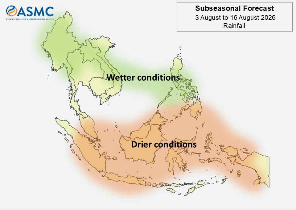
Over much of the northern ASEAN region, wetter conditions are predicted in the next fortnight (3 – 16 August). The highest likelihood of wetter conditions is over the northwestern parts in Week 1 (3 – 9 August), and over the southern and eastern parts in Week 2 (10 – 16 August).
Over much of the southern ASEAN region, drier conditions are predicted in the next fortnight (3 – 16 August).
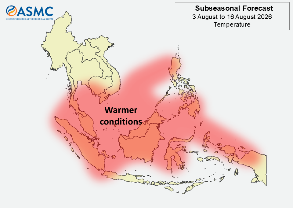
Warmer than usual temperatures are predicted over much of the ASEAN region in the next fortnight (3 – 16 August), except for most of Mainland Southeast Asia and the southern Maritime Continent.
A weakening Madden-Julian Oscillation (MJO) signal was present over the Western Hemisphere (Phase 8) in late July 2026, based on the RMM index. Most models predict an MJO signal to develop over the Western Pacific (Phase 6) during Week 1 (3 – 9 August), although models disagree whether the signal will continue to propagate or weaken during Week 2 (10 – 16 August).
The outlook is assessed for the region in general, where conditions are relative to the average conditions for the corresponding time of year. For specific updates on the national scale, the relevant ASEAN National Meteorological and Hydrological Services should be consulted.