Review of Regional Haze Situation for April 2026
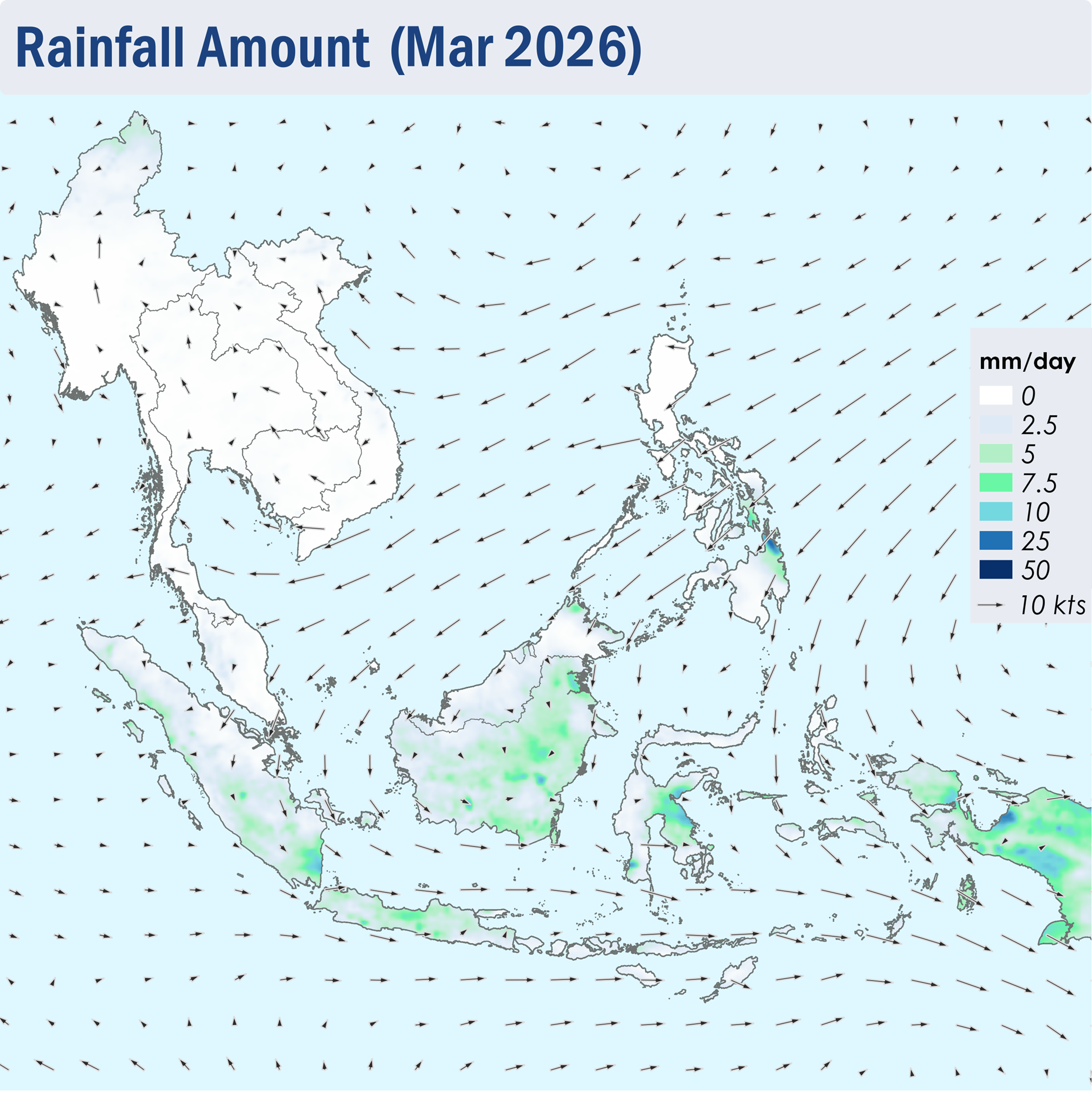
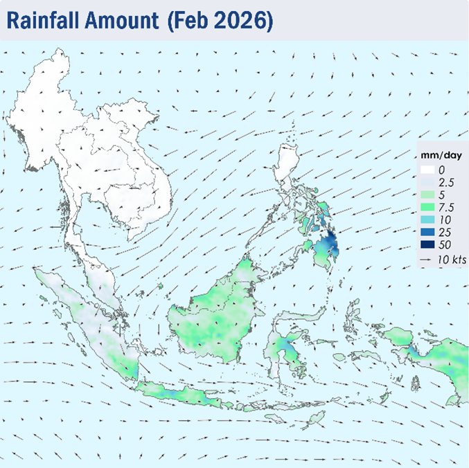
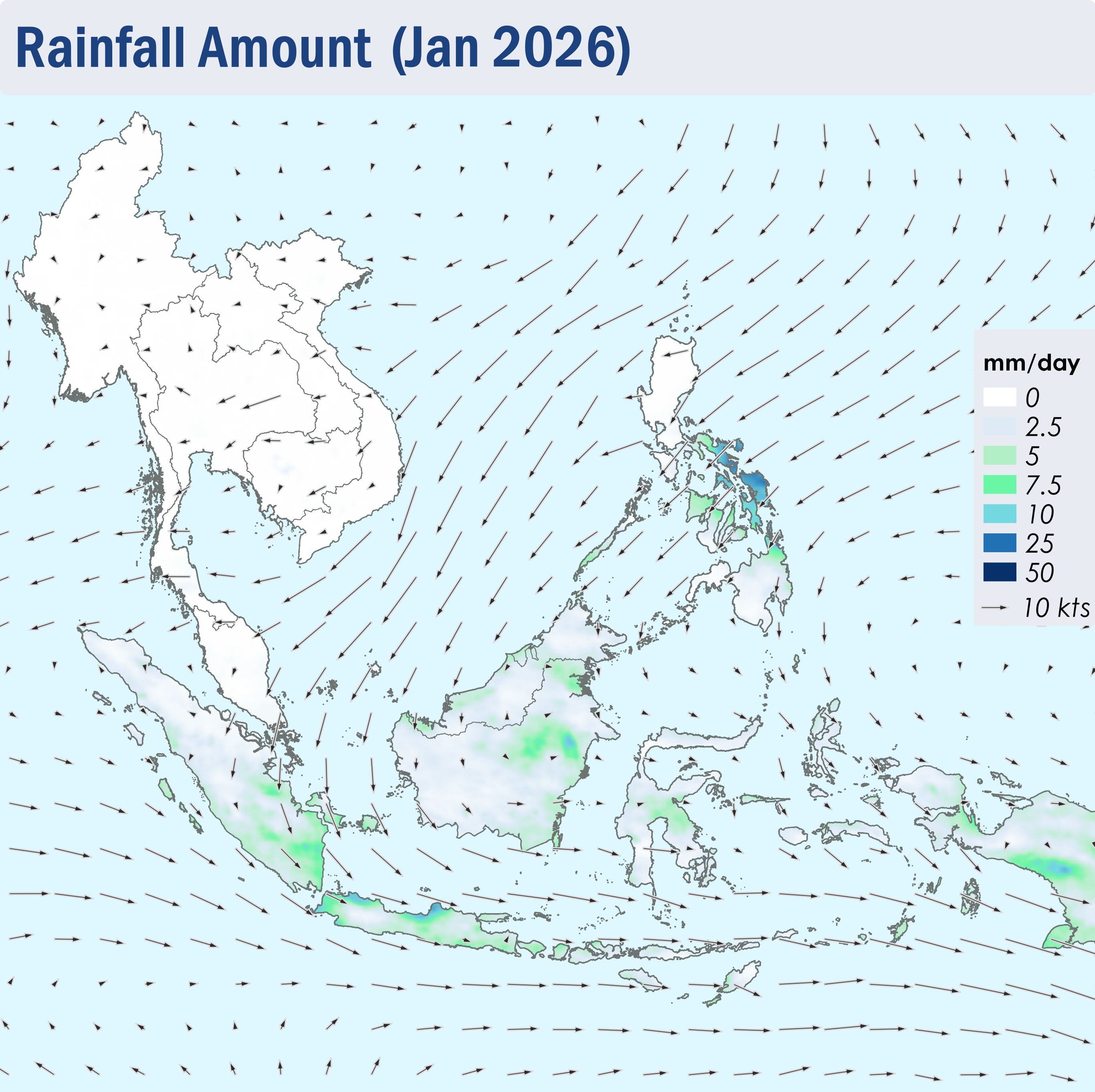
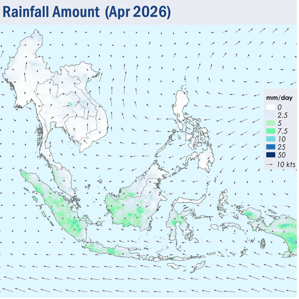
1.1 In April 2026, the prevailing winds across most of the ASEAN region turned light and variable in direction, except for the Philippines where the winds blew mostly from the northeast to east, and in the southern and central parts of the Mekong sub-region where winds blew from the southeast or southwest, as the monsoon rainband shifted northwards towards the Equator (Figure 1). This is characterised with the transition of the Northeast Monsoon into the inter-monsoon conditions.
1.2 Although isolated rainfall was observed over some parts of the Mekong sub-region and the southern parts of Philippines, dry conditions continued over most of the northern ASEAN region during the review period (Figure 1). There was a gradual increase in the shower activities in the second half of the month. In view of the expected ongoing rainfall over the Mekong sub-region, which could alleviate hotspot and haze conditions, the Alert Level for the sub-region was downgraded to Alert Level 2 on 24 April 2026. Meanwhile, showers prevailed over most of the southern ASEAN region, apart from the eastern parts of Peninsular Malaysia and the northern and eastern parts of Borneo, where conditions were drier (Figure 1).
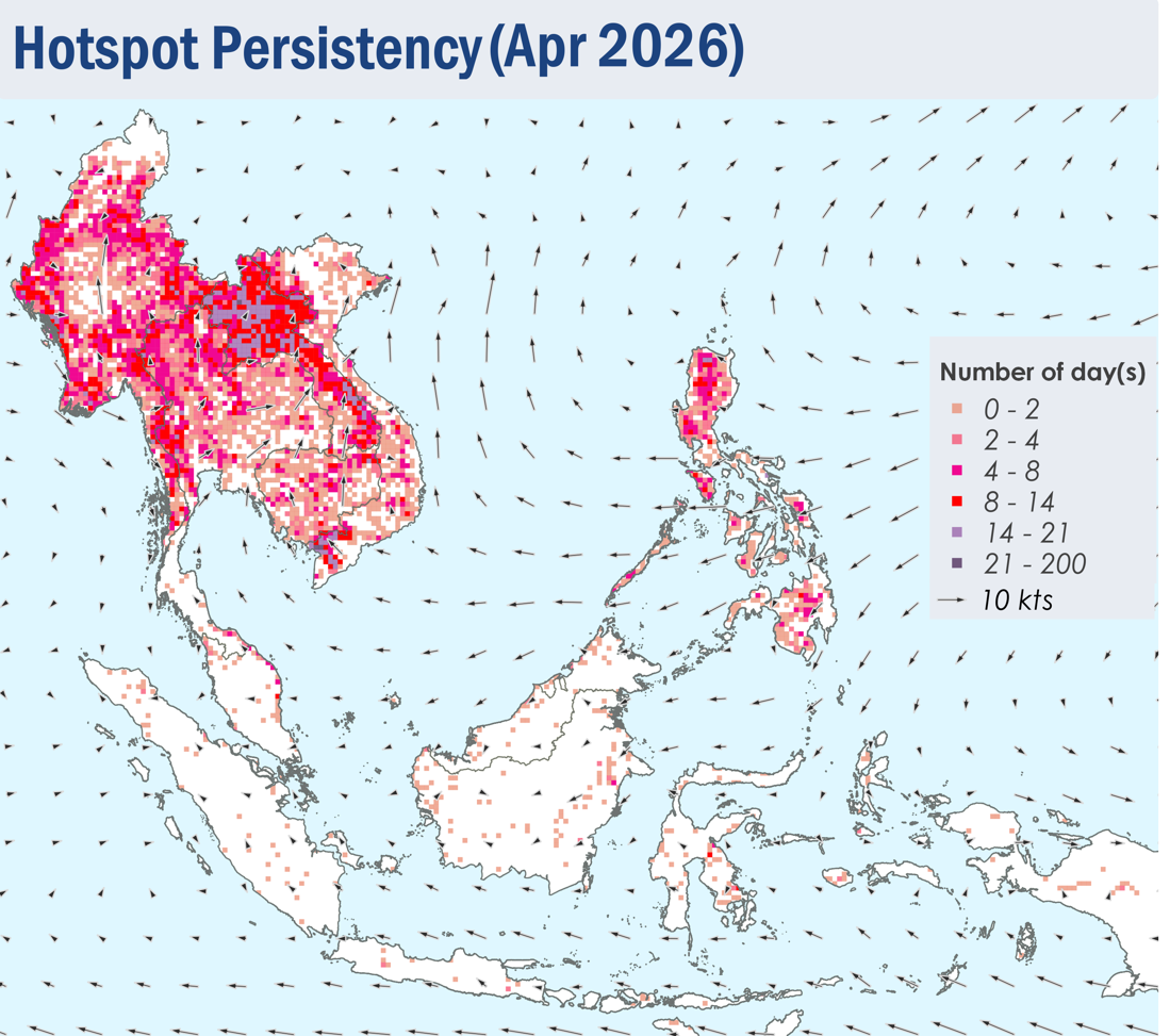
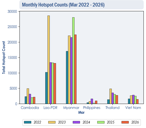
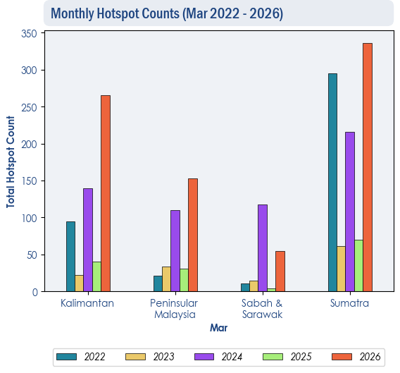
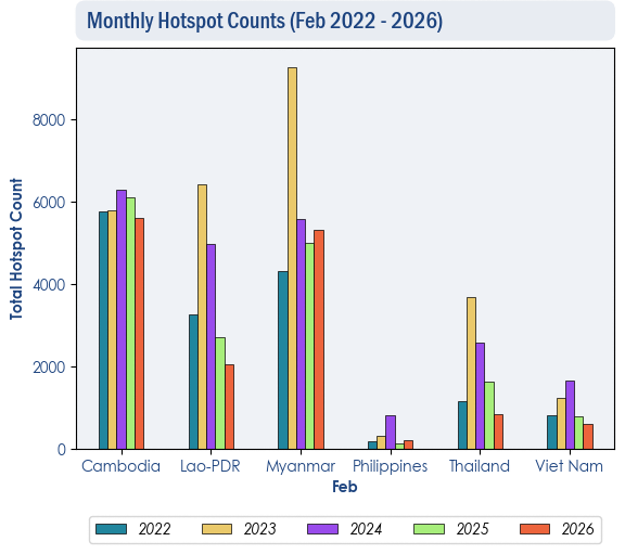
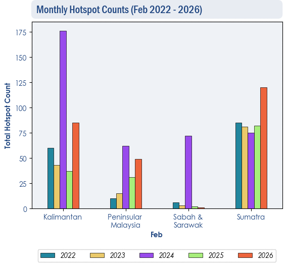
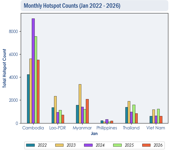
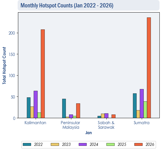
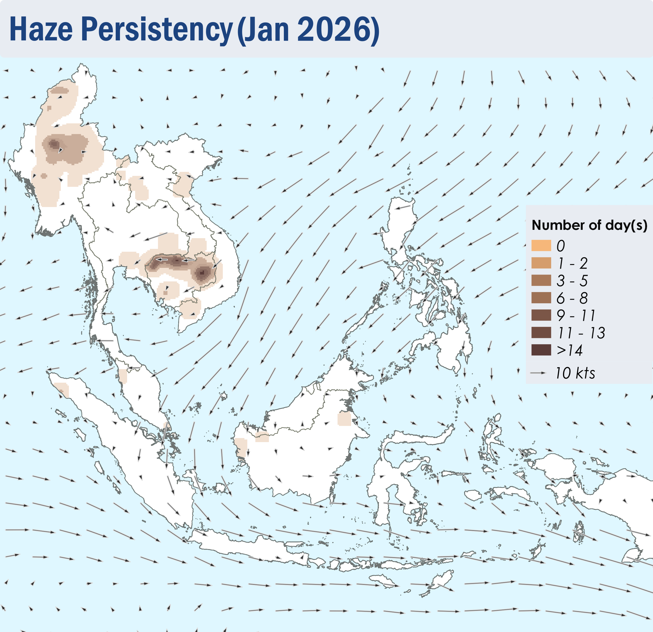
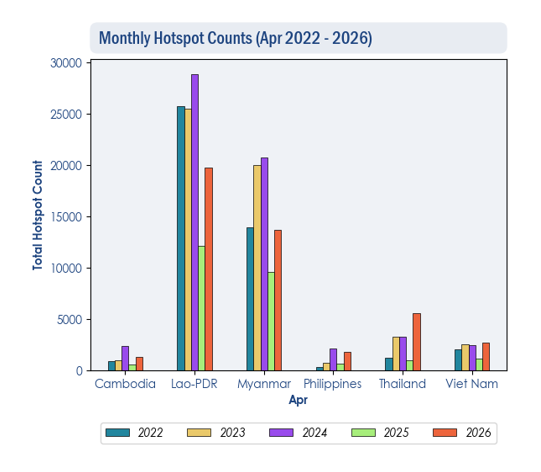
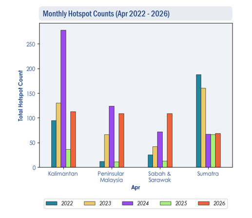
1.3 Over the northern ASEAN region, the hotspot counts for April 2026 were generally higher than or comparable to previous years, notably in Thailand where the hotspot counts were the highest in 5 years (Figure 2). Over the southern ASEAN region, the hotspot counts for April 2026 were generally lower or comparable to previous years, except in Sabah and Sarawak, where the highest hotspot count was recorded in 5 years (Figure 3).
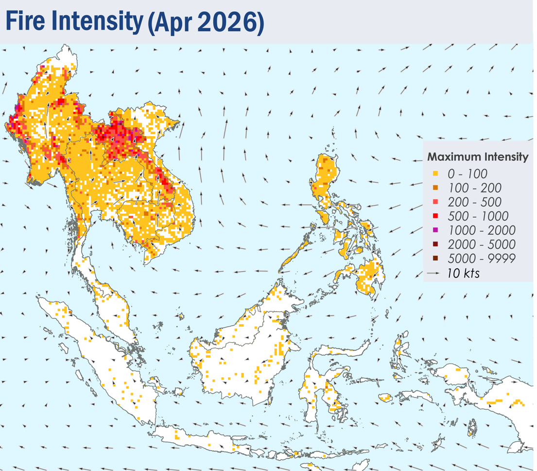
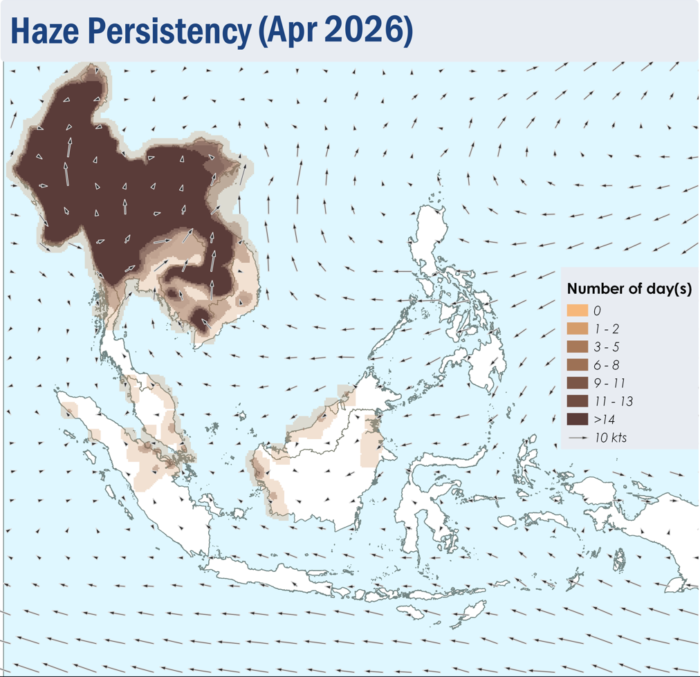
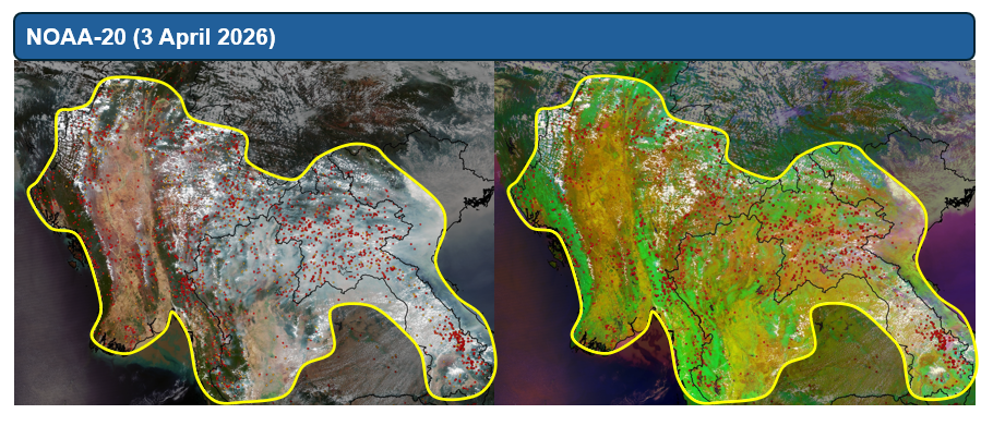
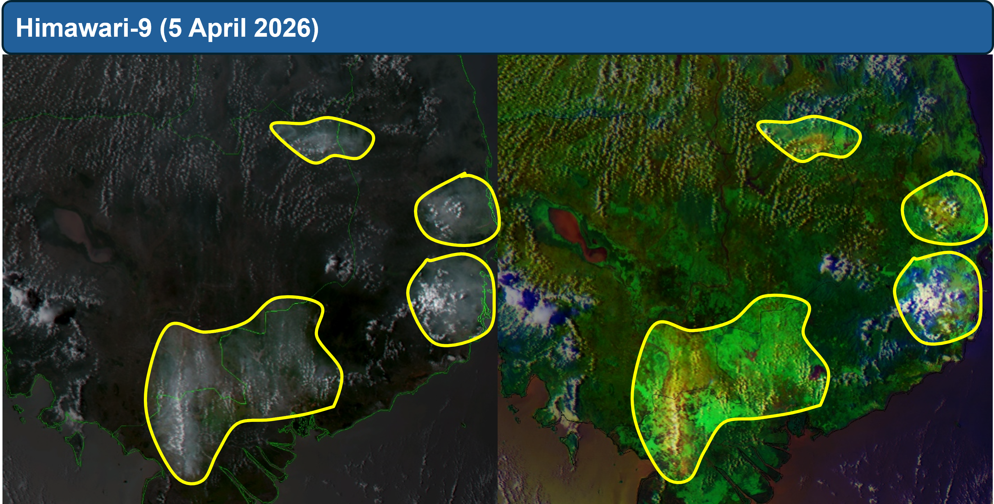
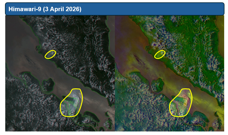
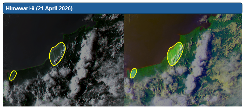
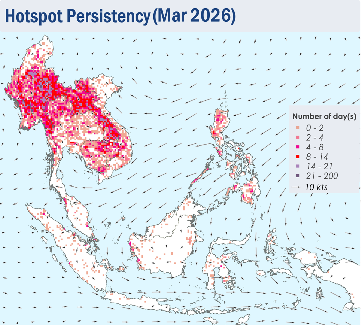
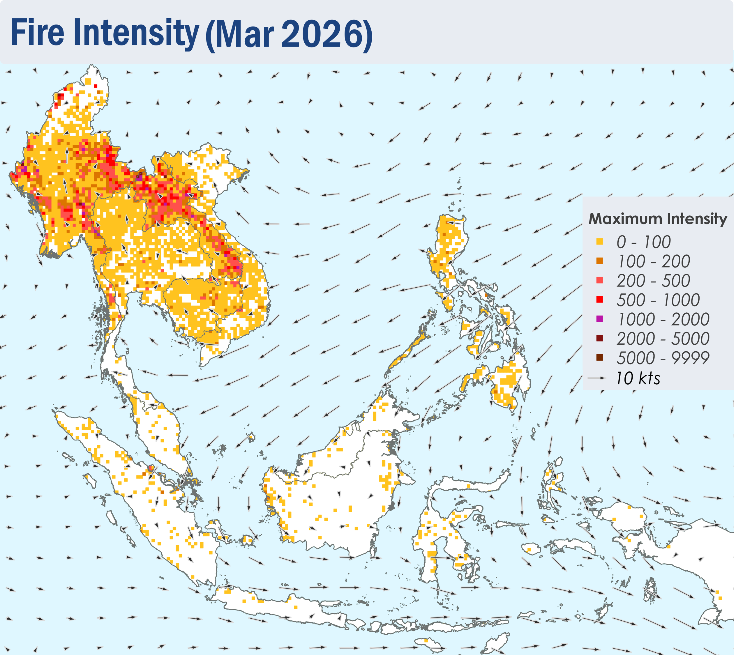
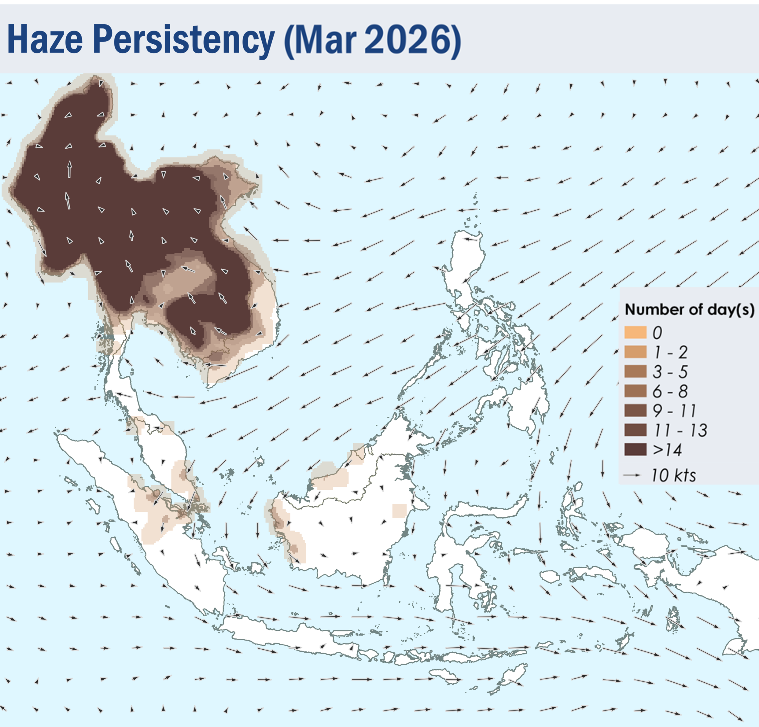
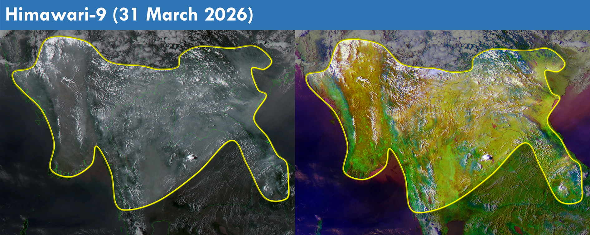
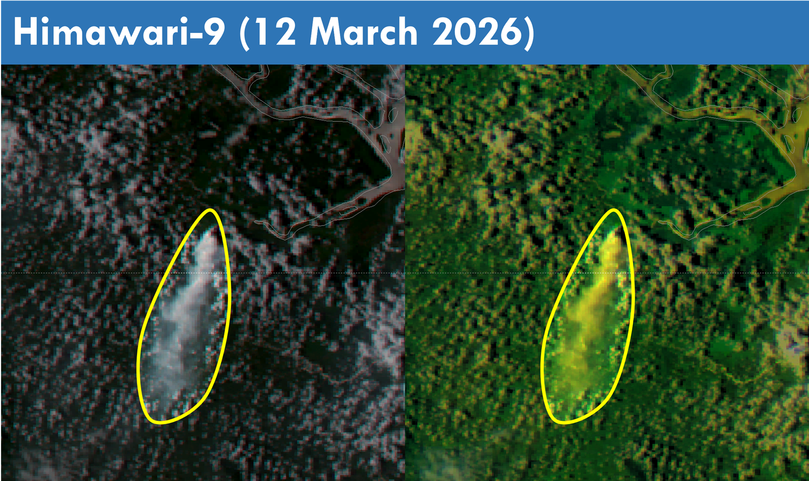
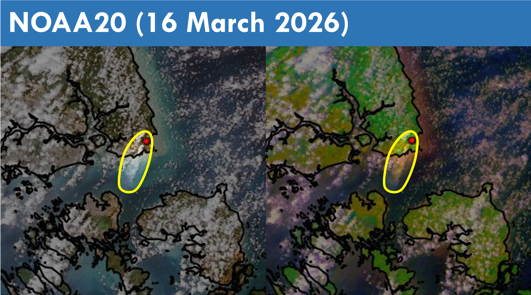
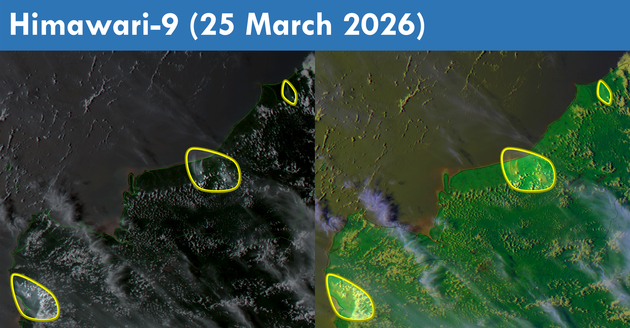
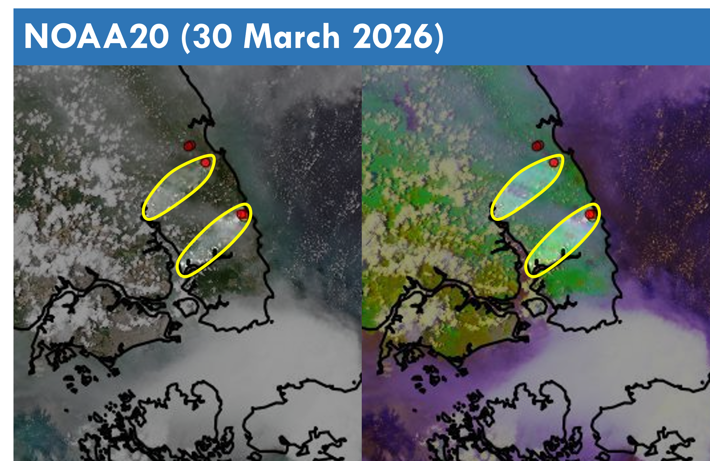
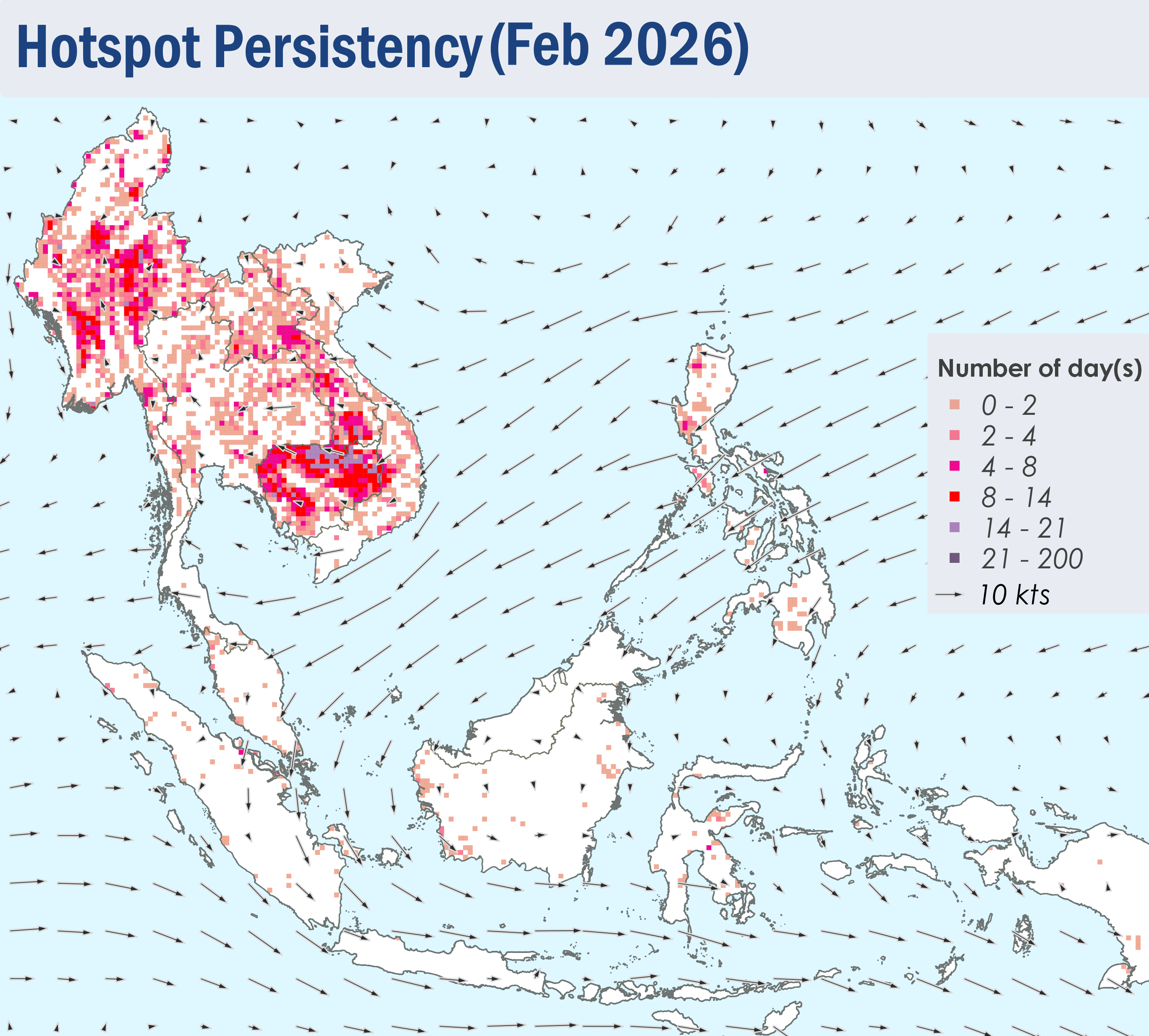
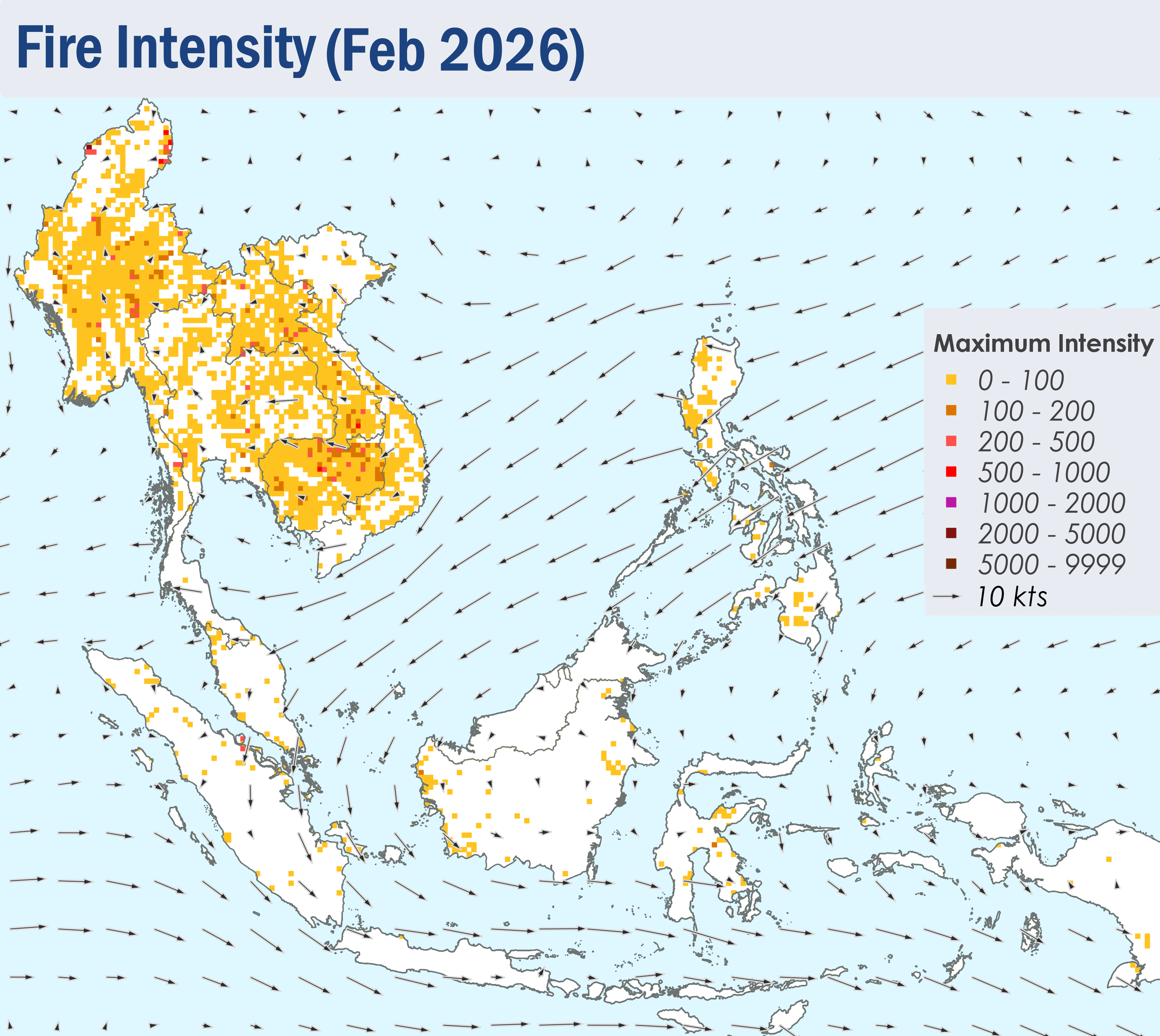
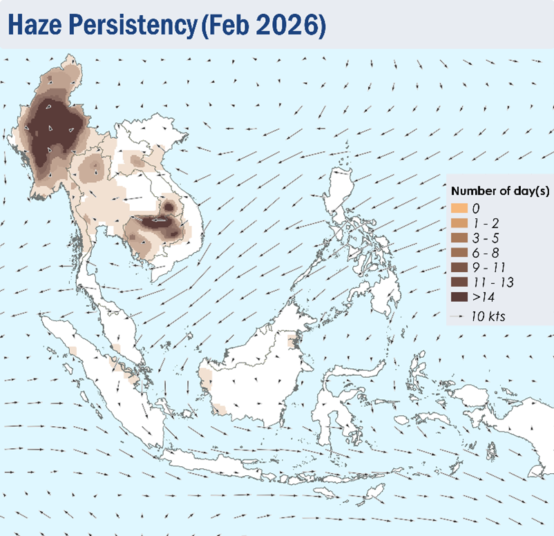
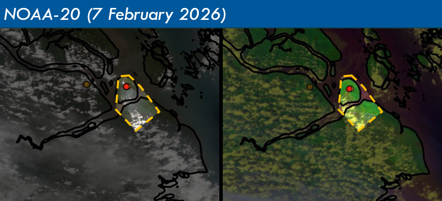
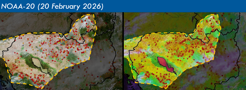
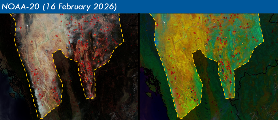
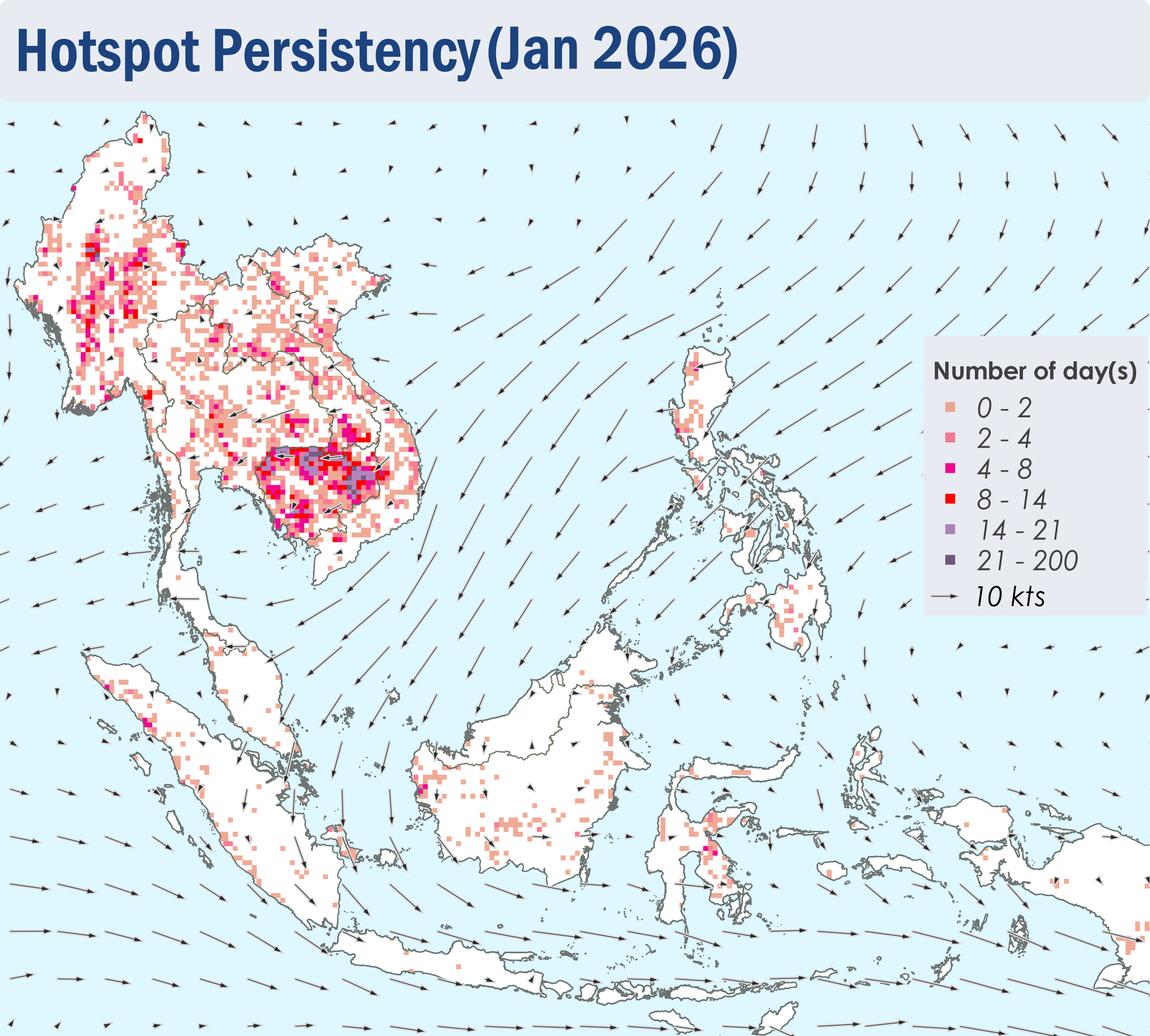
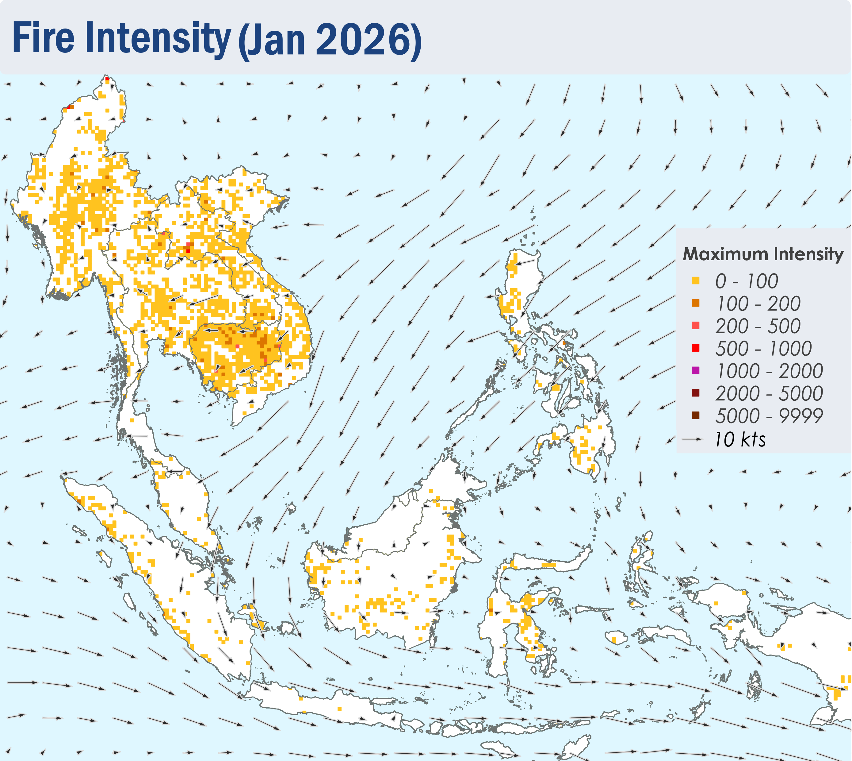
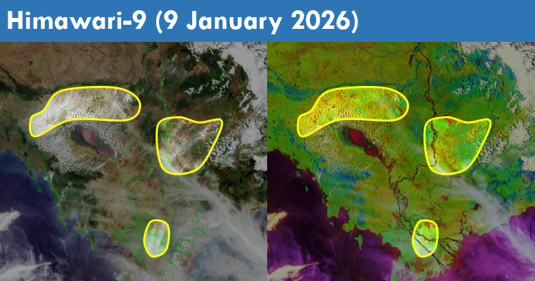
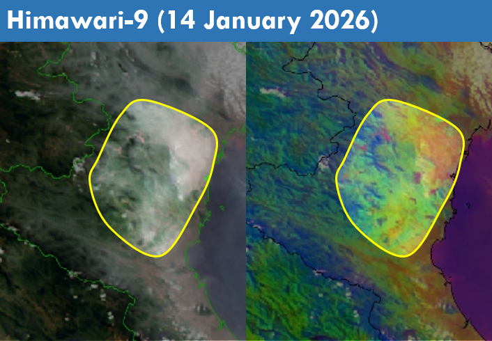
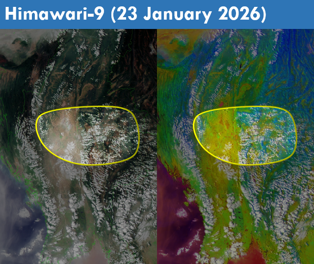
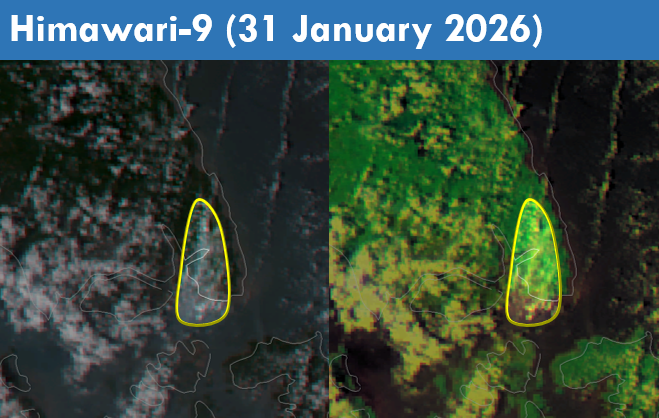
1.4 Scattered to widespread hotspots were detected in the Mekong sub-region. Persistent and intense hotspots were detected mostly in Myanmar, Lao PDR, as well as the northern and western parts of Thailand (Figures 4 and 5). Moderate to dense transboundary smoke plumes were observed across the Mekong sub-region on many days, particularly over Myanmar, Thailand, Lao PDR, the northern and southern parts of Viet Nam, as well as the northern and southern parts of Cambodia (Figure 6, 7 and 8). During periods of dry weather over the southern ASEAN region, slight to moderate smoke plumes were observed emitting from hotspots detected mainly in parts of Peninsular Malaysia, the northern and central parts of Sumatra, as well as parts of Borneo. Dense plumes were also observed in the central parts of Sumatra (Figures 6, 9 and 10).