Review of Regional Haze Situation for May 2026
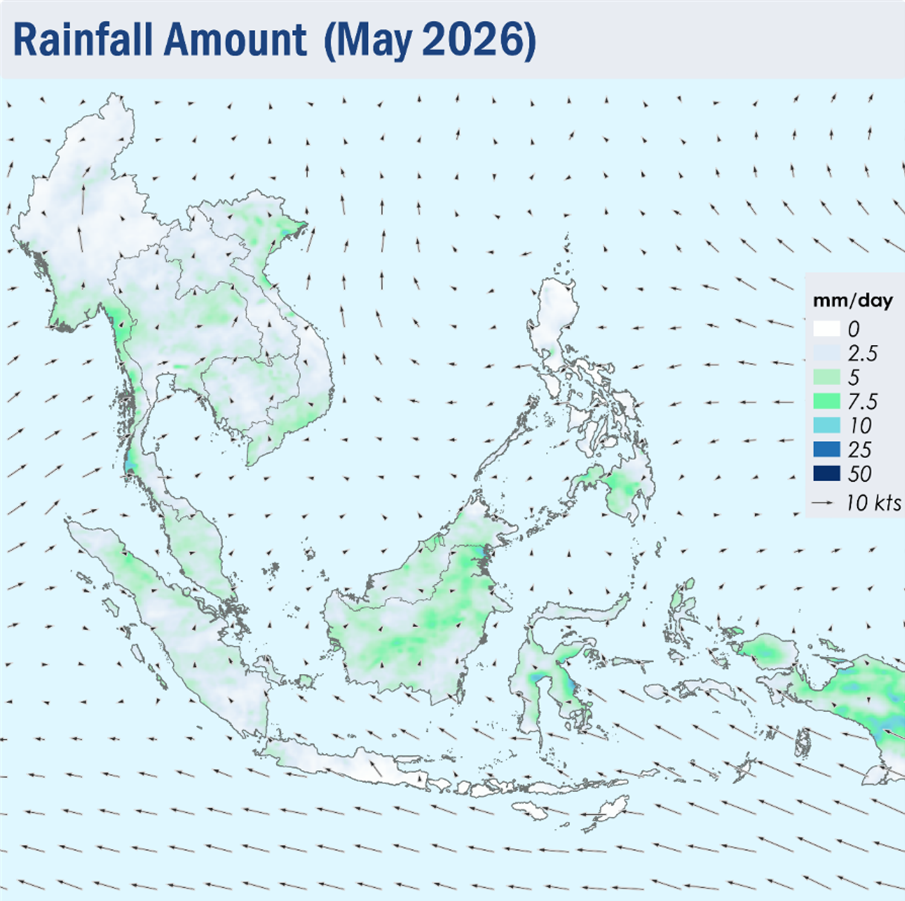
1.1 Light and variable winds were observed over many parts of the ASEAN region during the review period of May 2026 (Figure 1). Over the Mekong sub-region, the prevailing winds were mostly light and southerly, while southeasterly winds continued to dominate over Java, Sulawesi and the Lesser Sunda Islands.
1.2 Overall, the ASEAN region experienced wet weather during the review period as the monsoon rainband shifted northwards and was situated over the area near the Equator. The Alert Level for the Mekong sub-region was downgraded to Level 0 on 14 May 2026 following the increase in showers and the expected persistent rainfall over the sub-region. The southern ASEAN region continued to experience wet weather, except for drier conditions over Java and the Lesser Sunda Islands.
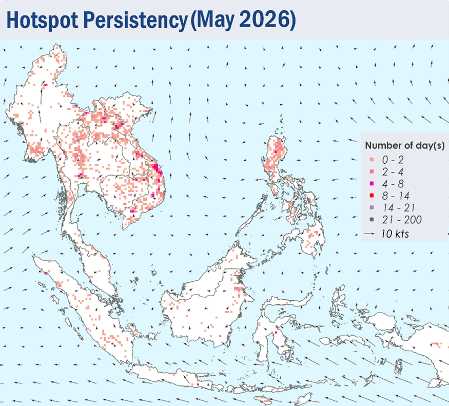
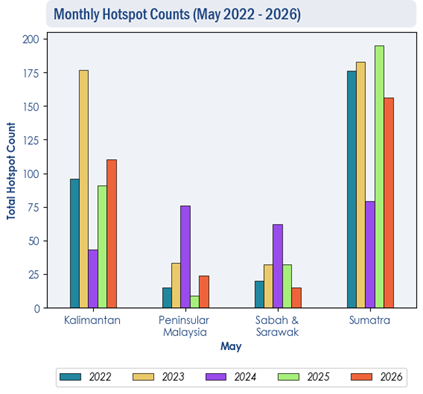
1.3 Hotspot counts in the ASEAN region were generally comparable to the previous years.
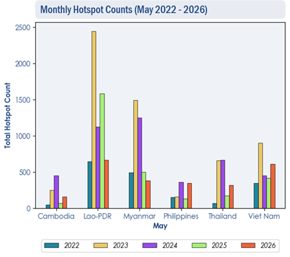
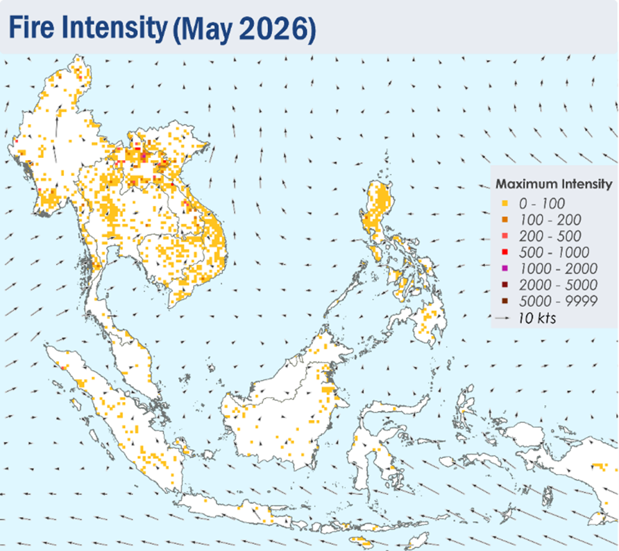
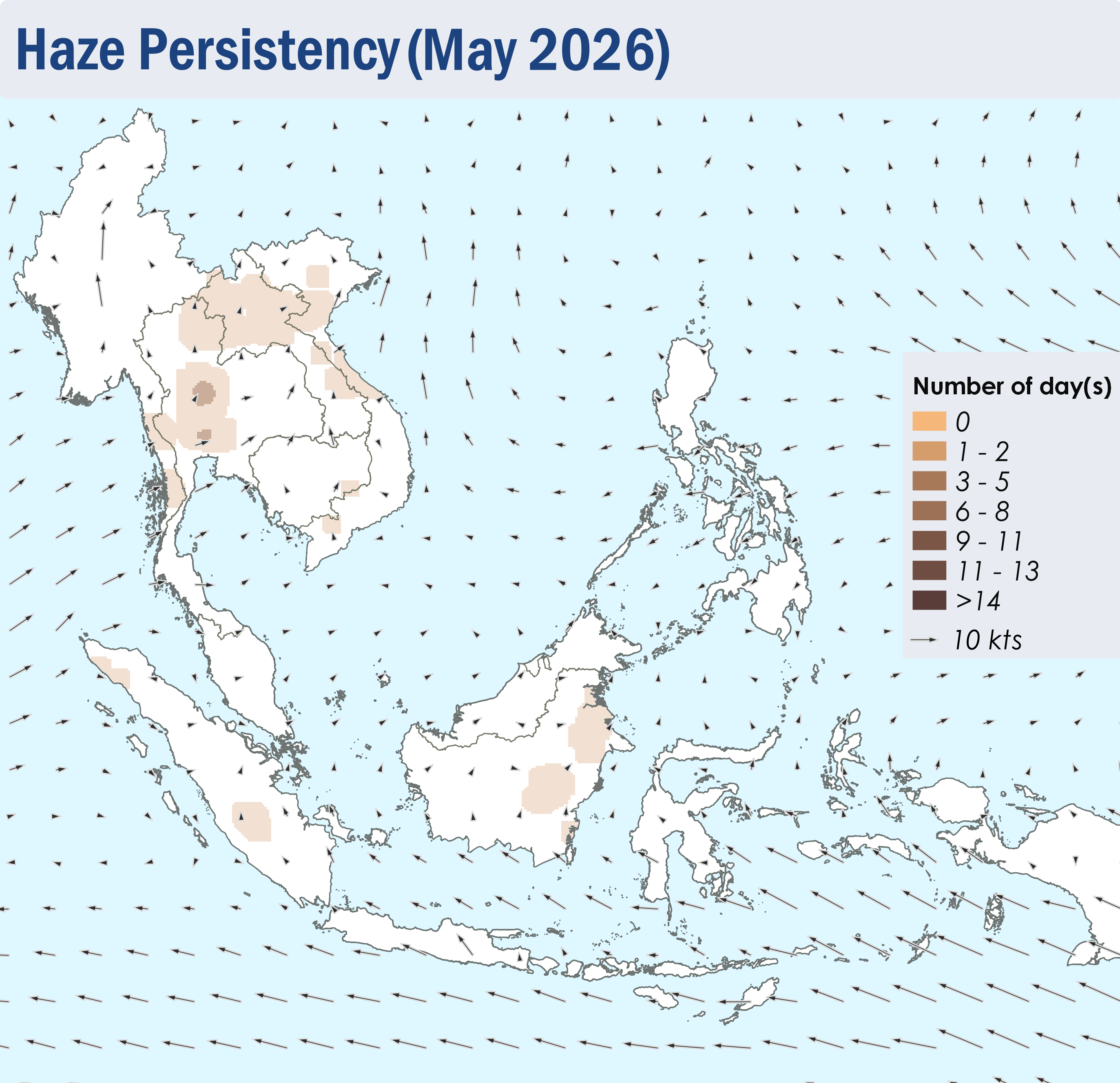
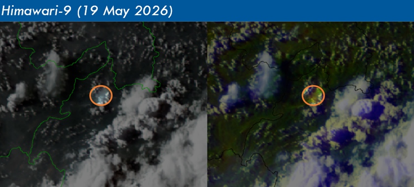
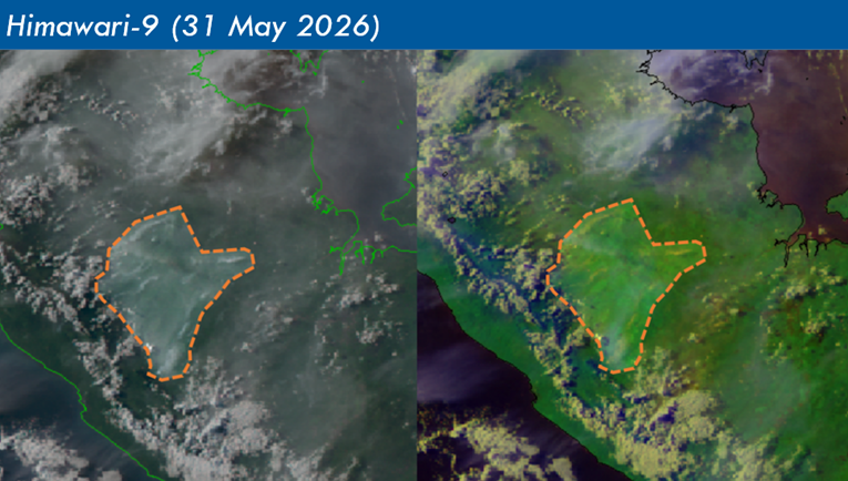
1.4 Isolated hotspots were detected in the northern ASEAN region, particularly in the northern parts of Lao PDR and the central parts of Viet Nam where hotspots are more intense and persistent. During the first half of May 2026, slight to moderate smoke haze was observed over the southern parts of Myanmar and the western parts of Thailand. Localised smoke plumes were also occasionally observed over the northern parts of Lao PDR and Viet Nam in the latter half of the review period.
1.5 For the southern ASEAN region, a few to isolated hotspots were mostly detected in parts of Sumatra, Borneo and Peninsular Malaysia. Slight and localised smoke plumes were observed emanating from these hotspots on a few days.