Subseasonal Weather Outlook (28 June – 11 July 2021)
Issued 25 June 2021
First forecast week: 28 June – 4 July
Second forecast week: 5 July – 11 July
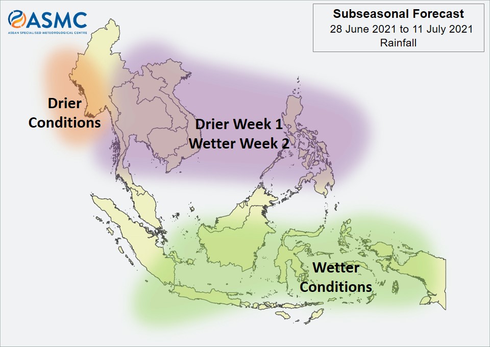
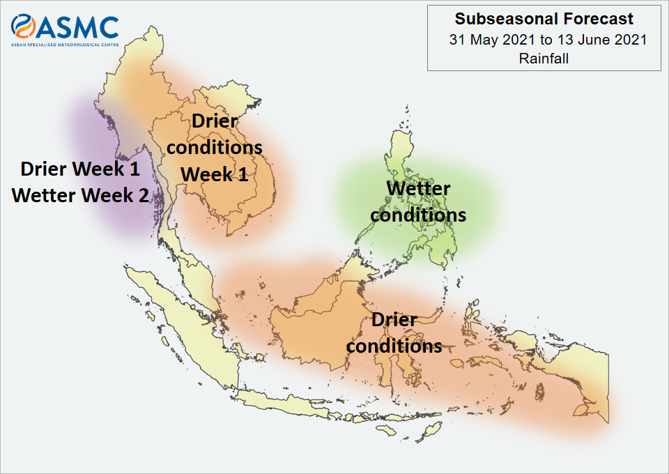
Wetter conditions are expected over the southern parts of the Maritime Continent in Week 1 (28 June – 4 July). In Week 2 (5 – 11 July), there is an increased chance of wetter conditions continuing, particularly over the southeastern parts of the Maritime Continent.
In Week 1 (28 June – 4 July), drier conditions are expected over much of the northern ASEAN region. Most of this region is expected to transition to wetter conditions in Week 2 (5 – 11 July) except for coastal regions of Myanmar where the drier conditions are expected to persist.
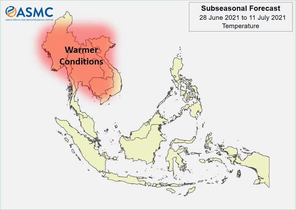
Warmer temperatures than usual are expected over much of Mainland Southeast Asia in the next fortnight (28 June – 11 July), although these warmer conditions may ease over its eastern parts in Week 2 (5 – 11 July), coinciding with the wetter conditions.
A less coherent MJO signal was present over the Western Hemisphere and Africa (Phase 1) towards the end of June. There is disagreement between the models regarding the MJO’s development. Some models predict the MJO to continue propagating eastwards and strengthen over the Maritime Continent (Phases 4 and 5).
The outlook is assessed for the region in general, where conditions are relative to the average conditions for the corresponding time of year. For specific updates on the national scale, the relevant ASEAN National Meteorological and Hydrological Services should be consulted.