Category Archives: Regional Weather Outlook for Year 2026

January 28, 2026

Subseasonal Weather Outlook (2 – 15 February 2026)

Subseasonal Weather Outlook (2 – 15 February 2026)

Issued: 28 January 2026
First forecast week: 2 – 8 February 2026
Second forecast week: 9 – 15 February 2026

figure1

Figure 1: Rainfall Outlook

figure2

Figure 2: Temperature Outlook

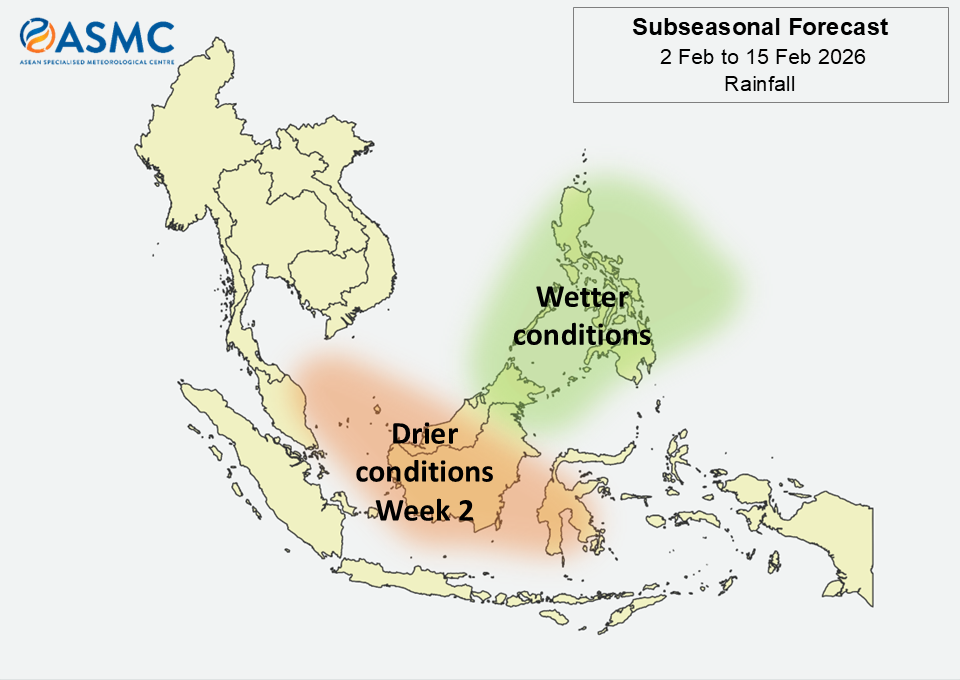
Wetter conditions are predicted over most of the northeastern Maritime Continent in the next fortnight (2 – 15 February).

Drier than usual conditions for this time of the year are predicted over most of the central Maritime Continent in Week 2 (9 – 15 February).

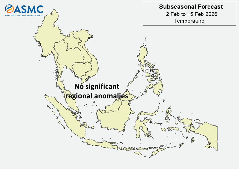
No significant regional temperature anomalies are predicted in the next fortnight (2 – 15 February).

A Madden-Julian Oscillation (MJO) signal was present over the Western Pacific (Phase 7) towards the end of January, based on the RMM index. Most models predict the signal to weaken by the start of the forecast period and remain inactive during the forecast period, although a few models predict a short-lived MJO signal over the Western Hemisphere (Phase 1) and Indian Ocean (Phase 2) in Week 1 (2 – 8 February).

The outlook is assessed for the region in general, where conditions are relative to the average conditions for the corresponding time of year. For specific updates on the national scale, the relevant ASEAN National Meteorological and Hydrological Services should be consulted.

January 14, 2026

Subseasonal Weather Outlook (19 January – 1 February 2026)

Subseasonal Weather Outlook (19 January – 1 February 2026)

Issued: 14 January 2026
First forecast week: 19 – 25 January 2026
Second forecast week: 26 January – 1 February 2026

figure1

Figure 1: Rainfall Outlook

figure2

Figure 2: Temperature Outlook

Drier conditions are predicted over the equatorial region in Week 1 (19 – 25 January).

Warmer than usual temperature for this time of the year is predicted over parts of the central and eastern Maritime Continent in Week 1 (19 – 25 January).

Cooler than usual temperature is predicted over parts of southeastern Mainland Southeast Asia and parts of the northeastern Maritime Continent in Week 1 (19 – 25 January).

A Madden-Julian Oscillation (MJO) signal emerged over the Western Pacific (Phase 6) in the second week of January based on the RMM index. Most models predict this signal to continue propagating eastwards, reaching the Western Hemisphere (Phases 8 and 1) by Week 2 (26 January – 1 February).

The outlook is assessed for the region in general, where conditions are relative to the average conditions for the corresponding time of year. For specific updates on the national scale, the relevant ASEAN National Meteorological and Hydrological Services should be consulted.

December 31, 2025

Subseasonal Weather Outlook (5 – 18 January 2026)

Subseasonal Weather Outlook (5 – 18 January 2026)

Issued: 31 December 2025
First forecast week: 5 – 11 January 2026
Second forecast week: 12 – 18 January 2026

figure1

Figure 1: Rainfall Outlook

figure2

Figure 2: Temperature Outlook

Wetter conditions are predicted over parts of the northeastern Maritime Continent in Week 1 (5 – 11 January).

Drier conditions are predicted over the western and parts of the central Maritime Continent in the next fortnight (5 – 18 January).

Cooler than usual temperatures are predicted for most of Mainland Southeast Asia in Week 1 (5 – 11 January). These cooler conditions are predicted to ease in Week 2 (12 – 18 January).

No significant Madden-Julian Oscillation (MJO) signal was present in the last week of December 2025. Most models predict the MJO signal to remain inactive during the forecast period (5 – 18 January).

The outlook is assessed for the region in general, where conditions are relative to the average conditions for the corresponding time of year. For specific updates on the national scale, the relevant ASEAN National Meteorological and Hydrological Services should be consulted.