Subseasonal Weather Outlook (22 February – 7 March 2021)
Issued 19 February 2021
First forecast week: 22 February – 28 February
Second forecast week: 1 March – 7 March
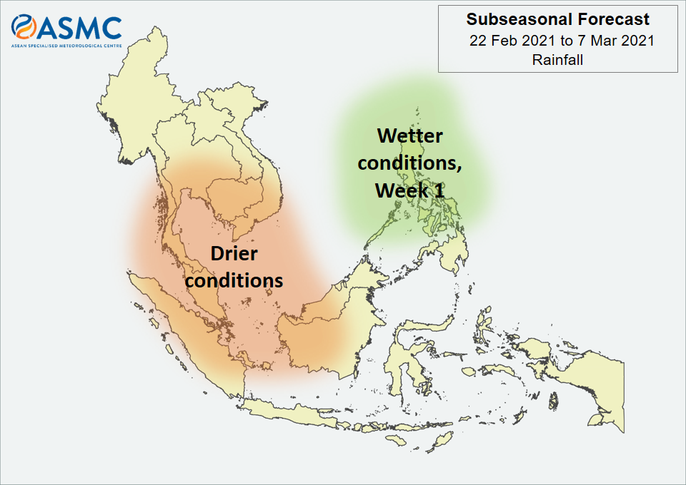
Drier conditions are expected over the western Maritime Continent and southern Mainland Southeast Asia in Week 1 (22 – 28 February). There is a chance of these drier conditions persisting through Week 2 (1 – 7 March), although with lower confidence than Week 1. Wetter conditions are expected over central and northern Philippines in Week 1, but the location is highly dependent on tropical cyclone development.
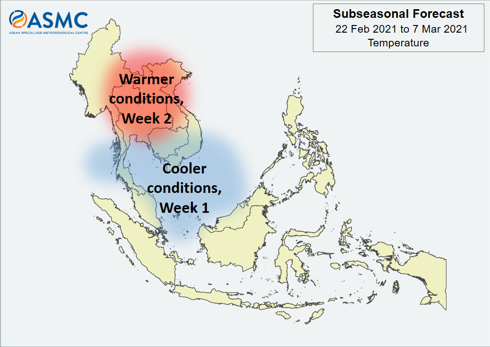
Cooler temperatures than usual are expected around the Gulf of Thailand and southern parts of South China Sea, including southern Viet Nam, southern Cambodia, and the eastern coast of the Malay Peninsula in Week 1 (22 – 28 February). Warmer conditions than usual are expected over central Mainland Southeast Asia in Week 2 (1 – 7 March).
There are signs that an MJO signal is currently present over the Western Pacific (Phase 7), although the models are predicting this signal to rapidly weaken in Week 1. Some models are predicting another MJO to develop in Week 2 (Phase 7 or 8) and continue propagating eastward.
The outlook is assessed for the region in general, where conditions are relative to the average conditions for the corresponding time of year. For specific updates on the national scale, the relevant ASEAN National Meteorological and Hydrological Services should be consulted.