Review of Regional Weather Conditions for First Fortnight of September 2019
1. Review of Regional Weather Conditions for First Fortnight of September 2019
1.1 In the first fortnight of September 2019, weak to moderate southwesterly or westerly winds prevailed over most parts of the northern ASEAN region (Figure 1). Anomalously strong southwesterly winds were observed to the east of Viet Nam and southeast of the Philippines due to the influence of Tropical Storm Kajiki and Typhoon Lingling (Figure 2). In the southern ASEAN region, the prevailing winds blew mainly from the southeast or southwest.
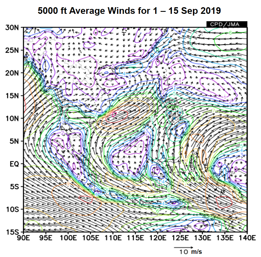
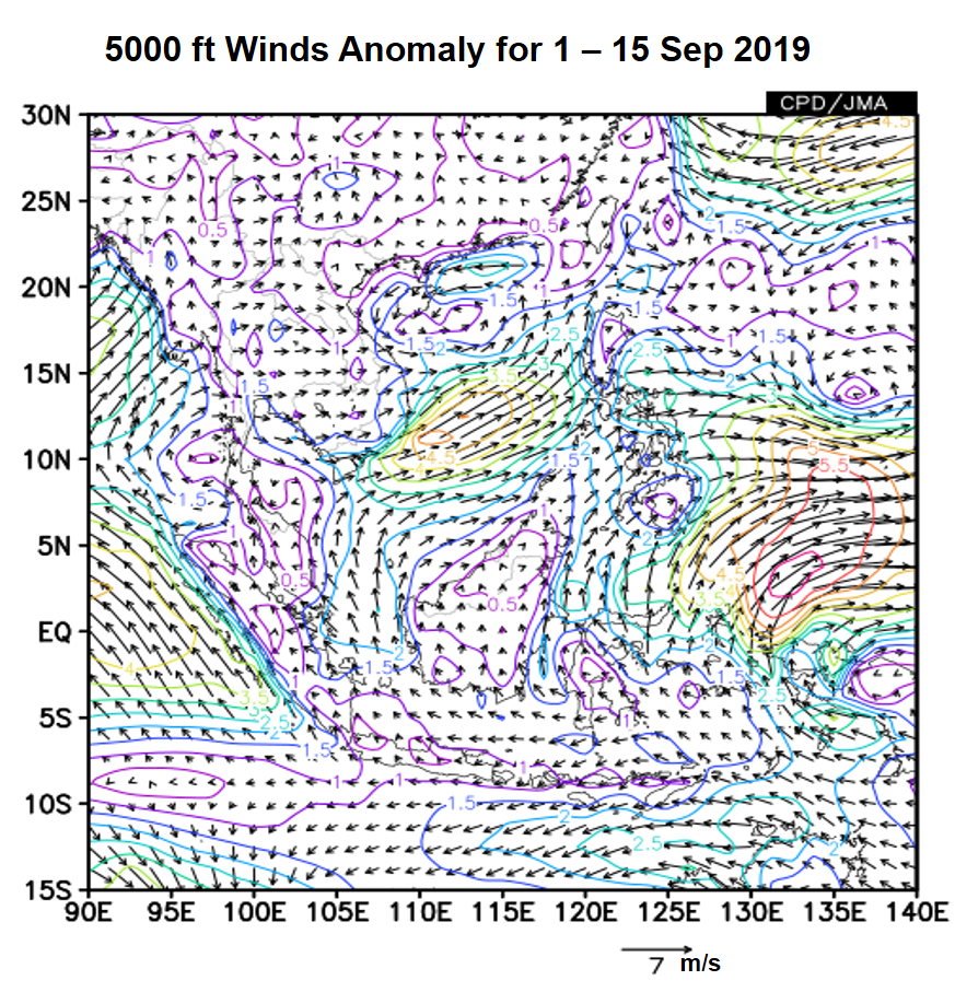
Figure 1: 5000 ft average winds (left) and anomalies (right) for 1 – 15 September 2019 (Source: JMA)
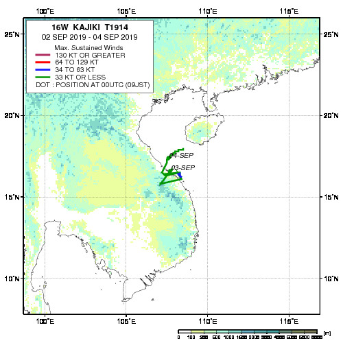
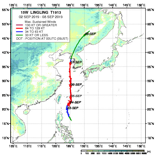
Figure 2: Historical track of Tropical Storm Kajiki (left) and Typhoon Lingling (right). (Source: JAXA)
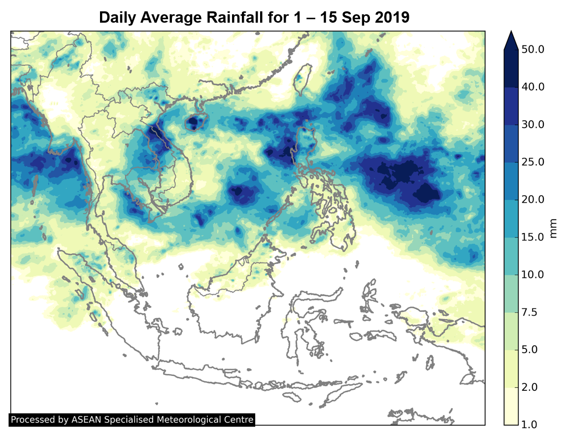
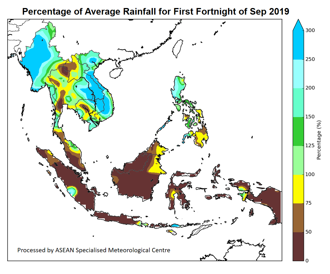
1.2 Southwest Monsoon conditions prevailed in the first half of September 2019. Much of the northern ASEAN region received above-average rainfall except for some areas in Cambodia and Thailand. In the southern ASEAN region, below-average rainfall was observed over many areas (Figures 3 and 4).
1.3 Throughout the first fortnight of September 2019, the Madden-Julian Oscillation (MJO) remained weak based on the RMM index and did not significantly influence the weather over the ASEAN region (Figure 5).
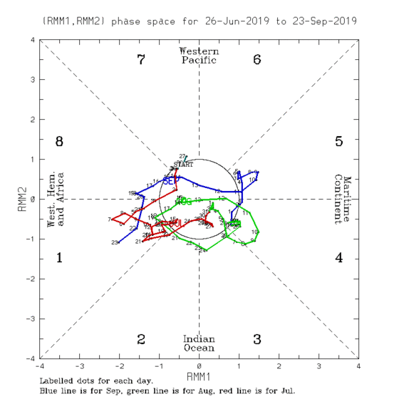
Figure 5: The MJO phase diagram for Sep 2019 (blue). The diagram illustrates the movement of the MJO through different phases, which correspond to different locations along the equator. The distance of the index from the centre of the diagram is correlated with the strength of MJO. When the index falls within the circle, the MJO is considered weak or indiscernible. (Source: Bureau of Meteorology)
1.4 The state of the El Niño-Southern Oscillation (ENSO) is currently neutral (neither El Niño nor La Niña), and the sea-surface temperatures (SST) over the tropical Pacific Ocean continue to show a cooling trend. An Indian Ocean-related index, known as the Indian Ocean Dipole (IOD), is observed to be in the positive phase, as colder-than-average sea surface temperatures continue to be present over the eastern Indian Ocean. The positive IOD has contributed to the drier conditions over the southern ASEAN region during the first fortnight of September 2019.