Review of Regional Weather and Smoke Haze for Feb 2016
1. Review of Regional Weather Conditions in February 2016
1.1 The Northeast Monsoon conditions continued to prevail in the region in February 2016. The monsoon rain belt hovered between the Equator and 10 S during the period and brought shower activities mostly to areas in the Java Sea and western parts of Kalimantan and Sarawak. The northern ASEAN region is currently in the traditional dry season and in February 2016, the region has been experiencing dry and warm weather conditions interspersed with a few brief periods of shower activities.
1.2 The ASEAN region experienced several occurrences of monsoon surges in February 2016 such as those on 6 – 10 Feb, 16 – 20 Feb, 24 – 29 February 2016. Most of the heavy rain associated with the monsoon surge fell over the sea areas between South China Sea and Java Sea, and over the southern districts of Sarawak. Kuching were affected by floods due to the heavy rainfall from first two monsoon surges in February 2016.
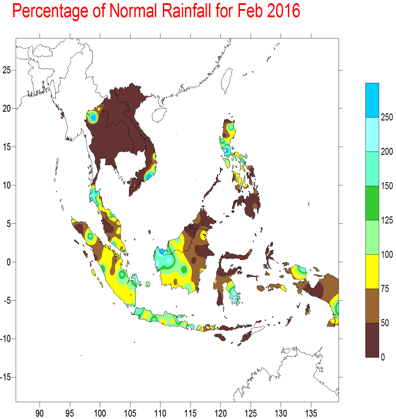
1.3 The prevailing El Niño conditions continue to bring drier than usual weather conditions over the eastern parts of the ASEAN region. Near-normal to above-normal rainfall was received in the equatorial region including Peninsular Malaysia, Sarawak, islands of Java, and West and Central Kalimantan. Large parts of the northern ASEAN region received below-normal rainfall, including the southern parts of Philippines. The regional rainfall distribution for February 2016 is shown in Figure Fig. 1A.
2. Review of Land/Forest Fires and Smoke Haze Situation
2.1 In the southern ASEAN region, shower in the region generally helped to subdue hotspot activities. Nonetheless, during brief periods of drier weather, localised burning activities were observed in Miri, Sarawak on 21 and 22 February 2016.
2.2 The northern ASEAN region is at the peak of its traditional dry season. Increased hotspot activities were observed particularly over Thailand, Myanmar and Cambodia in February 2016. The clusters of hotspots were mostly detected in Nakhon Sawan, Thailand, the southern parts of Arakan ranges in Myanmar, and the eastern parts of Cambodia. Hazy conditions were also reported in the northern provinces of Thailand such as Chiang Rai, Lampang, Lamphun in mid-February 2016.
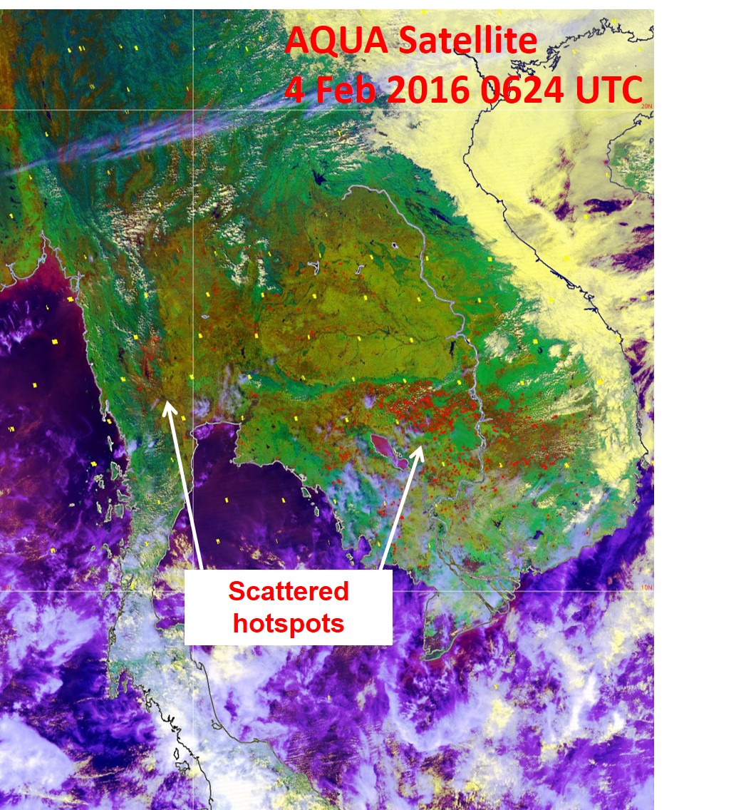
Fig. 2A: AQUA satellite image on 4 February 2016 shows scattered hotspots detected in Thailand and Cambodia.
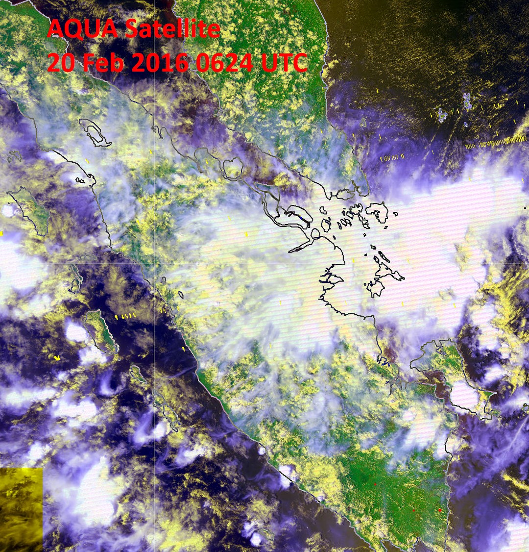
Fig. 2B: AQUA satellite image on 20 February 2016 shows widespread shower activities around Sumatra.
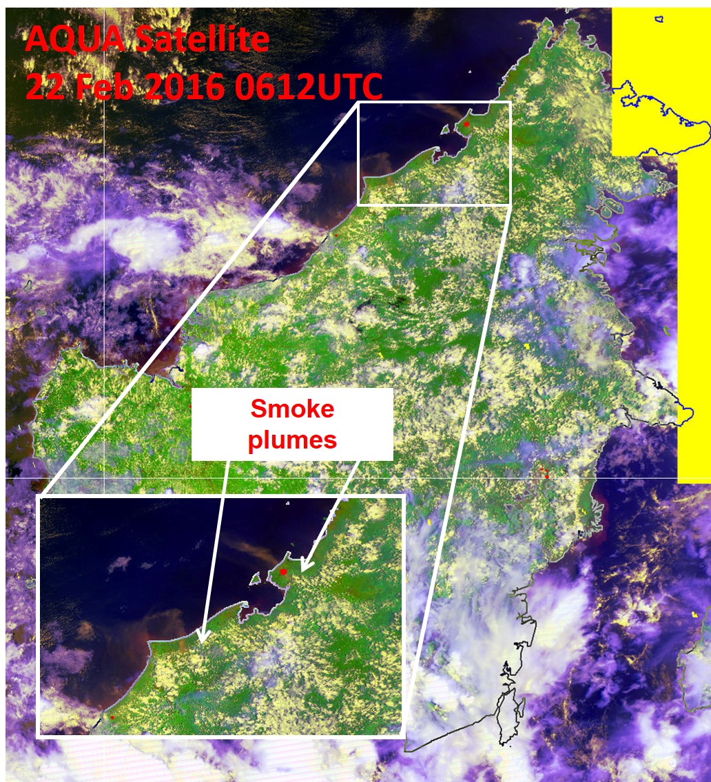
Figure 2C: AQUA satellite image on 22 February 2016 shows localised smoke plumes emanating from hotspots detected in Miri, Sarawak and Sabah.
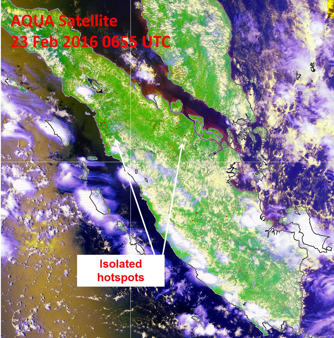
Fig. 2D: AQUA satellite image on 23 February 2016 shows isolated hotspots detected in central Sumatra.
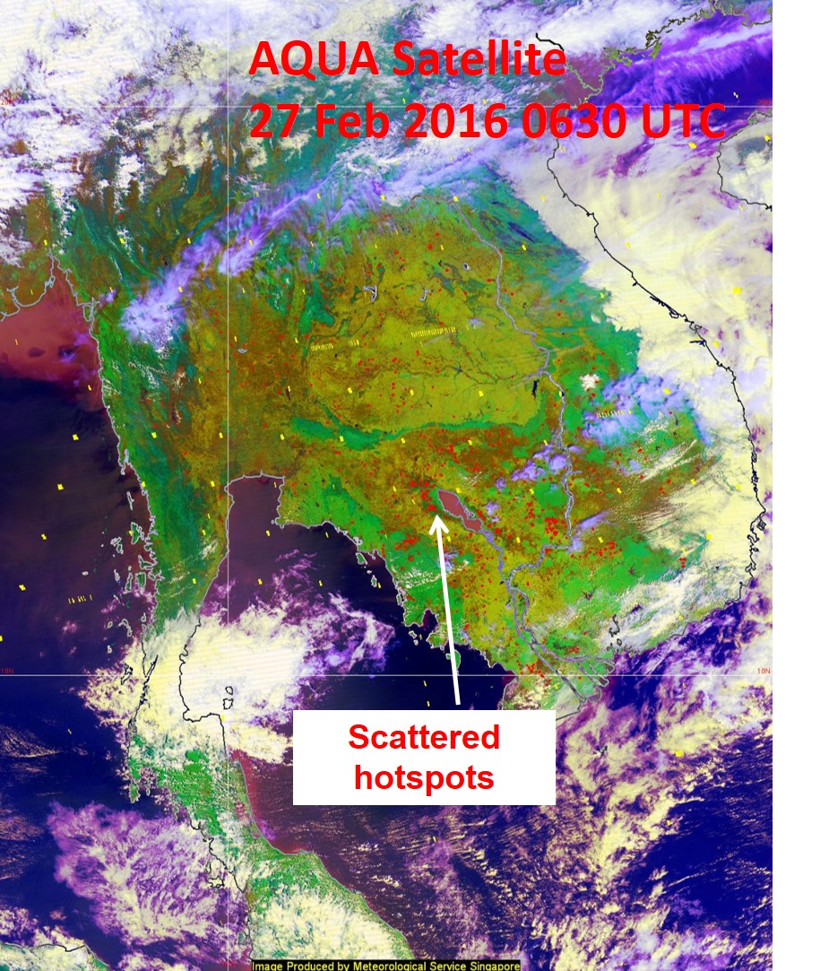
Fig. 2E: AQUA satellite picture on 27 February 2016 shows scattered hotspots mostly in Cambodia.
2.3 The hotspot charts for February 2016 for
- Cambodia, Myanmar, Thailand, Lao PDR and Vietnam;
- Sumatra, Borneo and Peninsular Malaysia;

Fig. 2F: Hotspot Counts in Cambodia, Lao PDR, Thailand, Vietnam, Myanmar for February 2016.
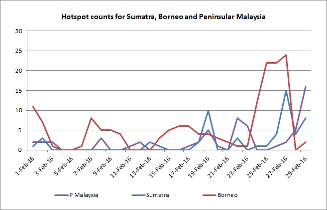
Fig 2G: Hotspot Counts in Sumatra, Borneo and Peninsular Malaysia for February 2016.
3. Status of El Niño/La Niña
3.1 The tropical Pacific Ocean continued to show strong El Niño conditions in February 2016.
3.2 The rainfall in the eastern parts of Southeast Asia region and western Pacific Ocean has been showing a clear response to the El Niño conditions, with observed large-scale drier-than-normal conditions. The consensus forecast based on assessments from international climate models and expert opinion suggests that the current El Niño conditions to continue through the first quarter of 2016 before transiting to Neutral (neither El Niño nor La Niña) by mid-2016 and persisting for a few months. There is a chance of La Niña development by the third quarter of 2016.
3.3 The region is currently in the Northeast Monsoon season (late Nov – Mar),and the impact of El Niño is usually less pronounced as compared to the Southwest Monsoon season (Jun – Sep). Typically, El Niño will bring drier than average rainfall conditions over to the southern and eastern parts of the region but less significant impact to the northern and western parts of the region during November to March. More locally-specific impact differs from place to place and for different seasons.